4/2 – Trey Tonnessen’s “Quick Moving System” Tuesday Night Forecast
Meteorologist Trey Tonnessen
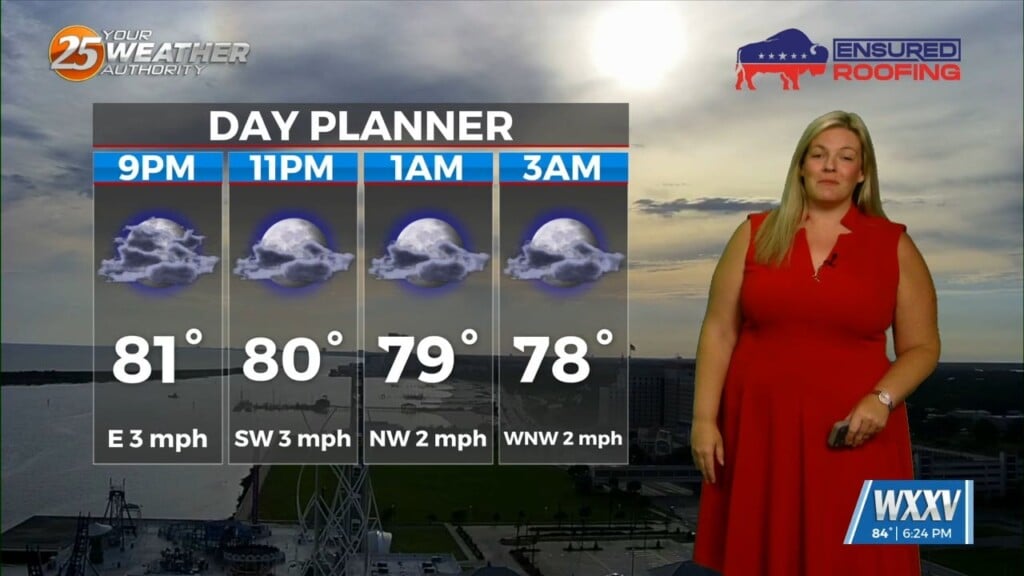
Convection allowing models continue to show slightly more than isolated storms tonight, and most of those prior to 10 PM. If we do get deep convection, it will likely be strong, but there are just too many failure modes in place for a robust severe weather event across the Mississippi Gulf Coast. The cold front should be well east of our area prior to sunrise Wednesday. Clear skies will take over from mid morning Wednesday through Wednesday night. Upper ridging will build eastward across the area from Thursday through the weekend. A strong upper trough and low will pull out of the Rockies into the Plains Saturday night or Sunday, but there is significant disagreement between the medium range weather models for early next week.
As always: A cloudy day is no match for a sunny disposition. Be nice to each other.
-Meteorologist Trey Tonnessen