3/28 – Trey Tonnessen’s “Double Clear Skies” Thursday Afternoon Forecast
Meteorologist Trey Tonnessen
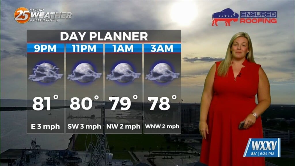
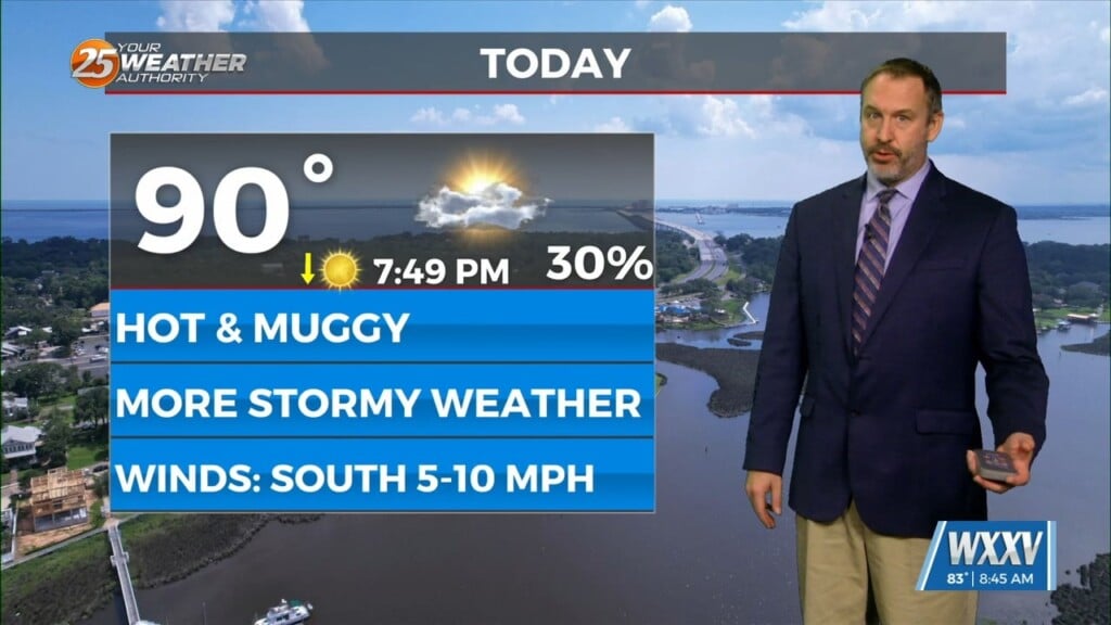
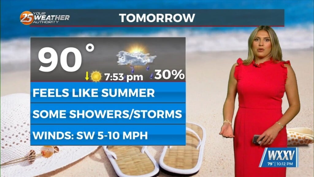
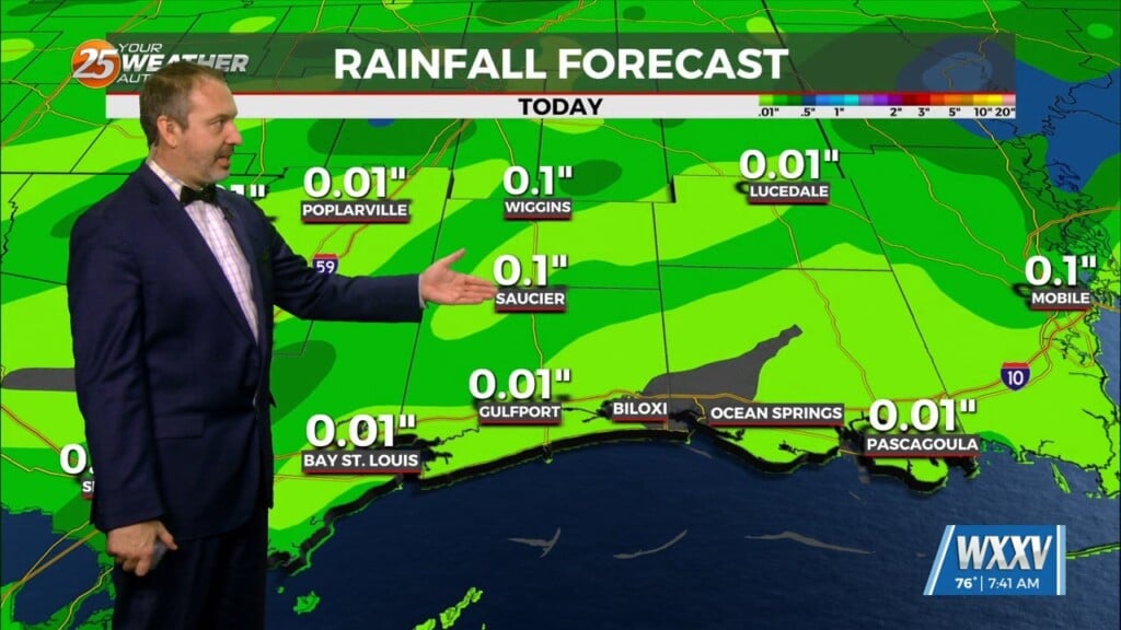
During this time period every year, it is typically difficult to secure clear skies and comfortably widespread for a 24 hour period. Not only will we have clear skies and ideal outdoor conditions for one day, but it appears almost locked in to stick around for a second day. Upper ridging over the Gulf of Mexico will be controlling the weather through the weekend and into Monday. In the cloud department, there won’t be more than high clouds across the area through Sunday or Monday. Temperatures will gradually creep up a couple degrees each day. By Sunday and Monday, high temperatures will generally be in the lower or middle 80s away from direct marine influences (sea breeze), with lows in the 60s. Tuesday into Wednesday will see an upper trough extend from the Great Lakes to the Texas Panhandle. This will push a cold front through the area sometime around Tuesday night. This will bring a chance of rain Tuesday or Tuesday night, followed by drier weather and sunnier skies. Even though by next week, temperatures will be 5 to 10 degrees cooler, it does not look like a major cold spell will happen.
As always: A cloudy day is no match for a sunny disposition. Be nice to each other.
-Meteorologist Trey Tonnessen