7/2 – Payton’s Monday Afternoon Forecast
Low pressure centered just off to the east will continue to move toward the west. As it does so rain chances will go up this afternoon through Tuesday. Some of the rain will be heavy a times, and localized flash flooding is possible. It’s not going to rain all day and night, but there will be scattered showers and thunderstorms. Going into Wednesday the low moves toward Houston, but there will still be plenty of moisture and daytime heating to give us scattered showers and thunderstorms during the afternoon and evening. I wouldn’t cancel any outdoor plans for July 4th, but have a backup plan just in cast. Going through the rest of the week and into the weekend afternoon showers and thunderstorms will be possible across the entire area. Temperatures will be running in the upper 80s to lower 90s this week.
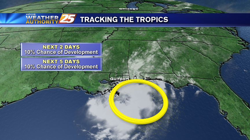
TROPICS: Significant tropical development of the upper level low and surface trough in the area is unlikely as it moves toward the west, but it will still produce heavy rainfall in the area.
Significant tropical development of the upper level low and surface trough in the area is unlikely as it moves toward the west, but it will still produce heavy rainfall in the area.


Leave a Reply