5/5 – Rob Martin’s “Heat Peaks Then Rain Chances” Tuesday Night Forecast
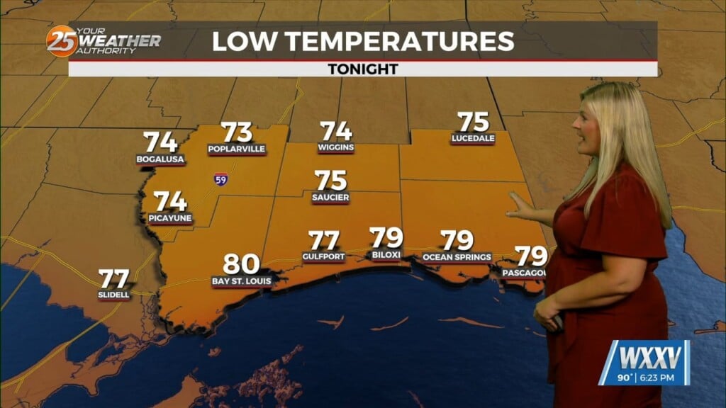
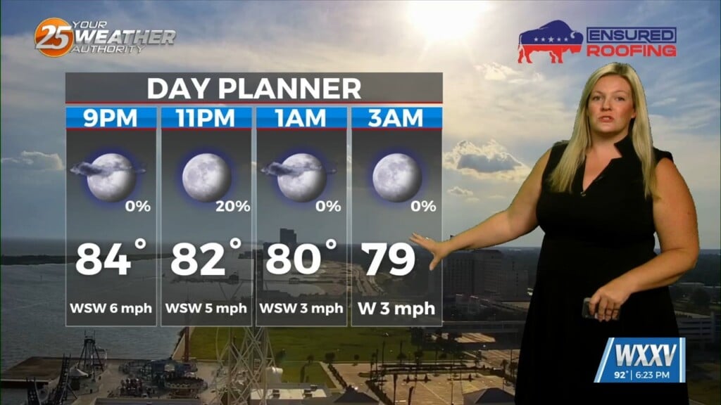
Expect a very pleasant Tuesday night as skies clear, with lows in the 60s. Cooler drainage areas around Pascagoula and central Jackson County could see some upper 50s. The very warm pattern continues in the short term, with 80s along the coast and readings closer to 90 inland. As high pressure builds further, heat for the week will peak Wednesday and Thursday with coastal areas mid-upper 80s and inland areas in the low 90s. Fortunately humidity will not be excessive, so max real-feels will be mid-upper 90s inland at most. Lows won’t stray too far from 70 degrees as we head through the week. So, we’re still waiting on that first official summer heat wave.
Moisture from an upper low meandering near Florida will bring scattered shower/t-storm chances on Thursday/Friday as humidity bumps up, but by later in the week maximum temps will drop a bit. Thursday’s rain chance are looking a bit more impressive, as models are placing a decent several-hour downpour just to our west in the late afternoon hours. For now it looks like we could see scattered afternoon/early evening showers and thunderstorms all the way into the weekend, although no day looks like a washout.
Moisture shifts east early next week and high pressure builds back in, resulting in more sunshine and hotter temperatures.