4/24 – Sam’s Friday night forecast
Meteorologist Sam Lucey has a look at the week ahead
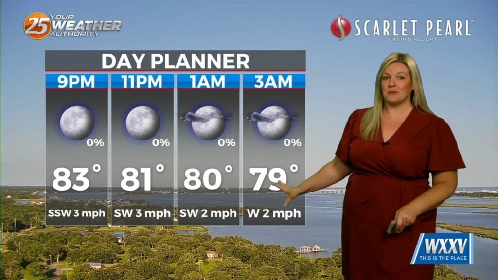
Tonight stays quiet for most of the evening, but clouds will increase overnight with showers and storms moving through after midnight. We have a marginal risk to see strong or severe storms with winds being the primary threat, and a much smaller chance for hail or a brief spin up tornado.
There’s another round of storms possible late Saturday afternoon after 3 PM. In between, we’ll see some sunshine with highs climbing into the low 80s. Rain coverage stays scattered, so not everyone will see it. Saturday night turns mostly cloudy once again with just a slight chance of a lingering shower before things quiet down.
By Sunday, moisture increases a bit more so you can expect mostly cloudy skies with scattered showers and thunderstorms developing mainly during the afternoon and evening. Highs will reach the low to mid 80s.
Into early next week, we start to dry out slightly. Monday and Tuesday look mostly sunny to partly cloudy with warm temperatures in the low 80s and a steady southerly breeze.
Better chances for rain return midweek, with isolated storms possible on Wednesday and a more noticeable uptick in clouds and rain chances heading toward the end of the week. By Friday, scattered showers and storms are back in the forecast along with breezy south winds.