3/26 – Rob’s FOGGY Monday Morning Forecast
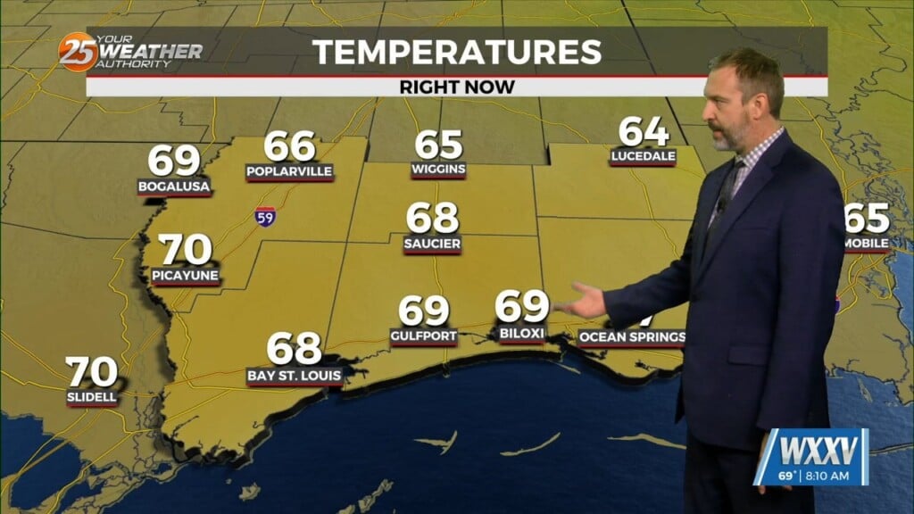
Once again this morning, the main focus will be on any fog development as otherwise, tranquil weather will persist today. A few very spotty showers are possible but for the most part, no significant precipitation is expected today or tomorrow. This will allow temperatures to climb a bit more during the day. Temps will climb into the mid-70s today, closer to 80 degrees for most of the area tomorrow.
Things begin to change on Wednesday as a slow moving trough and associated front approaches the area. Rain chances will increase slightly on Wednesday and then a bit more on Wednesday night. The bulk of the rain for our area would be on Thursday as the front pushes through, lingering into Thursday night. That said, overall rainfall totals from models is definitely on the downtrend, as most of the deepening moisture and energy from the system eject to the north before really making it into our area. There remains a slight chance for some strong to severe storms on Thursday, especially in the north and western parts of our area, but overall that chance has diminished for the time being as well. Cooler and drier conditions return to the region on Friday.


Leave a Reply