3/14 – Brittany’s “Pi Day” Tuesday Evening Forecast
Zonal flow aloft will turn northwesterly tonight as an upper- level shortwave trough, currently over Texas/Oklahoma, approaches and passes over our region. Upper ridging builds in its wake over the central US and shifts eastward through the remainder of the period. At the surface, strong high pressure over the Upper Mississippi River Valley pushes southeastwards, reaching the Appalachians by Wednesday night. As this high pushes to our east, winds will begin to veer from northeasterly tonight to southeasterly by Wednesday evening.
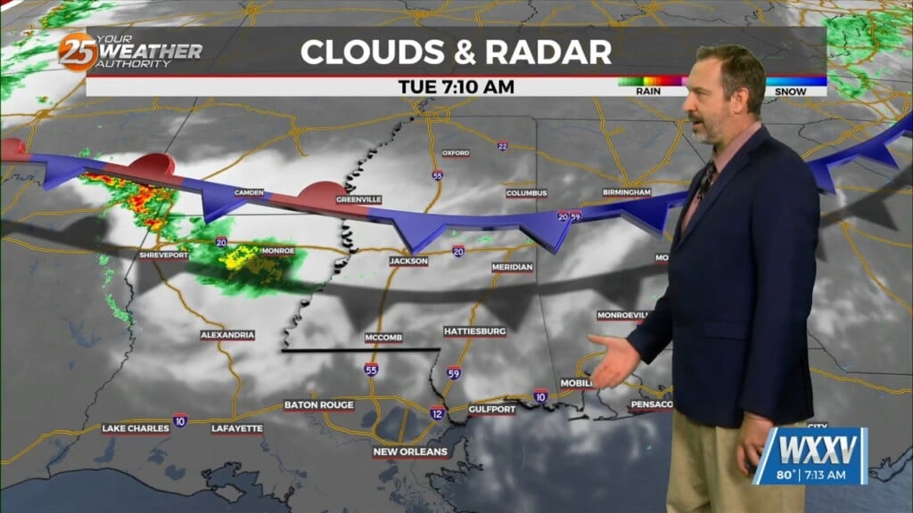
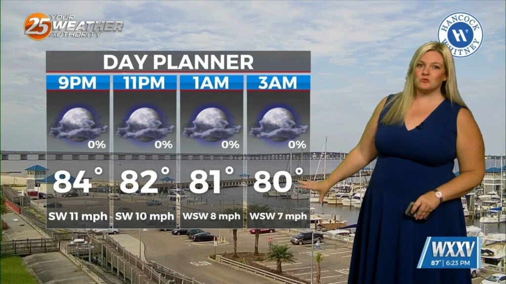
Mid-level clouds will continue streaming across the region tonight as the shortwave approaches and moves overhead. Cannot rule out a few very light showers this evening (PoPs generally around 10-20%). Skies begin to clear out by, or a little before, daybreak as the shortwave moves into the Gulf and the ridge begins to build overhead. Otherwise, cool temperatures tonight will start to moderate by Wednesday night, thanks to the return of onshore flow. Lows tonight will range from the upper 30s to low 40s for interior counties to the upper 40s to low 50s along the Louisiana coast. Highs tomorrow will generally be in the mid to upper 60s. Lows Wednesday night will range from the mid to upper 40s north of I-10/I- 12, and in the 50s for areas south.