12/07 Ryan’s “Frontal Effects” Friday Night Forecast
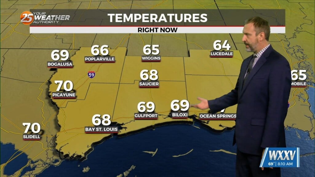
The weather is still benign, but we’re going to begin feeling the effects of tomorrow’s front very soon. The cloud cover and humidity has increased steadily over the last few days, and the winds are picking up as the pressure gradient tightens. The SPC currently has South Mississippi under a “marginal” risk for severe weather, but the metrics don’t seem to indicate any thing more than heavy rains and the potential for some damaging winds.
PRECIPITATION MODELS ARE AVERAGING BETWEEN 1-3″ OF RAINFALL ON SATURDAY, BUT LOCALIZED AREAS WILL LIKELY REPORT HIGHER TOTALS WHEN IT’S ALL SAID AND DONE.
It’s been so dry recently the rainfall won’t soak into the ground quickly, which will likely exacerbate potential flash flooding issues. The clouds are slow to clear through Sunday, but much cooler and drier air moves in as we begin next week bringing back our first taste of frosty air since last Monday.


Leave a Reply