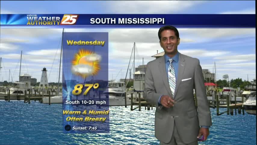
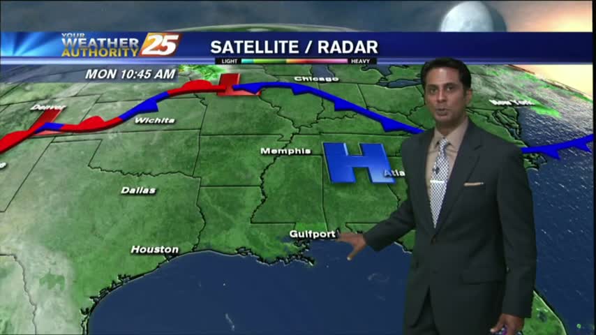
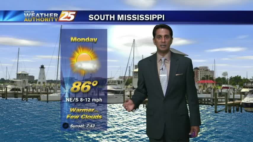
6/12 - Rob's Monday "Tropical" Workweek Forecast
After a beautiful weekend with sunny skies and drier air, the tropical air mass is moving back into the region...
After a beautiful weekend with sunny skies and drier air, the tropical air mass is moving back into the region...
After a bit of a break earlier this morning, showers continue to move in and develop along the viewing area.
After a rain-free start to the day under partly cloudy skies....the clouds and activity has moved back into the viewing area...
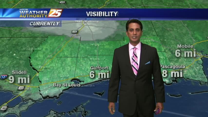
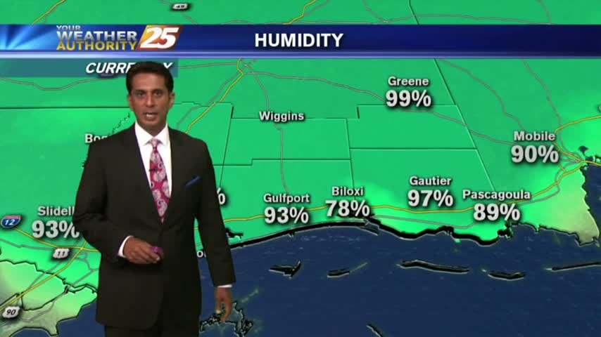
A break from the rain this morning...BUT areas of PATCHY DENSE FOG have developed along the Southern 6...
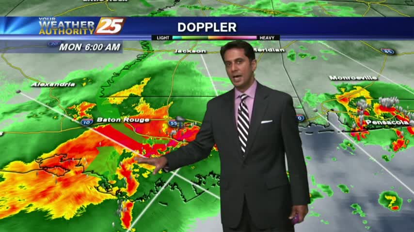
It's a gloomy start to the workweek/Memorial Day with showers/T-Storms, which continue from last night...

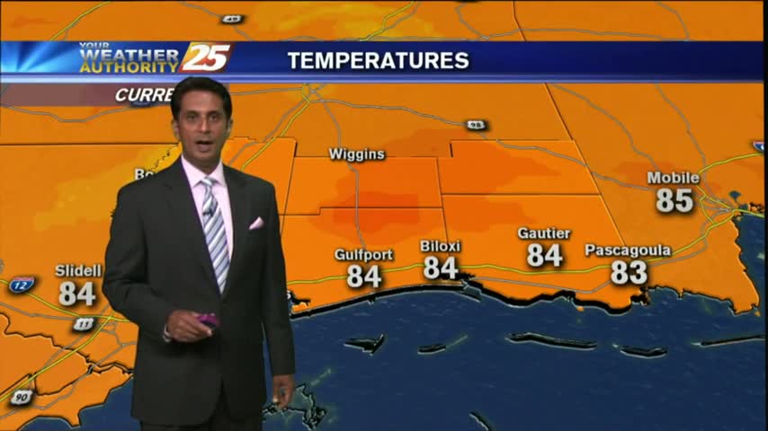
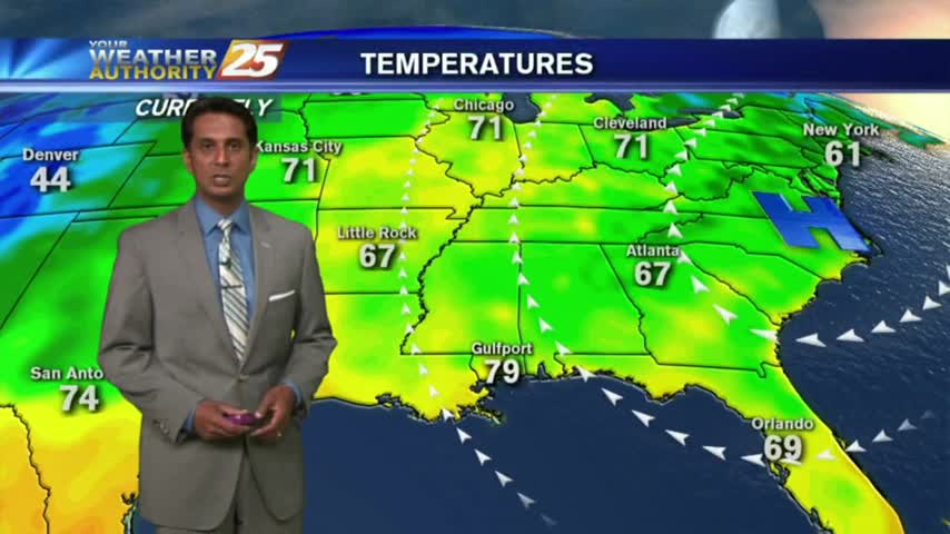
It feels much warmer this afternoon as the humid flow from the Gulf of Mexico continues to filter into the region...

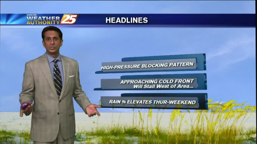
A MUCH WARMER start to the day as high-pressure begins to provide for a return-flow and more humid conditions going into the Memorial day weekend...
After a CHILLY start to the day, temps continue to warm along with decreasing humidity under clear skies...
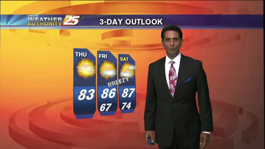
A clear and cool start this morning will lead to a warm and breezy afternoon. Cloud cover and rain chances on the increase as the weekend arrives.
After a cloudy start to the day, drier air continues to move into the region as high-pressure to the NW moves SE

With a stationary front over head, showers/t-storms continues with areas of patchy fog along the Southern 6...
Light rain has been moving into the area this morning, scattered showers/t-storms on-tap this afternoon...
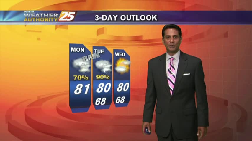
After a WET WEEKEND, showers and t-storms will move back into the area later this morning...

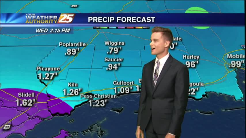
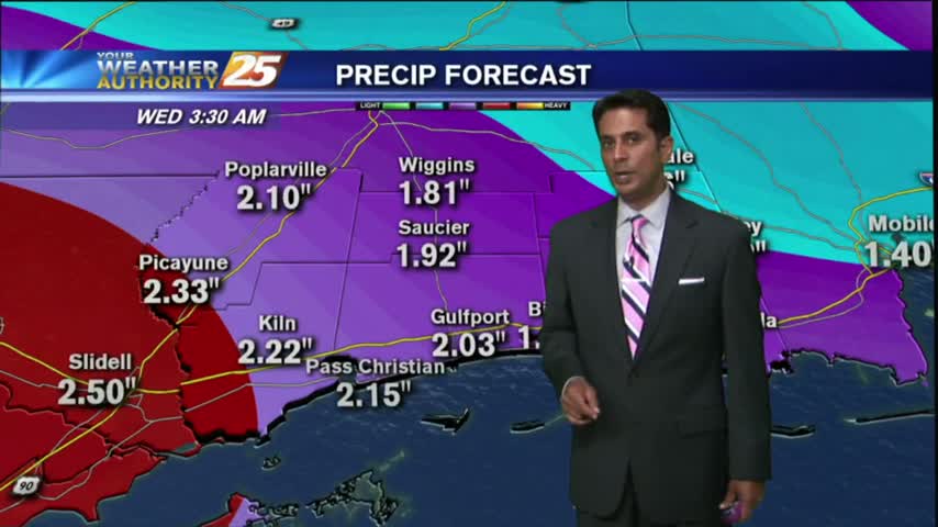
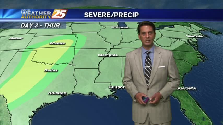
It's a WARM/HUMID day long the Mississippi Gulf Coast with the potential for HEAVY RAIN through the weekend...
Under mostly cloudy skies...it's a warm & Humid start with very light sprinklers along the coast.
After a HUMID start to the day, isolated showers have been moving into the area along with a few T-Storms for this afternoon...
After a warm/humid start...a tightening gradient east of the Rockies continue to elevate winds, now gusting into the upper teens/low 20 mph range.
Another Warm/Humid start to the day with areas of PATCHY DENSE fog along the coastal counties...
After a few morning clouds and patchy fog, a low-deck of clouds have now formed along the coastal counties...
Another humid start with areas of patchy fog as an area of high-pressure continues to block the Gulf Coast...
After a clear start with patchy fog, temperatures continue to warm with a few clouds developing...
A warm/humid start to the workweek along with areas of PATCHY FOG along the Southern 6...
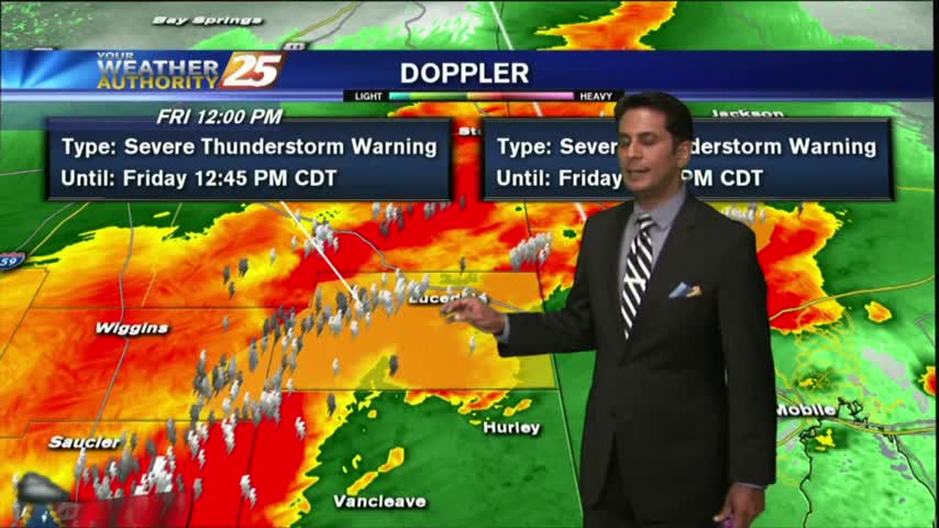
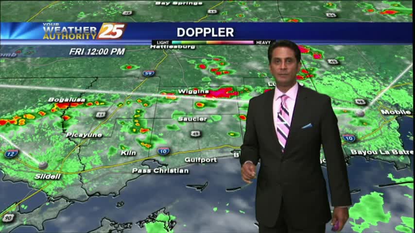
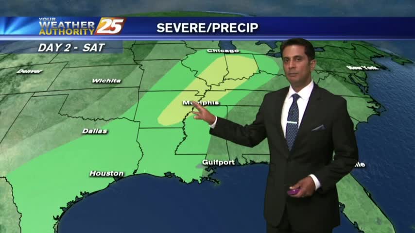
A line of T-Storms moving into the area in advance of an approaching cold front...

A warm/humid and BREEZY start to the day, along with areas of patchy fog along the coastal counties...