9/19 - The Chief's "Very Hot Temps Ahead" Monday Afternoon Forecast
High pressure will expand across the southern US early in the week and should be centered across TX. An upper level weakness looks to clip…
High pressure will expand across the southern US early in the week and should be centered across TX. An upper level weakness looks to clip…
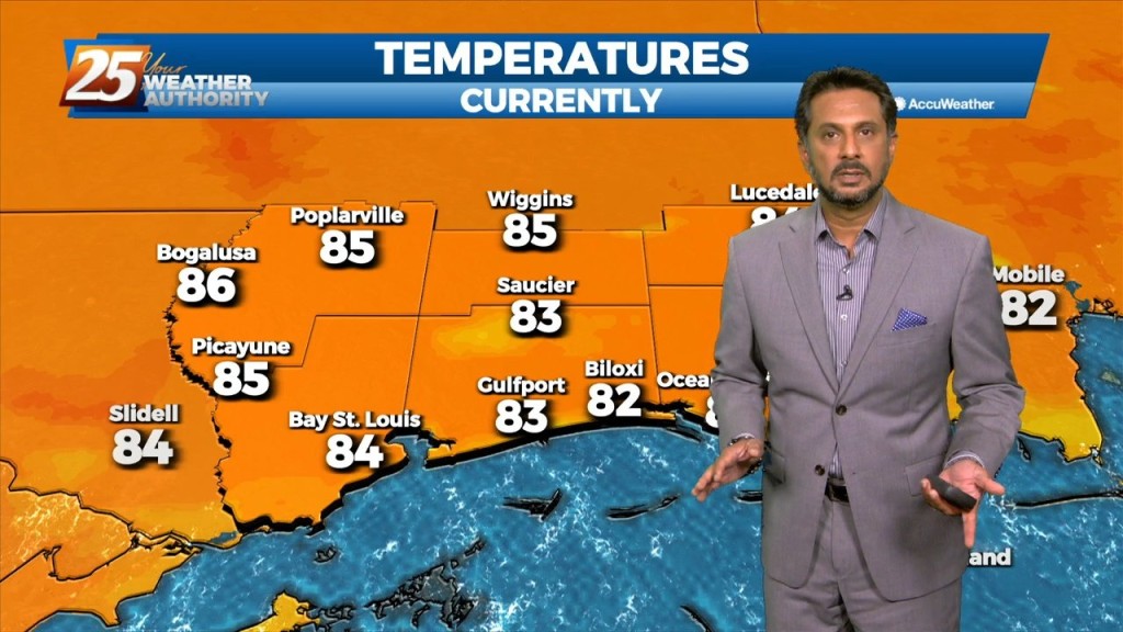
With a surface cold front to the south going stationary, drier air north of the front will continue to keep the area under pleasant conditions…
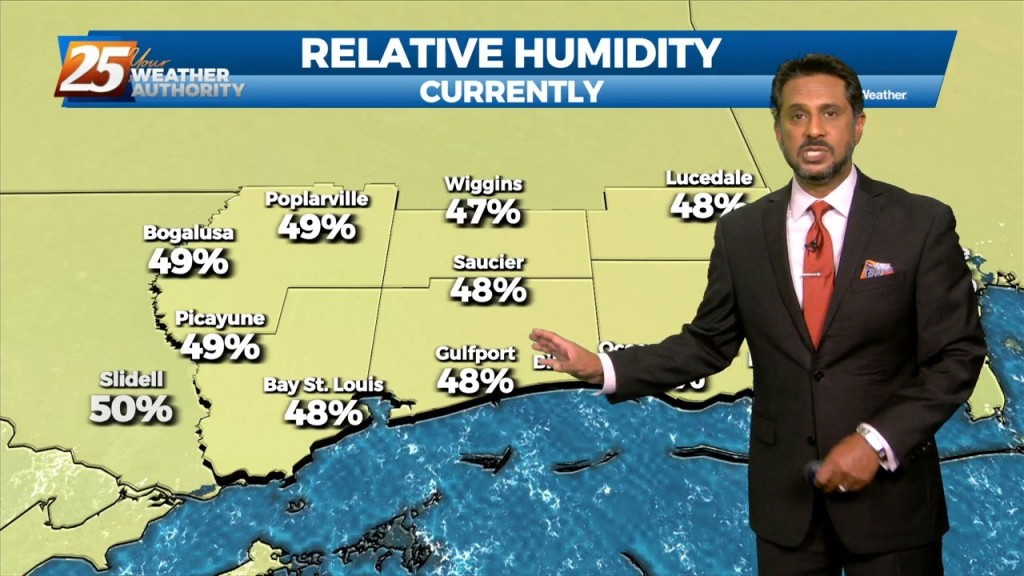
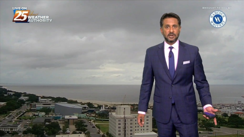
Lovely conditions ahead this afternoon as temperatures in the mid-80s and relative humidity in the 30/40% range will make it feel comfortable. As the evening and overnight…
The main story is a cold front overhead moving SE. The upstream support will press east allowing the high to surge the front south and east through our…

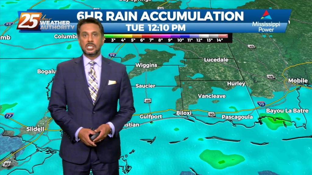
A stationary front draped along the coast east through the central Florida panhandle will continue to bring showers/t-storms. A few showers could bring heavy rain as rain rate will…
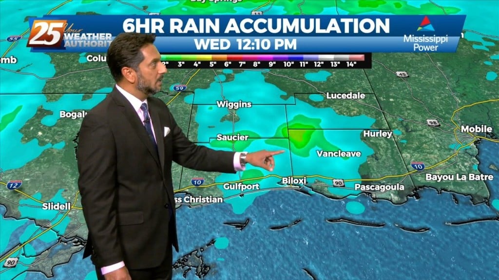
A trough of low pressure along the NW'tern Gulf of Mexico will slowly push SE as an upper low pressure system and training cold front moves through…
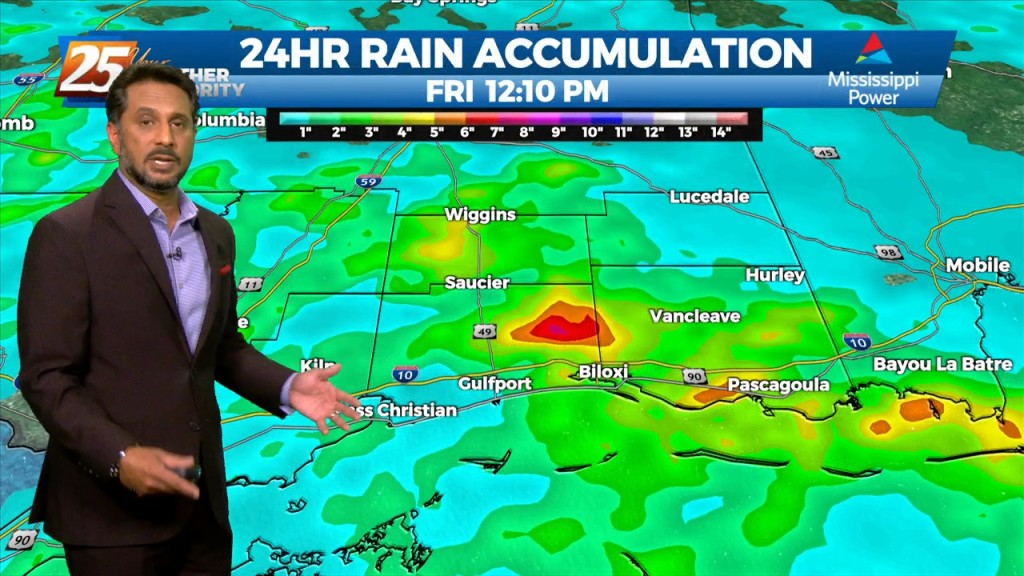
The best potential for rainfall, similar to Wednesday looks to be again along and west of the I-55 corridor later this afternoon. With the…
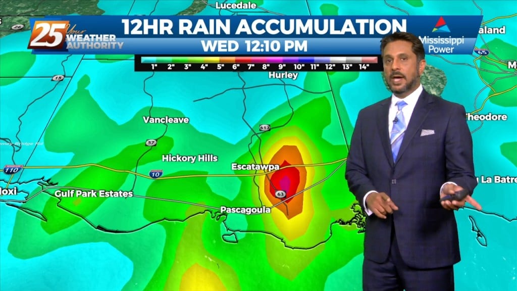
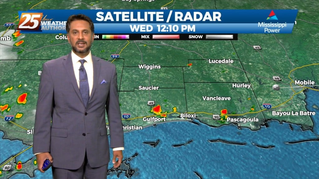
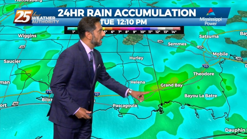
FLOODING ALONG RIVERS; WOLF, BILOXI AND TCHOUTACABOUFFA... A weaker surface low pressure and attendant boundary near or just offshore this afternoon will be the focus for…
FLASH FLOOD WATCH IN EFFECT - 7 PM... The threat for pockets of HEAVY RAIN will continue this afternoon. This will not be…
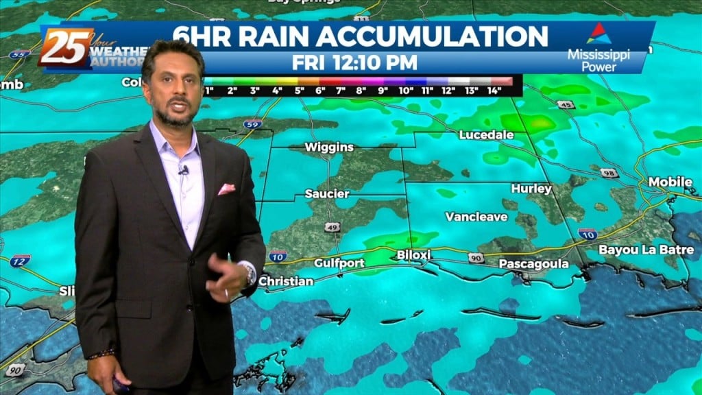
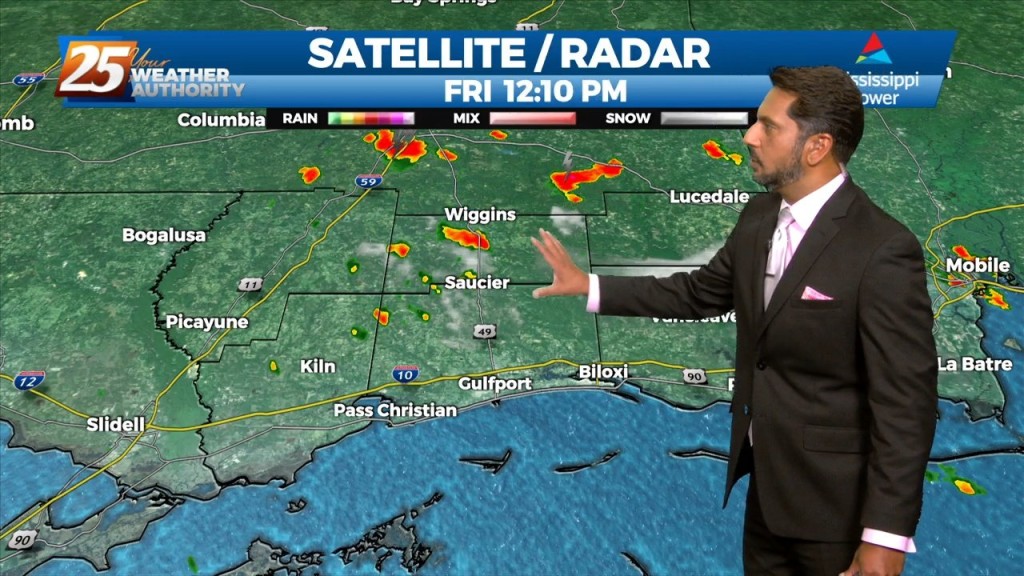
Today through Friday, high precip chances along with high rainfall rates will remain the topic along with an environment conducive for waterspouts. The surface…
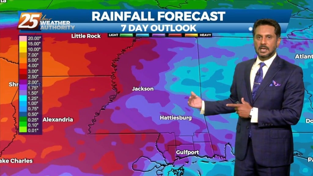
Rainfall tallies could be robust the farther north one moves though. This will be due to a surface low over east Texas and trough extending…
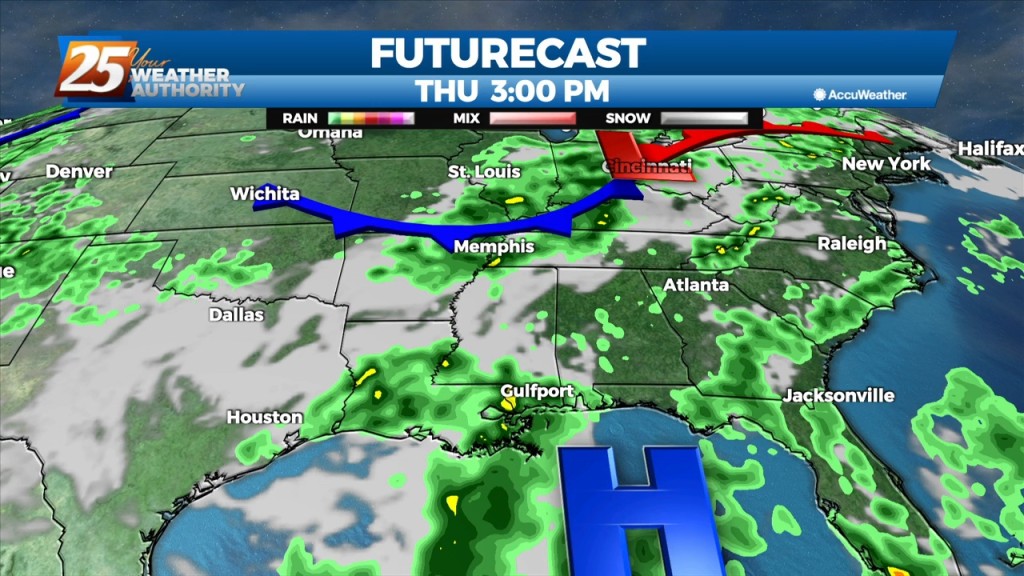
As minor disturbances move through multiple frontal systems through the Gulf South, they will trigger rounds of showers and thunderstorms each day. Moisture flow values remain…
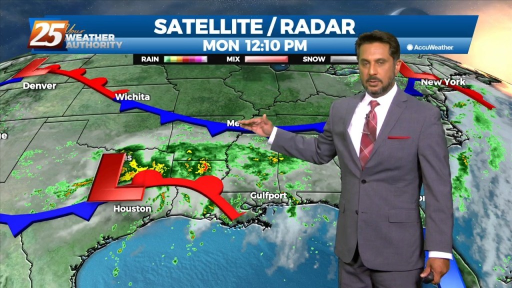
Water vapor imagery continues to show a plume of moisture extending from south Texas to the Carolinas, covering much of our area. The current disturbance that is…
This afternoon will continue to bring showers/t-storms to the area. The main concerns over the next few days will be the threat of thunderstorms. Heavy rain…
The focus this afternoon and evening will be on convective development to our north and east, moving into south Mississippi. A zone of low-level convergence oriented NW…
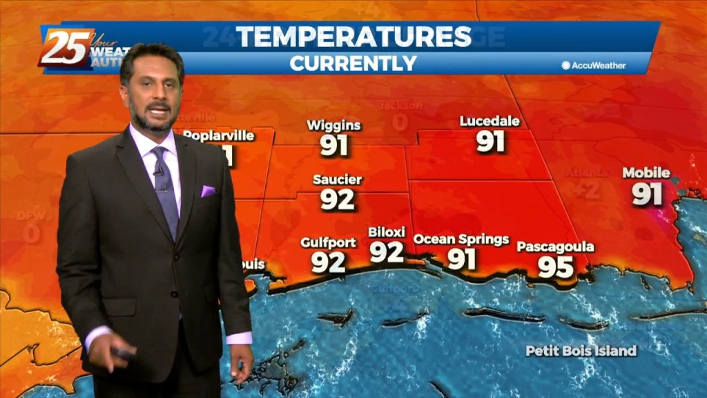
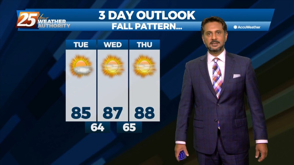
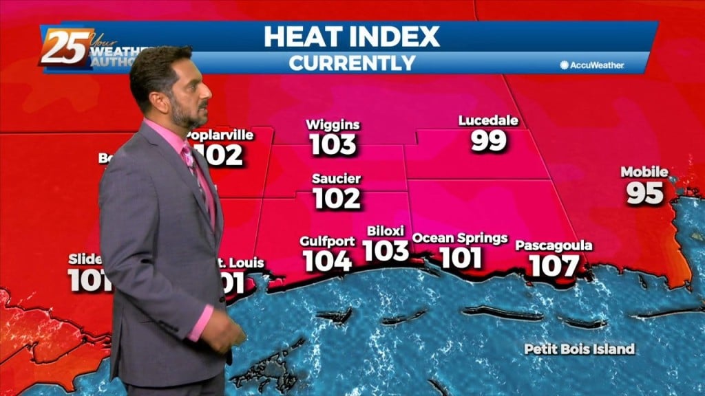
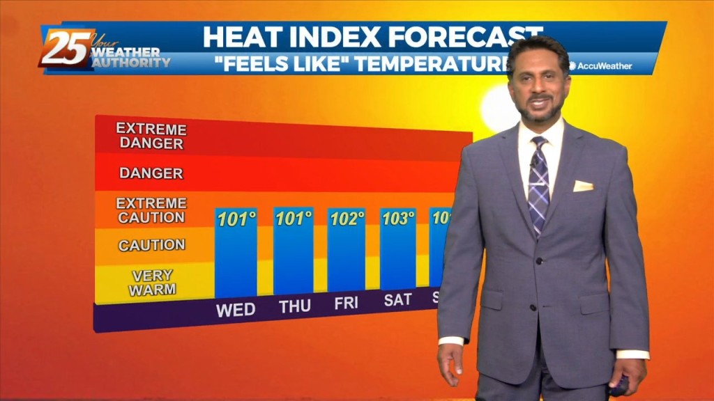
Low moisture flow will lead to low rain chances and HOT TEMPERATURES... The upper pattern doesn’t change a lot between now and Wednesday afternoon, with the local…
The upper high pressure over Colorado this morning will gradually build southeastward over the next few days, even as the trough to our northeast continues to dig…
The threat for heavy rain and pockets of FLASH FLOODING continues this afternoon. While it is very likely that some areas see heavy rainfall, the somewhat…
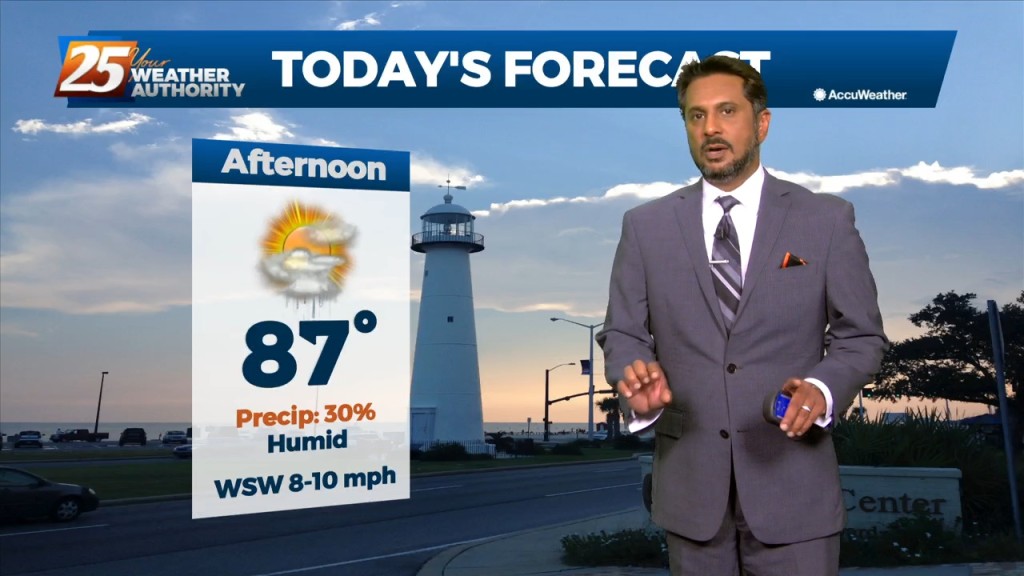
This afternoon will bring hot temperatures and a few showers/t-storms induced by the sea-breeze. Activity will fizzle out just before sunset. With an uptick in mid-level drier…
A weakness/subtle mid-level inverted trough over the northern Gulf continues a slow retrograding motion towards the WSW along the outer periphery of a mid-level high pressure…
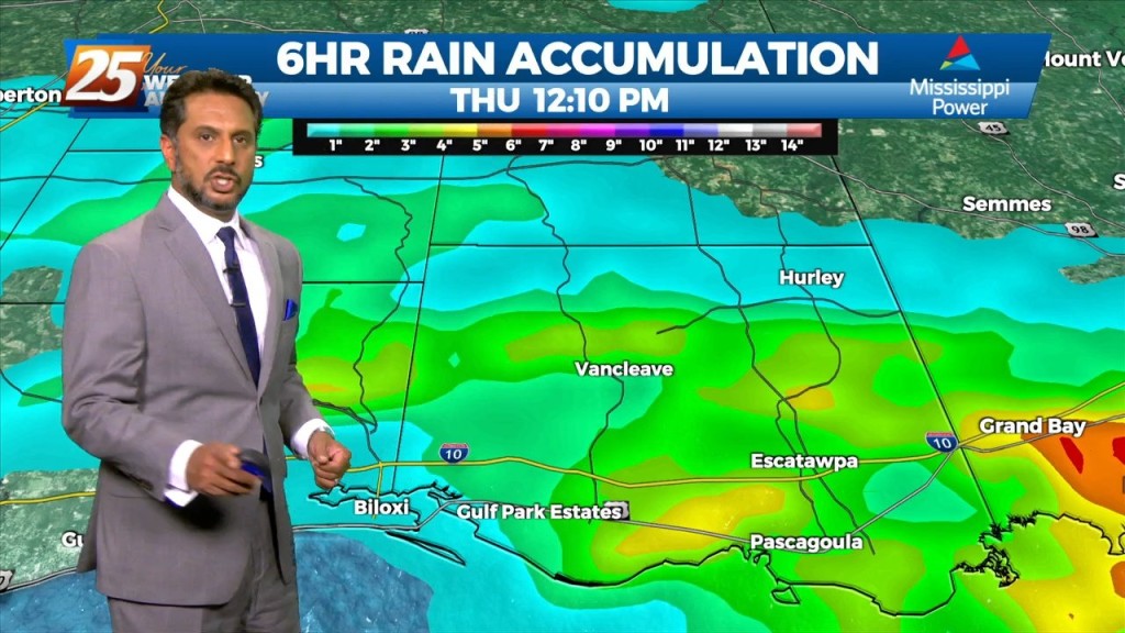
Many parts of the area have seen considerable rainfall over the past several days with a few locations having had measurable rainfall for quite an extended period. While…
Deep moisture from the Gulf of Mexico will continue to stream into the area with model indicating well above seasonal normal. This will allow for another…
Scattered shower/t-storms this afternoon will see a gradual transition of dry air replace deep moist air this weekend. Then another transition of this dry air to…
Very moist air along with erratic thunderstorm development thanks to sea-breezes and the like could run into a similar issue as yesterday where intense rates…