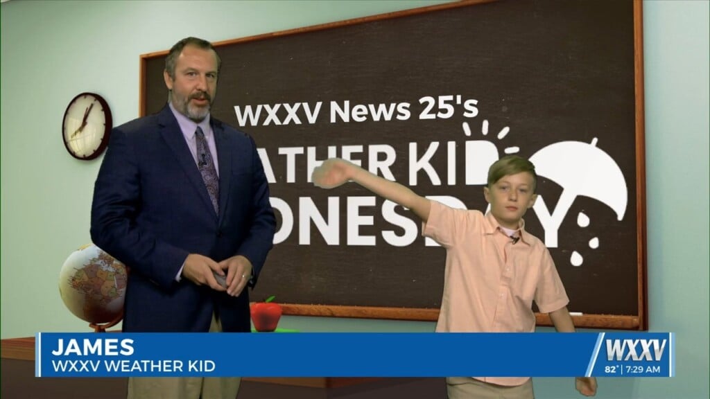
07/23 James' "Weather Kid" Wednesday Forecast
Today's WXXV Weather Kid Wednesday featured forecaster is James, a local 11 year old from the Gulfport area. James is a big fan of weather, and loves to go…
Today's WXXV Weather Kid Wednesday featured forecaster is James, a local 11 year old from the Gulfport area. James is a big fan of weather, and loves to go…
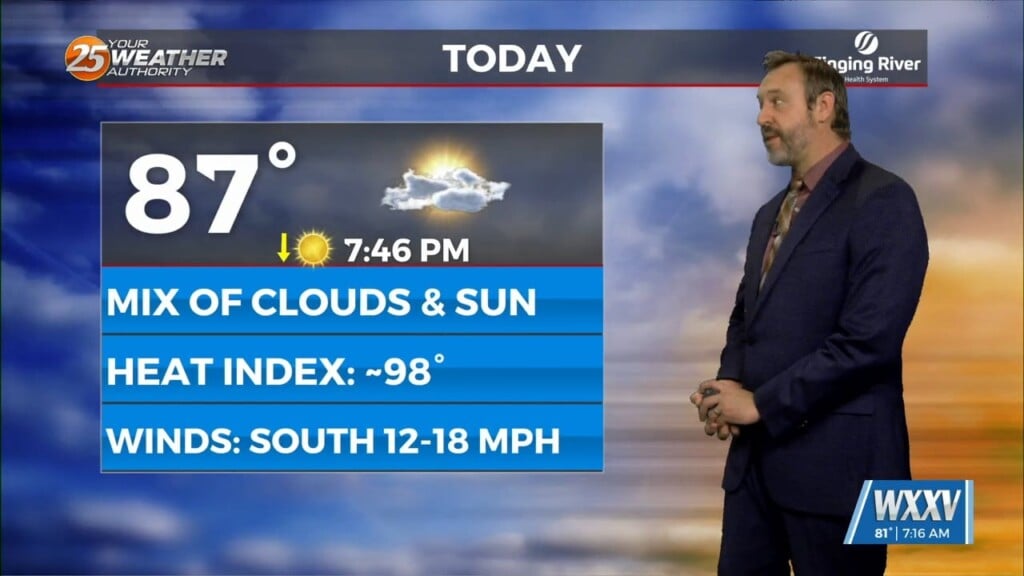
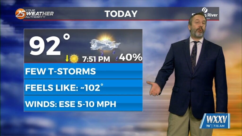
It's going to be a struggle to stay cool out there today as we're off to a sunny and hot start, with almost no chance of a cooling…
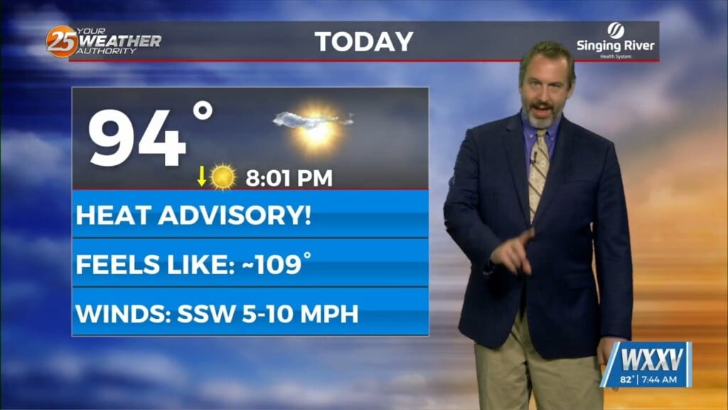
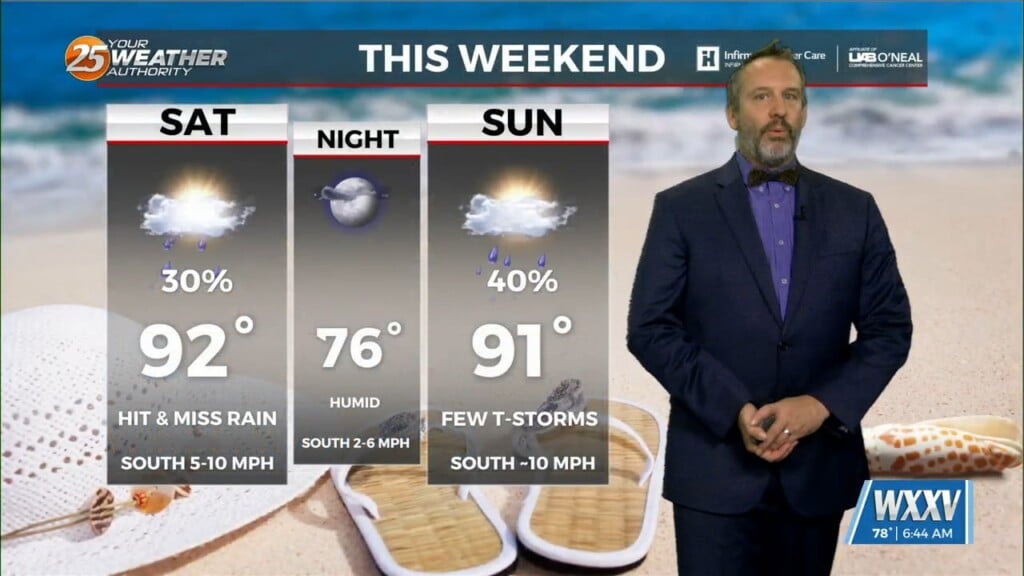
Expect it to be quite hot out there today thanks to sunny skies and drier weather, but we'll still see at least a couple of showers today with more…
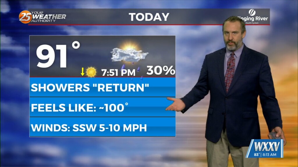
I'm saying showers "return" later today throughout the forecast, but the truth is they didn't really leave us in the first place...just thinned noticeably! It barely rained anywhere…
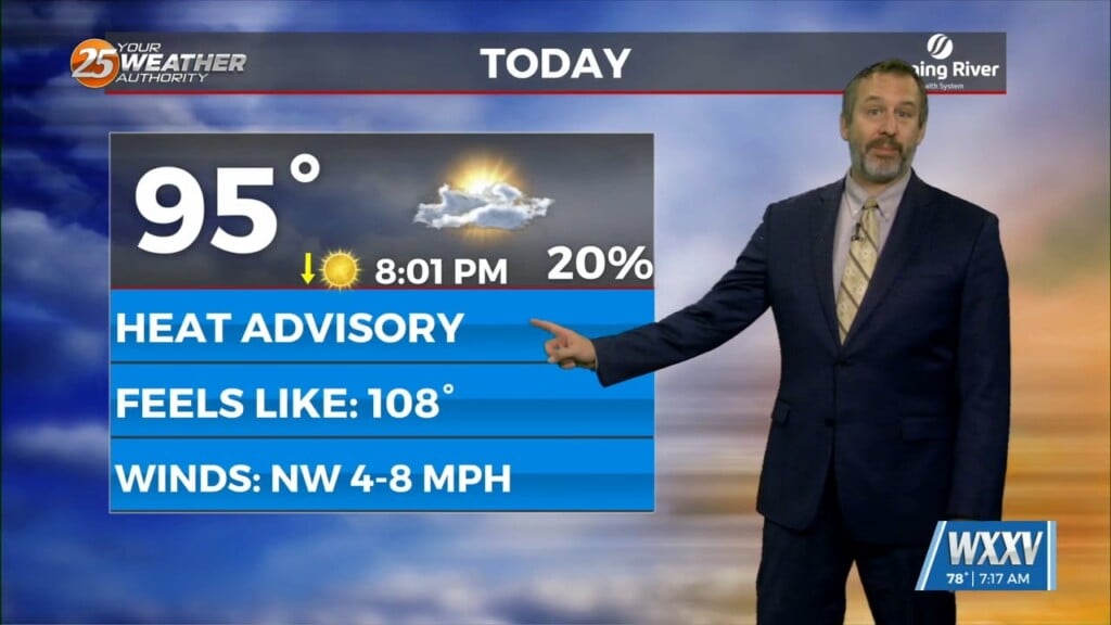
Expect much drier weather across South Mississippi for the next couple of afternoons! That means an end to the long streak of days with afternoon showers and thunderstorms,…
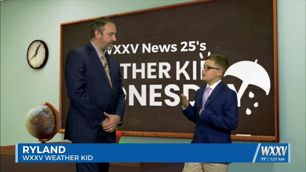
This week's WXXV Weather Kid guest forecaster is Ryland! Ryland is a big fan of weather, loving how quickly it can change and how powerful it can be. He loves…
Another week, another wet start as we continue the summertime pattern we spent the last several weeks of spring enjoying. That typically means coastal/Mississippi Sound showers and thunderstorms…

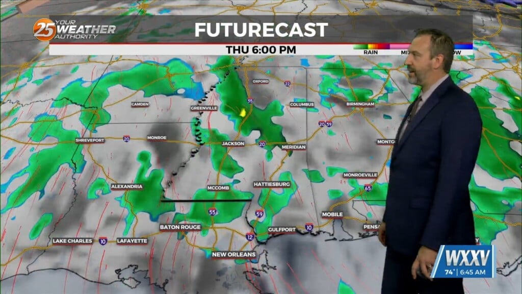
The middle of the week was noticeably less active than many recent days in regards to afternoon showers, but now the rain returns as we head into the…

EJ and Elizabeth will be taking on new roles at WXXV starting next week, but they are leaving the morning show in good hands! Introducing our new…
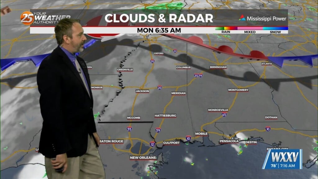
Not breaking any new ground with today's forecast as we start off a new week, but with the same ol' pattern we've enjoyed for the last…
It's the last day of spring 2025 today thanks to the summer solstice occurring later tonight, but we'll continue our long period of summer-like weather. That…

We're starting off with relatively nice weather and clear skies this morning, but more storms are on the way again this afternoon. Severe weather is not expected, but…
Expect more of the same pattern of summer-like weather out there again for the next several days with no end in the foreseeable future. That means more afternoon…
We're in for more familiar weather across South Mississippi today with initially spotty, then more frequent shower and thunderstorm activity popping up later in the day. It won't be…
We are firmly entrenched in a summertime pattern, leading once again to cloudy, stormy skies as we head into the afternoon. Today's activity will trend on the "lighter"…

For this week's WXXV Weather Kid Wednesday, we met Norah, a local weather enthusiast and puddle jumper. Norah has been known to video her own weather related content, and is…
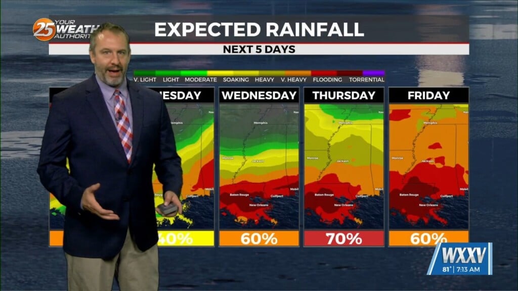
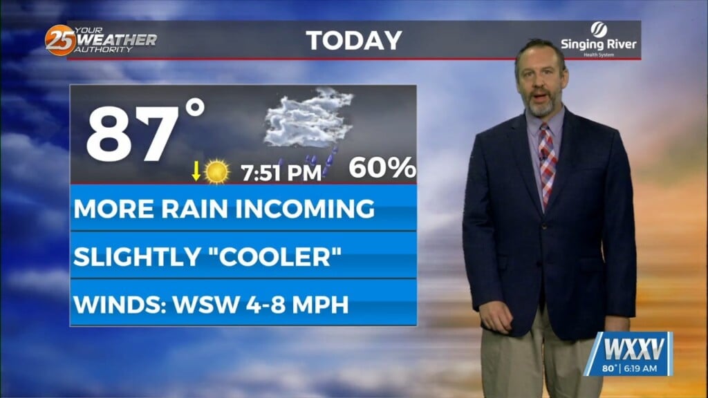
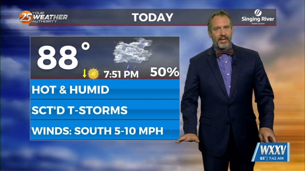
Expect a rainy week ahead, which will back our afternoon temperatures down a couple of degrees, but won't do much about the humidity. Today will still be on…

Thanks for joining us today, Madelynn! If you'd like your child to be our next Weather Kid...or Weather Teen in this case...just fill out the form on our website…
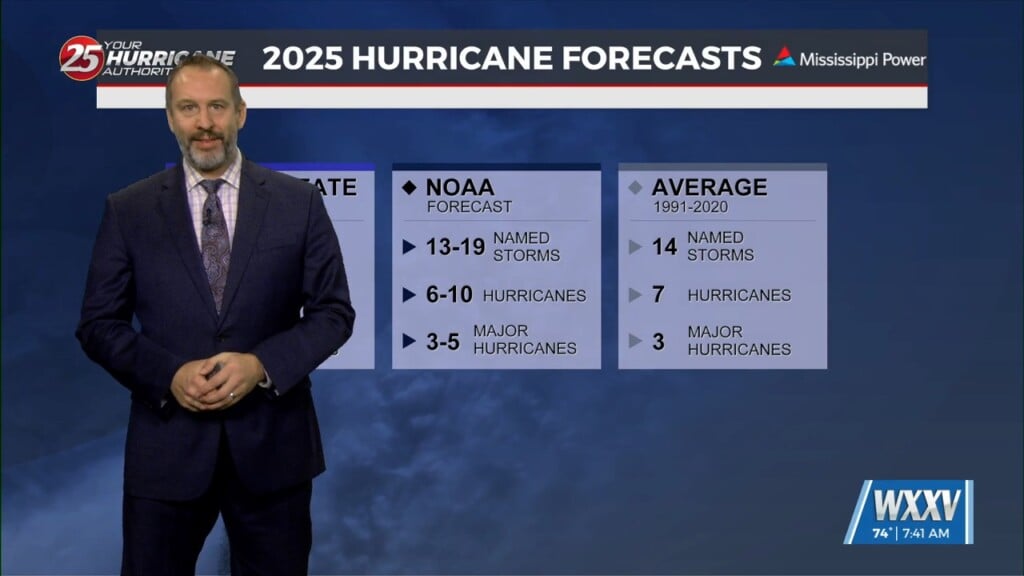
The Atlantic Hurricane Season for 2025 officially began yesterday, so today we take another look at the forecasts. Many of this year's forecasts have called for a slightly above…
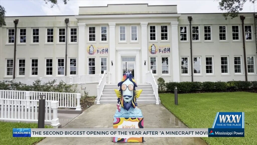
GULFPORT, Miss. (WXXV) — A brand-new family entertainment center is making its way to the Mississippi Gulf Coast, and they're hiring now. Hippie Fish, a vibrant new venue…
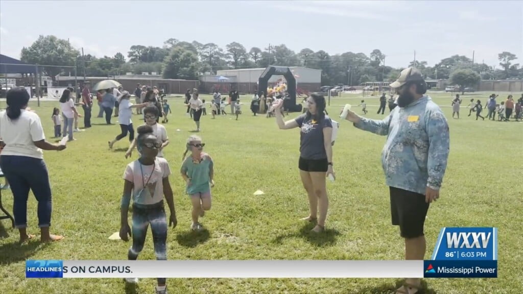
GULFPORT, Miss. (WXXV) — With Memorial Day approaching, students at Pass Road Elementary in Gulfport took part in…
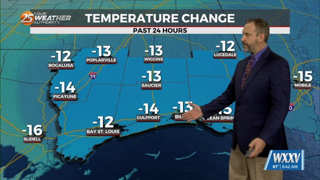
We're finally seeing a break in our summertime pattern as much cooler weather has moved in on the back of yesterday's cold front. Temperatures fell a little lower…
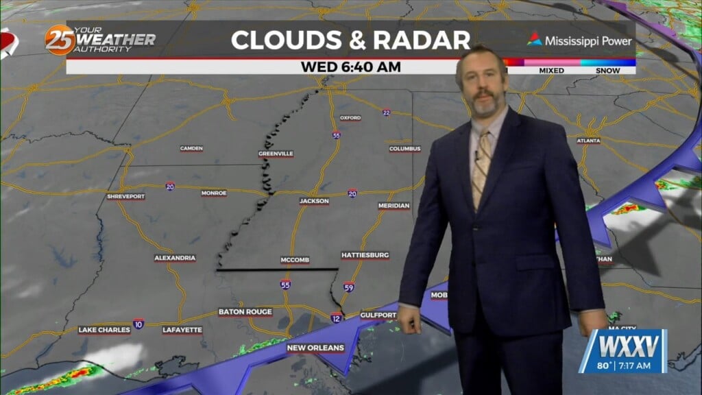
It feels like it's been months since I could say this, but we're finally getting a cold front to pass through South Mississippi today. In fact, as I…