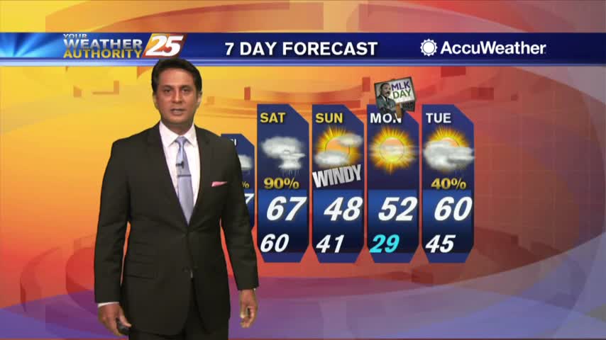
6/14 - Sam's Parker's "Toasty Into The Weekend" Friday Forecast
High pressure becomes centered over the region and the activity will remain suppressed today and tomorrow. Very dry air aloft associated with subsiding air will effectively…
High pressure becomes centered over the region and the activity will remain suppressed today and tomorrow. Very dry air aloft associated with subsiding air will effectively…

Activity will remain suppressed today and tomorrow as high pressure becomes centered over the region. Very dry air aloft associated with subsiding air will…
A highly amplified pattern in the mid and upper levels will remain in place through Saturday night across the CONUS. Today into tonight, the forecast area…
A much drier air mass in the wake of an overnight cold front will remain in place through Thursday. The next reinforcing shot of dry air…
High pressure has begun to shift to its southeast throughout today. Westerly winds continue tonight dropping to 3-6 MPH overnight. Even though we will see cold…

At the surface, high pressure extended from the Great Lakes southward to Florida will shift slowly eastward over the next few days, to be centered…
A warm start with upper-level clouds moving across the area from east to west...
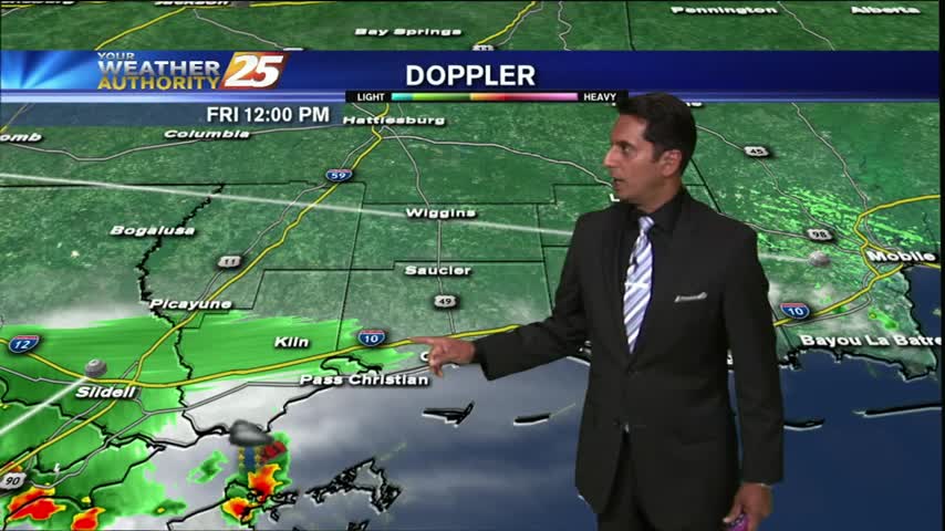
A rain-free start to the day under cloud coverage, but the activity will increase later today...
It has turned out to be a BEAUTIFUL afternoon...
After a FRIGID START, temperatures are slowing warming into the 50s under sunny skies...
As an area of high pressure continues to move SE, the warming trend will begin this afternoon...
A very mild start to kick-off the weekend as drier air continues to affect the region...
After isolated t-storms over the sound this morning, this afternoon will be HOT & HUMID...