4/30 - Rob's Thursday Morning Forecast
A cool and dry start with BEAUTIFUL conditions ahead...
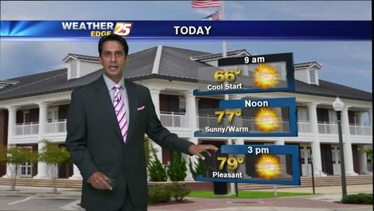
A cool and dry start with BEAUTIFUL conditions ahead...
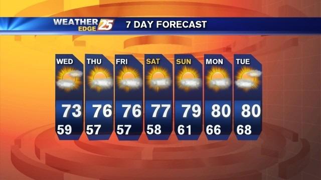
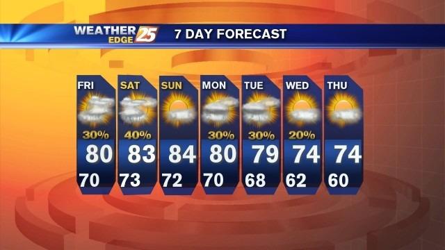
Skies will be partly cloudy tonight, with lows falling into the middle to upper 50s along the coast and lower to middle 50s inland.
A cloudy start with clearing skies through today...
Expect mostly cloudy skies tonight with a chance for showers and isolated storms. Expect lows to drop into the upper 50s with winds shifting from the northwest around 10 mph.
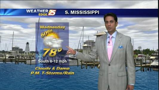
A cloudy and damp start with t-storms later today...
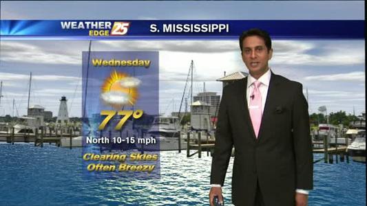
Rain continues through Wednesday.
Sunny and warm start to December
Wet and hot weekend.
Great looking weekend.
A mild & humid start with t-storms tonight...
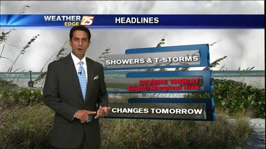
There is a slight risk for severe weather Friday and Saturday, with large hail and damaging winds the main threat. Expect mostly cloudy skies for tonight, with the best chance for scattered showers and storms early. Lows will be near 70.
It's a cloudy start with showers & t-storms to develop late morning...
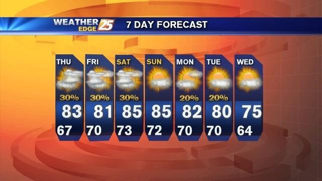
Low temperatures will drop into the middle to upper 60s tonight under mostly cloudy skies. Expect a chance for scattered showers and storms.

A BEAUTIFUL morning with clear, cool and dry conditions...
Weather forecast for Tuesday 042115
Beautiful week expected
A cool and dry start, with a beautiful day on-tap.
Weather forecast for the week starting 04/20/15

A mild and cloudy start, with MAJOR changes by this afternoon...
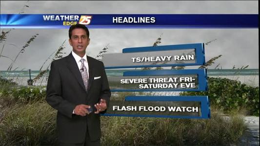
The Flash Flood Watch for our area has been extended until 7 p.m. Saturday as scattered showers and storms will be likely for Saturday, with a few strong to severe storms possible.
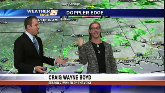
Season 7 voice winner, Craig Wayne Boyd, interrupts weathercast for 041715
A Flash Flood Watch remains in effect until 7 p.m. Friday. Expect scattered showers and storms during the beginning of tonight with lows in the upper 60s.
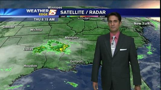
It's a dry start with areas of patchy fog on this Thursday morning...
A MUCH drier start with lower rain chances for this afternoon...