
5/27 - Sam Parker's "Storms for Lunch" Tuesday Morning Forecast
Another day of storms this time with a higher chance of severe weather. Our next round of storms are expected to impact the local area…
Another day of storms this time with a higher chance of severe weather. Our next round of storms are expected to impact the local area…
Possible chance for severe weather later today with some portions in the enhanced risk for severe thunderstorms. Isolated to scattered severe thunderstorms will be possible…
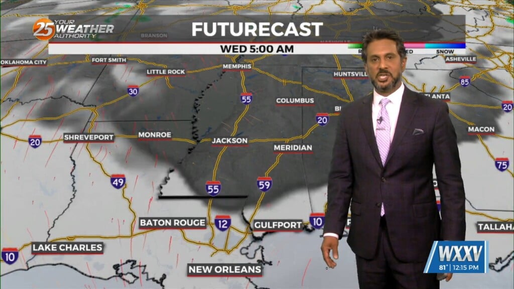
Possible chance to see severe storms Wednesday afternoon and night. Smaller rain showers continue over night for some of the area. Wednesday will be another warm…
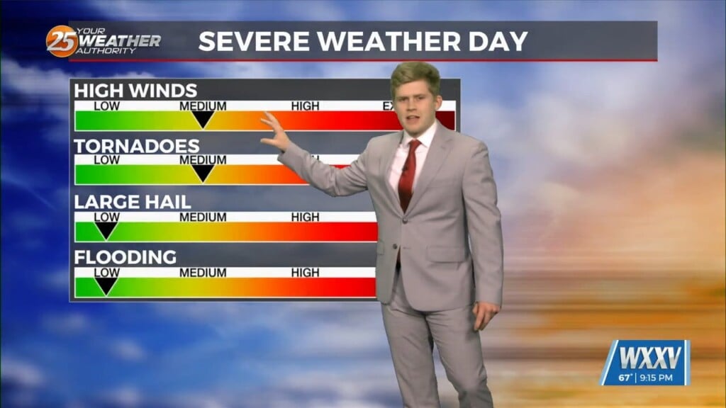
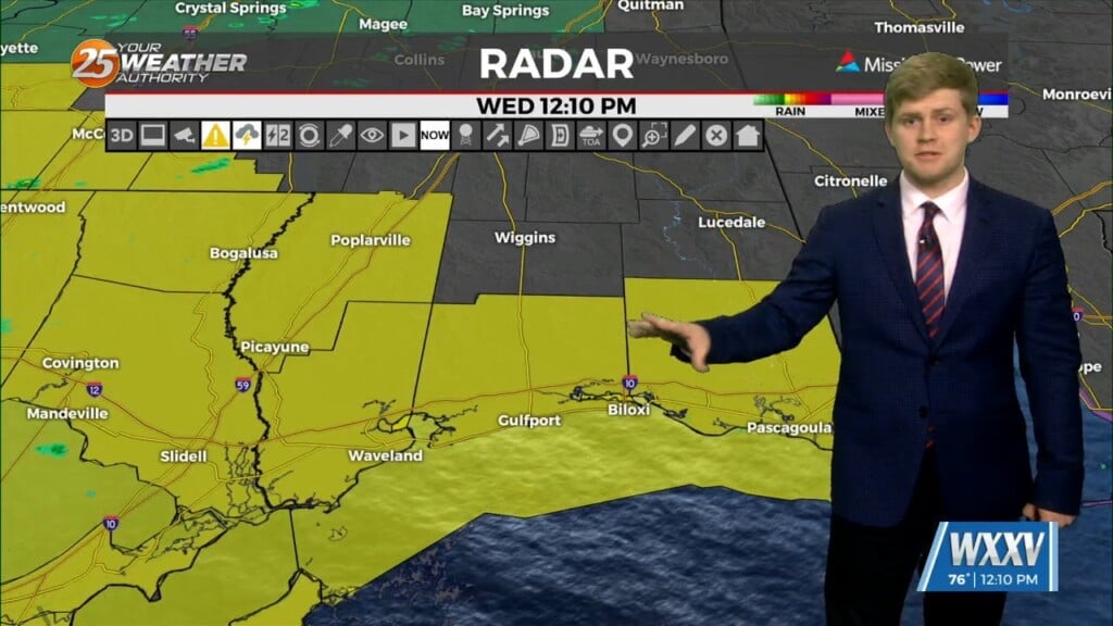
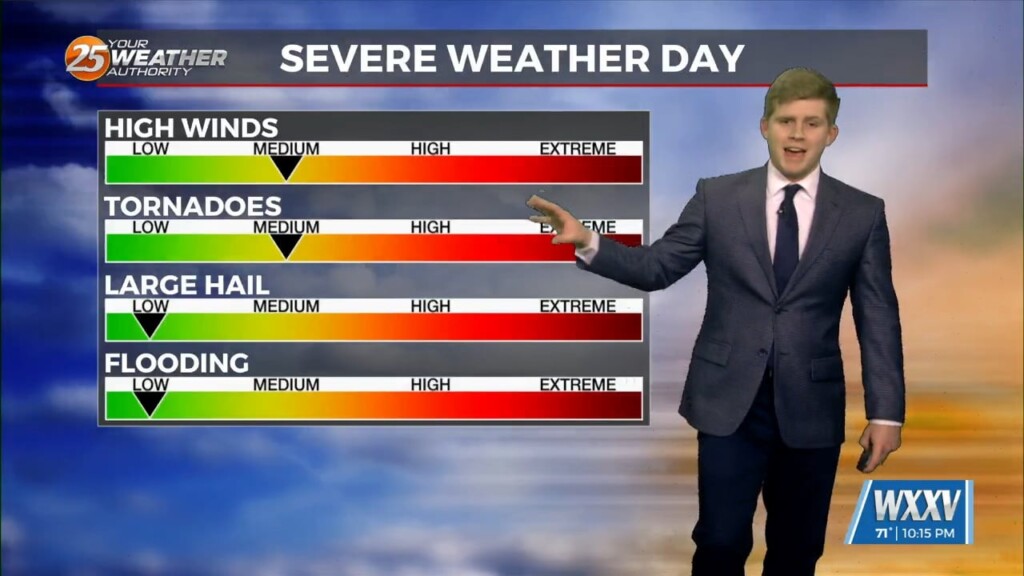
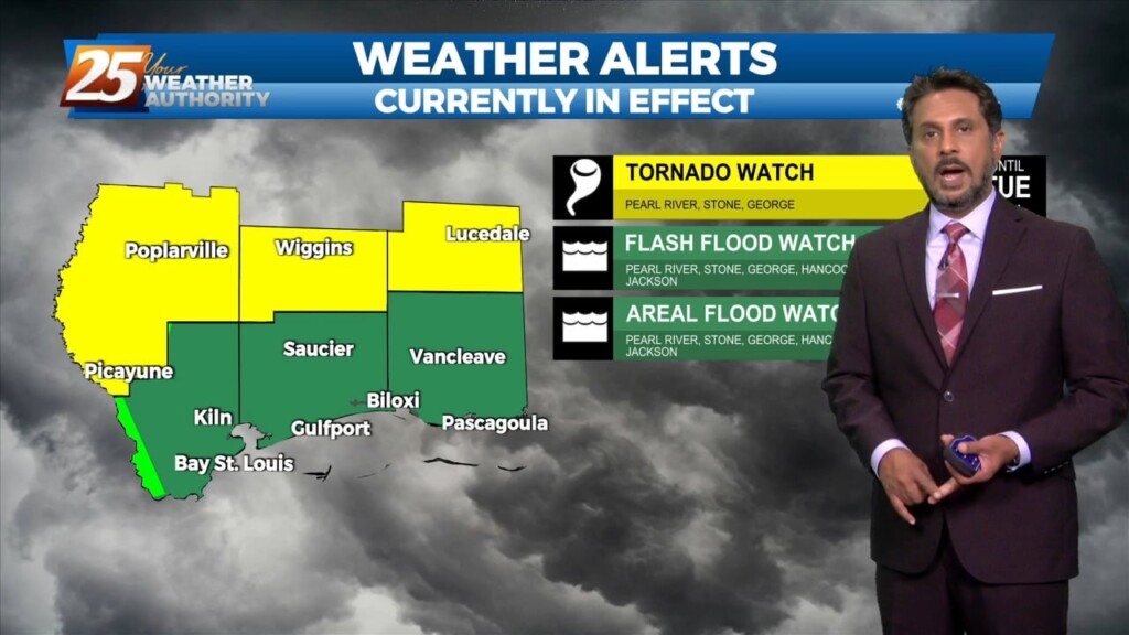
Foggy tonight Gearing up for the Chance of damaging winds, hail, and tornadoes tomorrow. 3 different tornado warnings across south MS earlier today. A dense…
Winds will begin to weaken dropping below advisory thresholds this afternoon. But there will still be gusts to 25mph at times and even higher winds up…

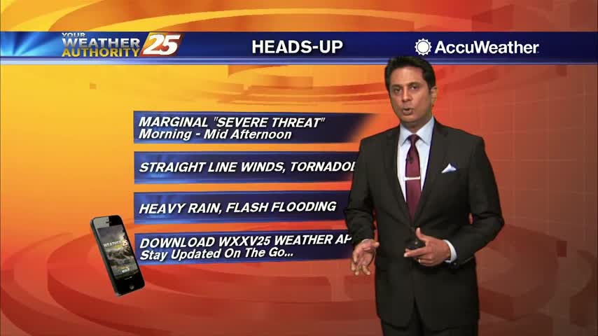
With severe weather in the area, News 25 wants to make sure the public is weather aware. News 25’s Everett Ganier Jr. spoke with Chief Meteorologist Rob Knight ahead of…
The front to the west has begun to slow with discrete super-cell t-storms developing in advance of the main system. The low level jet does somewhat…

A SEVERE THREAT WILL BE IN THE AREA this afternoon and overnight... There is now a slight risk for severe storms capable of producing damaging winds,…
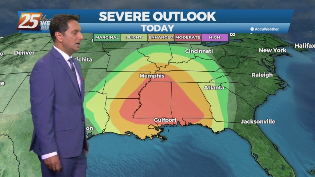
THE AREA/STATE IS UNDER A MODERATE (LEVEL 4 OF 5) SEVERE POTENTIAL THROUGH TONIGHT... A cold front to the west with a squall line in advance…
Even warmer temperatures this afternoon with a cold front draped across N'tern Mississippi...
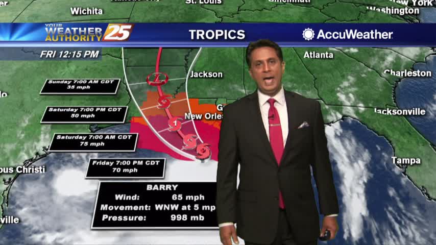
Rain band continue to move across the area as TS Barry heads towards the central Louisiana coast...
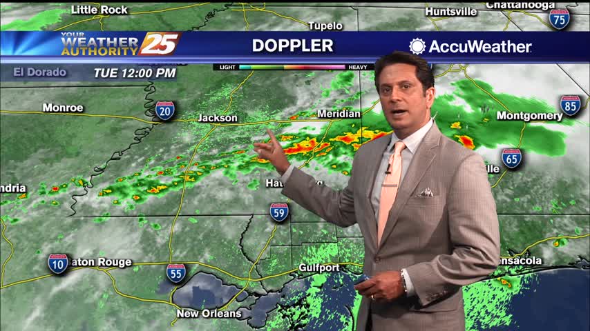
Patchy fog this morning as line of showers and t-storms beginning to develop and move into the area...