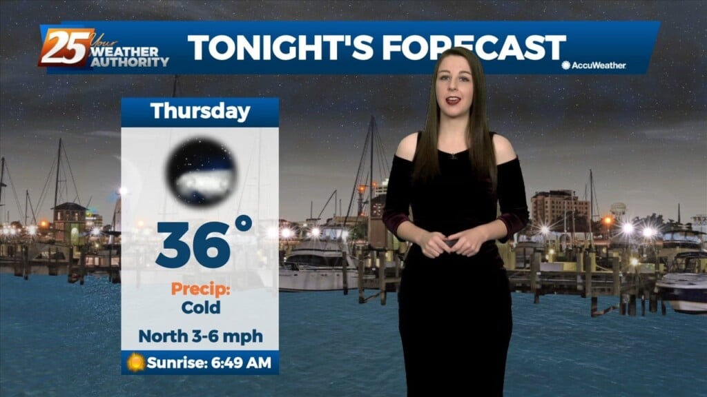
1/26 - Brittany's "Cold" Thursday Night Forecast
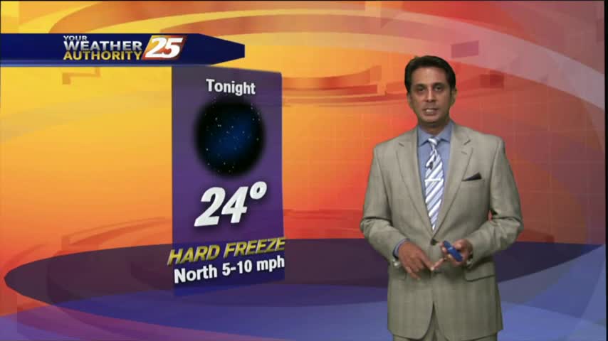
Mostly clear skies and cold temperatures will continue through the night. The only cloud cover expected will be a few high level cirrus clouds passing through on the back…
Mostly clear skies and cold temperatures will continue through the night. The only cloud cover expected will be a few high level cirrus clouds passing through on the back…
High pressure continues to build over the area today and winds will gradually subside over the next 24 hours, at least over land areas. Very…
Humidity is increasing rather quickly from the east tonight, as our flow is now coming off the gulf. Although we had a weak southerly breeze today, humidity remained quite…
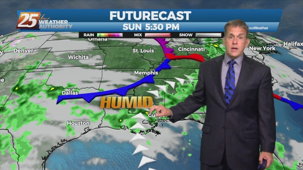
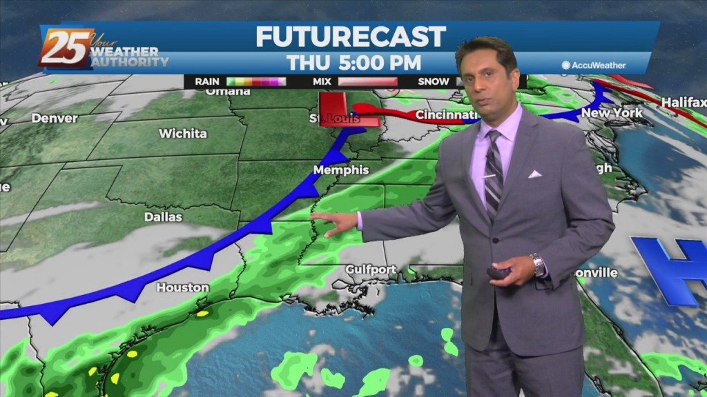
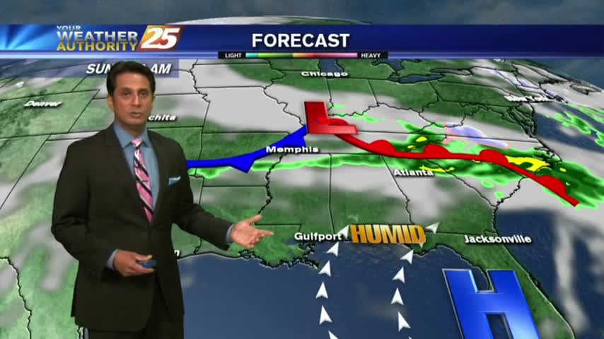
Tonight into Wednesday, zonal flow will continue to dominate the upper level pattern. Southerly surface winds will act to reintroduce warm air and moisture into the region,…
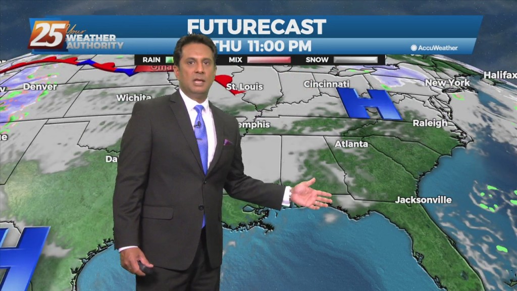
Surface high pressure remains in control of the northern Gulf coast, with a broad center/axis extending from across SE LA, northeast into MS/AL and central TN. The surface high…
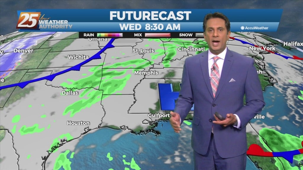
Return flow in the low-levels is already trying to begin but by midday and for the next few days it will increase with temperatures already moderating today…
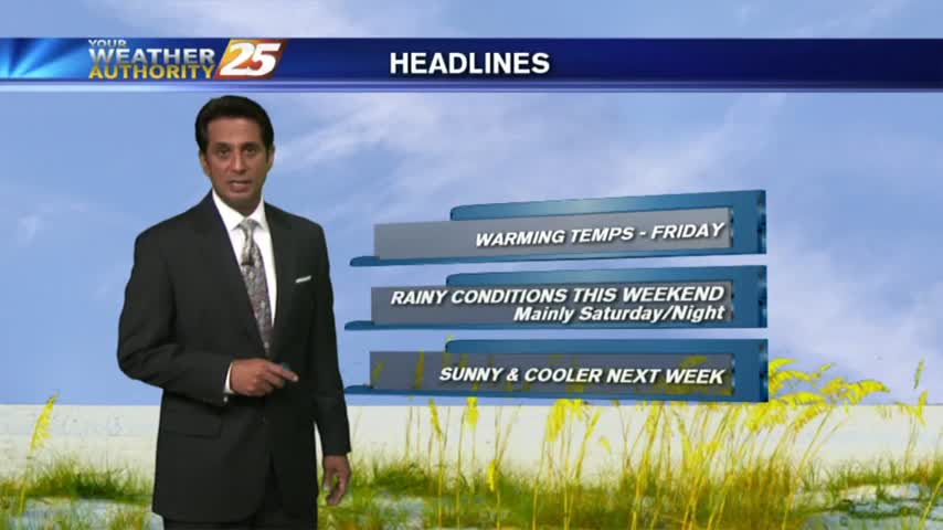
The pattern will put the area in a region dominated by high-pressure. So a quiet weather pattern with slowly moderating temps expected through midweek. Guidance is generally in good…
Rapidly increasing temperatures today will jump by several degrees along with increasing cloudiness. Low level moisture will also begin to return as high-pressure continues east, a splitting trough…
Much of the workweek will remain a temperature forecast as surface high pressure keeps any rain potential out of the area through midweek. Mild daytime temperatures in the mid…
A beautiful Tuesday afternoon ahead with sunny skies but cool temperatures...

Cloud coverage continues through the area but a few breaks are starting to let sunshine in...
Another cold start to the day as high-pressure to the NW moves closer to our area...
After another COLD start to the day, the wind flow has switched with the warming trend beginning...

Another VERY COLD start to the day, but the warming trend has begun...
Another CHILLY morning but major changes ahead as an area of high-pressure overhead begins to move SE...
It's another COLD start heading into the weekend with inland areas under a FROST ADVISORY...

A chilly/frigid start to the day with continued breezy conditions from last night...
A CHILLY start to the day with mid/upper level clouds moving across the N'tern Gulf of Mexico...
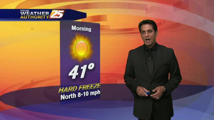
Another FRIGID start to the day with a HARD FREEZE WARNING through 11 a.m...with the warm-up beginning tomorrow...

Another FRIGID start to the day as upper-level non-rain producing clouds begin to move across the area...
After a cold and cloudy start to the day, clouds have cleared with SUNNY skies this afternoon then FRIGID conditions overnight...
Changes through the weekend with frontal passage now has FRIGID temperatures along the Mississippi Gulf Coast...
With high-pressure in the area, overnight cooling has brought areas of patchy fog and low clouds...