5/11 - Rob's Thursday Afternoon Forecast
A WARM/HUMID air mass moving in from the GOM has mostly cloudy skies through the region...

A WARM/HUMID air mass moving in from the GOM has mostly cloudy skies through the region...

As a more humid air mass moves into the region, areas of PATCHY DENSE FOG has developed once again...
With elevated humidity, patchy fog this morning has burned off leaving a few/partly cloudy skies...
A warm front developed this morning with a few light sprinkles, now under warm, humid and breezy conditions...
As a warm front develops north of the area, a few light showers have been moving in from the GOM...
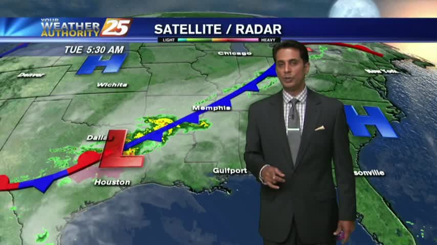
It's a warm, humid and windy start to the day in advance of an approaching cold front to the NW...
Another WARM/HUMID morning with areas of VERY DENSE fog along the coastal counties...
Another morning of continued southerly flow has areas of PATCHY DENSE FOG along the Southern 6...
After light fog and mostly clear skies earlier this morning, clouds continue to move into and develop in the area...
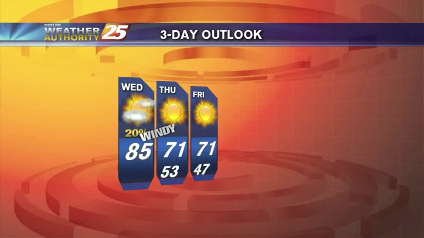
After a warm/humid start with patchy fog, warming temps continue to bring drier conditions to the area...
A WARM/HUMID flow from the Gulf of Mexico has areas of PATCHY FOG along the Southern 6...
With a VERY HUMID air mass advecting in from the Gulf, isolated showers continue to move in from the south...
As moisture flow continues from the GOM, areas of PATCHY FOG has developed along the viewing area...
After a humid start with areas of PATCHY FOG, warming temps has decreased humidity along with partly cloudy skies...
AS a southerly flow continue to bring elevated humidity, this morning is starting off with areas of patchy DENSE fog...
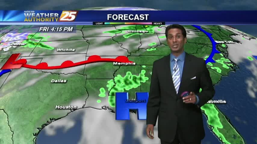
After early morning showers/t-storms with a slight threat for SEVERE...the brunt of the activity has moved to our east.
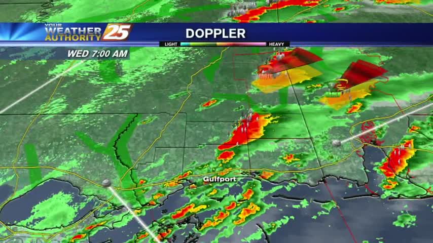
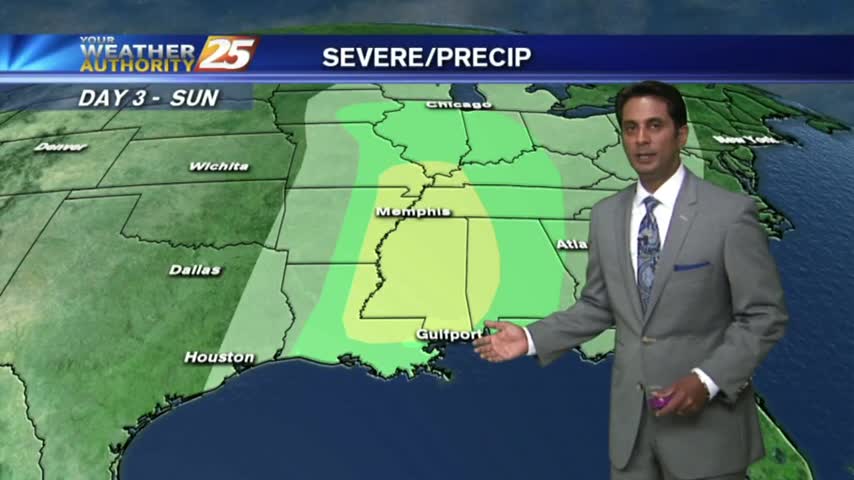
Showers & t-storms moving into and developing along the Southern 6 with a TORNADO WATCH in effect...

Residual moisture from yesterday has areas of PATCHY DENSE FOG, then sunny and warm conditions through today...
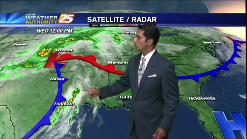
With a batch of low-level moisture from earlier this morning now to the east, skies have thinned to partly cloudy...

As a WARM/HUMID flow continues from the Gulf of Mexico, areas of patchy dense fog has along the southern 6.
After a few very light showers earlier this morning, drier conditions are moving into the area...
A warm and humid start with a cold front in central Mississippi and a few light showers along the Southern 6...
After a cloudy, warm/humid start to the day...showers & t-storms continue to develop and move into the area...

After partial clearing yesterday...the clouds are back in the area along with rain developing along the Southern 6...