6/18 - The Chief's "Tropical Moisture Slowly Departing" Tuesday Afternoon Forecast
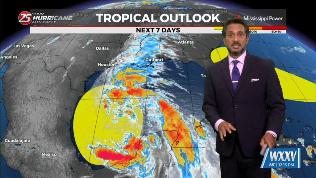
The area of low-pressure over the Bay of Campeche has been designated Potential Tropical Cyclone 1. Still have a fairly significant surface flow between the…
The area of low-pressure over the Bay of Campeche has been designated Potential Tropical Cyclone 1. Still have a fairly significant surface flow between the…
The next reinforcing shot of dry air will move down behind a new backdoor cold front overnight/Wednesday morning. There is not a lot of boundary…
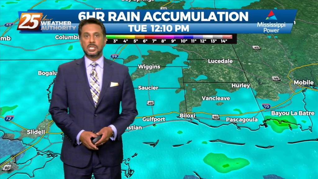
Rainfall tallies could be robust the farther north one moves though. This will be due to a surface low over east Texas and trough extending…
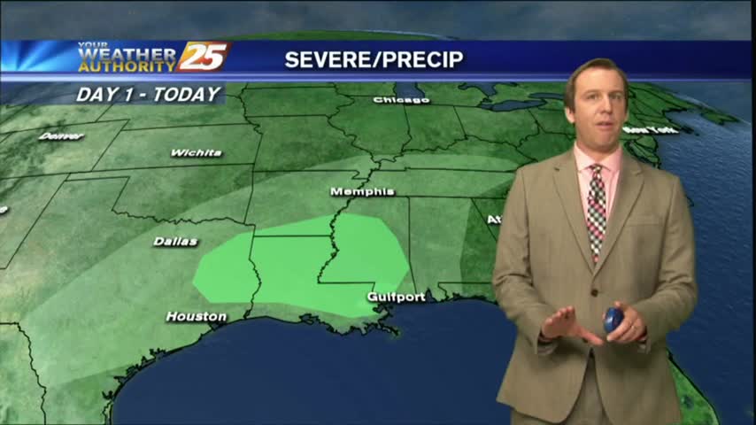
A complex of t-storms moving in from the west could provide for SEVERITY this afternoon...
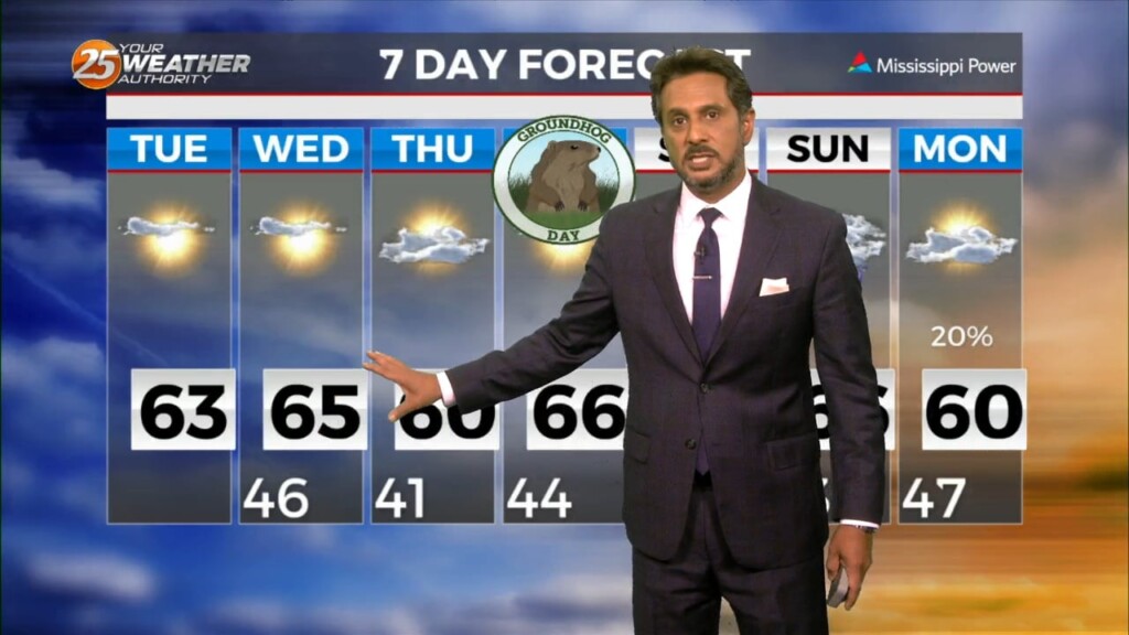
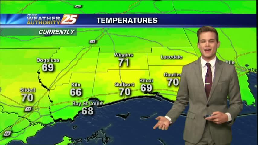
After another CHILLY start to the day, temperatures are warming nicely into the 70s...
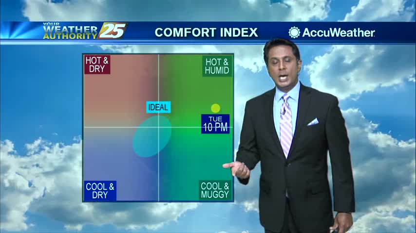
Hot temperatures this afternoon will feel hotter when we factor in the humidity, heat index will be around 103 degrees...
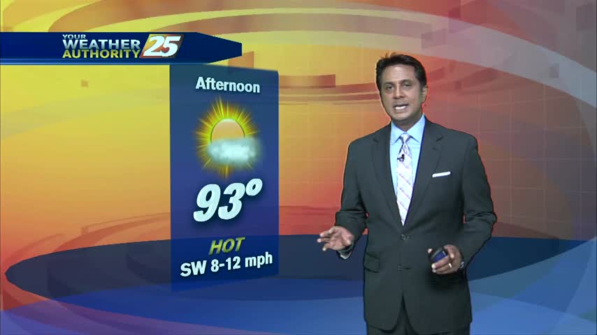
HOT temperatures this afternoon under plenty of sunshine...
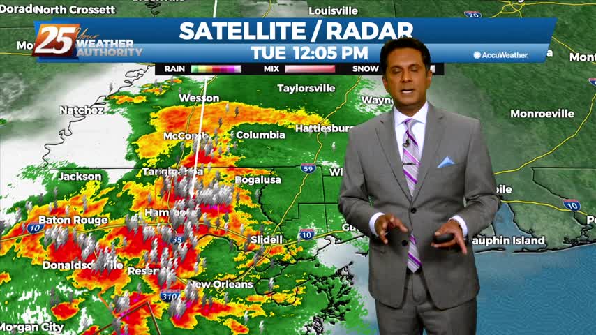
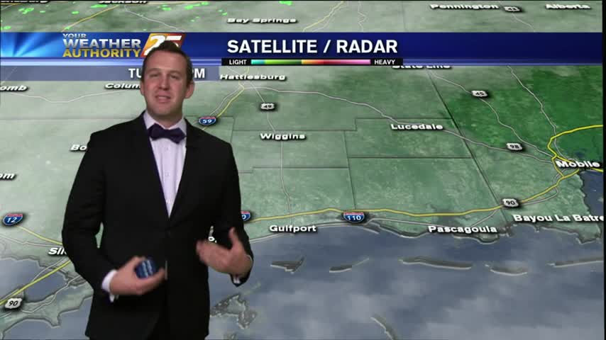
Ended up with a little bit of a break in the rain for the late shows, but make no mistake, we will see more showers and thunderstorms through the night and into tomorrow. Click the link for the full forecast.
The overcast skies moved in as expected, and we've even seen a few thunderstorms already, but there are even more storms ahead. Watch the full forecast for the details.
A wonderful day to be outside, but colder air is on the way.
Tuesday afternoon's forecast calls for the rest of the evening to remain pleasant with calming winds and clouds increasing through the night. Not too much is expected out of this increase, as the clouds will clear out quickly as we…