04/07 Ryan's "Chilly, Sunny Start" Tuesday Morning Forecast
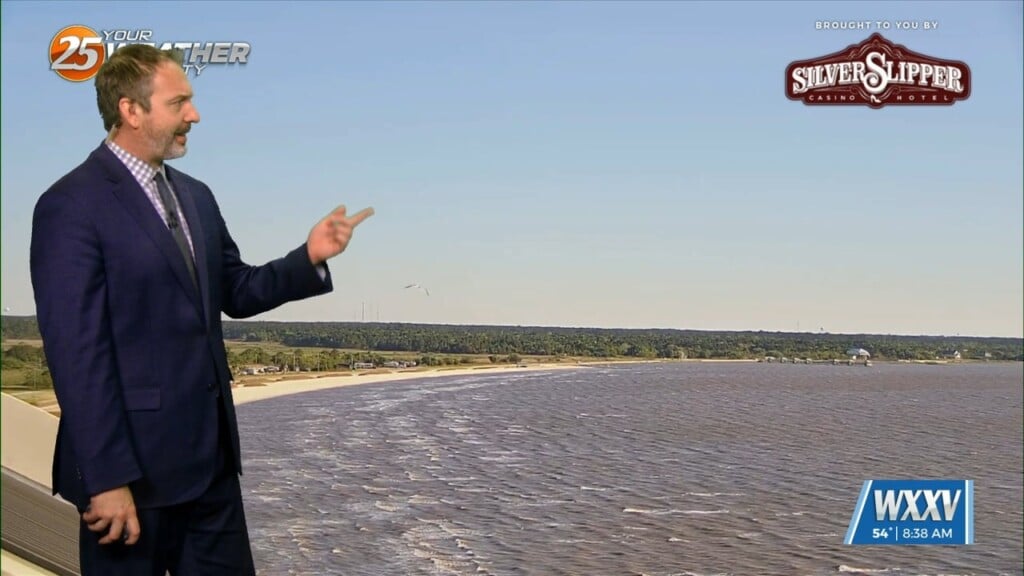
We got off to a chilly, but sunny start to the day out there with our coldest weather we'll see with the last front that moved through.…
We got off to a chilly, but sunny start to the day out there with our coldest weather we'll see with the last front that moved through.…
Friday featured a warm one for the Mississippi Coast as Gulfport Biloxi International Airport recorded a record high temperature. Winds back off this evening and any remaining clouds…
A weak cold front, packing no moisture and only a wind shift, makes it through our area overnight. Winds will turn to a north/northwesterly origin and become…
Pleasant and cool conditions this evening will give way to winds picking up in the wake of a cold front overnight. This front will be lacking…
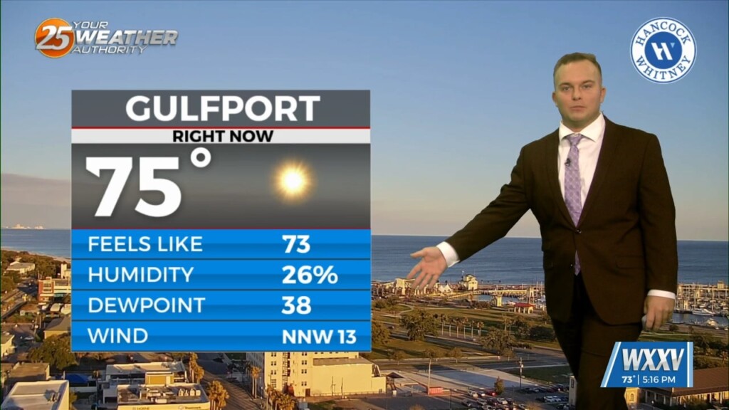
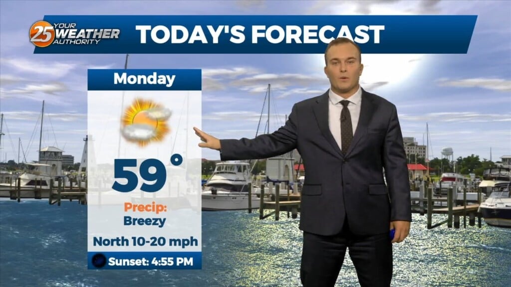
It is chilly, but not frigid to start off this week. Morning temperatures a few degrees below average temperatures for the day will warm to near-seasonal averages…
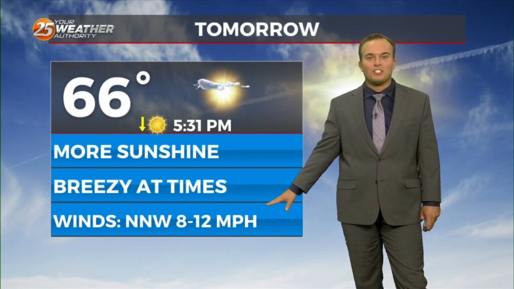
Another cool and breezy afternoon will be in store for us. Temperatures will be similar to yesterday but winds will be slightly more tolerable. Lots of sunshine…
It is another cold start to the day with winds still remaining in play. Temperatures in the upper-30s to lower-40s will have a wind chill factor to…
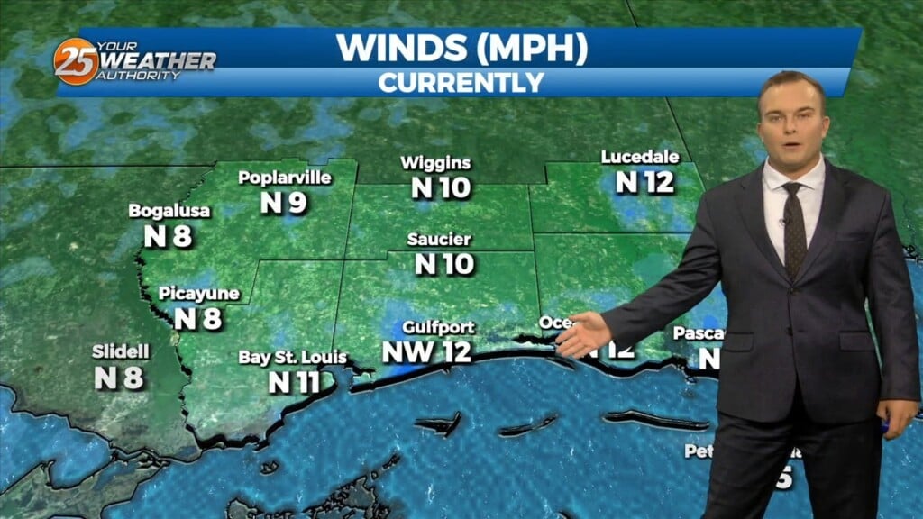
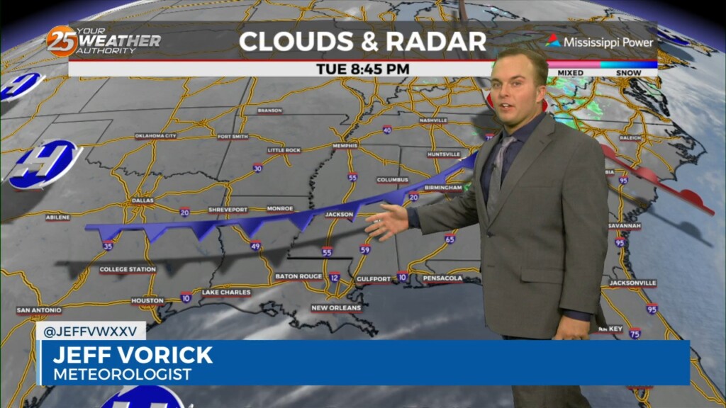
Some thin, upper-level clouds move in this afternoon. Outside of that, sunshine does dominate and expect cool conditions. It will be breezy if not windy at times.…
It is a much colder start this morning with temperatures in the 40s and breezy northerly winds behind a cold front. Expect sunshine to dominate early but…
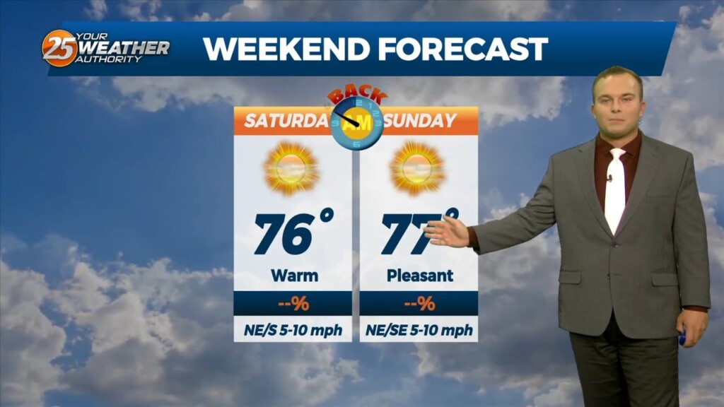
Expect cool temperatures overnight under clear skies and light winds. Saturday features tons of sunshine with a warmer start, and day overall. Winds will remain light and shift…
Temperatures will cool off quickly this evening but it will be a pleasant one. It will be several degrees warmer out the door tomorrow morning with the pattern…
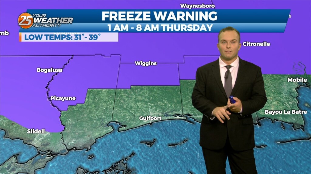
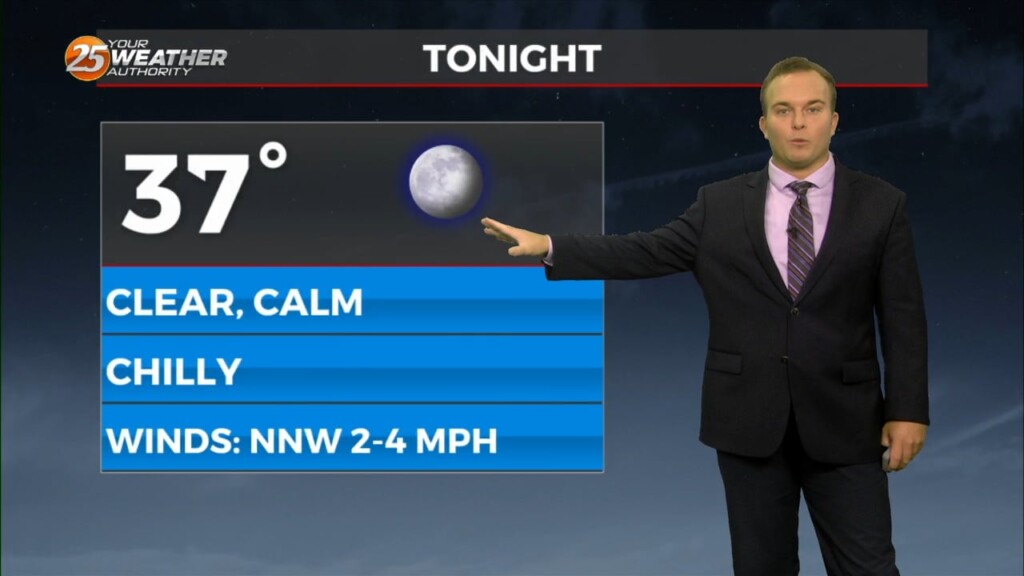
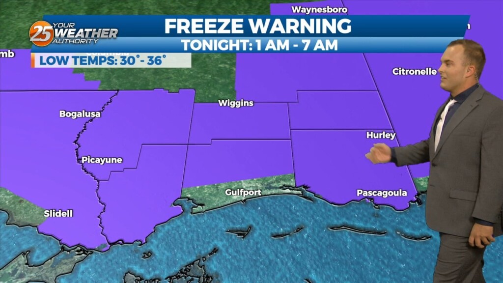
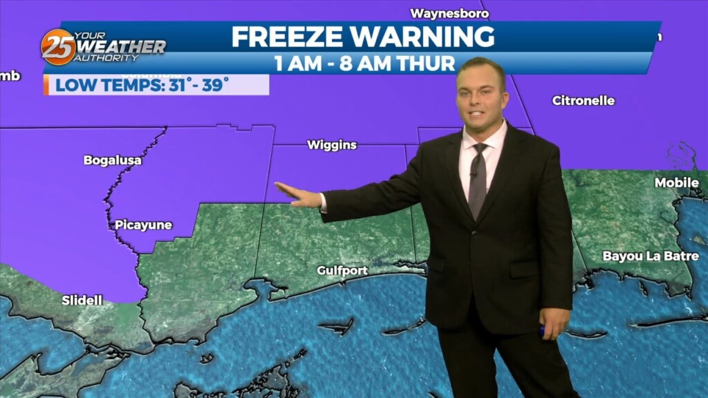
Temperatures will continue to plummet overnight as winds back off. Due to that and clear skies, tonight will be colder across the area. A Freeze Warning is…
Breezy conditions will remain tonight and already-cool temperatures will start to plummet shortly after sunset. Winds will back off enough overnight to allow for very quick…
A Dense Fog Advisory is in effect until 9 AM due to the potential for patches of dense fog to set up in the area. Expect fog…
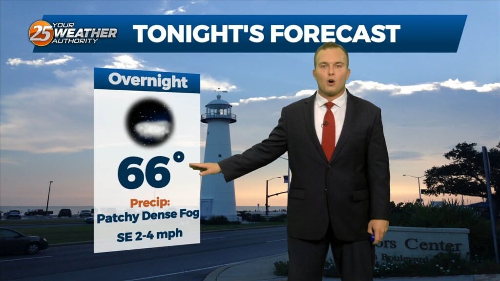
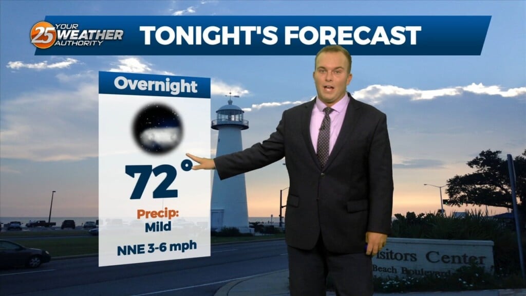
Any leftover clouds this evening will clear out fairly quick. It will continue to be mild overnight with humidity still lingering in the area. Due to winds backing…
Cloud cover will increase overnight and so will humidity. It will be partly cloudy out the door with slightly warmer temperatures. Southerly winds will dominate tomorrow and skies…
Warm and breezy conditions will linger into portions of this evening. Winds will back down and temperatures will be mild, but slightly warmer overnight. Cloud cover will…
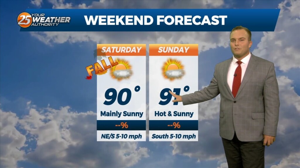
It will be mild to start off your weekend. Fall officially begins at 1:50 AM but it won’t necessarily mean much as our pattern won’t make any significant…

Some clouds this evening will clear out around sunset. Other than very stray showers, rain chances are put to bed for the next 48 hours or so. Passing…
Clouds will clear out overnight and a milder airmass behind a cold front will slowly work in. Temperatures will be quite pleasant out the door to begin…
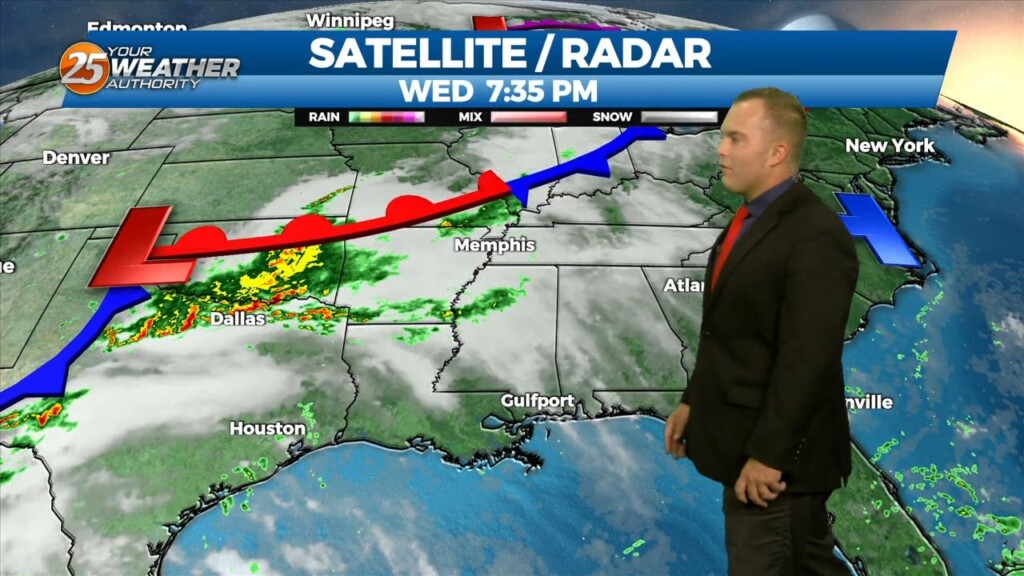
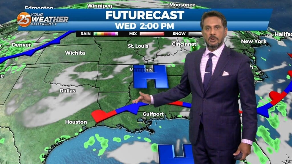
A cold front is gradually working through our area. Unrelated to it, a complex of thunderstorms that made its way into areas to our west is…
Skies will clear out overnight and temperatures will cool off to pleasant readings out the door tomorrow. Humidity won’t be a major factor so the heat will…
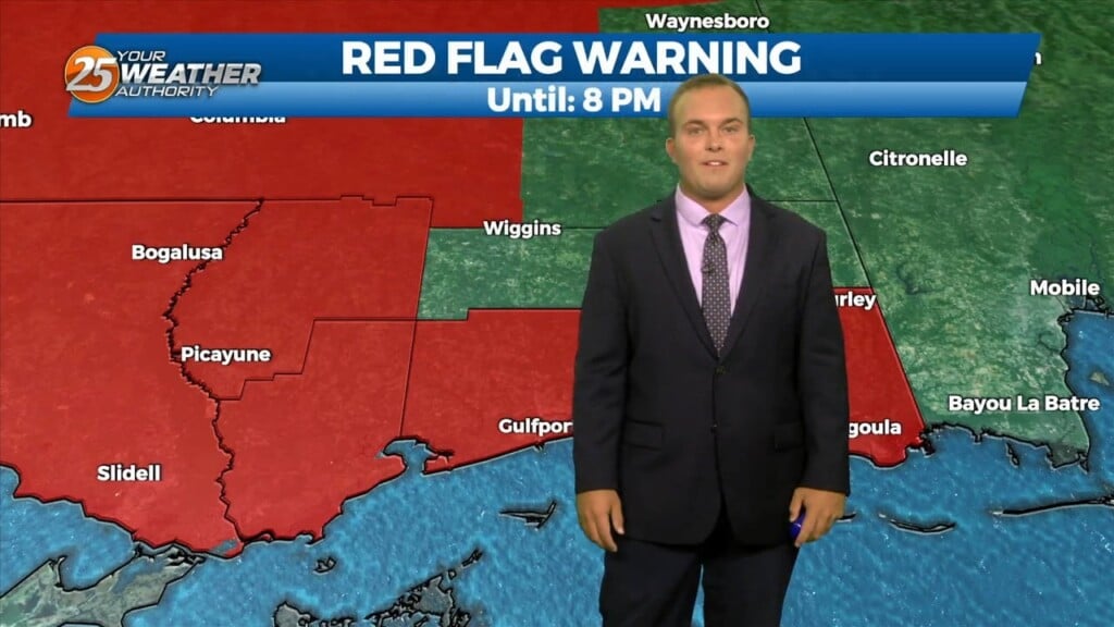
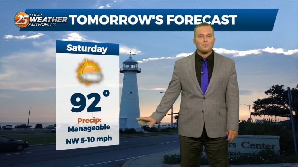
Dry conditions, low humidity, and breezy winds have provided for a Red Flag Warning being in effect until 8 PM. Do not burn, and continue that…
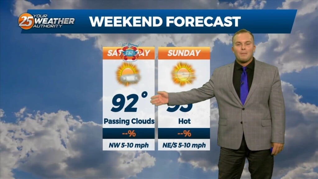
Another day of manageable heat and more in the way of sunshine is in store for the southern six counties. Currently a cold front is to…