5/31- The Chiefs "Scattered Rain Ahead" Wednesday Morning Forecast
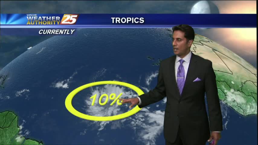
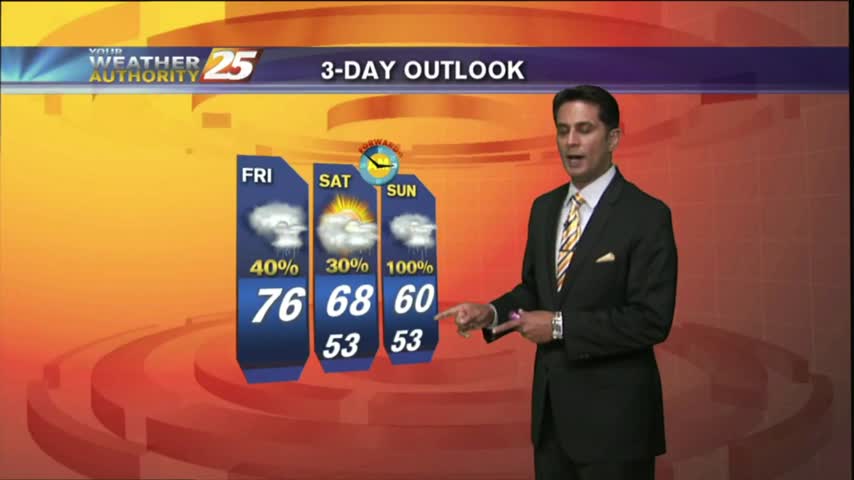
We are still dealing with an upper level disturbance in the Gulf near our outer coastal waters, with a lot of dry air being brought…
We are still dealing with an upper level disturbance in the Gulf near our outer coastal waters, with a lot of dry air being brought…
Sunshine is beginning to peek through the clouds as spotty rain continues...
Hot and humid continues along the area as a few showers and t-storms are expected this afternoon...
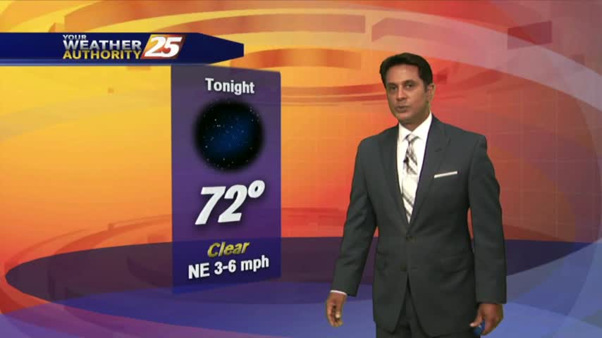
A nice start to the day/weekend as clear skies prevail with a north wind and temps in the upper 60s/low 70s...
A chilly stat with a few clouds moving into the area along with another cold front...
Extensive upper-level clouds from this morning beginning to clear to the east, providing much more sunshine this afternoon...
After a mild start with areas of patchy fog, it has turned out to be a beautiful 1st day of December with DENSE FOG lingering in southern Harrison Co...
As the pattern begins to shift, it's a cool start to the day with a humid air mass beginning to move into the region...
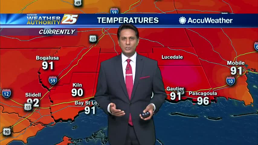
After a mild and humid start to the day, temperatures continue to warm...and expected in the upper 80s to low 90s this afternoon as we ring in Autumn...
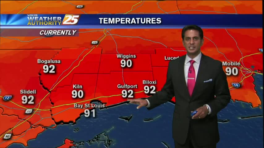
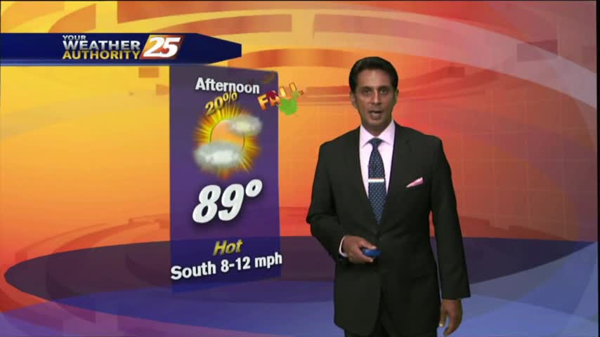
After a warm and humid start to your Friday, its downright HOT in the viewing area and through the region...
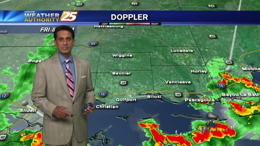
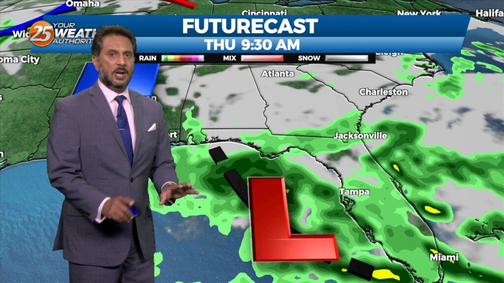
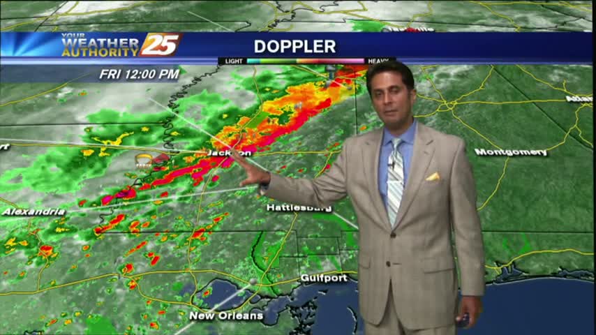
With a very strong tropical air mass dominating the area, showers & t-storms in the outer coastal waters are moving in from the south...
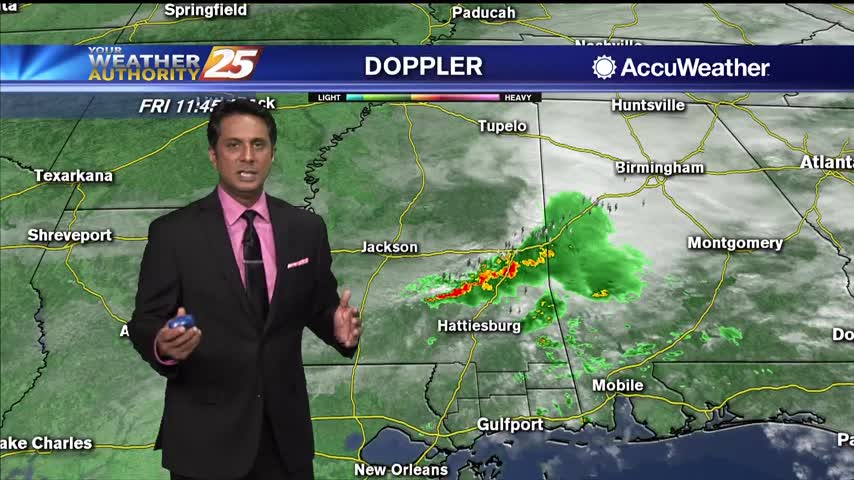
After overnight and early morning activity over the sound, showers/t-storms continue to flare-up along the viewing area...
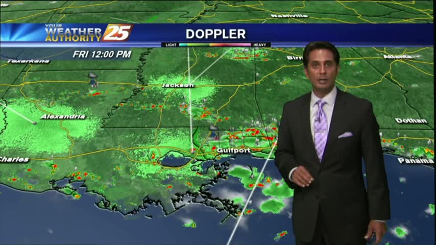
After a rain-free start to the day...isolated activity to the west is moving east and into the viewing area...
Overnight t-storms dissipated prior to sunrise but have redeveloped once again...
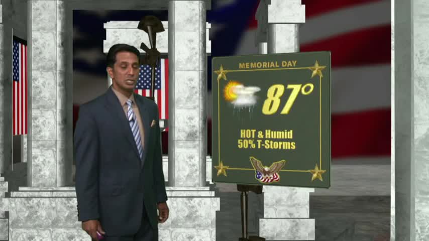
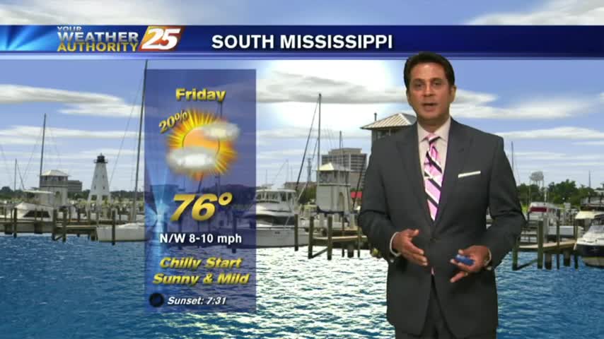
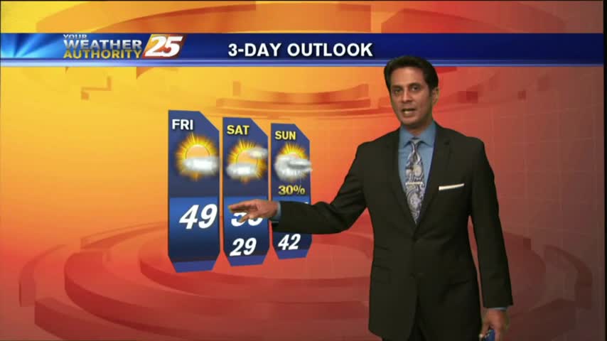
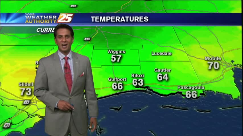
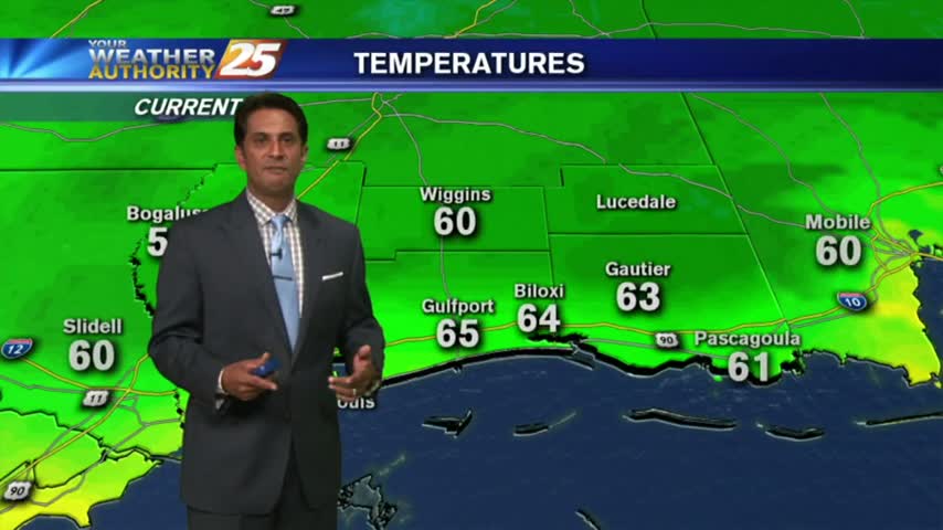
A MUCH WARMER start to the day as high-pressure begins to provide for a return-flow and more humid conditions going into the Memorial day weekend...
After bumpy weather yesterday, the final Friday of March is starting out much better...
The cold front which moved into the area earlier this morning with showers/t-storms...now beginning to move over the sound and dissipate...