6/9 - The Chief's "Heat Indices Close to 100" Friday Afternoon Forecast
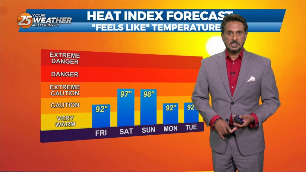
Hot temperatures heading into this afternoon with even higher heat indices values expected to max out closer to 100 degrees. High pressure across the…
Hot temperatures heading into this afternoon with even higher heat indices values expected to max out closer to 100 degrees. High pressure across the…
Only a few small changes in the upper pattern this morning, with an area of low pressure over New England with another over Nevada.…
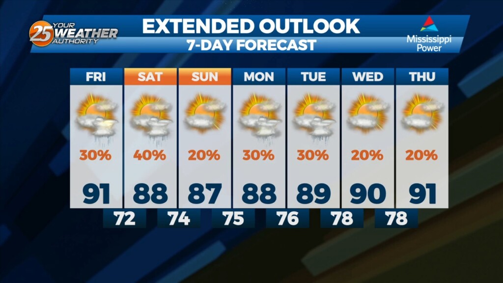
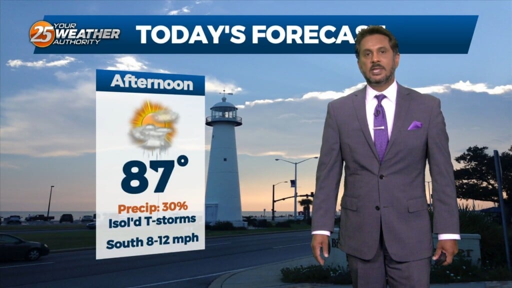
This afternoon our temperature will reach the low 90s with heat indices close to 100, please practice summertime safety. There is a 20% chance of an afternoon…
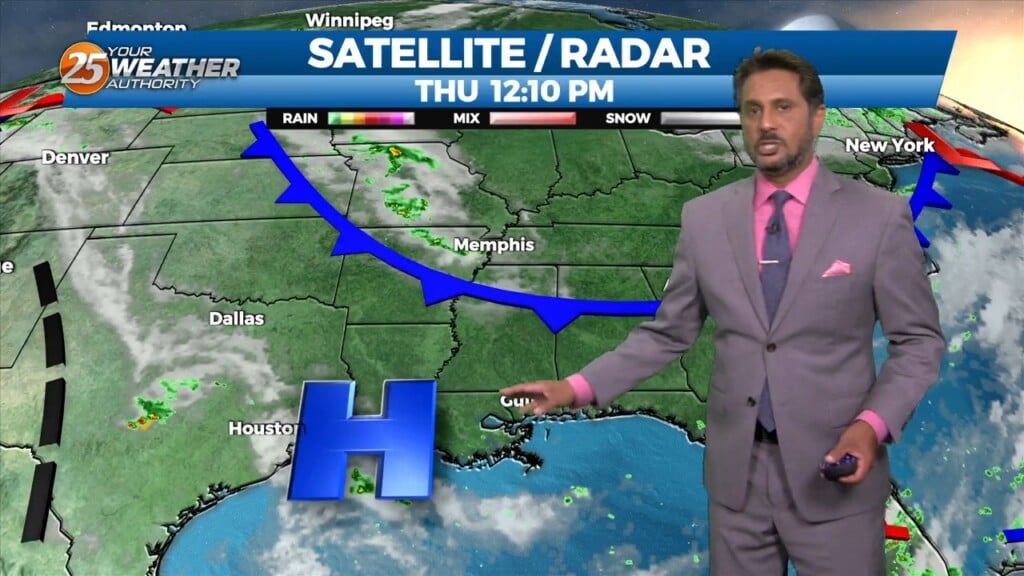
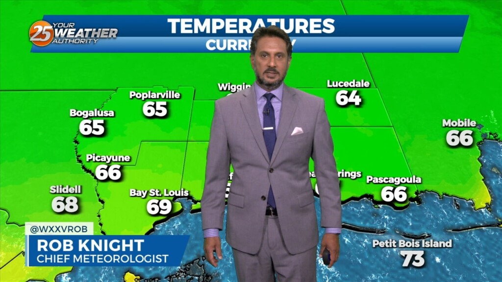
This morning there are a few high clouds pushing out of our area to the southeast. This will leave us with clear skies allowing plenty of…
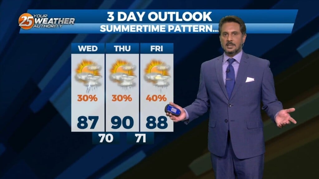
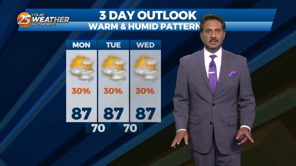
Summertime pattern continues this afternoon and the remainder of the extended forecast. This means hot temperatures ahead with high pressure to the NW and a…
Overnight showers & t-storms in the outer coastal will continue to move towards the coast early this morning and dissipate. Hot temperatures ahead with high…
A stationary front continues to linger south of the area. This will continue to bring hot and humid conditions along with a 40% chance for…
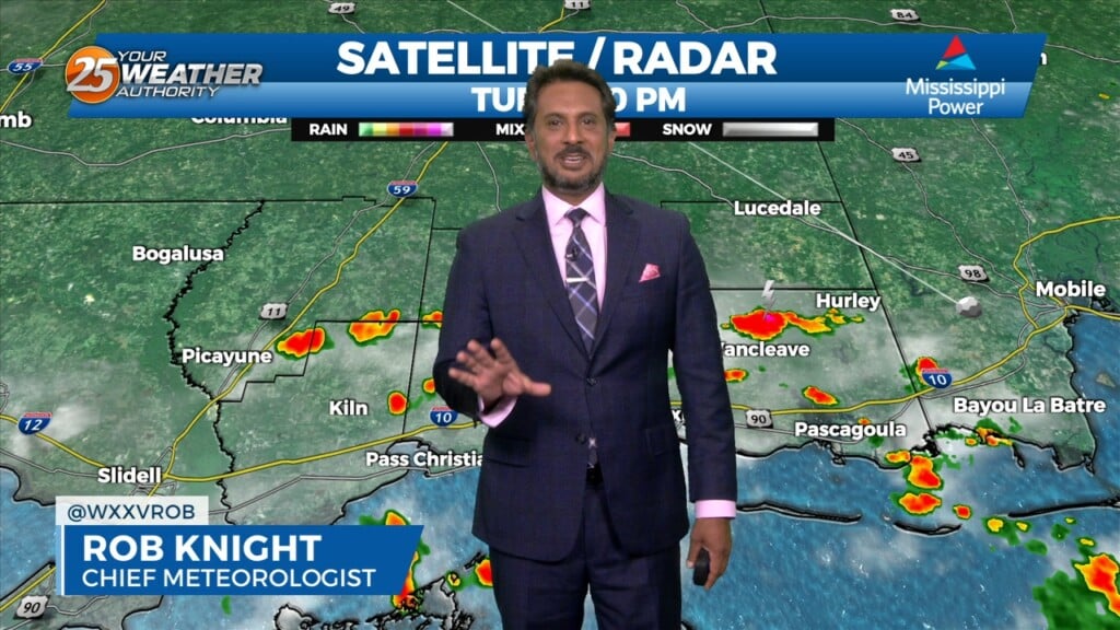
This morning there is a stationary front near the Mississippi coastline, with radar indicating isolated showers moving northwestward from the Gulf of Mexico. Temperatures will be in…
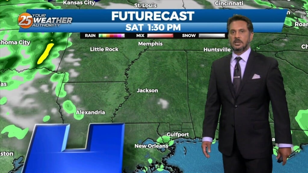
We are still in a persistent pattern of afternoon showers and thunderstorms due to a boundary in the area will last through Wednesday. This afternoon daytime heating interacts…
A very persistent pattern of afternoon showers and thunderstorms due to a boundary in the area will last through Wednesday, given that no significant…
High pressure to the NW coupled with TD #2 to our SE will continue to provide for e NE/E wind this afternoon...dropping relative humidity into the 40% range.…
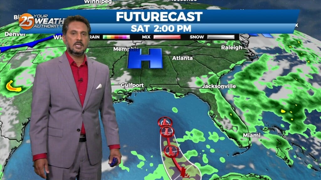
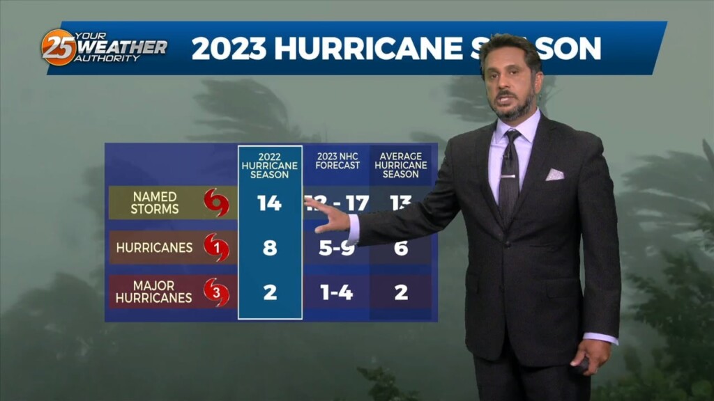
What a quick change since yesterday morning with Tropical Depression Two forming yesterday afternoon. This happened because it is easier for a small system to tighten…
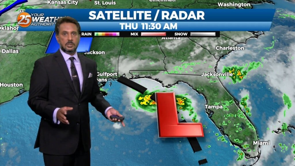
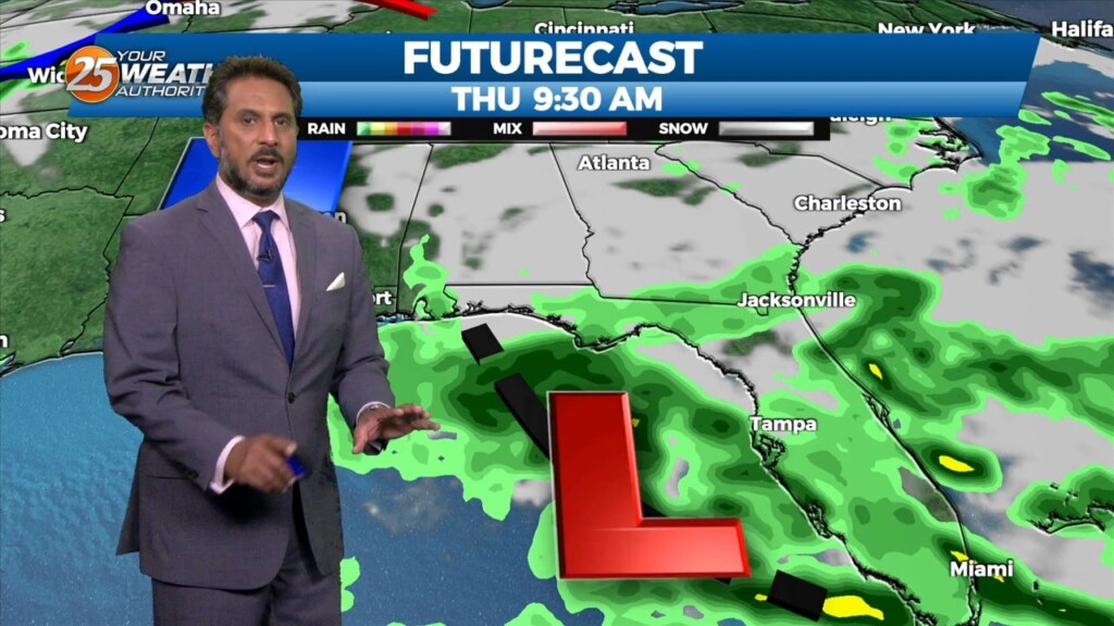
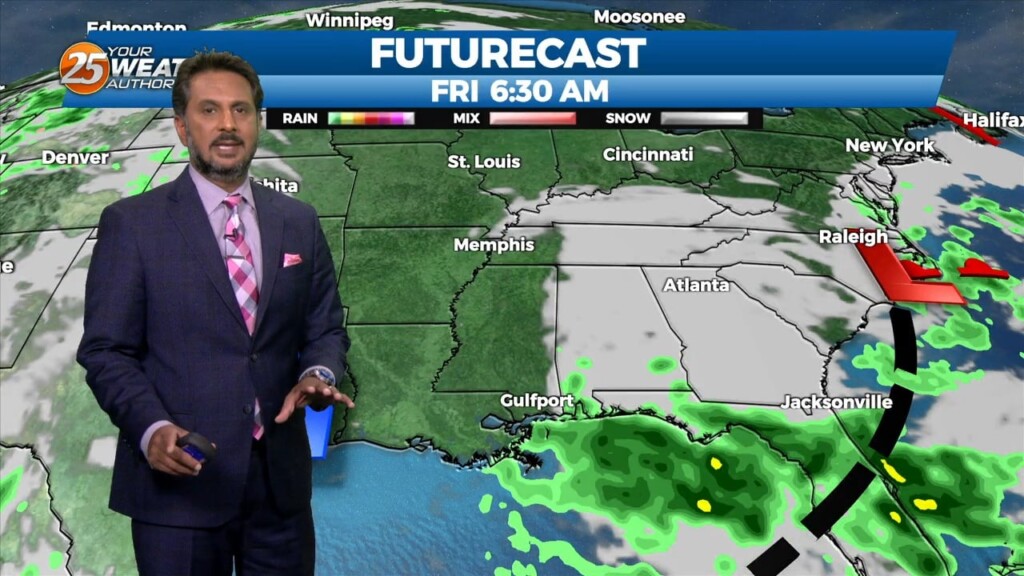
Heading in to this afternoon rain will continue to move in from the southeast. That being said, an area of low-pressure off the Florida west coast…
Showers and thunderstorms associated with an area of low pressure over the northeastern Gulf of Mexico have increased and become better organized during the overnight hours.…
Today is June 1st and the official start of the 2023 Hurricane Season. That being said, an area of low-pressure off the Florida west coast will…
Heading in to this afternoon expect hot conditions under partly cloudy skies. All eyes continue to track an upper level disturbance in the Gulf near our…
We are still dealing with an upper level disturbance in the Gulf near our outer coastal waters, with a lot of dry air being brought…
There is a surface boundary running northwest to Southeast across the area. We are seeing temperatures this afternoon 3-5 degrees warmer than yesterday at this time. Considering today and yesterday are very similar, we still…
A very weak disturbance was seen this morning just off the coast, which provided just enough instability combined with the sea breeze to produce isolated showers/t-storms…
A blocking pattern remains across the eastern half of the country with an upper ridge over the Great Lakes. Yesterday’s double barreled upper low, as expected, has…
Relative humidity has been rather low the past few days…and that trend will continue heading into the weekend. The current weak upper low pressure over…
Relative humidity has been rather low the past few days…and that trend will continue heading into the weekend. The current weak upper low pressure over the FL…
A drier day today as additional dry air advects into the region as northwesterly flow continues to take shape. Temperature will likely be a bit…
Showers and a few thunderstorms continue over portions of the Gulf waters this morning. This area is also the most favored for convection a disturbance south…