01/10 Ryan's "Potentially Severe" Friday Night Forecast
The cloudy, humid, and rainy conditions continue through the night, and will turn stormy heading into the early morning hours.
The cloudy, humid, and rainy conditions continue through the night, and will turn stormy heading into the early morning hours.
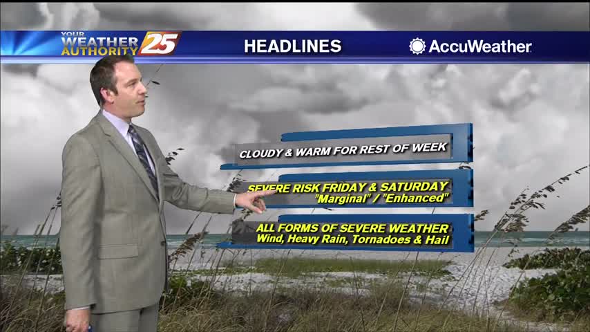
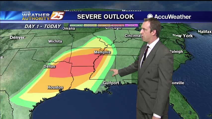
The cloudy skies have moved in and aren't leaving for the rest of the week. We're also gearing up for some potential weekend severe weather.
The skies remain clear tonight, but clouds will have moved in by the time most wake up and won't clear until next week.
The cold front moved through last night, but it won't get cold until tonight....
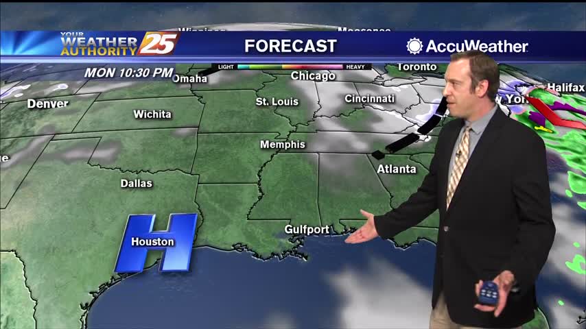
You won't notice much difference by the time you get up tomorrow, but we'll see some quick changes occur overnight as a front moves in.
The weather won't change significantly until a second front moves through overnight, but then we'll see some pleasant conditions move in.
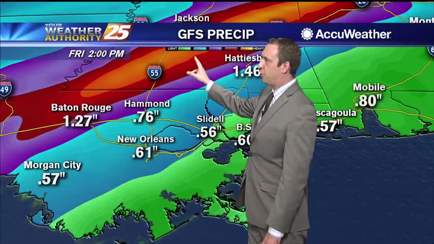
Still waiting on the first active weather of 2020 as a stalling front will carry rain into most of Friday.
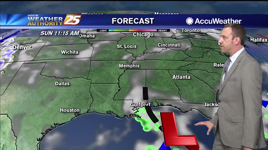
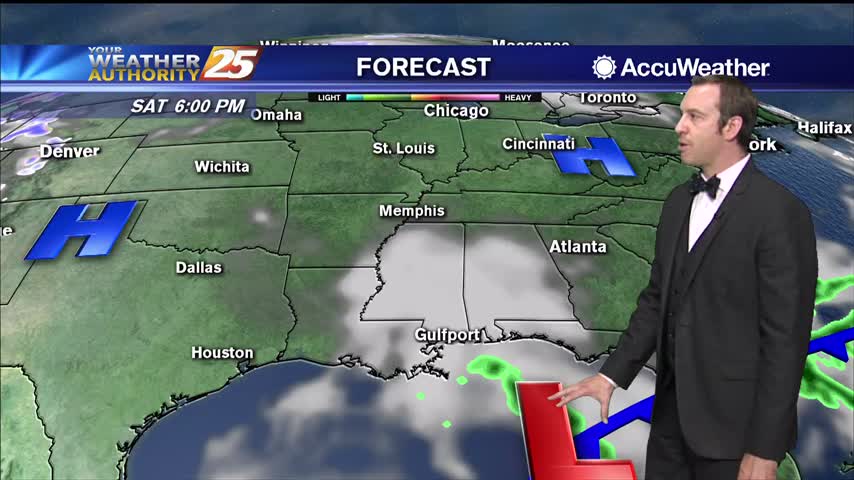
The new year arrived rather quietly, but active, potentially severe weather moves in quickly.
New Year's Eve is rapidly coming to a close, and 2020 will start nicely, but active weather moves in quickly.
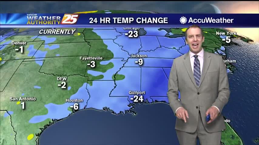
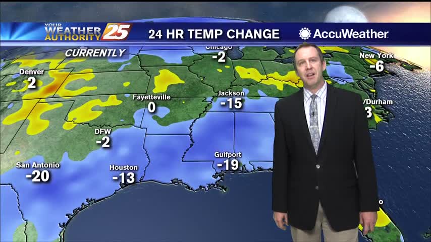
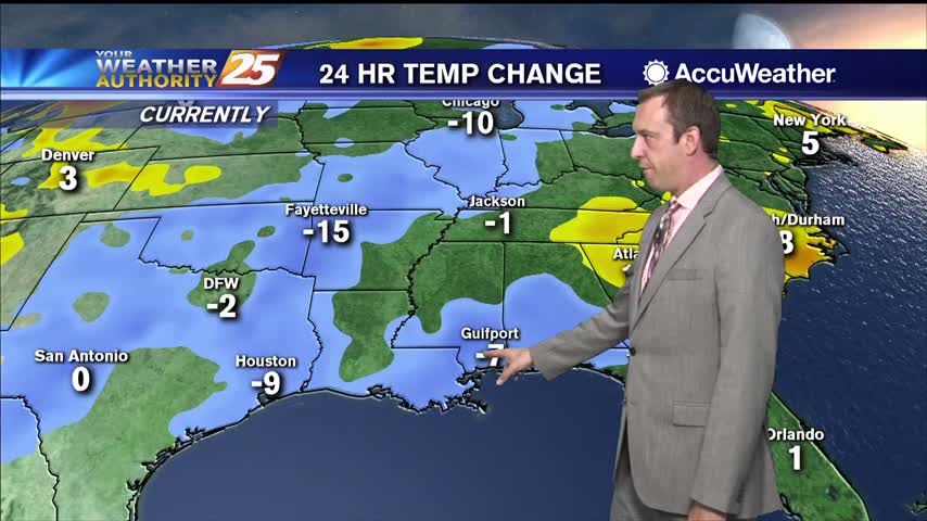
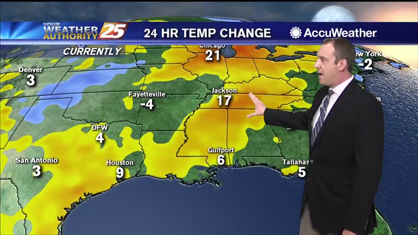
Much cooler and drier today behind yesterday's front, but it won't stay dry forever.

We're seeing cool and sunny afternoons, but downright frigid nights....
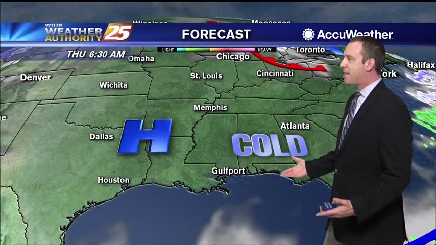
The cold air is moving in quickly behind yesterday's cold front, so get ready for some cool days and frigid nights!

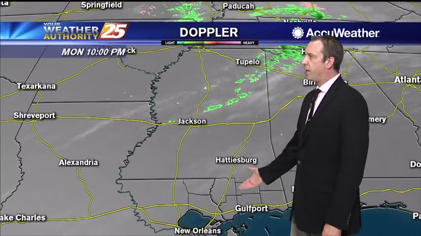
The cold front has gotten closer, and the storms have yet to begin, but they will soon....
The last week has been cloudy, rainy, and quite humid, but sunny weather is on the way after one last foggy night!
We won't see much of the last full moon of the decade due to active weather moving in, but it doesn't look like anything serious.
Front moved through yesterday bringing cold air and strong winds, but the really cold conditions won't show up until later tonight.
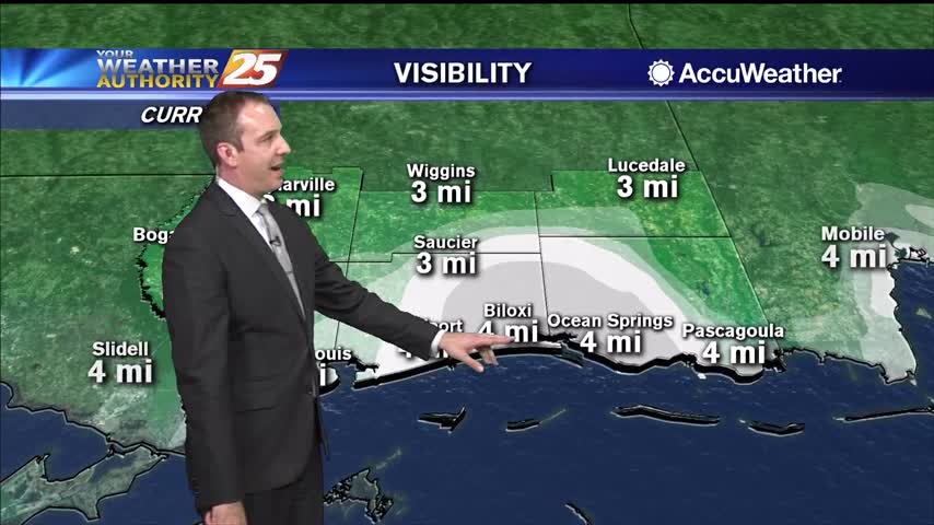
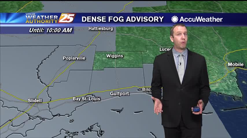
Dense fog advisories have been issued for South MS, and the approaching front isn't in any hurry so any changes will be slow.
Humid and warmer tonight, with patchy fog likely becoming an early morning issue, but it does dry up a bit over the weekend.
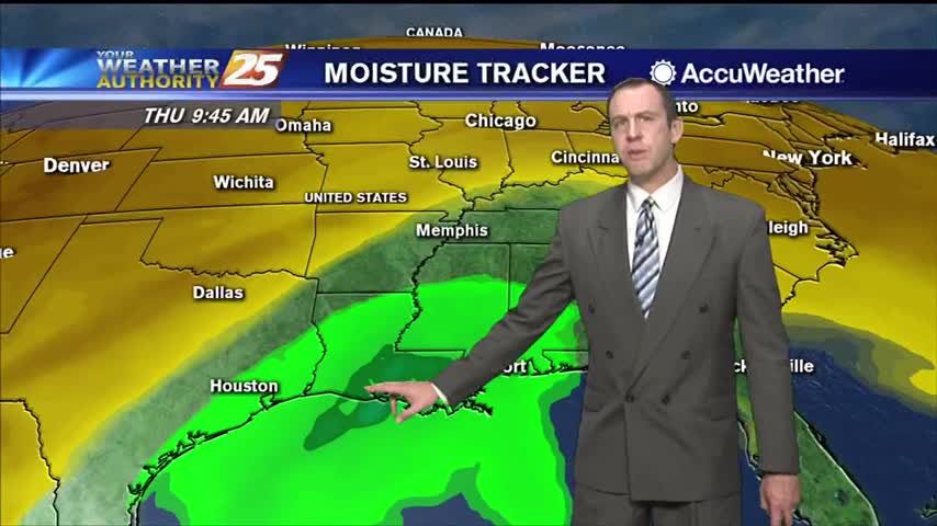
So far only cloud cover and the temperature has increased each day this week, but rain chances are added to the list tomorrow!
It's steadily getting warmer and more humid, but not much else will change until the front finally moves through on Friday.

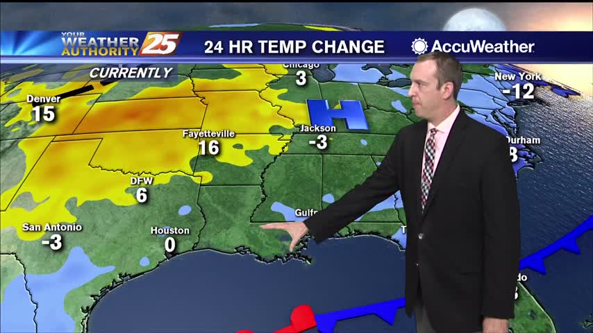
It's going to be chilly out there again tonight, but we are inching away from the freezing levels we were at last night.
It'll be short-lived, but freezing conditions are moving in overnight. Expect a rapid warming trend to begin Tuesday though.
It's going to be much warmer than it was last night, but another cold front isn't far away.
It's only cooled a handful of degrees so far, but we'll wake up to a chilly Thanksgiving!