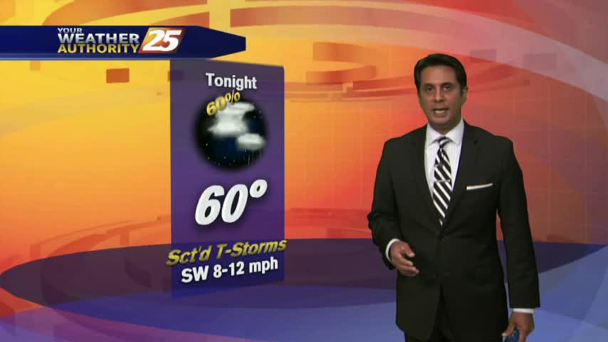
04/12 Ryan's "Warming Trend" Thursday Night Forecast
Today was slightly warmer and more humid than yesterday, and tomorrow will continue that trend, but a cold front brings potentially severe weather to the area just in time for a cool down....
Today was slightly warmer and more humid than yesterday, and tomorrow will continue that trend, but a cold front brings potentially severe weather to the area just in time for a cool down....
Today was as gorgeous as expected and we have at least one more such day left before the potentially severe storms arrive on Saturday....
After a warmer start to the day, warmer temps will begin moving into the region as the humidity elevates...
Warming temperatures under beautiful blue skies as the humidity is beginning to return to the area...
It's a slight warmer start to the day with cloud coverage and light rain as a warm front is moving through the NW Mississippi...
Cooling continued this afternoon and will continue into the night, but the thermometer will begin swinging the other way tomorrow. Click the link for the full forecast details.
We cooled into the upper 50s as expected today, but now we'll begin a warming trend which will carry us into the weekend. Click here for the full forecast with Meteorologist Ryan Mahan.
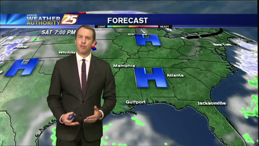
It's been a brutal week of cold, dry, and often dangerous weather; but we're finally seeing a warming trend that will carry us all the way through the weekend. Click here for the full forecast.
The warming trend that began yesterday continues through today, tomorrow, and into next week. We'll see another cold front by Monday though, click the link for details.
Today was the last afternoon below 50 degrees and tonight will be the last evening below freezing for at least as week as warmer, wetter air moves in rapidly through the weekend. Watch the full forecast for more.
It will be considerably warmer tonight that it was last night as moisture continues to pour in, meaning fog will become more of an issue in the coming nights. Watch the forecast for details.
It was a cool and clear Halloween night, but the moisture and temperature continue to rise for the next several days. Very little rain is expected though, so be sure to watch the forecast for details.
Tonight's low will rise out of the 40s and back into the 50s, and this warming trend will continue for the next several days. Click the link for the full forecast.
As the south wind from yesterday afternoon continues in advance of the approaching cold front, it's a WARMER more humid start to the day...

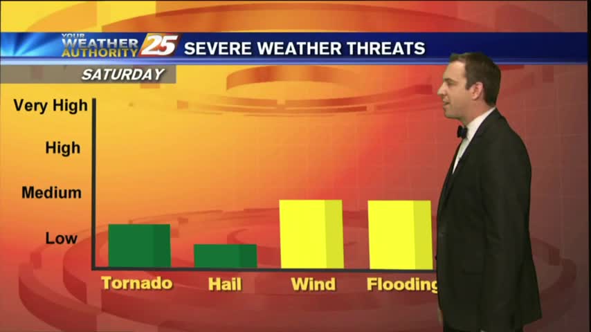
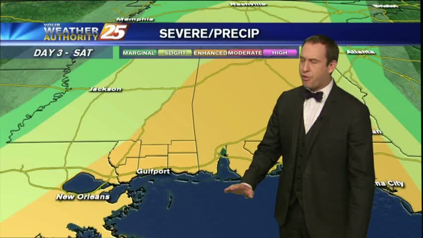
The humidity and temperature will continue to rise into tomorrow ahead of our next cold front, which could bring some damaging weather overnight Friday. Watch the full forecast for details.
Moisture was on the rise this afternoon and will wane a bit tonight, but expect it to return in earnest for the weekend just before a front brings thunderstorms. Watch the full forecast for more.
A more humid start to the day with partly/mostly cloudy skies moving in from the west...
After a warm/humid start to the day under mostly clear skies, the clouds have moved back in with t-storms/rain on-tap this afternoon....
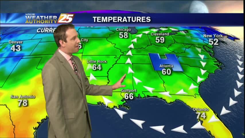
A southerly component with the winds overnight has continues as a more humid air mass is now the the area, with warmer temps this morning.
After VERY DENSE FOG earlier this morning, we now have partly cloudy skies and warming temps into the 80s...
A WARM/HUMID flow from the Gulf of Mexico has areas of PATCHY FOG along the Southern 6...
With a SOUTHERLY wind flow, warming temps continue with elevating humidity moving in from the GOM...
After an ABSOLUTELY BEAUTIFUL weekend, only minor changes are on-tap for the workweek...
After a cloudy start to the day, skies have cleared with an abundance of sunshine along with breezy conditions developing...