
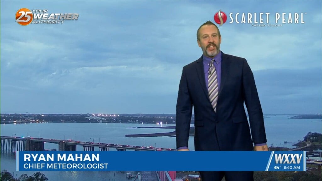
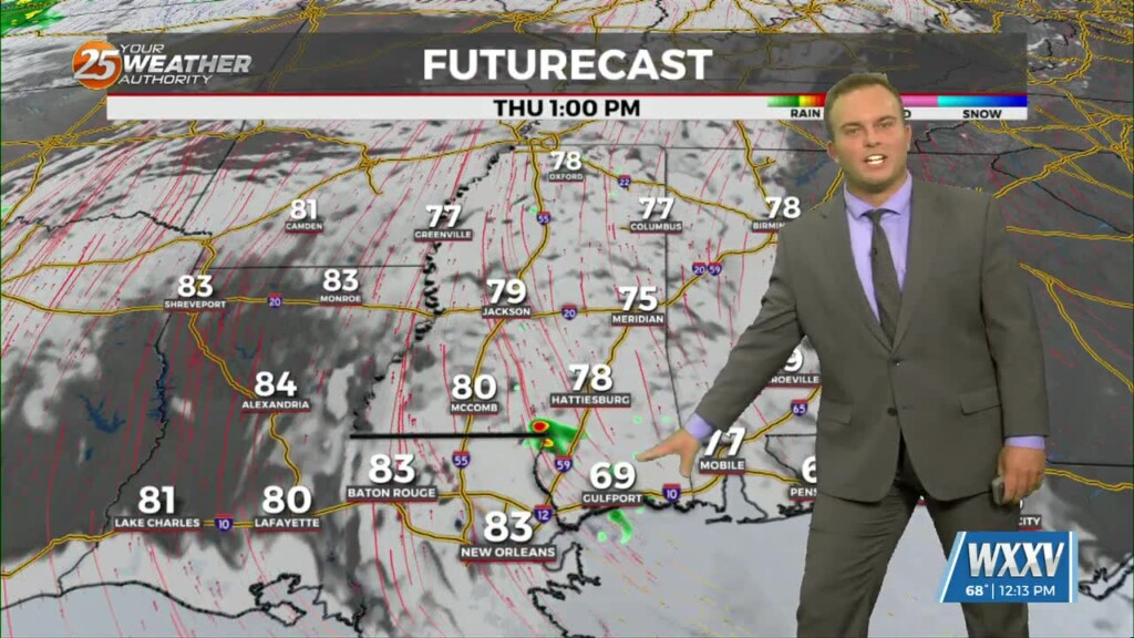
04/16 Ryan's "More Humid" Thursday Morning Forecast
Yesterday saw a little cloud cover move through our otherwise sunny skies, and today will see a little more on top of getting a little more humid. The…
Yesterday saw a little cloud cover move through our otherwise sunny skies, and today will see a little more on top of getting a little more humid. The…
We've had some appropriately cold morning weather recently, but today is more of the warm & cloudy variety with lows only falling into the low 60s earlier today.…
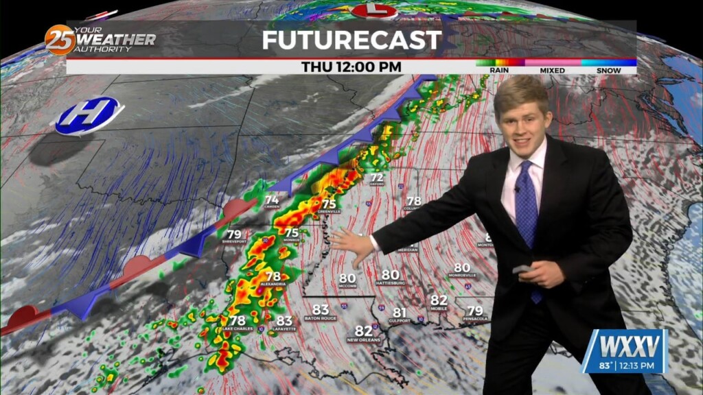
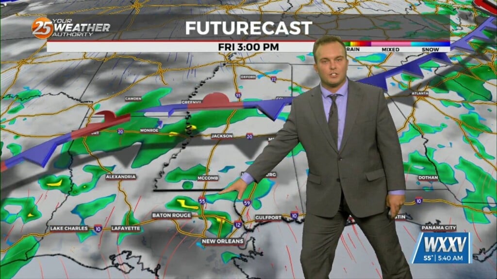
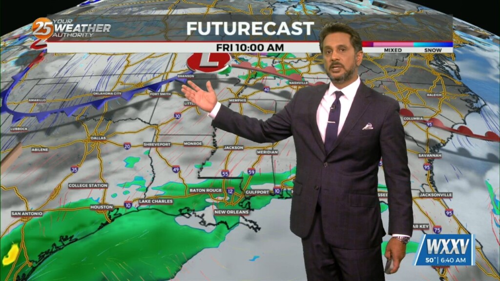
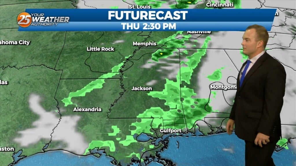
A cold front will move through the central plains and come to an abrupt stall near the Texarkana region late Thu. This will be close enough for…
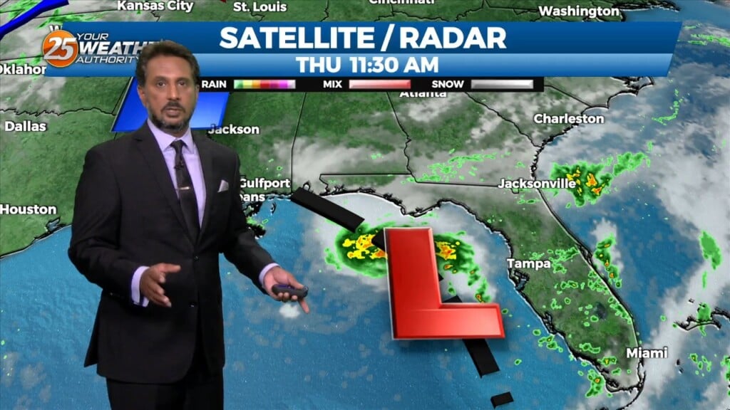
For the forecast, it still looks like we will see shower and thunderstorm coverage increase even more over the next few days. Weather features will be…
With high pressure still in control along with a weak cold front to the NW, sunny skies and a zonal/progressive upper flow regime across the…
Cloudy skies remain through a good portion of the afternoon with a 20% chance of light showers as well. Skies will clear out somewhat towards this evening and…
More clouds are around to start your Wednesday. A cool start will turn into a warm one today with temperatures reaching the 70s by…
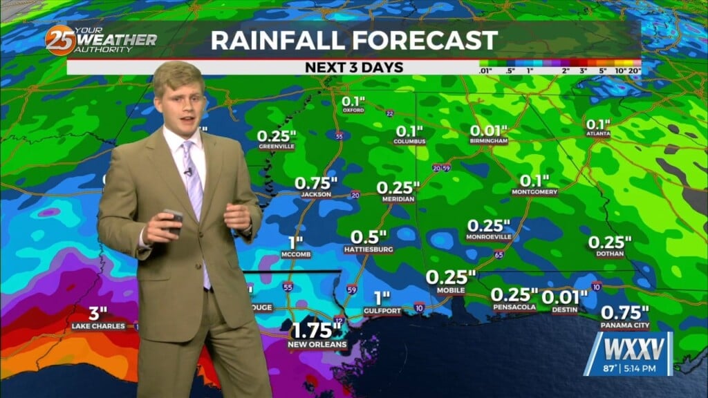
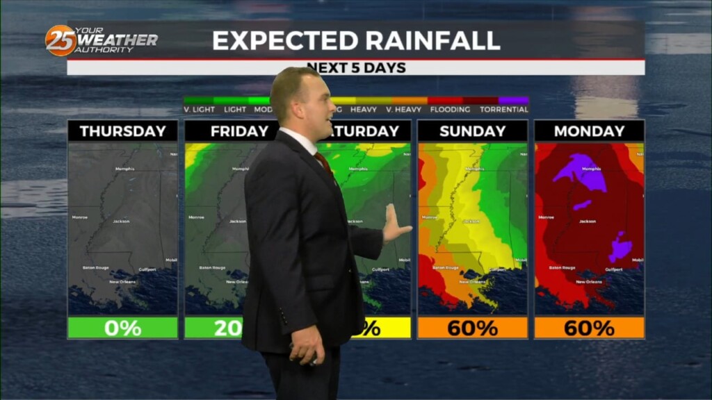
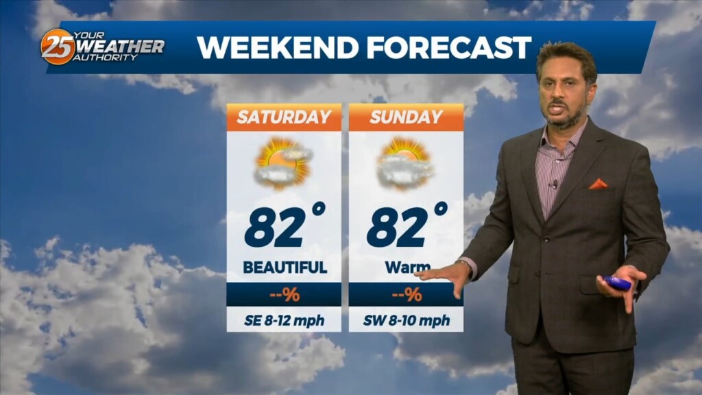
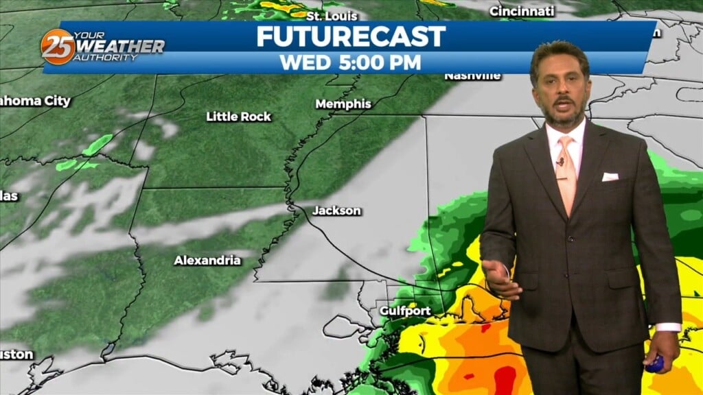
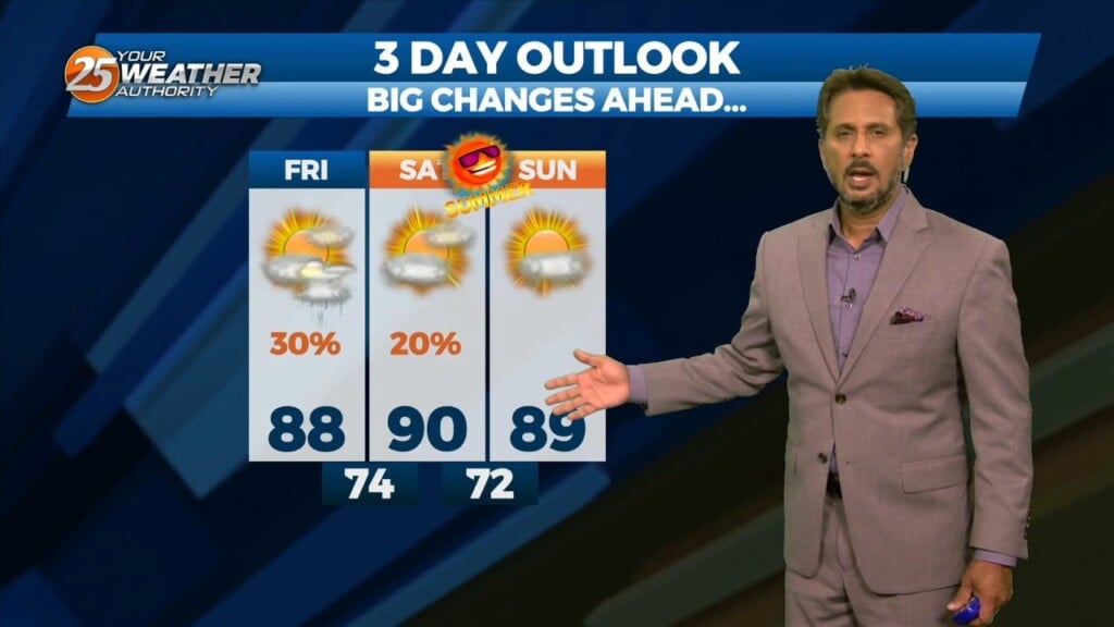
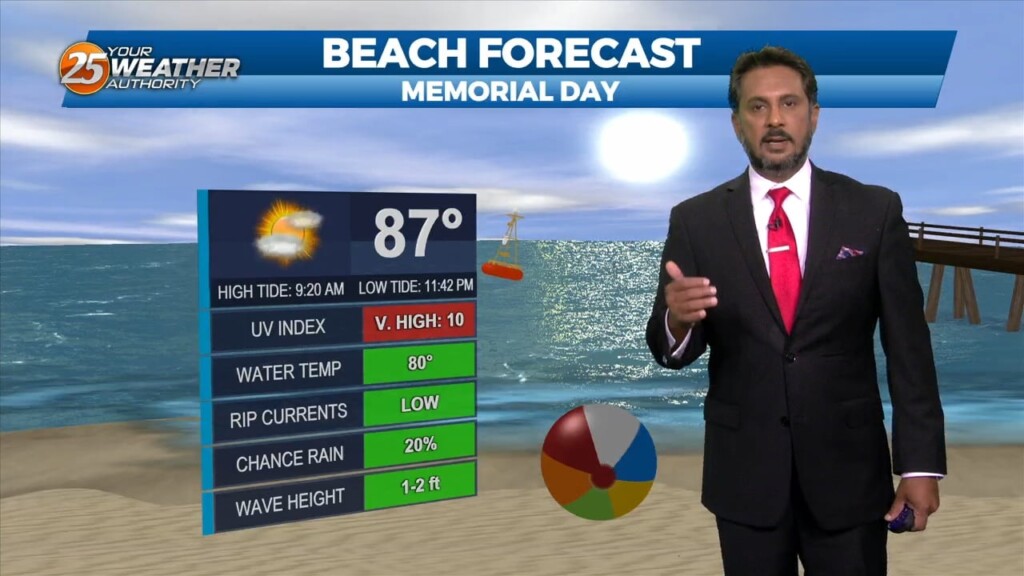
No significant changes in forecast though the weekend. An area of low-pressure along the W’tern Gulf will bring higher rain chances for the start of the weekend.…
An upper-level high-pressure sits over the Mississippi River Valley with weakness off the New England and California coasts. At the surface, high pressure was centered near the…
It will be cold overnight but outside of very patchy frost, temperatures will be slightly more manageable. Light winds will provide for a slight wind chill factor…
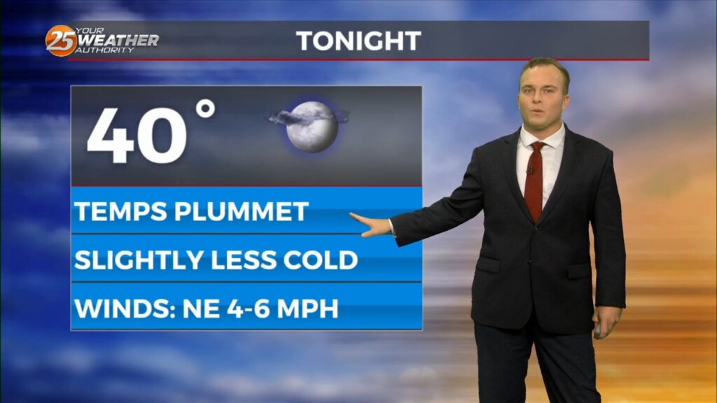
Skies clear out this evening which will help temperatures plummet again. Despite the overall moderating trend being underway, it will be a cold night again with some spots…
Expect a mix of clouds and sunshine this afternoon with warm temperatures continuing in the area. Winds will remain breezy especially along and south of…
A disturbance over northern Mexico is promoting its development as it ejects over the southern plains. High pressure over the GOM will keep the disturbance too…
East to southeast winds will remain in place much of this week thanks to strong high pressure setting up over the eastern United States. Overnight, expect…
The past few days have seen a mostly benign pattern when speaking in reference to showers and thunderstorms; however, there have been other aspects of…
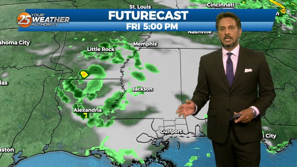
A very weak front just north of the area will continue to move toward the Atlantic Coast today and Saturday with upper high pressure beginning…
The axis of the upper disturbance extended from the Great Lakes to the Florida Panhandle early this morning with upper high pressure over the Rockies. If…
It will be slightly less chilly overnight but overall, the same conditions will hold true with clear skies and light winds. Some spots could see fog develop…

The breeze will be less of a factor this evening as we will continue to enjoy nice conditions. Overnight, clear skies and light winds dominate and…
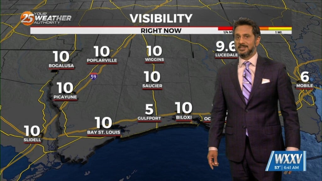
It’s another October morning with crisp temperatures in the mid to upper 50s across much of the area. Drier air and surface high pressure remains…
Scattered showers and thunderstorms will be possible this afternoon as temps warm into the upper 80s/low 90s within a fairly moisture regime. Although the latest…
As we head toward the equinox, the upper pattern is becoming more active across the northern half of the US. Upper level high pressure was noted…
Heading in to this afternoon rain will continue to move in from the southeast. That being said, an area of low-pressure off the Florida west coast…
A blocking pattern remains across the eastern half of the country with an upper ridge over the Great Lakes. Yesterday’s double barreled upper low, as expected, has…