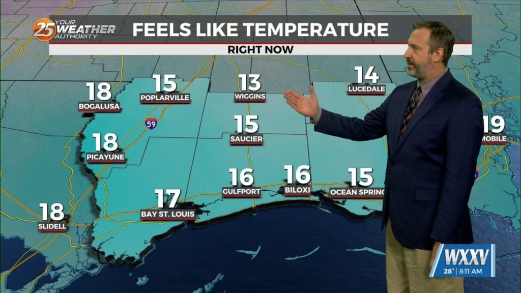
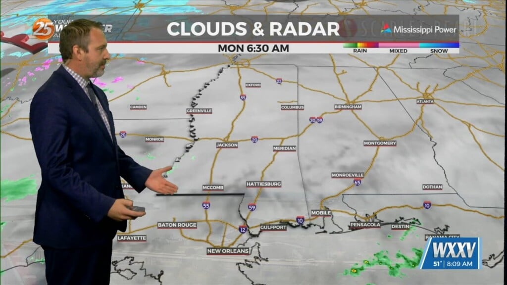
03/02 Ryan's "Coolest" Monday Morning Forecast
Last week saw a weak front move through over the weekend, starting off with the coolest weather of the week as we slowly warmed. Unlike last week, we didn't…
Last week saw a weak front move through over the weekend, starting off with the coolest weather of the week as we slowly warmed. Unlike last week, we didn't…
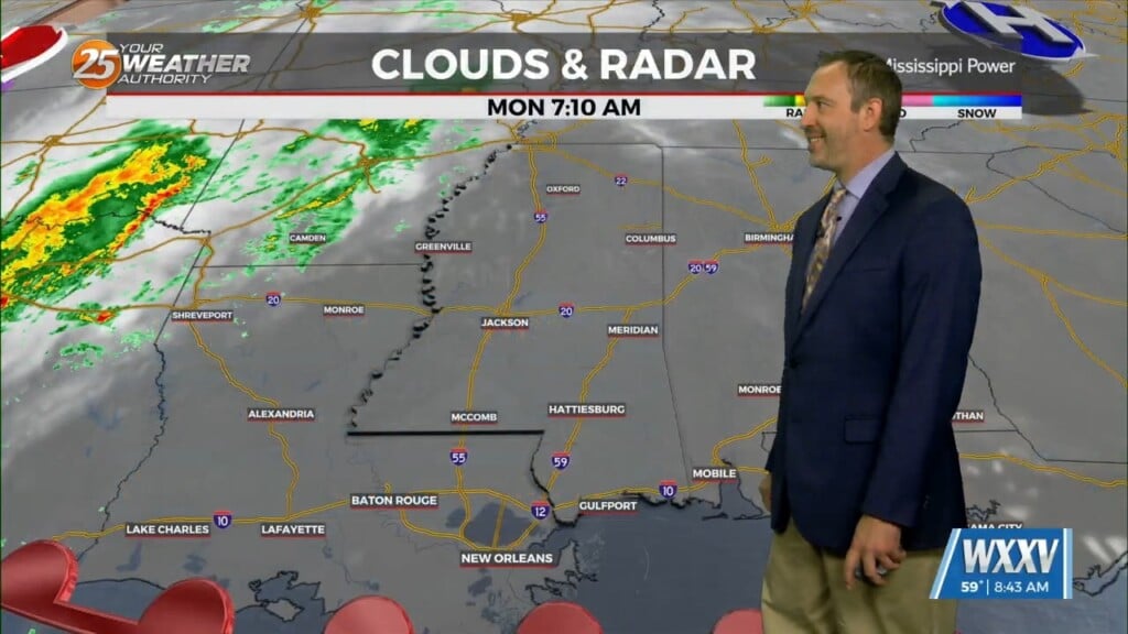
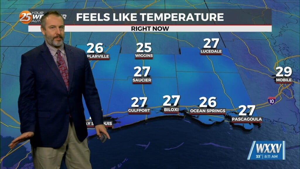
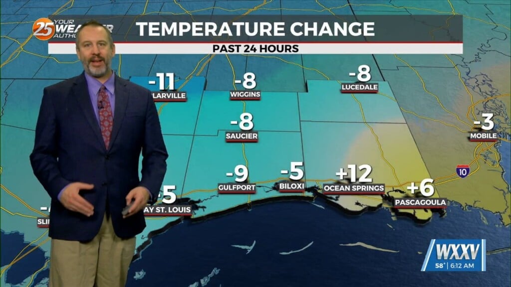
Winter returns to South Mississippi for a short time before things warm up all over again. We'll start this week off with some much more seasonally appropriate weather,…

It is Lundi Gras and we're still trending in a good direction for any Carnival festivities as the season comes to an end. We saw a little…
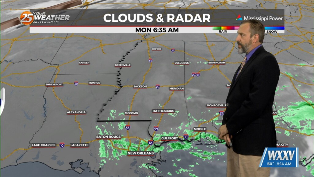
We have another warmer week ahead after last week's spring-like weather, with only a slight cool-down expected over the weekend. Our normals are starting to climb back…
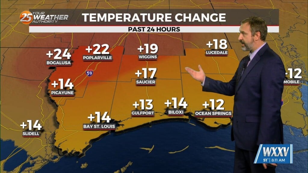
We're slowly warming up after seeing the coldest weather yet over the weekend, with another day and a half of warming left before our next cool-down. That means…
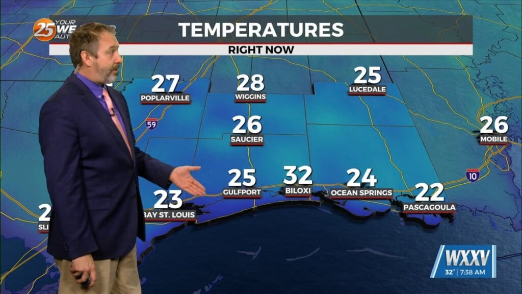
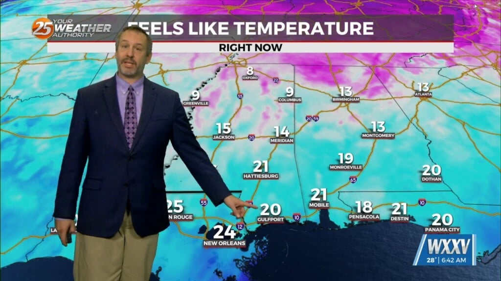
Last week started frosty, but ended more on the spring-like side as a front moved through bringing some of our coldest weather yet this winter. Lows fell into…
We had some rare wintery weather over the weekend with some early morning flurries Sunday, but now it's just frosty for the next couple of mornings. In fact, today…

Last week a cold front starting things off frosty, but while we saw another front move through over the weekend we're in for a warm week ahead.…
Our rather balmy weather for the week of Christmas was a boon for fans of warmer weather, but now those who prefer cold weather can rejoice as things…

Christmas is later this week and instead of cooling nicely we're off to a damp start and warming for most of the week. This morning saw lows in…
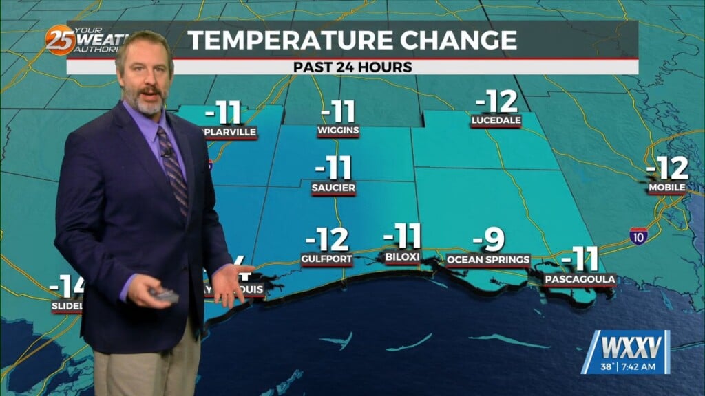
Today was the coldest day we've seen so far this season, with the frigid weather putting us on par with our historic snow day from earlier this year! Coastal…
Today started on the damp side thanks to the weekend's rain, but don't expect another drop until the end of the week and not very much even then.…
We saw a few sprinkles with yesterday's front and a slight cool-down into the chilly 40s this morning, but we're in for a nice afternoon with a…

Last week started off with frosty-to-freezing weather, but we're starting off today with our coolest morning of the week with a low of 56. That's double what last…
The first full week of November 2025 is starting off going from cold-to-cool thanks to building high pressure and dry air, though it'll feel almost spring-like by the end…
This time last week we were seeing lows in the mid 40s on the coast, but we're off to a warm start this week as lows only fell…

We were off to quite a cool start this morning thanks to this fall weather moving in on the backside of this weekend's front. Colder, drier air is…
Today has long looked like the most cloudy of the last couple of weeks, which won't be all that hard considering how dry and sunny it's been. Still only…
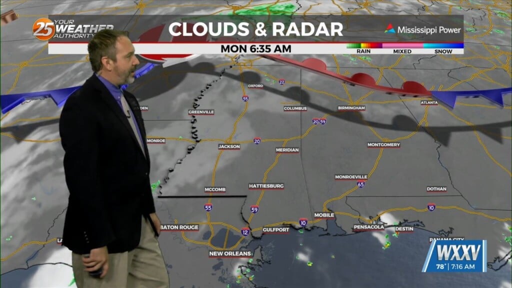
We're starting the week off on the dry side with just a few morning clouds and ample afternoon sun, but rain moves in quickly for a…
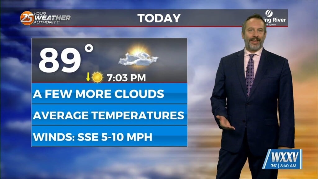
Expect more of the same pattern of summer-like weather out there again for the next several days with no end in the foreseeable future. That means more afternoon…
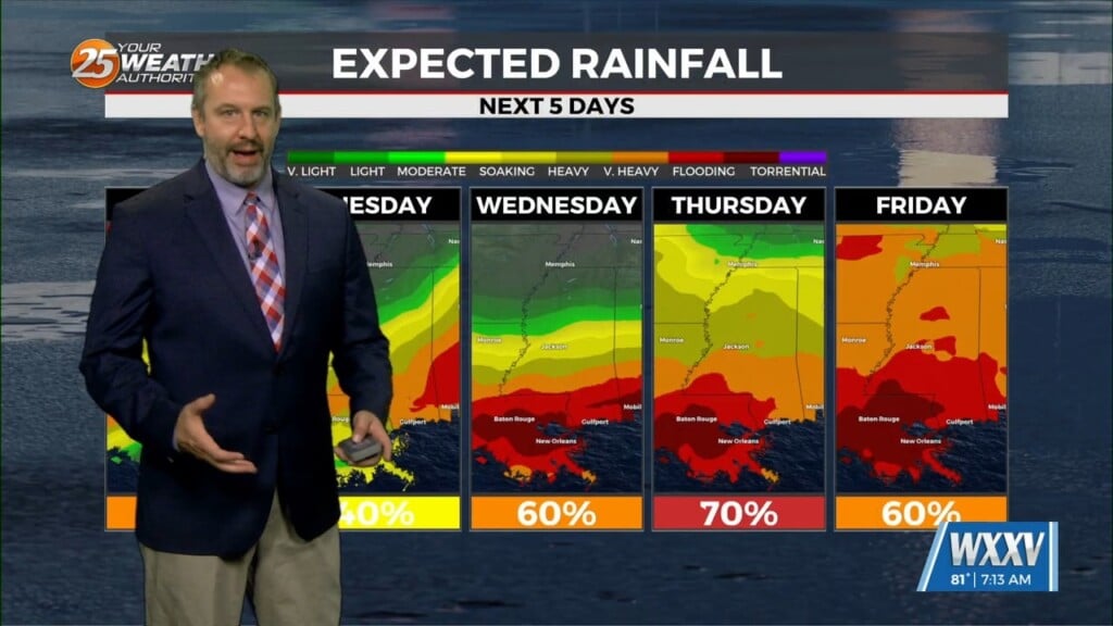
Expect a rainy week ahead, which will back our afternoon temperatures down a couple of degrees, but won't do much about the humidity. Today will still be on…

We're off to a nice start this week after a perfect spring weekend in South MS, but things are starting to get a bit warmer and more humid…
I expected this broad low to be a little further south of us, but it crept in and left things damp, cool & cloudy to start off this…