6/10 - The Chief's "Isolated Afternoon T-Storms" Monday Morning Forecast
The first 24 to 36 hours of the forecast are somewhat uncertain. Currently we have widely scattered showers that have been developing off the coast along…
The first 24 to 36 hours of the forecast are somewhat uncertain. Currently we have widely scattered showers that have been developing off the coast along…
An upper high pressure remains over Mexico but has been suppressed southward by a weakness extending from the Great Lakes to Texas. A cold front…
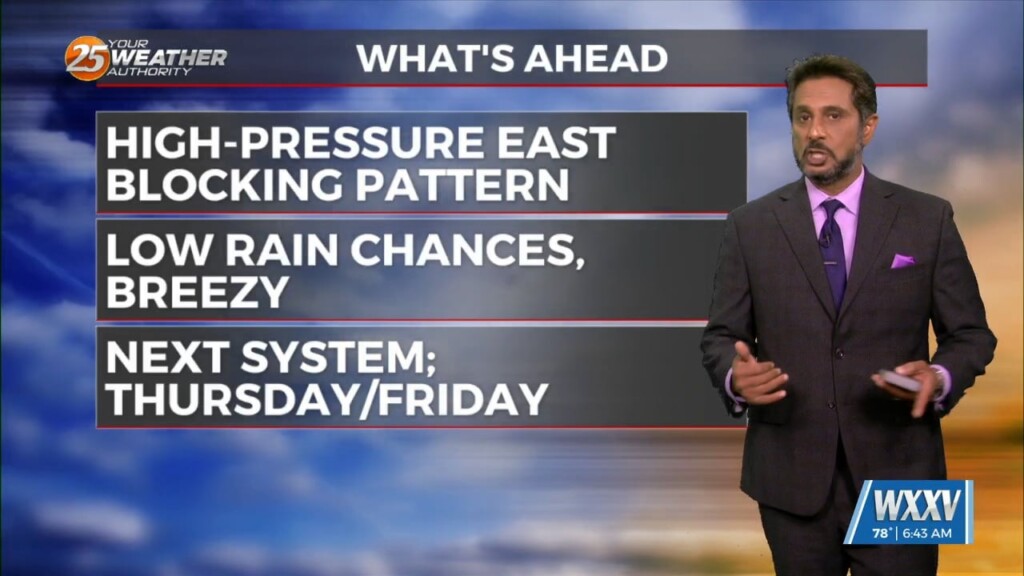
Strong high pressure will dominate the Gulf South through the entire short term period. The deep layer subsidence associated with this high pressure will result in…
A rather zonal/progressive upper level flow will continue through the morning and into the afternoon hours across our region. Later today and…
The upper air pattern shows high-pressure extending from south Texas to the Dakotas, with an upper low-pressure centered near Las Vegas. At the surface, high pressure…
Cloud coverage and breezy conditions will increase this morning as an approaching cold front to the west stalls. Early Wednesday we will see a cold front…
The only story this morning will be fog developing along the MS Gulf Coast. Aloft, a dry northwesterly flow should persist through the near term period.…
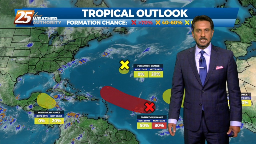
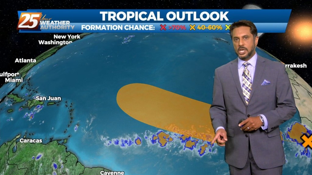
An easterly wave in the SE GOM is expected to continue to move west-northwest toward the Rio Grande Valley of south Texas by late tonight or…
Upper high pressure centered near Kansas City this morning, with an easterly wave over the central Gulf of Mexico. Very isolated showers and a thunderstorm or…

A stalled stationary front just north will push south by early afternoon bringing subtle (nice) changes. This will also keep most activity over the marine areas…
There is a low pressure system is in the Great Lakes region with a cold front draped just north of the area that has become stationary. This…
Weakness in the upper levels extends from Missouri to Baja California. At the surface, low pressure associated with the weakness was centered over Illinois with a frontal…
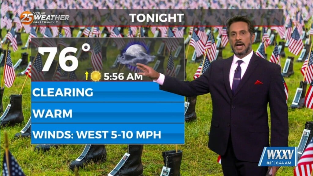
After a cool start, temperatures have warmed into the upper 70s/low-80s. A quiet weather pattern will continue through the workweek prior to the next frontal boundary…
A strong surge of tropical moisture and upper diffluence is approaching the north central and NW gulf this morning. The deepest moisture surge will be…
There is little change in thinking from the previous forecast concerning the overall trend of gradually increasing moisture, lift, and rain chances through Wednesday. The overall…
Upper level high-pressure is expect to pretty much remain in place through the short range portion of the forecast. An approaching cold front to the NW will slowly move E/NE and ride north of the Hattiesburg area. By late Tuesday…
Not much in the way of changes expected over the next few days with high pressure over the Gulf of Mexico. Daily high temperatures generally in the 90 to 95 range and afternoon dew-points in the lower and mid 70s…
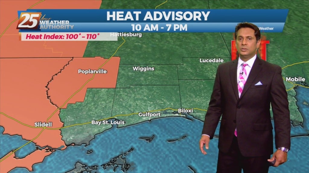
The expansive mid to upper level high pressure area will remain just off to the north and west of the region which will keep the forecast area in a battle between very warm/hot low level temperatures and scattered diurnally driven…
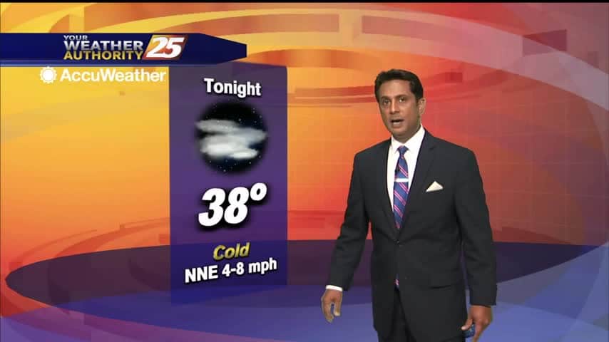
In the wake of the overnight cold front, winds continue to elevate...

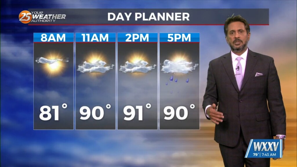
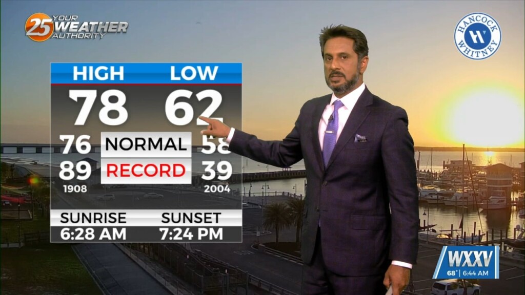
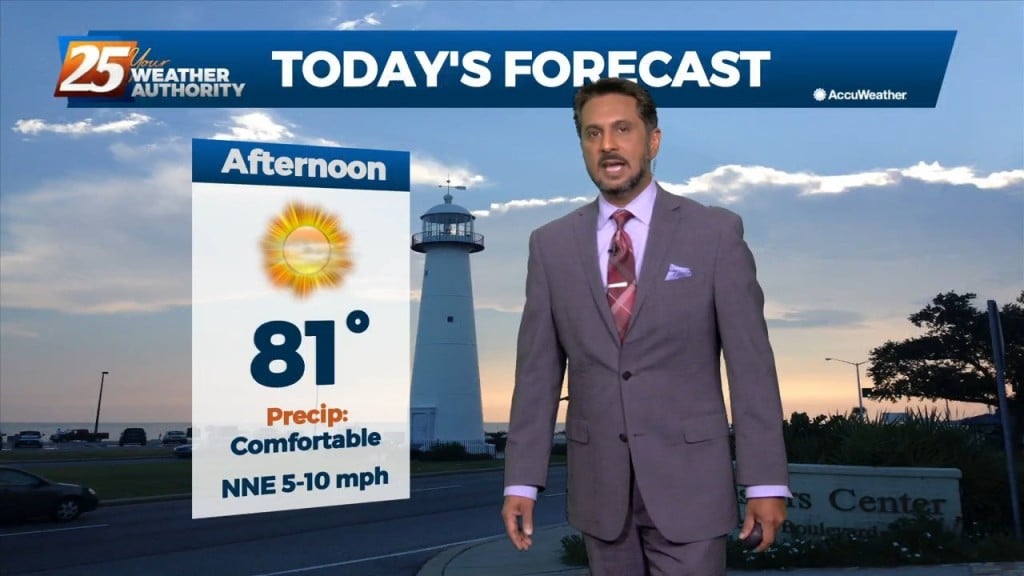
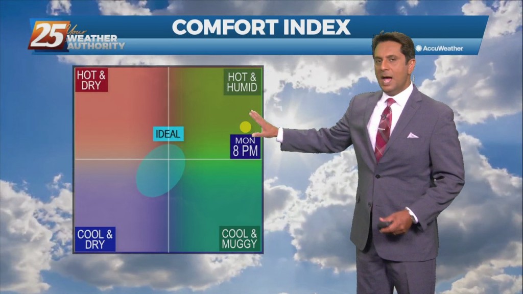
A BEAUTIFUL Monday afternoon ahead with sunshine mix with clouds and warm temperatures in the low 80s...