6/20 - Rob's Hot & Humid "Midday News" Forecast
The final day of Spring is shaping up nicely with much more sunshine and HOT conditions...

The final day of Spring is shaping up nicely with much more sunshine and HOT conditions...
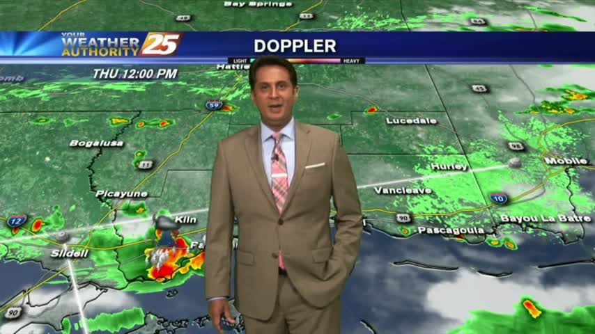
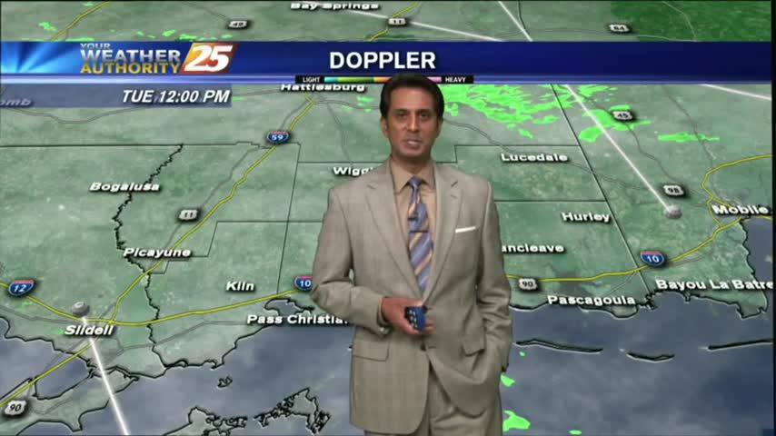
HOT & HUMID with showers and t-storms beginning to pop along the Southern 6 and the region...

After a warm start, it's getting hot and humid with isolated showers/t-storms developing...
Another WARM & HUMID afternoon as cloud coverage continues to move through in advance of an approaching cold front...
After a chilly morning, temperatures will top out around 70 degrees this afternoon...
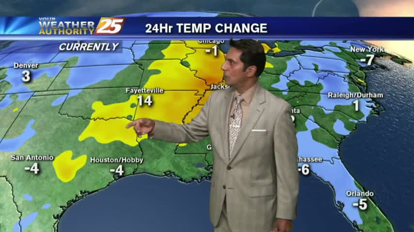
In the wake of this mornings cold front, surface high pressure building in from the north will maintain these below normal temps through Friday...
After a warmer start to the day, low-level clouds have been moving in and out of the area...
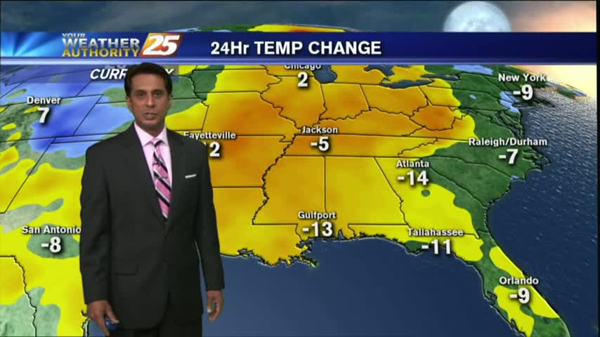
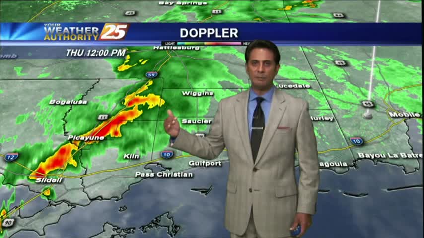
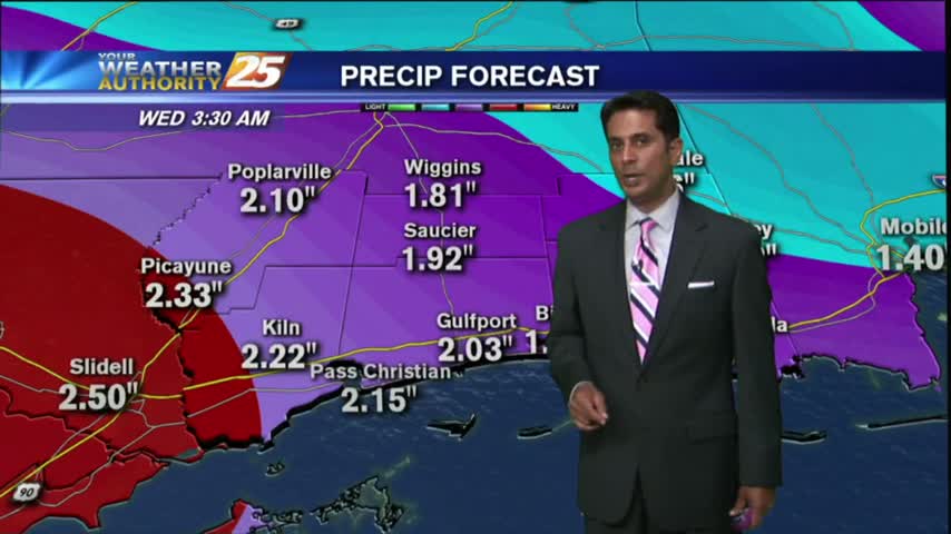
It was a much warmer start to the day with morning low temps about 20 degrees warmer than yesterday. Moderate rainfall is now moving across the area...
After a FRIGID morning, the cold air is moving out of the area...hopefully for the season!
After a CHILLY start to the day, a sunny, cool and breezy afternoon is on-tap...
In the wake of a cold front, cloudy skies coupled with a strong wind from the North has the mercury struggling to warm...
After a MUCH WARMER start to the day, the mercury continues to climb into the 70s, under cloudy skies...
After another morning of FREEZING temps, the mercury is rising nicely with the return flow in full effect...

After a MUCH WARMER start to the day earlier this morning, mild and humid conditions can be expected this afternoon with windy conditions...
After another FRIGID start to the day with temps in the upper teens...they are slowly warming into the upper 30s...
Gray/gloomy conditions continue with more in the way of cloud coverage than rain, but it will come....
After a fogy start, beautiful blue skies dominates the viewing area as temps continue to warm...
After a FOGGY start to the day, we continue to find minimal effects from a cold front moving through...

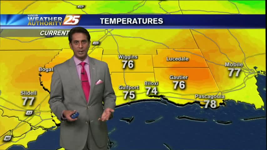
After another CHILLY start to the day, temps have warmed nicely with just a few low-level clouds along the immediate coast...
A CHILLY...but slight warmer start to the day. Temperatures will continue to warm heading towards the weekend...
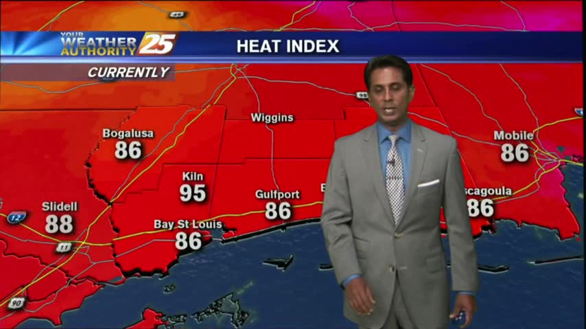
It's a HOT late summer afternoon as temperatures area climbing into the upper 80s...BUT, the HEAT INDEX is much higher...

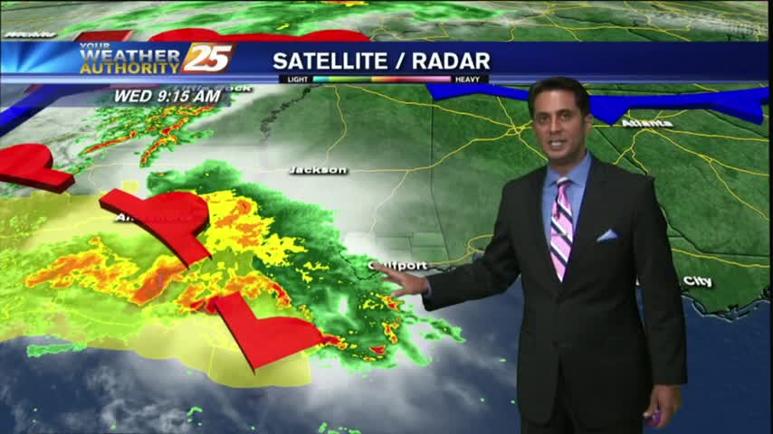
Morning showers/t-storms have subsided and moved to the east as the stationary front moves east...
Light rain has been moving into the area this morning, scattered showers/t-storms on-tap this afternoon...
After a clear start...clouds have moved in along with isolated t-storms associated with a warm front moving through the area...