6/13 - Sam Parker's "Rain Free" Thursday Midday Forecast
Today will bring increasing subsidence through the area as high pressure begins to expand eastward from the southern Plains. Cumulus cloud development can be expected this afternoon…
Today will bring increasing subsidence through the area as high pressure begins to expand eastward from the southern Plains. Cumulus cloud development can be expected this afternoon…

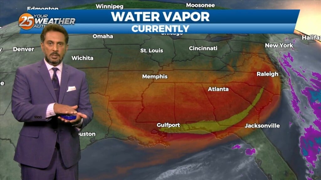
A MUCH DRIER air mass at the surface though the upper levels continue to flow into the region. This dry surge will move through and out…
An upper level disturbance extends from off the New England coast to the Carolinas, down to the northeast and central Gulf of Mexico. High…
High pressure to the NE continues to shape the forecast but as expected, models have backed off of bringing showers into the area from the gulf…

It will be lovely out the door tomorrow with clear skies and light northeasterly winds allowing for temperatures to cool off. Sunshine will be dominant again, with…
A cold front from over the weekend has brought in very nice changes to the feel of the air for South Mississippi. Humidity is a non-factor this evening…
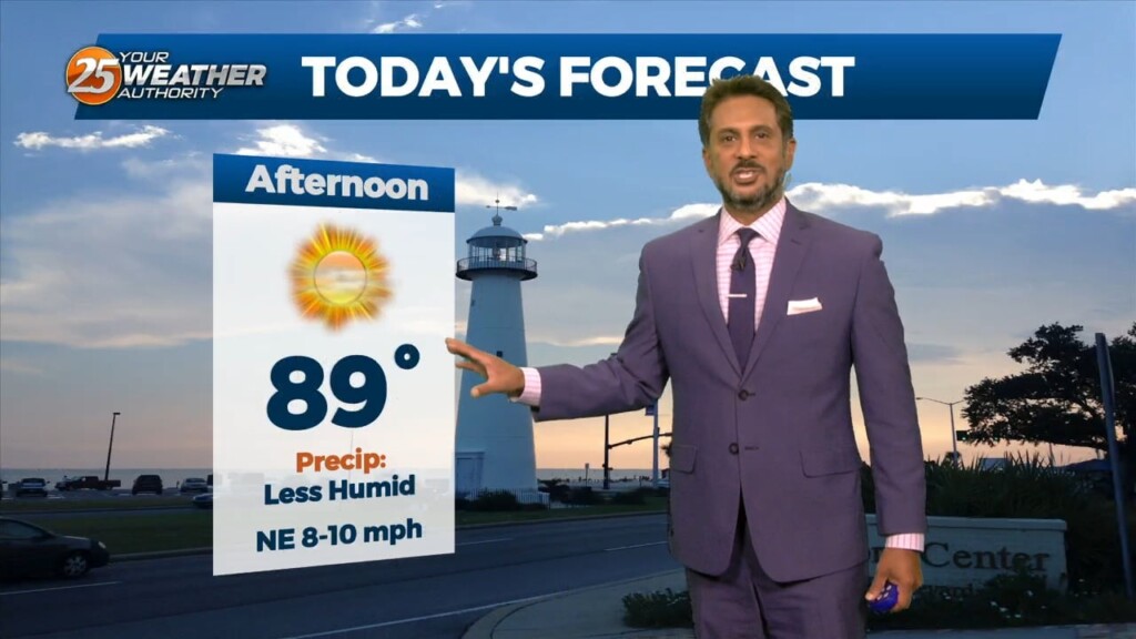
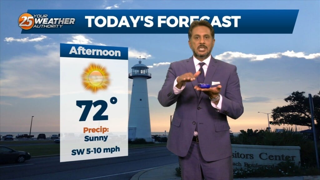
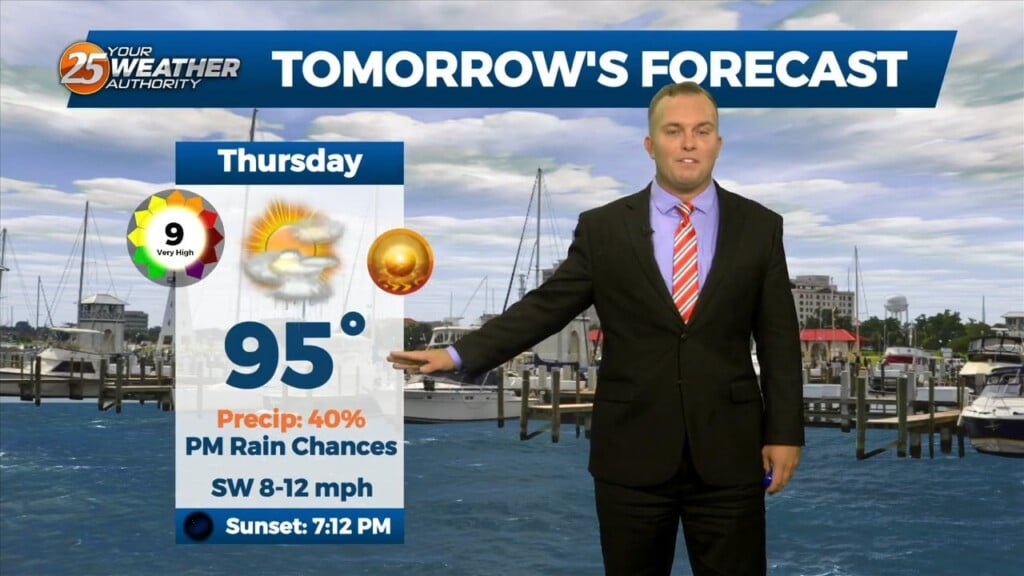
This afternoon will be very similar to yesterday in terms of low humidity values and temperatures warming back into the upper 80s to low 90s. Tuesday…
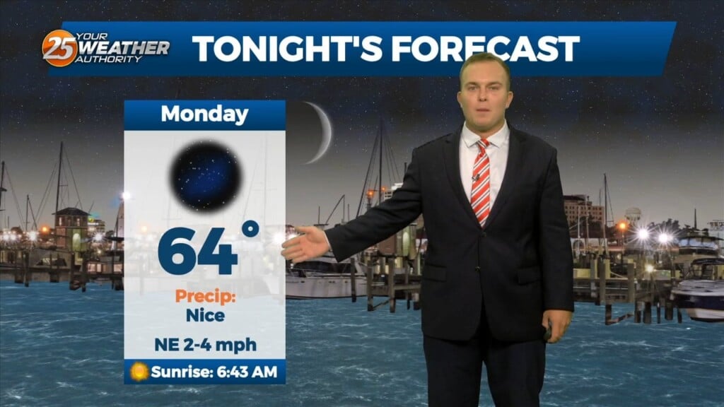
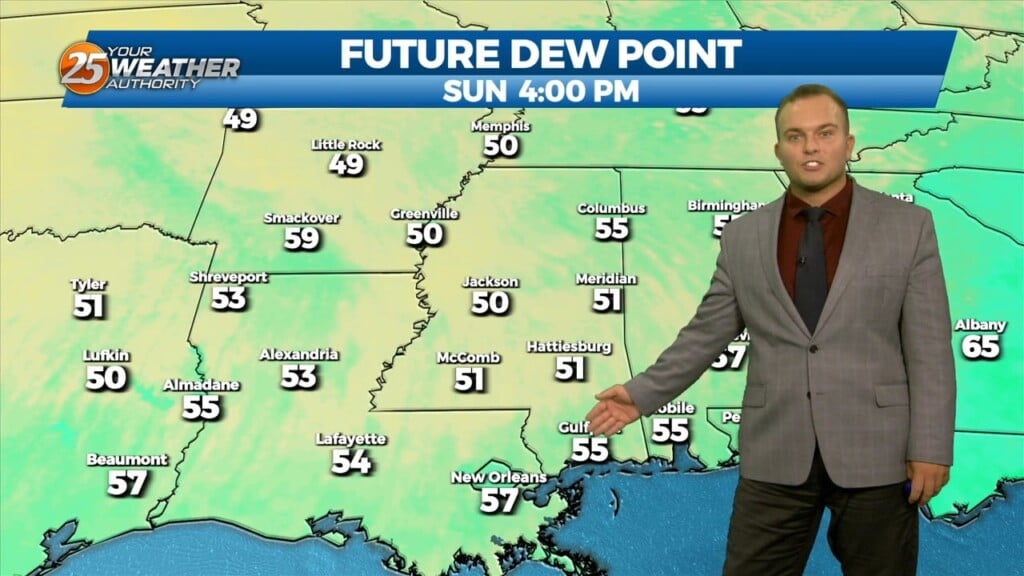
Overall, it’s a very tranquil and "cool" morning across the region with temperatures generally in the 60s with light northerly surface flow continuing. Surface dew-points…
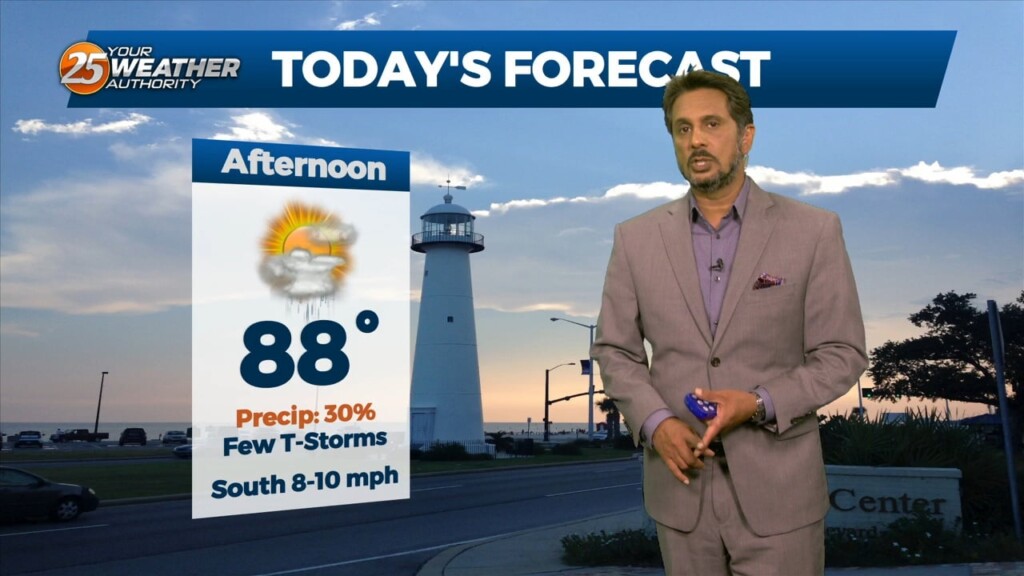
Expect mostly clear skies overnight with a mild, but muggy start to your Saturday. Tomorrow will be much like earlier today with cloud cover building…

Very spotty rain chances will be present this evening with only about 20% coverage expected. Clouds will clear out overnight and it will be a mild and muggy…
The stalled stationary front to the south is beginning to wash out quite a bit, but will linger into the final weekend of summer.…
Clouds will clear out overnight and a milder airmass behind a cold front will slowly work in. Temperatures will be quite pleasant out the door to begin…
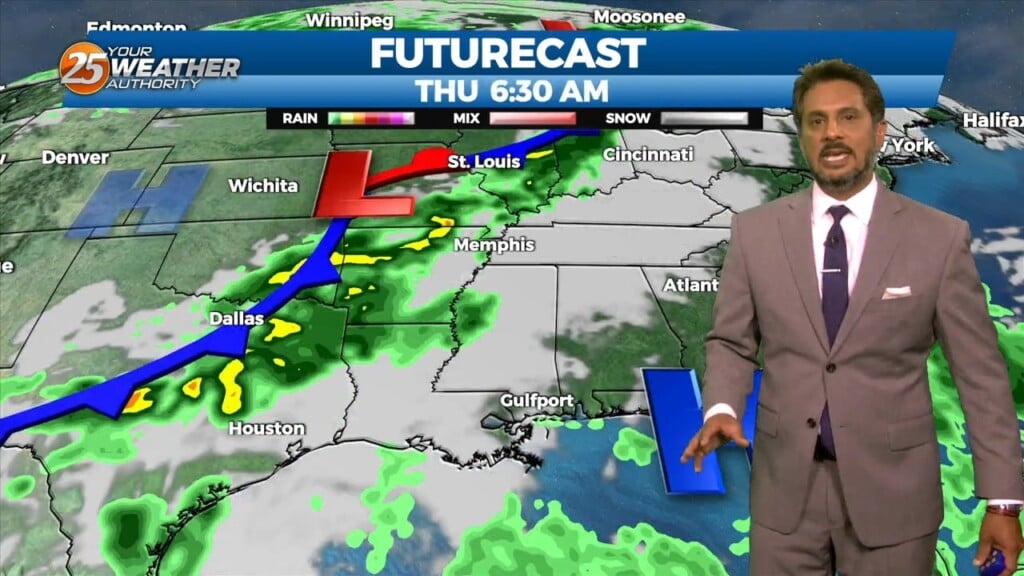
A cold front is gradually working through our area. Unrelated to it, a complex of thunderstorms that made its way into areas to our west is…
This afternoon an area of high pressure is located over New Mexico, with a trough from the eastern Great Lakes to Georgia. The remnants of the line of…
High pressure is centered over New Mexico this morning, with a trough from the eastern Great Lakes to Georgia. The remnants of the line of thunderstorms that dove…
Skies will clear out overnight and there will be a pleasant feel to the air out the door tomorrow. A less humid pattern will gradually work in by…
Showers and thunderstorms will gradually wind down across South Mississippi. Skies will clear out overnight and a less humid pattern will slowly start to take…
Warm and humid conditions will remain in place overnight. Some mid-to-upper level clouds will pass through the area tonight but they will not be a factor for…
Clouds from earlier in the afternoon will thin out some this evening as temperatures will remain quite warm. Expect the humid feel to the air to…
Rain chances will fade and skies will clear out overnight. Your Wednesday will start off on a mild note with humidity lowering. Skies will only feature a…

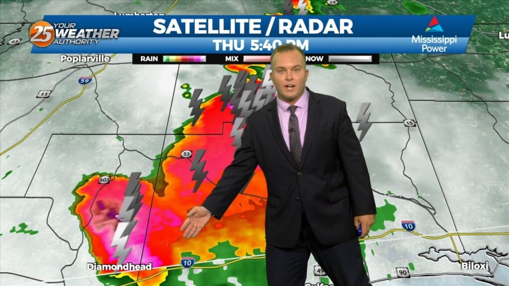
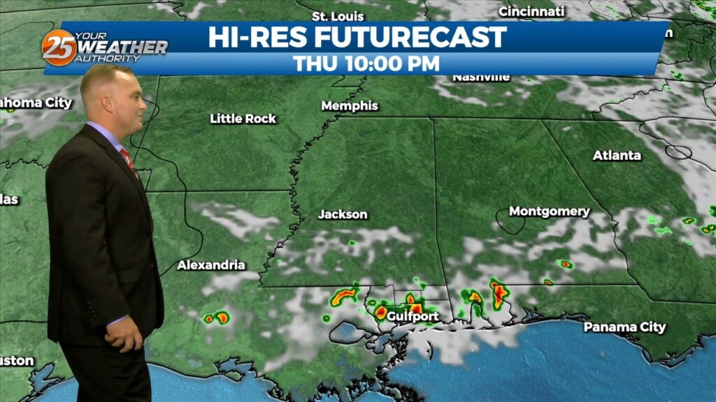
Showers and thunderstorms are in our area. Expect for them to continue to be scattered in nature this evening. Overnight, activity will gradually come to…
Skies will clear somewhat overnight and rain chances will gradually exit the picture for the night. It will remain mild, and humid. Tomorrow will start…
Thunderstorms will remain around early on this evening for a lot of you. Very heavy rain and isolated pockets of gusty winds and small hail are possible…
Other than spotty showers, rain chances have exited the area for the most part and skies will clear out overnight. A front is moving through the area…