
3/25 - The Chief's "T-Storms With SEVERE Potential" Monday Afternoon Forecast
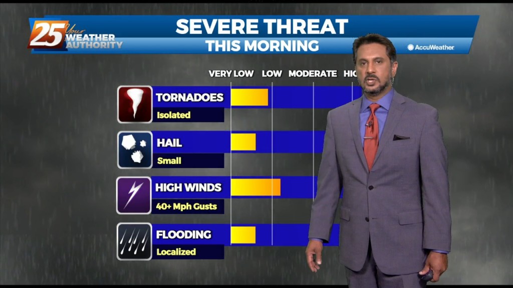
SEVERE THREAT this afternoon/tonight, with multiple potential hazards in the first 24 hours of the forecast before the weather quiets down for a while. A…
SEVERE THREAT this afternoon/tonight, with multiple potential hazards in the first 24 hours of the forecast before the weather quiets down for a while. A…
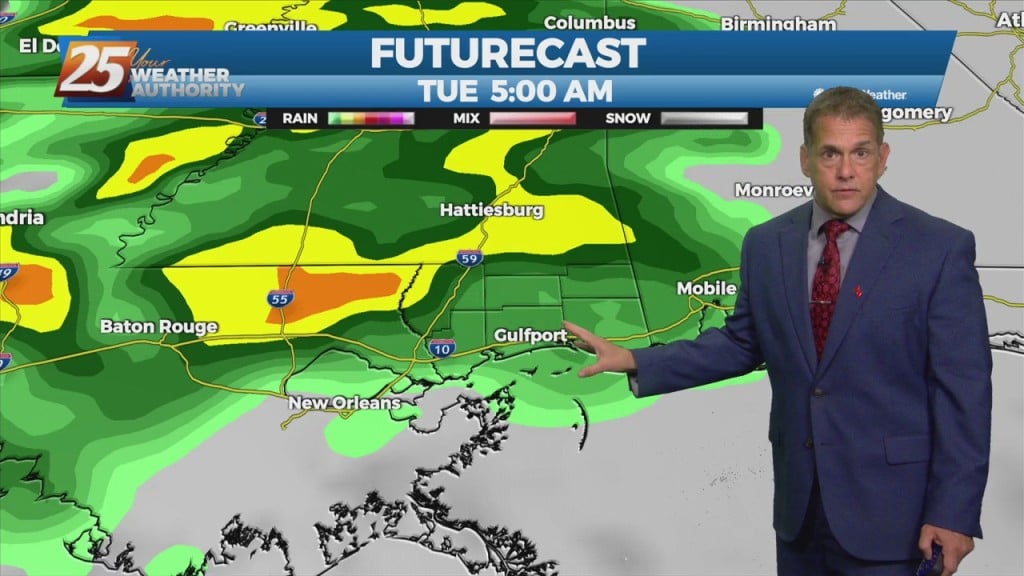
There is plenty to talk about in the first 24-48 hours with a challenging forecast ahead. An impulse riding SE along a stationary front to the…
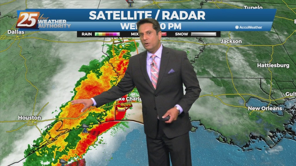
Significant severe weather and excessive rainfall threats can be expected this afternoon into mid-evening...especially from the Interstate 10 corridor northward. A vigorous system just to the…
While isolated showers are streaming north across the local area, the activity will ramp up through midday. The upper disturbance is becoming somewhat negatively tilted early this morning,…
Severe weather is back on the slate, following the recent trend of about one per week. Showers arrive late tonight followed by thunderstorms entered from the…
A cold front will continue east with a line of convection ahead of it by early to mid-afternoon. While the very warm and moist airmass is expected to…