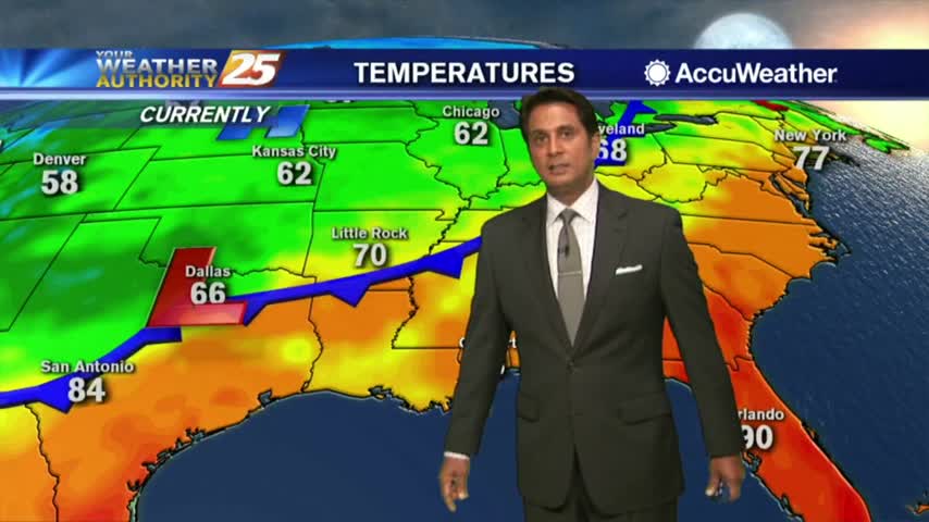
5/5 - Sam Parker's "Buckets of Rain" Monday Night Forecast
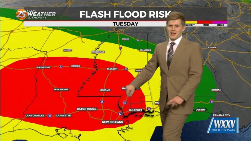
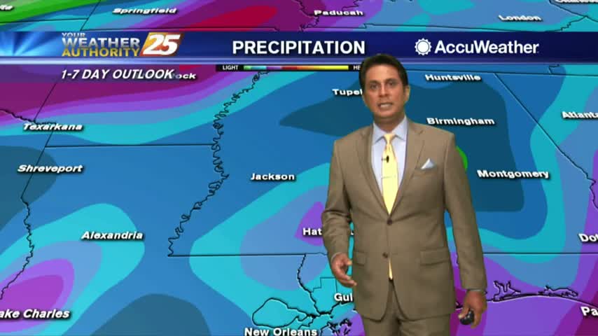
Heavy rain threat Tuesday evening through Thursday across all of south Mississippi. Monday was beautiful with slightly below seasonal average. Now the main threat Tuesday…
Heavy rain threat Tuesday evening through Thursday across all of south Mississippi. Monday was beautiful with slightly below seasonal average. Now the main threat Tuesday…
A pleasant weekend across the area highs remained in the upper 70s but this new week has a few things in store. starting off with…

Residents have been worried as the hole was here prior to Monday's weather but with all that heavy rain we experienced it has grown in size. Caution tape has been placed around…
The overall pattern begins to shift with high pressure centered over eastern North Carolina, with a weakness/cold front along the lee side of the Rockies.…
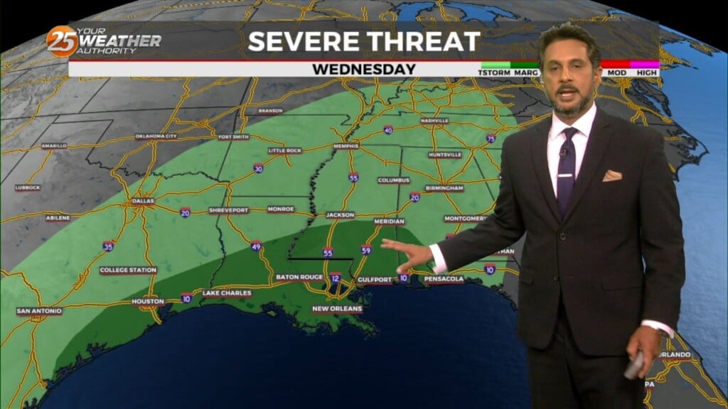
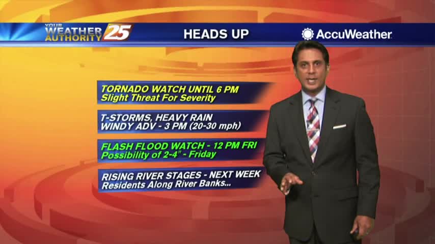
We remain under a “slight” risk (level 2 of 5) for severe storms this evening and tonight. Although the main line isn’t expected until after 9 PM,…
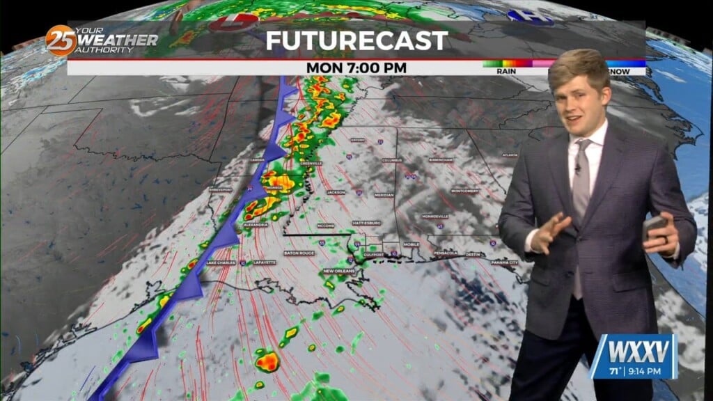
Heavier showers to our west will weaken as they make their way through our area tonight. It’ll stay breezy off the gulf and the warm…
Ares of patchy fog this morning then another round of showers and t-storms...
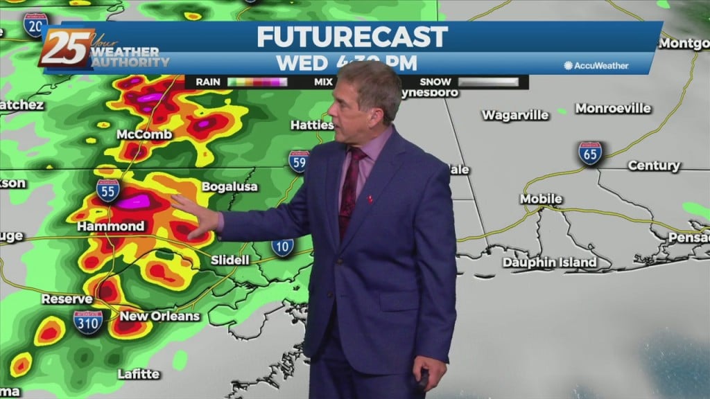
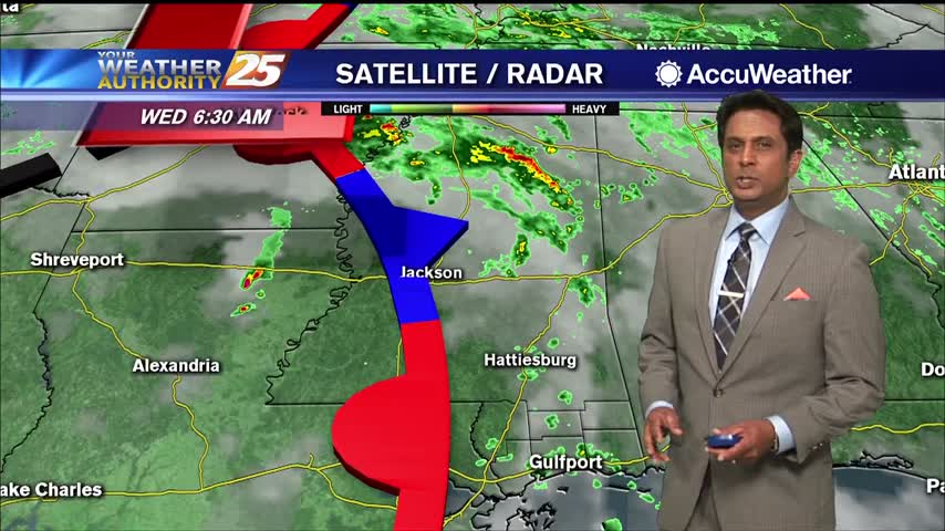
Rainfall is developing in the area in advance of a cold front west of Baton Rouge, our area is under a TORNADO WATCH...
A cloudy and warmer start with pockets of light rain moving in from the Gulf...
Activity is beginning to redevelop with daytime heating...