07/28 Ryan's "Scorching Start" Monday Morning Forecast
We're off to a scorching start this week due to high heat and humidity, activating Heat Warnings across parts of South Mississippi. Even in the areas without warnings,…
We're off to a scorching start this week due to high heat and humidity, activating Heat Warnings across parts of South Mississippi. Even in the areas without warnings,…
It's going to be a struggle to stay cool out there today as we're off to a sunny and hot start, with almost no chance of a cooling…
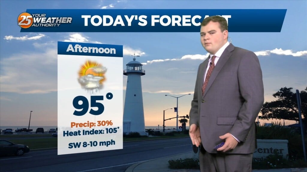
Just walk outside and you will know the forecast. It`s Summer, hot, muggy, daily rain chances, and just downright oppressive conditions. This afternoon temps will warm into…
This afternoon high pressure was centered near El Paso, Texas, extending northward through the Plains States. At the surface, high pressure was centered over Florida and the Northern…
High Pressure continues to be centered near El Paso, Texas this morning, extending northward through the Plains States. At the surface, high pressure was centered over…
Upper level high pressure continues to spread eastward through the central MS River Valley and into the southern Appalachians. Basically, in a nutshell, same old same old…
The stubborn high pressure continues to remain centered over the I-35 corridor from Kansas through much of north and central Texas this morning.…
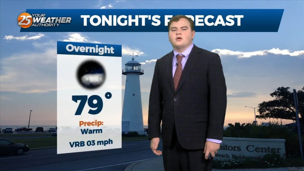
Tonight we will steadily drop into the upper 70s for overnight lows with mostly clear skies. Unfortunately little change in the overall pattern is expected through the end…
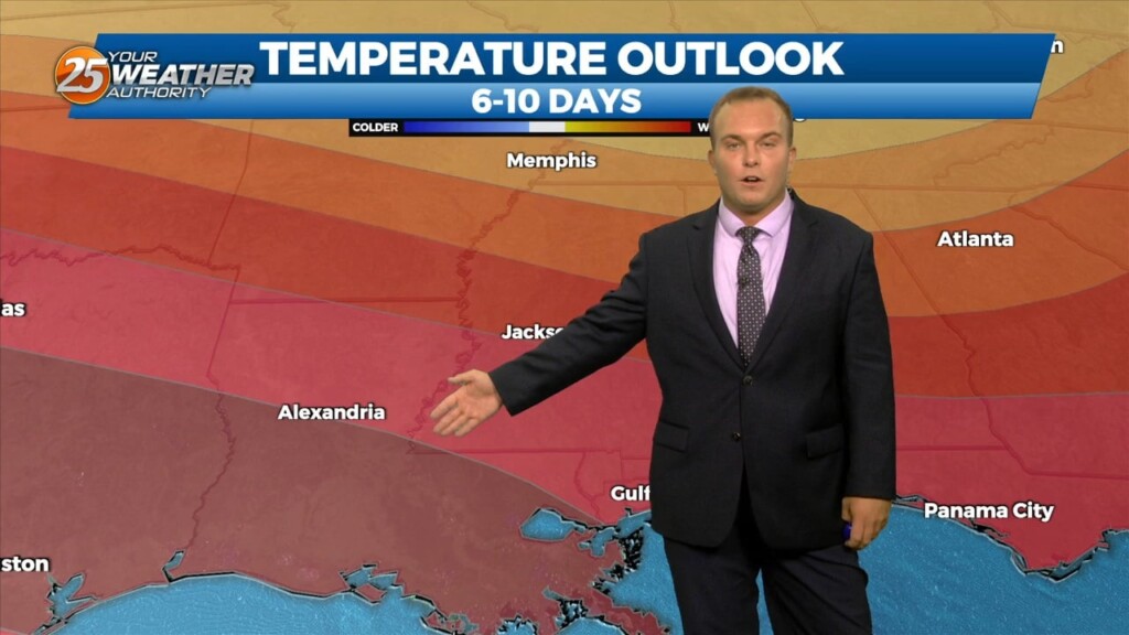
Unfortunately little change in the overall pattern is expected through the end of this week as high pressure remains dominant. However currently there is an overall weakness…
An easterly wave in the SE GOM is expected to continue to move west-northwest toward the Rio Grande Valley of south Texas by late tonight or…
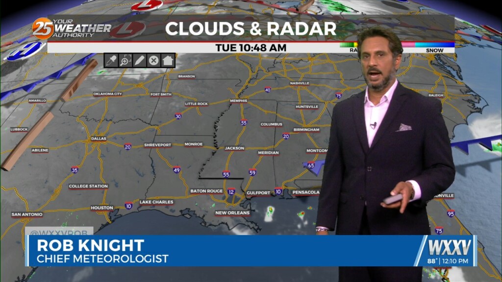
Upper high pressure centered near Kansas City this morning, with an easterly wave over the central Gulf of Mexico. Very isolated showers and a thunderstorm or…
Skies remain clear overnight and it will be slightly warmer with more humidity as compared to last night. Tomorrow will again be hot, with a modest increase in humidity.…
The heat is back and it will be very uncomfortable for a lot of you this evening. Humidity is on the upswing as well and the pattern…
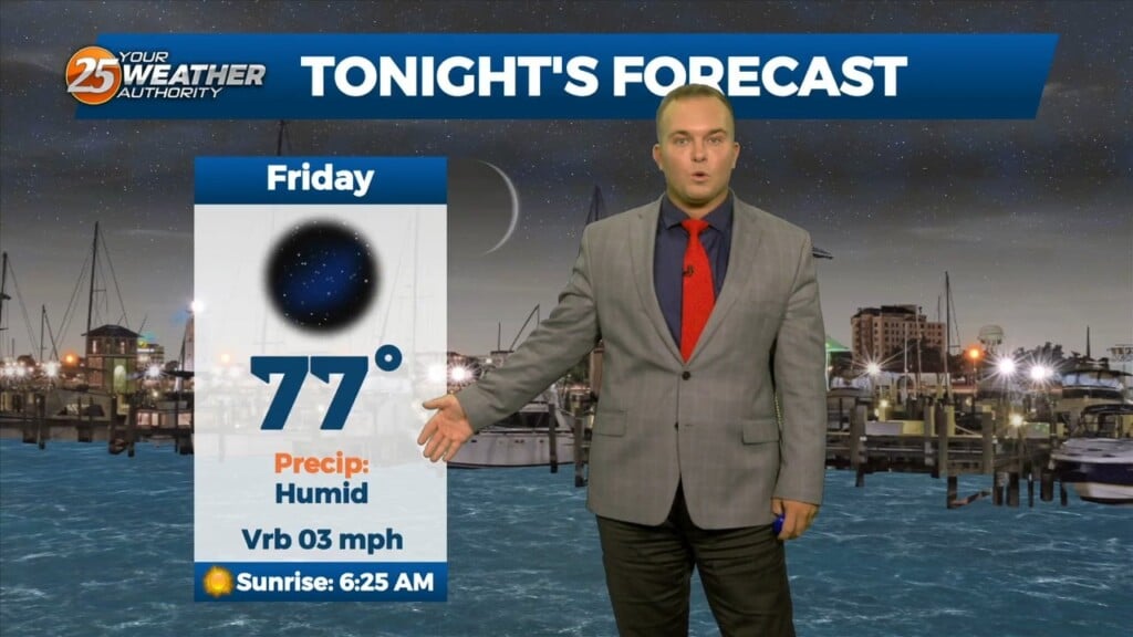
Clear skies and still-mild temperatures will be what you experience overnight. Humidity is gradually on the upswing. Friday will be dominated by sunshine and hotter temperatures. In some…
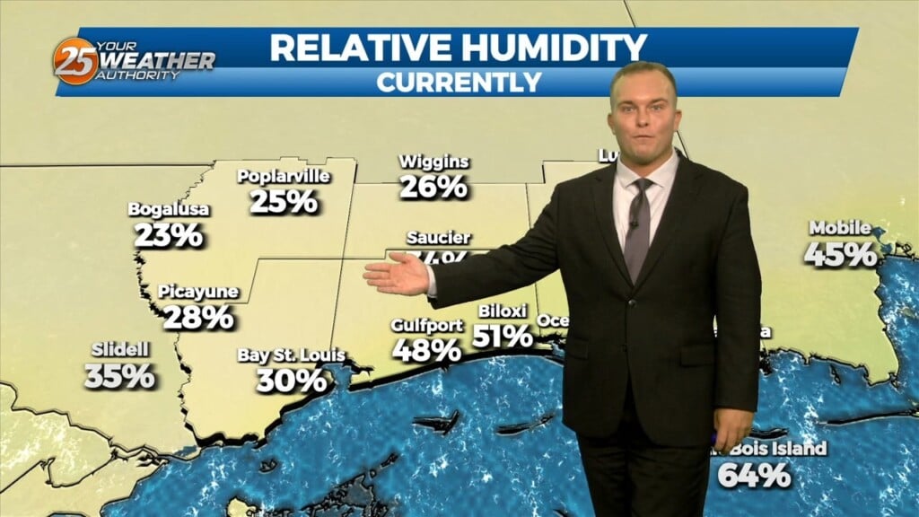
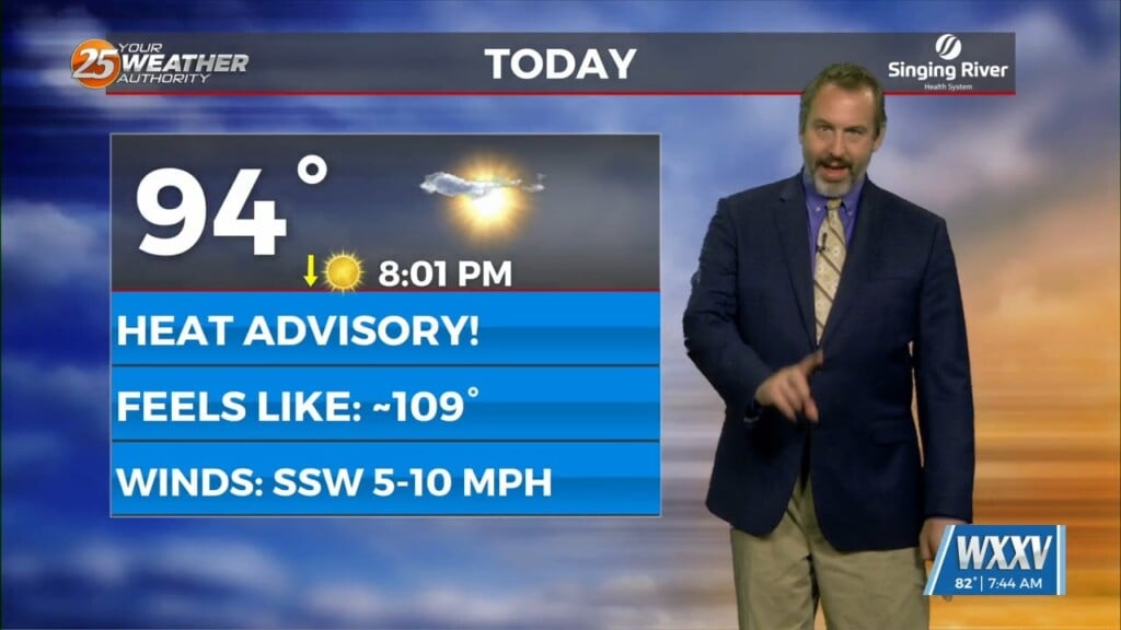
With the exception of some of the immediate beachfront, humidity did not make much of a return today. Heat indices around 100 degrees for…
It will not cool off to any comfortable level overnight. The humidity remains in place while skies will be mainly clear. Southerly winds will continue to be…
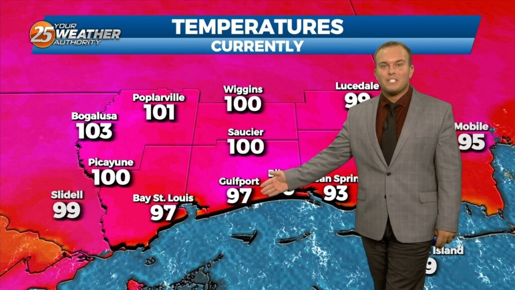
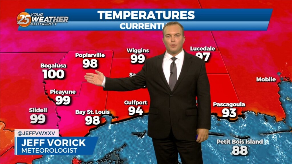
More heat continues in the area. The mercury reached 100 degrees at Gulfport earlier, breaking the daily record of 99 degrees. Many spots have been feeling…

It will remain hot and humid overnight as southerly winds continue. The warm nights and long duration of this heat wave can and do account for…
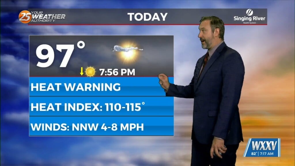
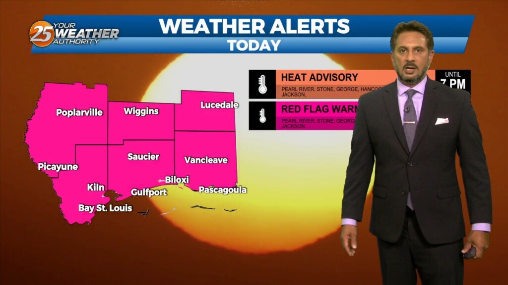
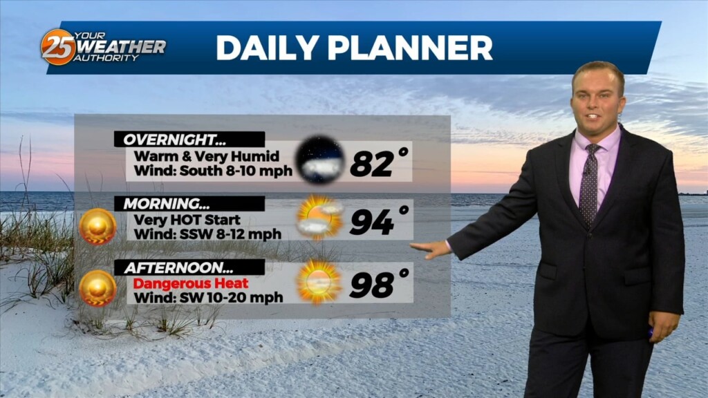
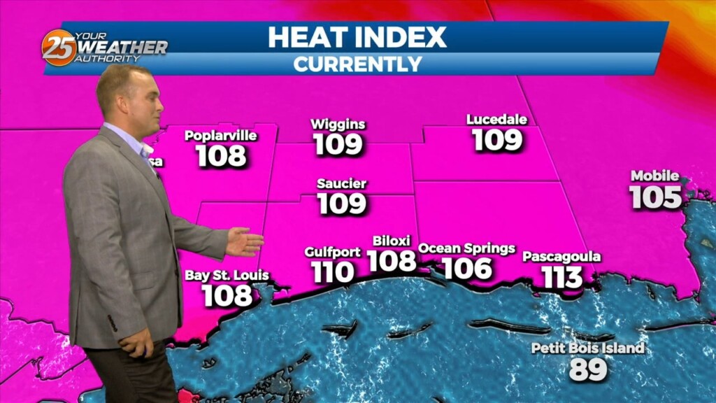
Extremely hot conditions continue for South Mississippi. Heat alerts remain in effect until 7 PM as heat indices are over 110 degrees. Clouds will clear overnight but…
It will remain very warm overnight with southerly winds ushering in extremely high levels of humidity. Some clouds will be around at times but the…
As has been the case for a while, dangerous heat continues into this evening. Heat alerts expire at 7 PM but it will still be VERY…
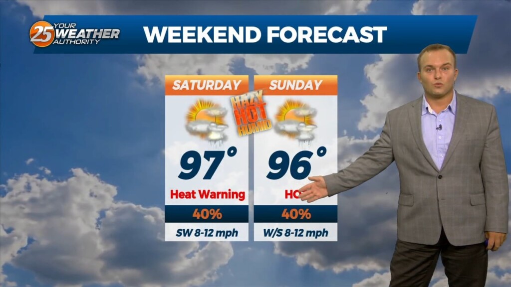
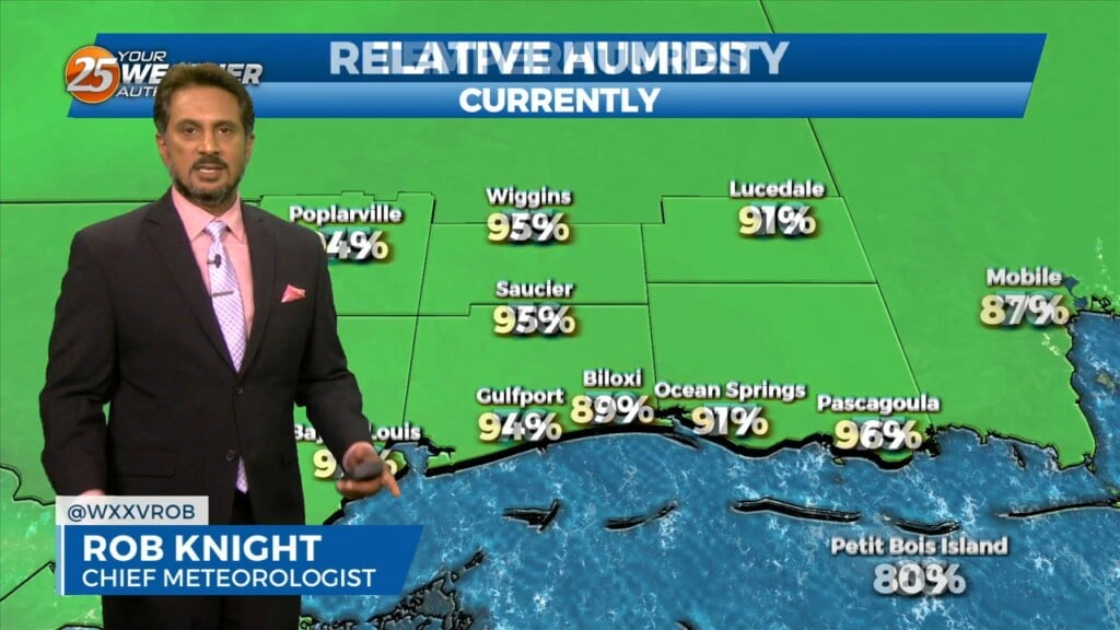
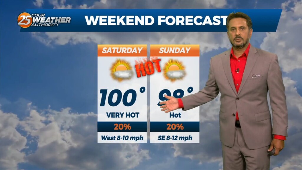
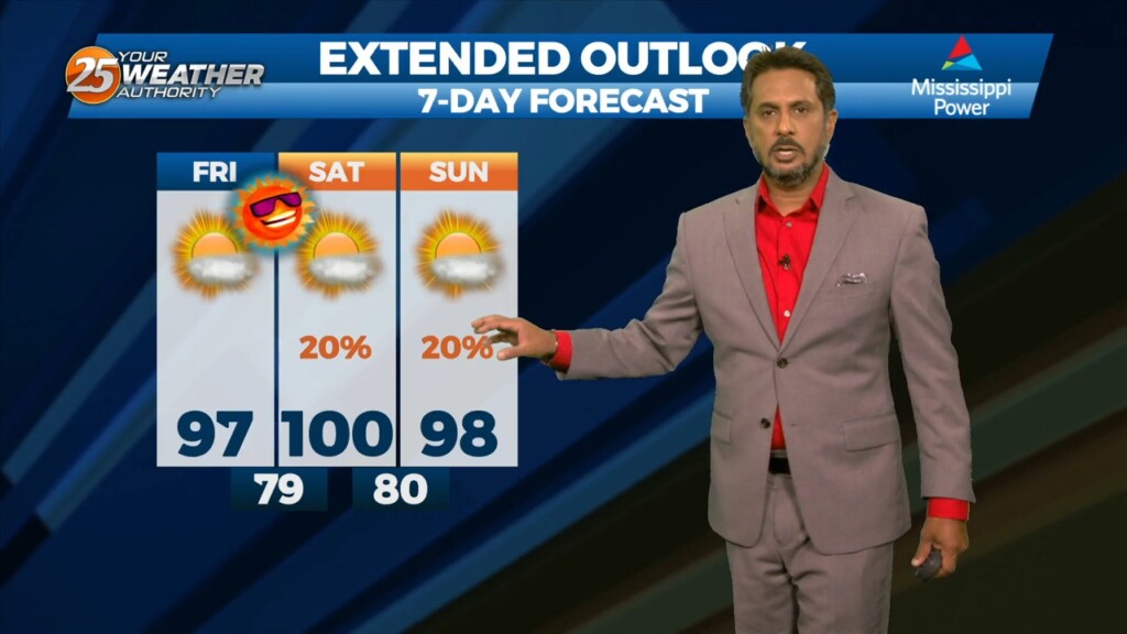
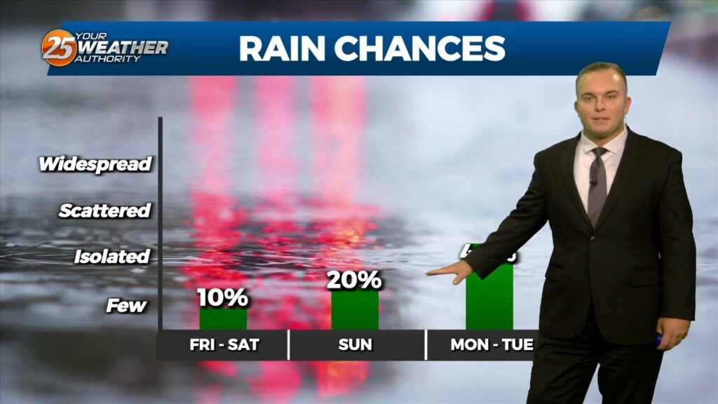
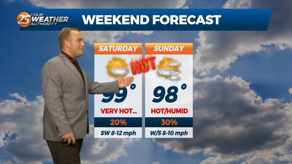
The humidity will be unrelenting tonight into this weekend. Temperatures will struggle to cool below 80 for much of you. This combined with another day of hot…
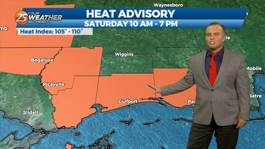
An Excessive Heat Warning is in effect for the majority of our area, with the exception of George and Stone County, until 7 PM. Regardless of alert, be…
The humidity will remain in place overnight. Temperatures will not drop off too much more even under clear skies. Expect a very hot start tomorrow and the…