08/28 Ryan's "Dark & Cloudy" Wednesday Morning Forecast
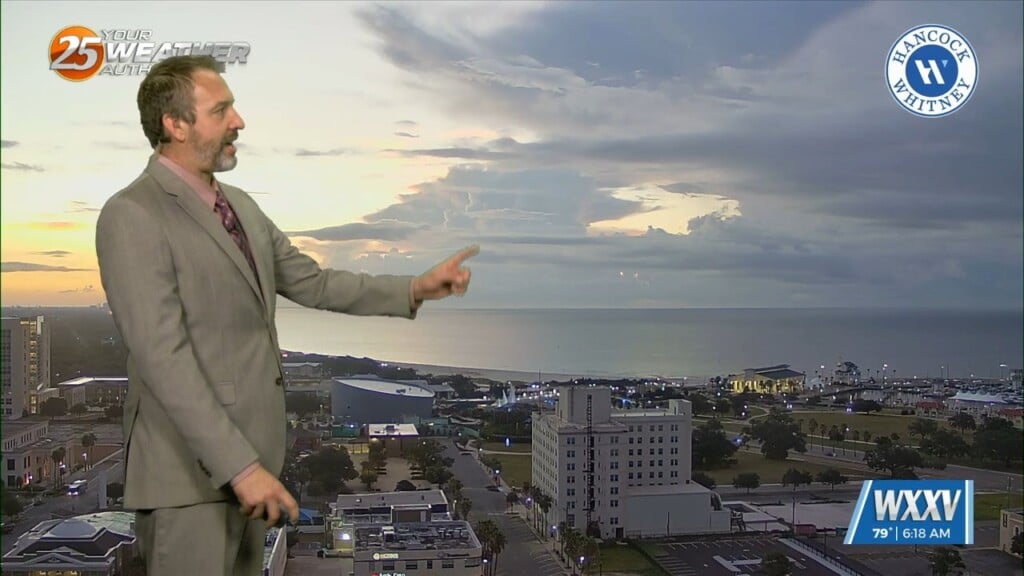
While not anything to worry about, expect dark & cloudy skies to greet you this morning. Things have been much more clear in the morning over the last…
While not anything to worry about, expect dark & cloudy skies to greet you this morning. Things have been much more clear in the morning over the last…
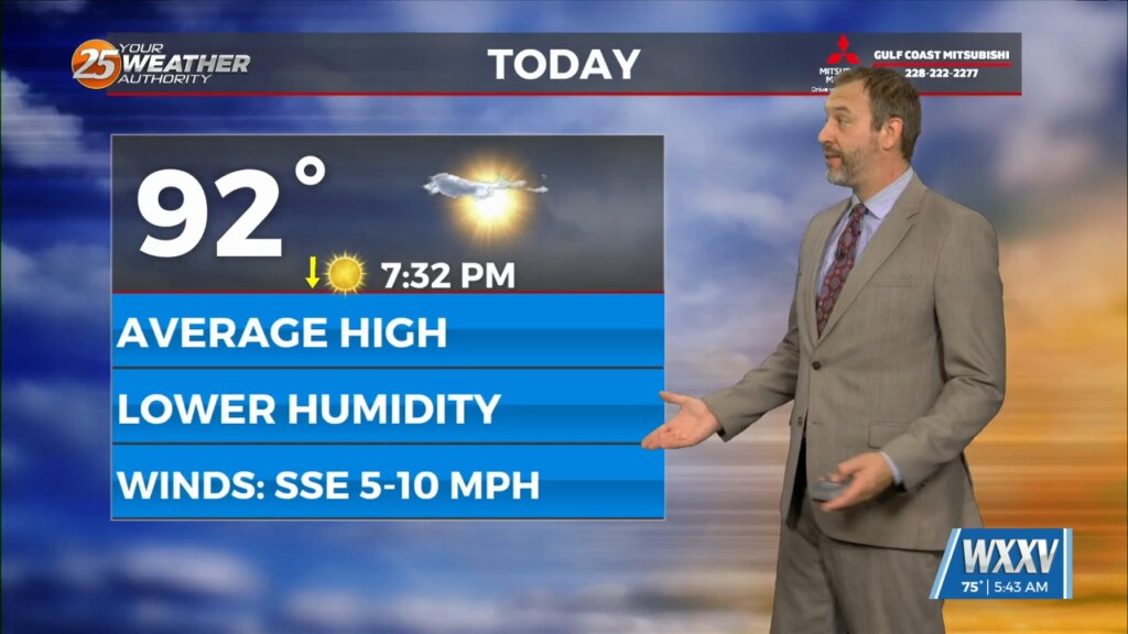
I expect today will be our driest day in terms of rain, but the humidity is noticeably climbing from its lowered values we saw last week. It's not going to…
Things are changing noticeably on us now after a similar couple of days. We've now put our lowest temperatures and lowest humidity behind us, and while today will still…
The last couple of days have been cooling slightly and drying out, and while those pleasant conditions will continue another few days they're starting to see changes. This morning…
Dry air aloft and lower humidity at the surface continue to dominate South MS weather, leading to an even cooler morning and a pleasant afternoon ahead! It won't be…
That's right, we may be heading deeper into summer, but for the next few days it's finally cooler and even a little drier! Let's go ahead and temper those…
Today is already slightly drier, but the humidity will fall even more in the days ahead as a weak front pushes drier air into South MS. For today, it…
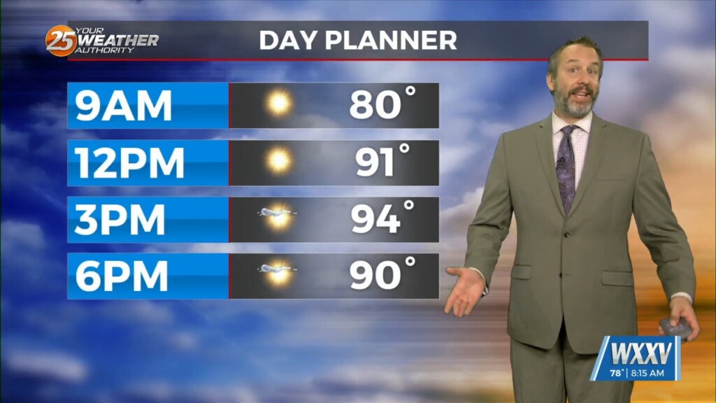
Today has been forecast to be the hottest day of the week for the last several days, as the temperature and humidity inch up to their highest levels. That's…
The title above is correct, while you likely couldn't tell without looking at the numbers, we are in for a slightly "cooler" week ahead! That's not to…

To be clear, it is still summer in South MS (hot & humid), but our next few highs and lows will be technically cooler. I say "technically" because if…

You read that title right, today will be even hotter as temperatures keep rising each day and night. Thankfully that's not a trend that'll continue for too much longer, but…

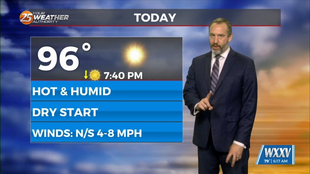
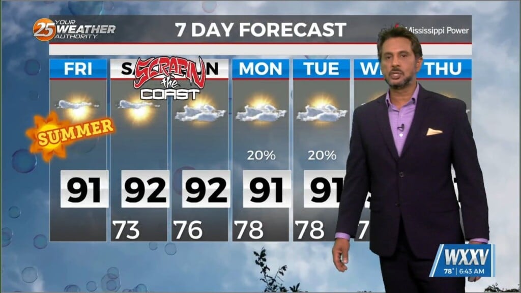
Temperatures starts in the mid-90s and slowly starts it's way up through the middle of the week before slowly working it's way back by the weekend. Heat indices will range…
Just walk outside and you will know the forecast. It`s Summer, hot, muggy, daily rain chances, and just downright oppressive conditions. This afternoon temps will warm into…
The main story today will be the heat as high pressure continues to spread eastward along the Gulf Coast today. Low level moisture will be on the…
While the low level circulation of former Tropical Storm Alberto dissipated yesterday afternoon, the mid and upper circulation is still evident with…
High pressure to the NE appears to strengthen a bit and move back over the next few days. This suppresses the circulation to the southwest enough…
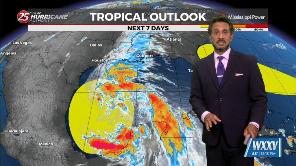
The area of low-pressure over the Bay of Campeche has been designated Potential Tropical Cyclone 1. Still have a fairly significant surface flow between the…

Activity will remain suppressed today and tomorrow as high pressure becomes centered over the region. Very dry air aloft associated with subsiding air will…
Overall the forecast as a whole is a tale of two scenarios with the first part being: high confidence, mostly dry, and HOT. The second part:…
At the surface, a frontal boundary was drifting into the N’tern GOM. Dew-points are in the low/mid 60s in the area with slight cooler temperatures this…
A drier air mass will continue throughout the column bringing rain chances close to zero. As high pressure moves into the region to shape the forecast…
The very weak front has finally settled and now stalled in the outer-coastal waters. The drying throughout the column has been achieved bringing rain chances close to…
The front that has been talked about is arriving this morning. This is more of a weakness at the surface than a front, but there is some…
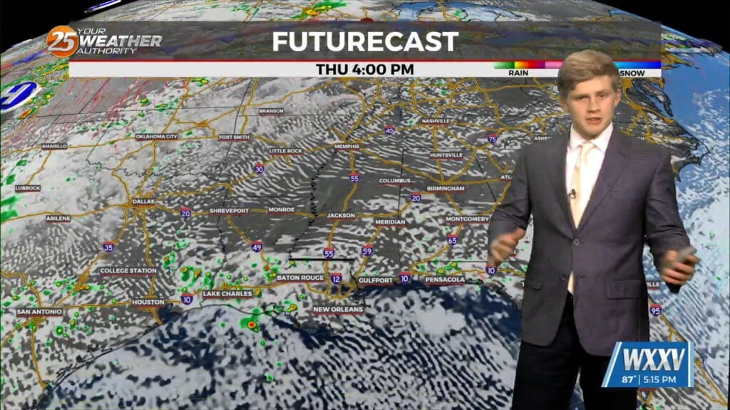
A complex of t-storms well to the NW will continue SE and dissipate late this evening. The activity will move in to the region and traverse…