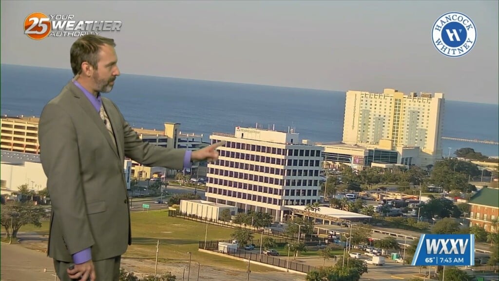
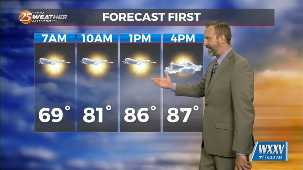
10/09 Ryan's "Even Cooler" Wednesday Morning Forecast
This morning was even cooler across South Mississippi than yesterday's amazing start, but we'll see a bit of a warming trend through the rest of the day. Thankfully, it…
This morning was even cooler across South Mississippi than yesterday's amazing start, but we'll see a bit of a warming trend through the rest of the day. Thankfully, it…
Yesterday wasn't too bad out there, but today is already noticeably cooler and this afternoon will be even better thanks to cooler, drier air! That's all thanks to yesterday's…
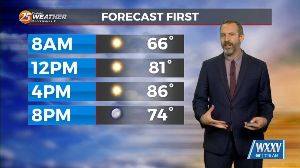
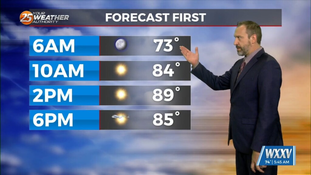
Good morning, Gulf Coast! Things are still a bit on the warm side this morning, but the good news is it'll be the warmest morning of the week as cooler,…
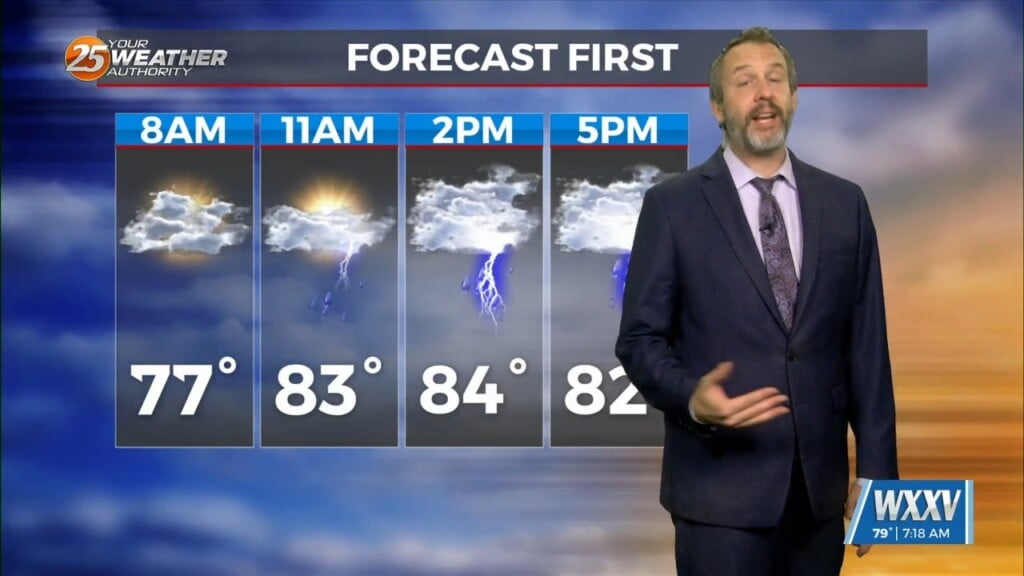
Your Thursday will get off to a nice, sunny start, but it won't last too long as cloud cover and rain moves in quickly later today. We aren't expecting…
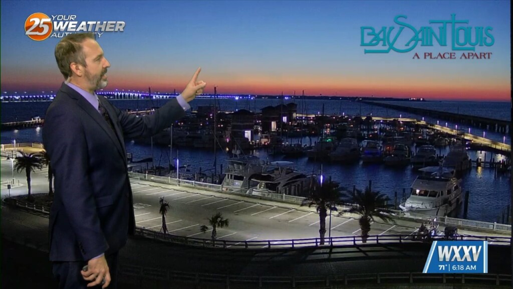
After a fall-like start to the weekend, our more "seasonal" late September weather has returned! That means things will be slightly warmer than they should be, though thankfully the humidity…
Fall officially began last Sunday morning, but it waited until today to noticeably arrive in South Mississippi. Yesterday was a good start after Wednesday's front moved in, but dew points…
Today will see fluctuating cloud cover and breezy conditions throughout the day thanks to influences from Hurricane Helene, but ultimately it'll just usher in an appropriately fall-like end to…
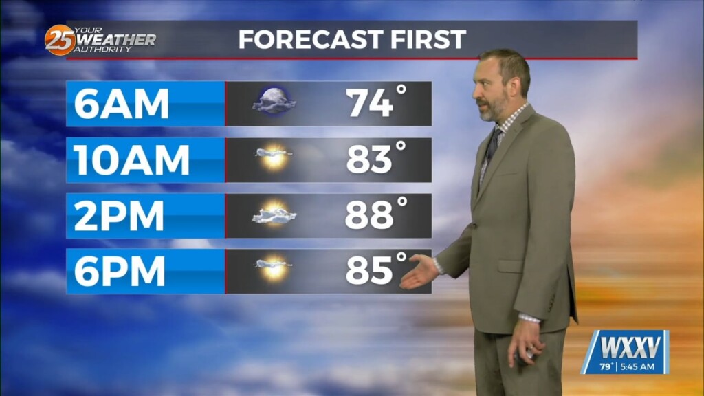
This morning won't be wildly different from the last few mornings, but an approaching cold front is bringing a bit more cloud cover, humidity, and eventually some thunderstorms. We're…
Fall may have started Sunday, but we're still seeing more summery weather at the moment, though a few more clouds will cool things down a tad today. Just a…
Fall officially arrived Sunday morning just after sunrise as the equinox occurred, making today the first full day of fall 2024! If you've lived in South MS for any…
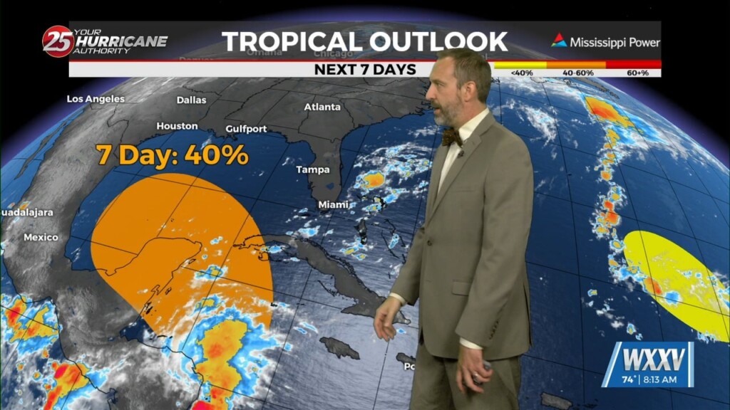
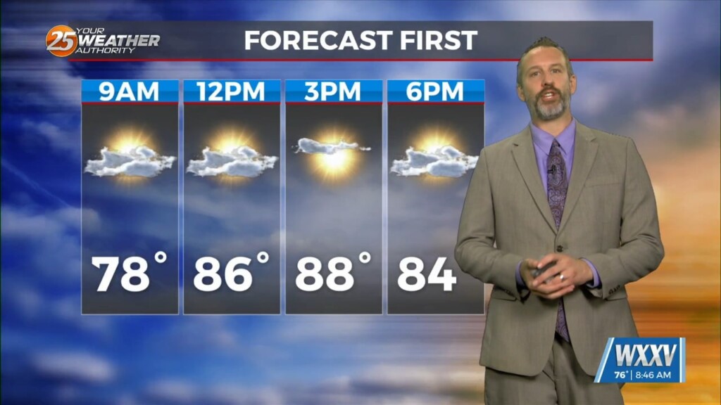
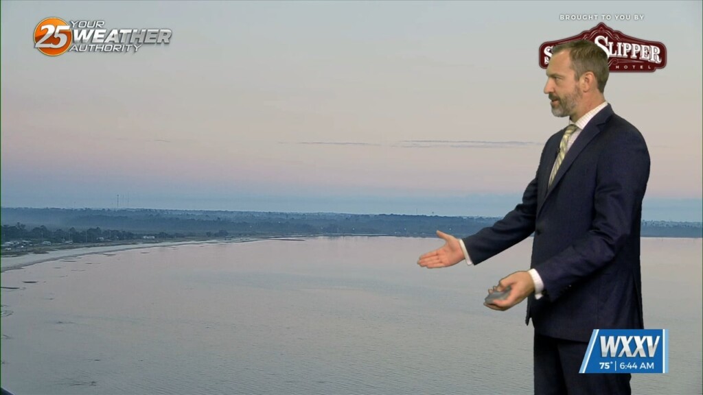
A sunny, hotter weekend lies begins today, but you'll also need the latest update on potential tropical developments. Lets get the good news out of the way…
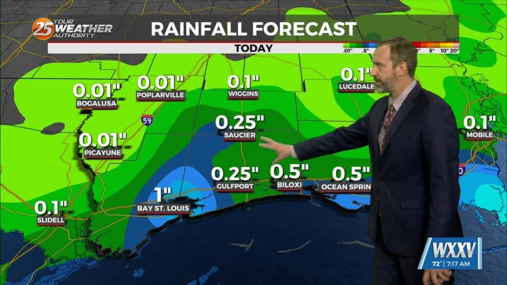
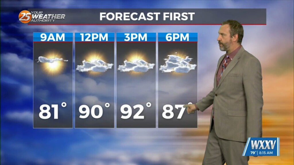
Yesterday didn't see much rain as we're starting to see noticeably drier conditions moving into the mid-and-upper-levels. That'll lead to fewer clouds, no showers, and lots more sun today…
It was slightly cooler this morning, and while the humidity did drop some it didn't drop enough to keep us from enjoying another misty morning across South MS. Like…
We've had some noticeable misty areas over the last few mornings, but today's are much more so and a little more widespread as well. There aren't any Dense…

Things get off to a cloudy start this week as the "ghost of Francine" returns from the north, bringing clouds and scattered showers later this afternoon. We'll likely see…
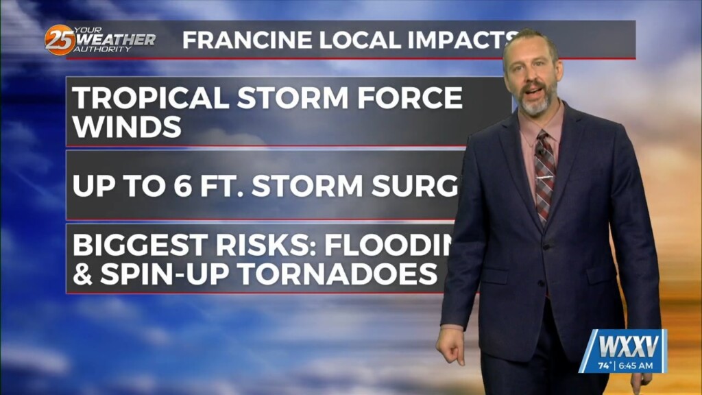
Francine became a hurricane last night after struggling with shear and dry air throughout yesterday afternoon, but organized a bit more overnight and will continue to strengthen for the…
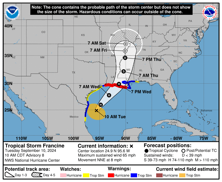
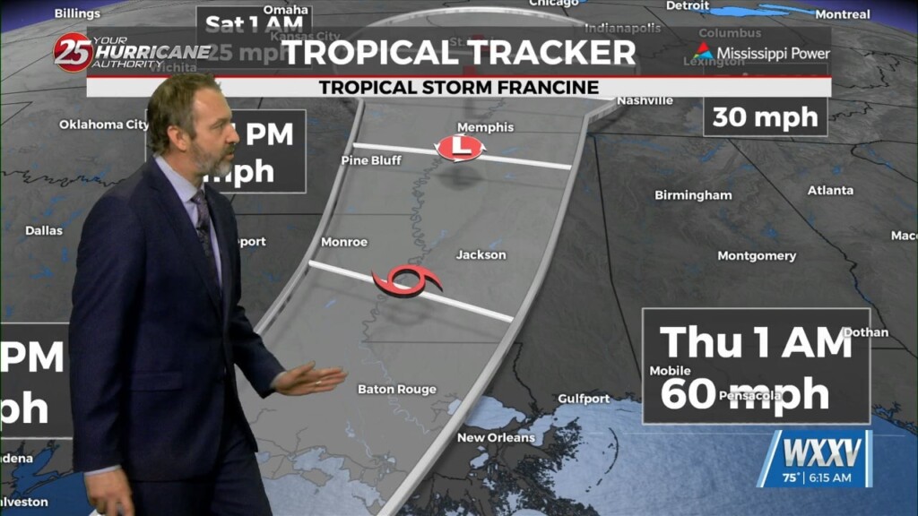
The latest from the National Hurricane center on Tropical Storm Francine has brought about some changes. The landfall time has sped up, now expected around 6 PM in Central Louisiana. That said, the center track did shift more noticeably eastward,…
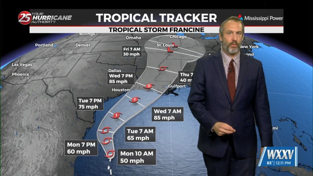
Tropical Storm Francine developed before noon yesterday, but didn't significantly organize overnight. Throughout yesterday though the forecast intensity of the storm did increase, with a 100 mph Category 2…
Here's the latest on Tropical Storm Francine, which formed late this morning out of Potential Tropical Cyclone Six: The last few updates have seen little change to the central track.…

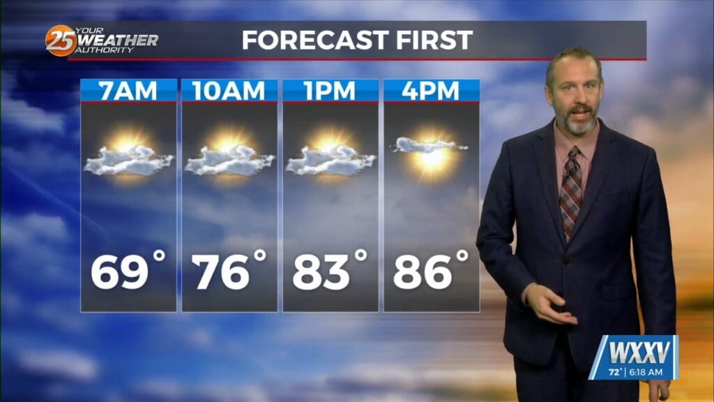
Sunday ended up as forecast with "fall-ish" drier air and cooler mornings moved in, and while we're starting the week off that way it won't stick around. We're already…
I've been trying to prepare you over the last couple of nicer days for the grey & rainy conditions beginning later today. In fact, the "grey" part of…
September is here, but it's still going to be summer for quite some time in South MS! Today is a good example of that as almost every aspect of…
Expect some nice weather for Labor Day today, with sunshine and dry weather expected to start off the week. That's exactly what we're seeing now, with nothing but clear,…
I've been talking about it all week, and it's finally here...the coolest day of the week! That's only because it'll also be the wettest day of the week…