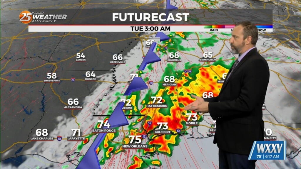
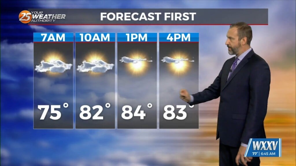
11/18 Ryan's "Cloudy Start, Stormy End" Monday Morning Forecast
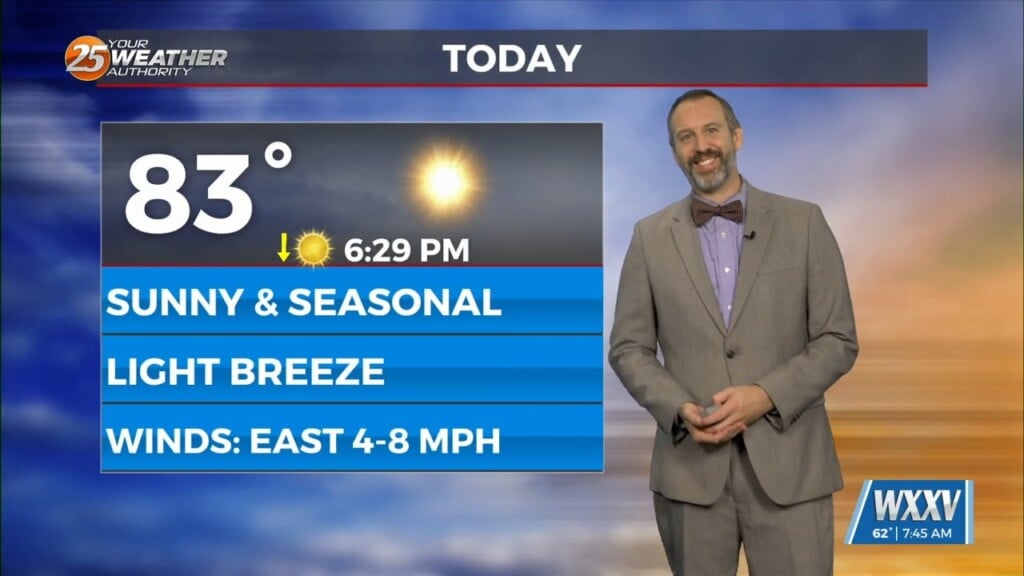
Your Monday will largely just be more cloudy and warmer than the last couple of days have been, but we're in for a stormy end that could…
Your Monday will largely just be more cloudy and warmer than the last couple of days have been, but we're in for a stormy end that could…

Things are finally going to feel like fall after a warm, dry October and a quite humid first couple of weeks of November! Yesterday's front has lows down into…
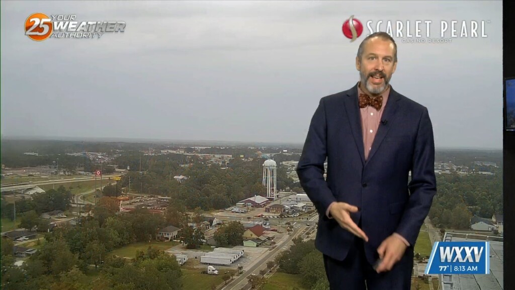
It was cloudy and a bit stormy yesterday as a front moved in, but today's post-front weather will be considerably nicer! By that I mean the cloudy skies and…
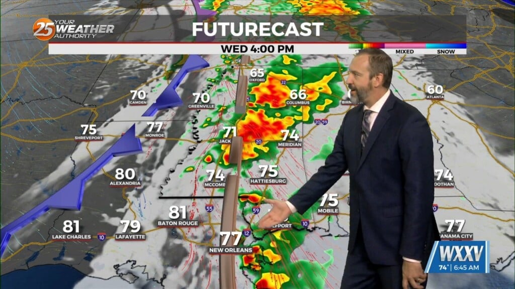
Tuesday was much cooler than it has been thanks to the consistent light rain that stuck with us for the front half of the day, but this…
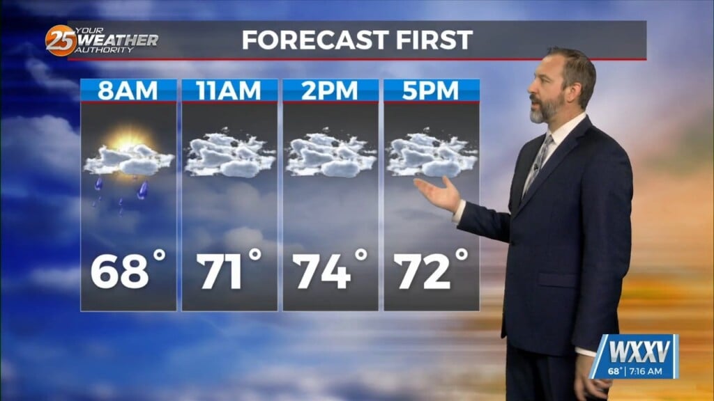
We're off to another damp start today, though unlike yesterday we won't see the sun peaking through this afternoon. I expected we'd see some clearing yesterday as we…

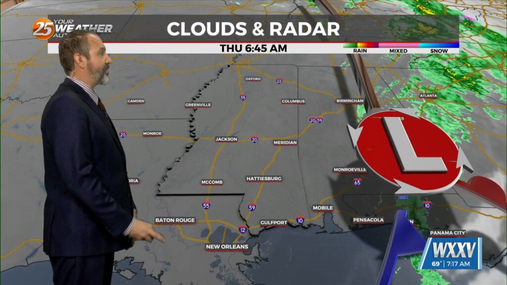
We're getting a dreary end to a fairly damp and grey week, though I expect today will end up one of the drier of the week ahead of our next…

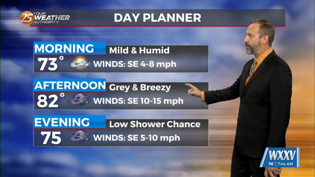
A lingering overnight shower led to damp roadways in Gulfport this morning, with another day of spotty showers and more consistent grey skies. This morning remained on the…
It's another warm one out there across South MS, and while it's slightly cooler than the start of the week was it's still 20° above normal. Our morning…

It's Election Day across the country today, and South Mississippi has more warm & humid weather on tap without any significant rain. Like yesterday, cloud cover will stream across…

It's still warmer than it should be out there after a barely noticeable break over the weekend, but not much is changing this week. In fact, our afternoon high…
Expect to head out for your morning commute with grey skies and misty, damp weather across South Mississippi. Yesterday did see a little rain in the area in…
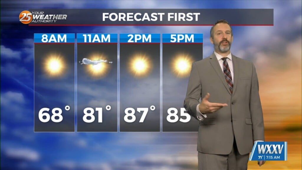
It's going to be quite a warm Halloween for everyone on the Mississippi Gulf Coast! Our morning was even more humid than it was at the start of the…

The fog takes a break this morning despite the lingering humidity, but today's winds are keeping it away and will cause clouds to move in through the day.…

The humidity continues to rise, leading to warmer mornings and more fog in the days ahead as a front moves in. Unfortunately this front won't pass through, so don't…
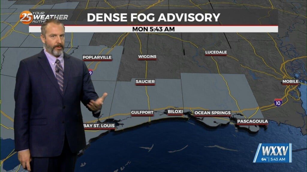
We were right on the edge of foggy morning weather by the end of last week, but we're starting this week off with it firmly in place. It has become…

Get ready for another nice day, South MS, but we may start seeing some fog development as the humidity continues to inch upwards. Couple this with more clear skies,…

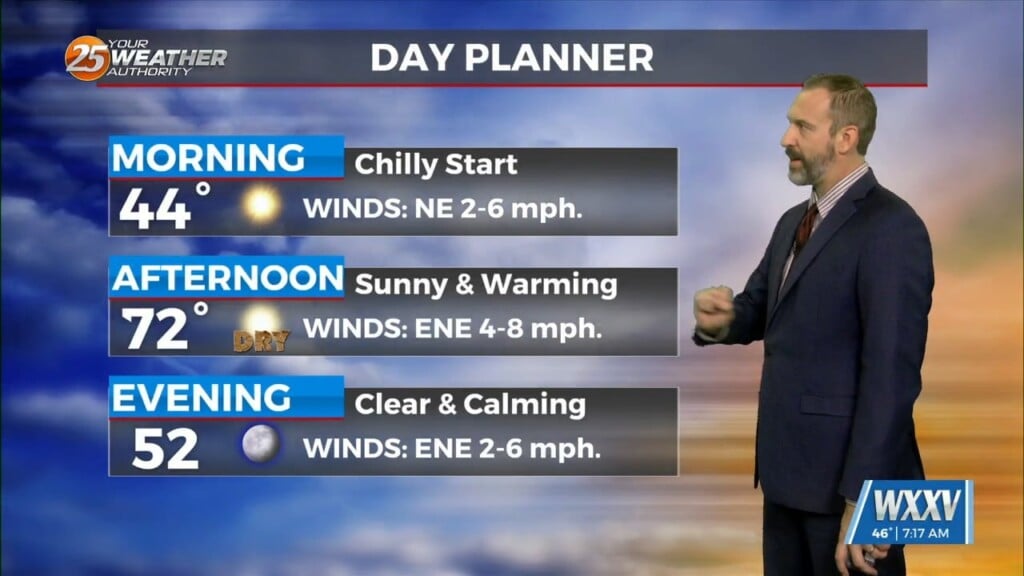
Recent mornings have been a bit too cool if you ask me, I'm notoriously not a fan of cold weather, but thanks to steady warming we're back to…
Our afternoons crept above normal a couple days ago, but our mornings have still been considerably cooler thanks to clear skies, low humidity, and light winds. We'll…

While not quite as chilly as the weekend, we're still seeing some nice cool mornings out there as we start off this week. This morning ended up several degrees below…
Expect a smoky start to the day in addition to it being one of the coolest mornings since early March for South Mississippi. While it wouldn't surprise me…
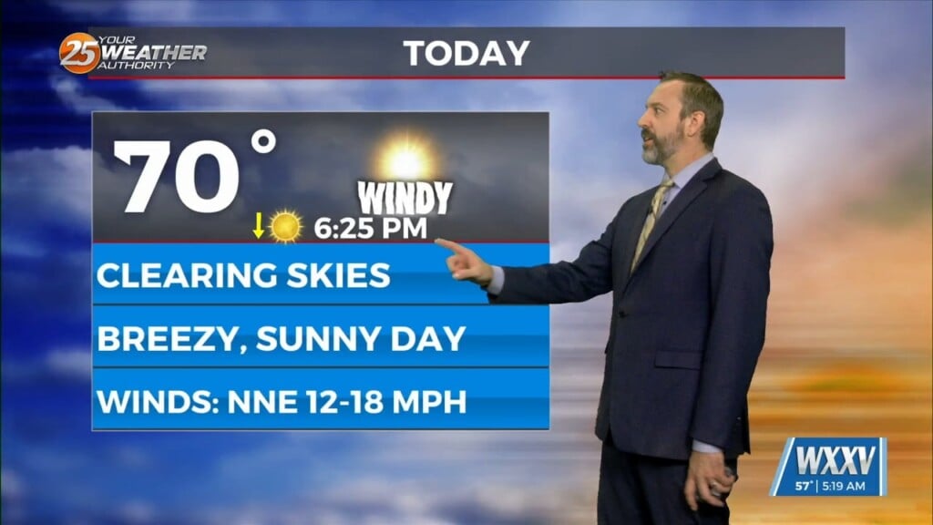
Things had already begun to cool off yesterday thanks to Monday evening's cold front, but stronger high pressure moving in overnight is responsible for today's windy weather. This…

Despite a similar temperature thanks to our cloudy morning skies, it'll feel noticeably better thanks to considerably drier air. That means for the second day in a row, lows…
Just like last week we're starting things off with a warm-up across South Mississippi, but another cool-down is coming, bringing the coolest weather we've seen since the start of the…
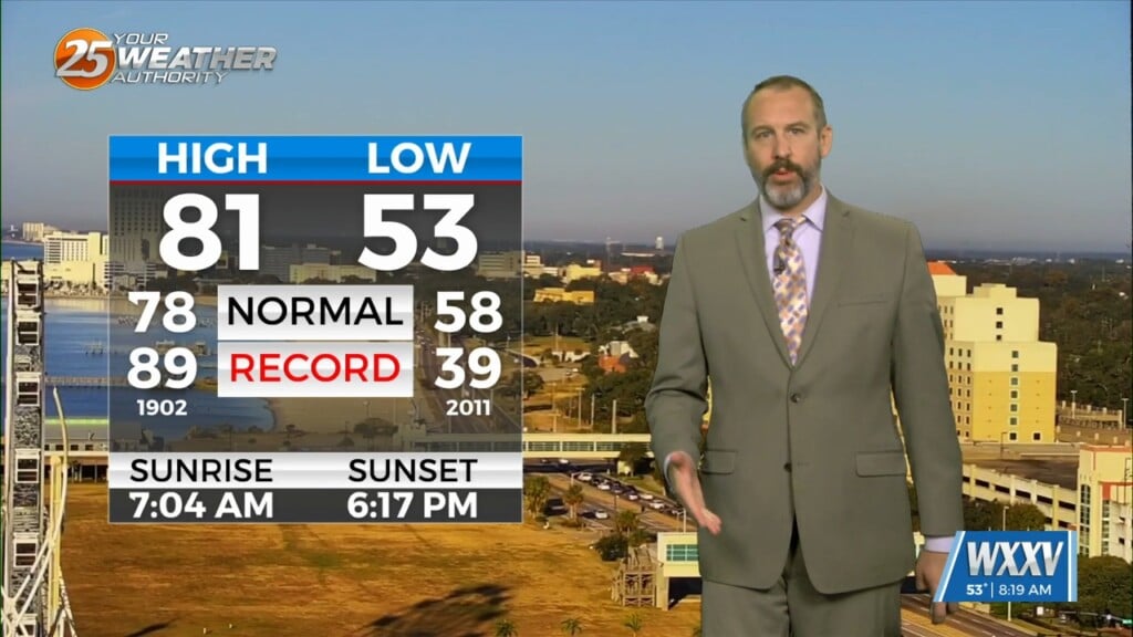
I hope you enjoyed the coolest morning of the week so far, with a few coastal lows falling into the mid 50s! Gulfport and Biloxi stayed on the warmer side…