12/23 Ryan's "Seasonally Cold" Monday Morning Forecast
This is going to be a weird week for Christmas thanks to some seasonally cold weather this morning and later today, but much warmer weather slowly moves in. Not…
This is going to be a weird week for Christmas thanks to some seasonally cold weather this morning and later today, but much warmer weather slowly moves in. Not…
Chilly few days ahead then warm and mild temperatures as we get closer to Christmas. We saw plenty of sun shine and pleasant afternoon steps in…
Chilly weather today as cloud cover hung around most of the day and didn't leave until the sun went down. The sun will return…
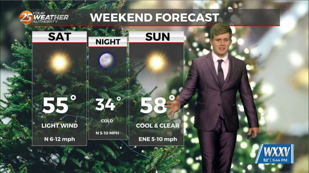
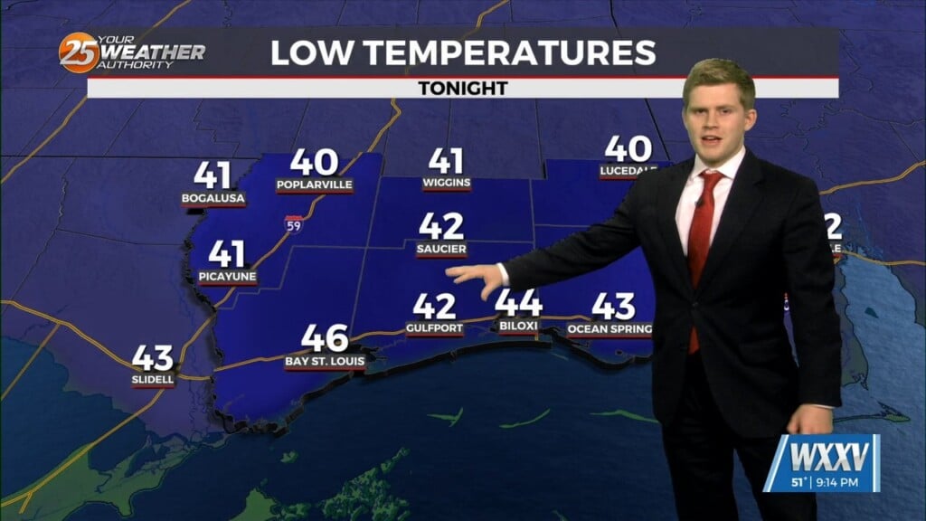
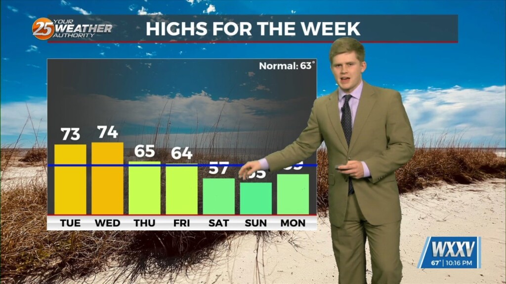
Cool temperatures to end the week and a cold weekend ahead. A cold front passing through tonight which we will have Thursday morning temperatures down in…

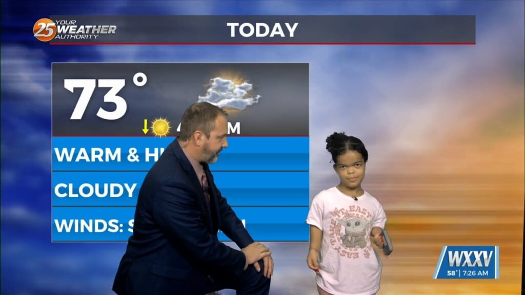
Today's WXXV Weather Kid was Kate, a 10 year-old who loves crafts, games, and playing outside. She's not fan of cold weather, so she wasn't all that bummed this…
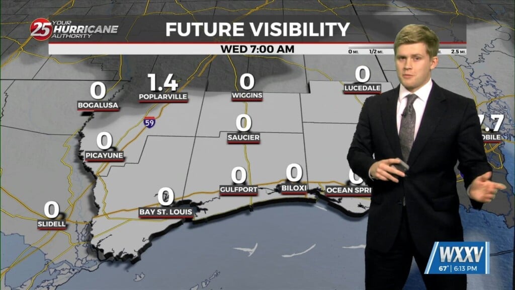
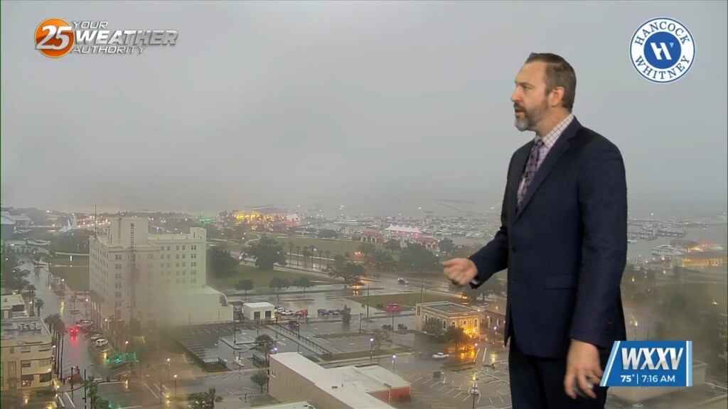
As the forecast isn't hard to see tomorrow morning will be as another morning of fog to roll in. NWS has issued a dense fog…
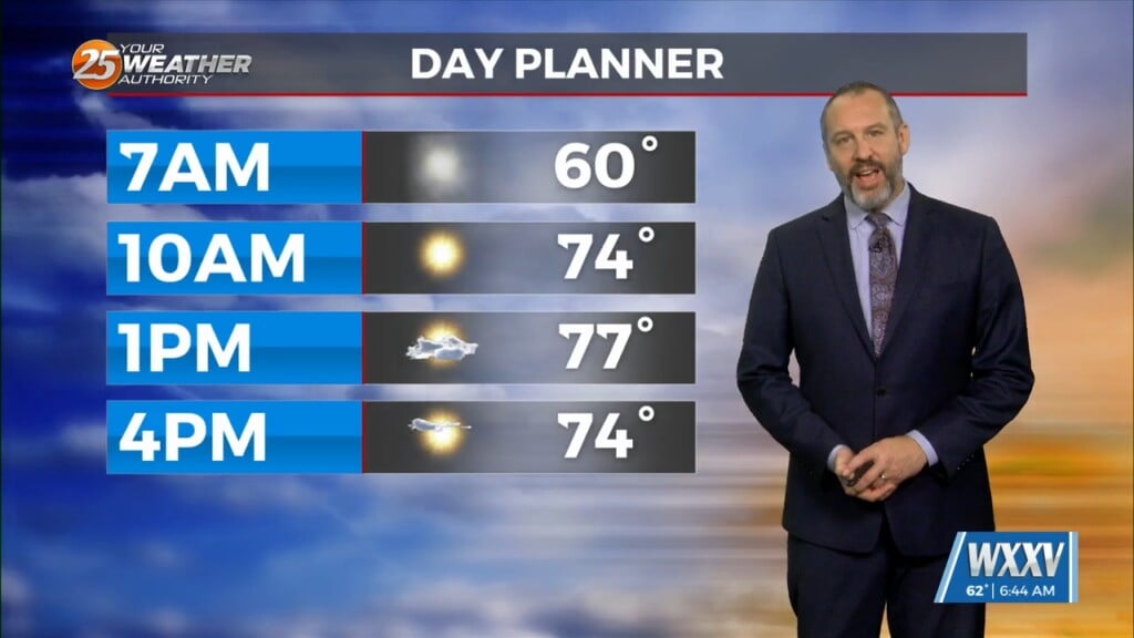
Mondays high temperature was 76 degrees and its mid December that's weirdly warm this time of year. Our normal average high is 64 for today.…
It's not going to feel much like "December" this week, thanks to a pattern leading to warmer, more humid weather for most of the week. That lead to a…
Had a warmer morning than yesterday mainly stay in the 40s but a north easterly breeze made the wind chill down in the 30s. We will…
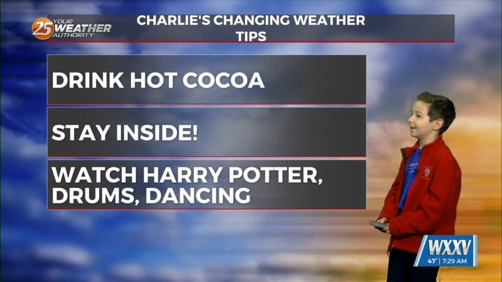
It's Wednesday once again, and that means it's time to meet today's Weather Kid! This week we met Charlie, a 10 year old from Pass Christian who goes to…
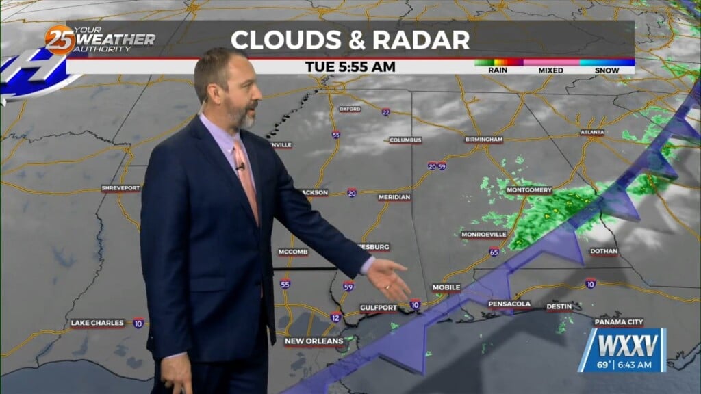
Yesterday saw some local areas end up with a few inches, but we're in for even more rain later today. That's due to a very slow moving front, which…
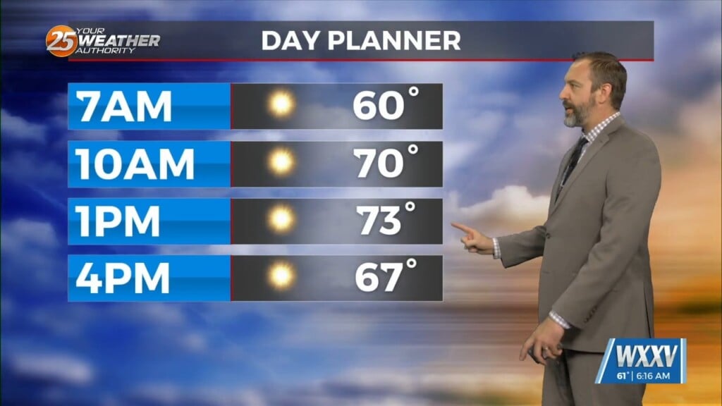
We've had some appropriately cold morning weather recently, but today is more of the warm & cloudy variety with lows only falling into the low 60s earlier today.…
We enjoyed another frosty start to the day this morning, and have at least one more left before we'll leave the wintery weather behind for a few days. Today's…

It was clear and frosty across South MS once again, a continuation of the dry weather we saw move in after last week's front. Our afternoon highs will…
Yesterday's front didn't bring much rain, but things are cooling quickly as we finish off the week and head into the weekend. In fact, we have I believe our…
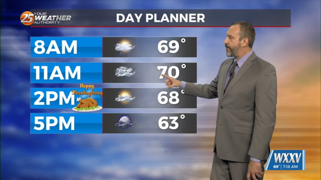
It may be Thanksgiving, but we're once again seeing temperatures over 20 degrees above normal for late November. That's due to our next cold front, which is actually passing…
Today's WXXV Weather Kid helping me with Wednesday's forecast is Angela! Angela is a 5th grader from Biloxi Upper Elementary, and she loves hanging out. She advises "chilling" inside on…
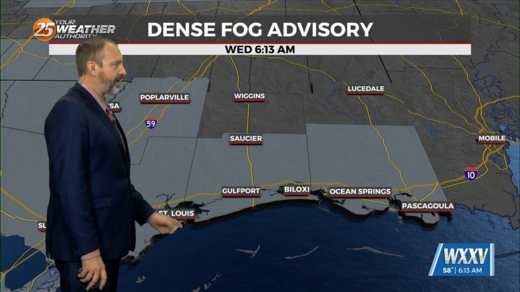
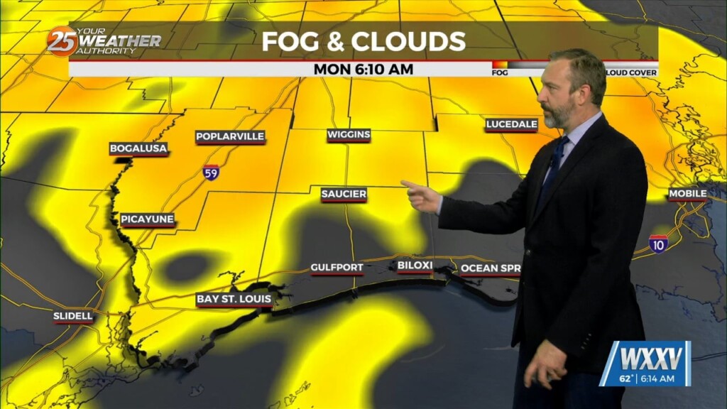
Yesterday's cold front brought some slightly cooler weather, but it wasn't much drier, leading to a foggy start to your Wednesday. We even had some Dense Fog Advisories early on,…
The first front out of the two we'll see this week is through South Mississippi, with only a couple showers and a cloudy day ahead to show for it.…
The end of last week brought a cold front and some seasonal weather, but we're off to a much warmer start this week as another front approaches. That's due…
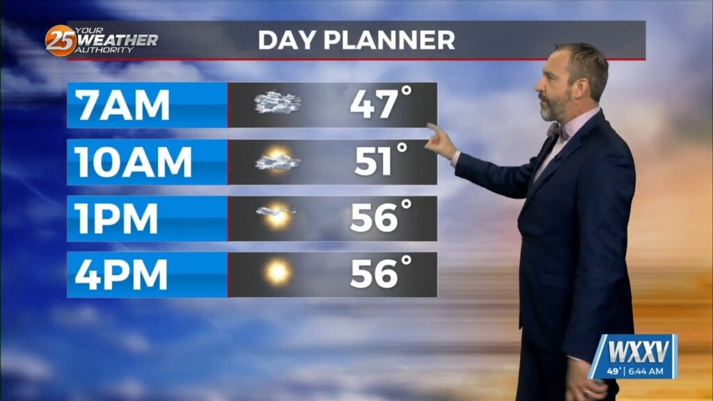
It was another chilly, but not quite frosty morning across South Mississippi today, even though it did warm up a degree or so. We haven't seen many consistently…
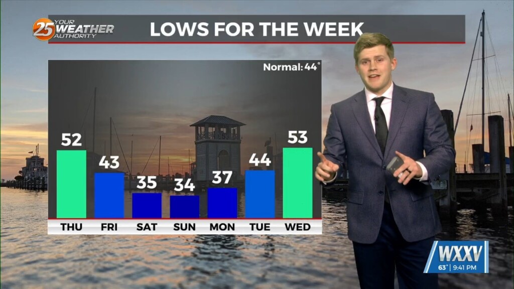
It's taken a while, but we're finally getting some more consistent chilly weather in South Mississippi. In fact, it'll be below "normal" for both our highs and lows…
Yesterday's front brought some heavy rainfall and a few rumbles of thunder, but now things are clearing out and cooling down nicely! It won't be all that noticeable right…
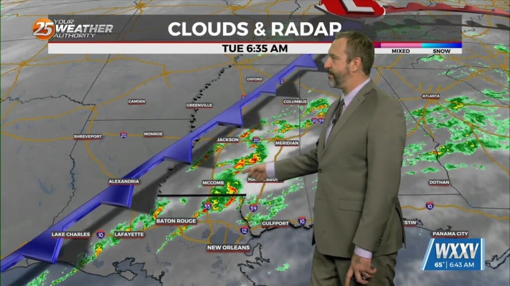
The rain started last night, but we're just now getting our heavy rain as showers and thunderstorms pop up along this morning's cold front. We're still under a level…