01/13 Ryan's "Chilly & Damp" Monday Morning Forecast
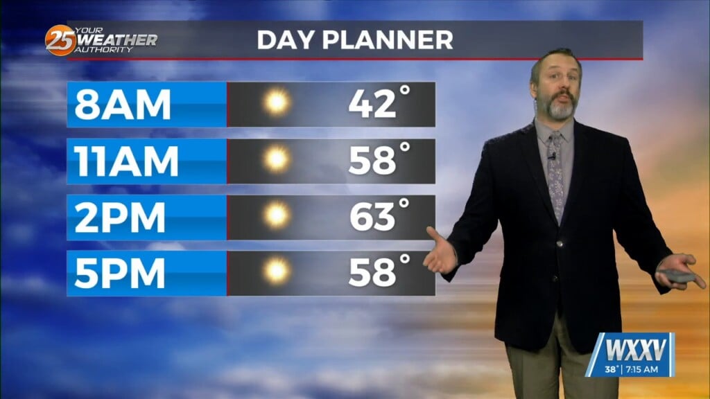
Things cleared out for the start of the weekend, but saw rain return quickly on Sunday setting us up for a chilly & damp start to the week.…
Things cleared out for the start of the weekend, but saw rain return quickly on Sunday setting us up for a chilly & damp start to the week.…
Rain all day and a cold night ahead with more rain chances Sunday. saw around 1.25" of rain recorded at GPT airport and most of…
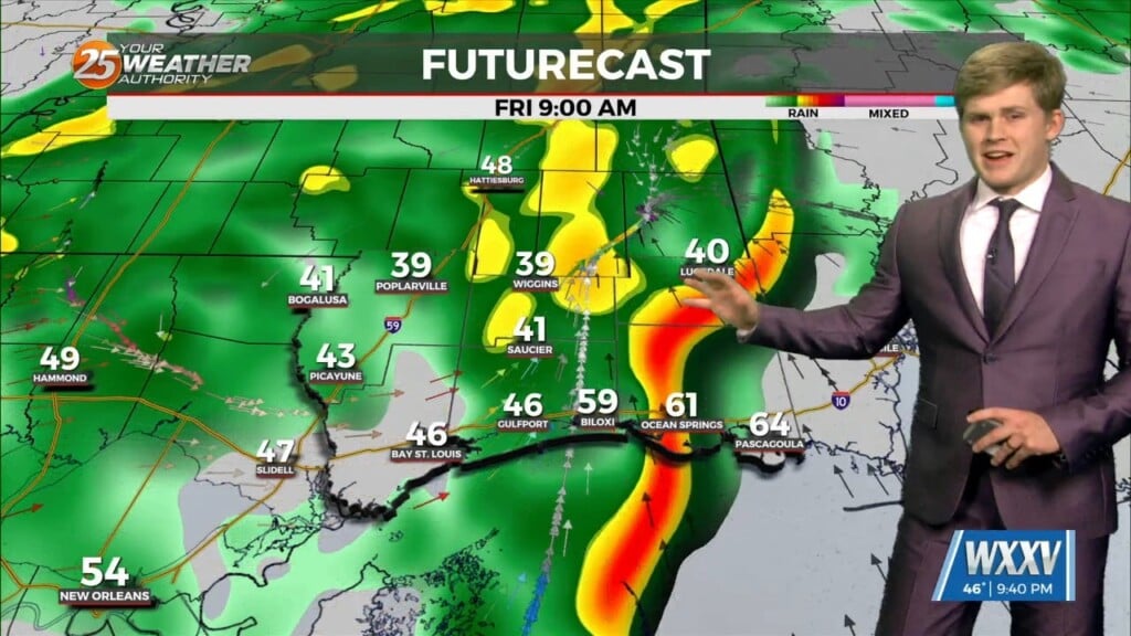
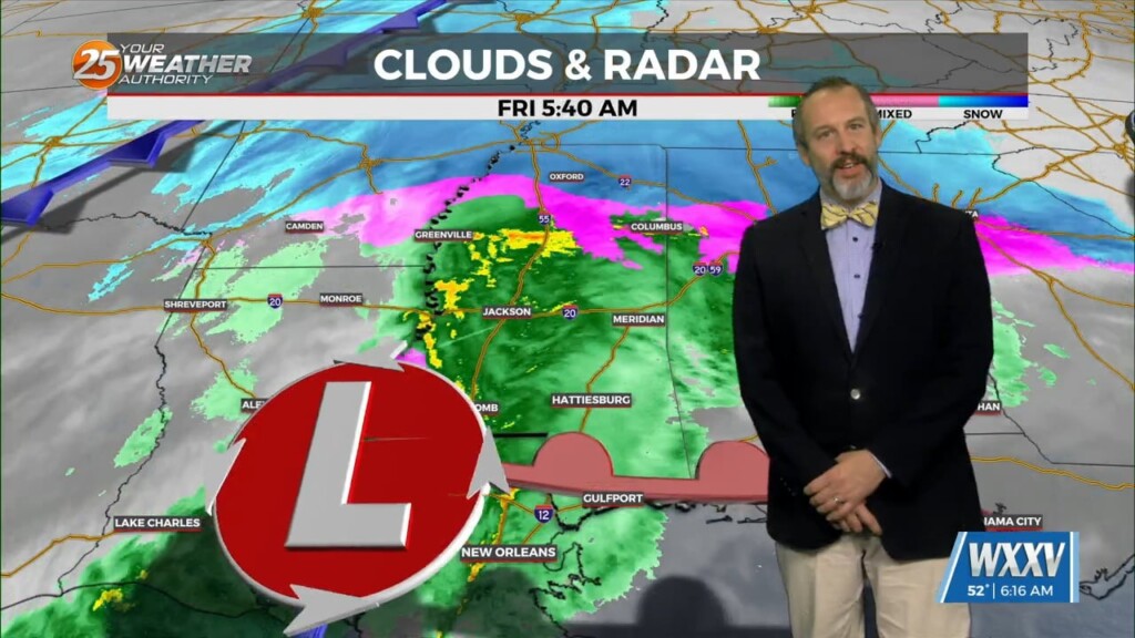
Heavier rain to come Friday morning bringing gust winds. Our storm system morning through tonight into Friday with cold rain. Temperatures will be around the…
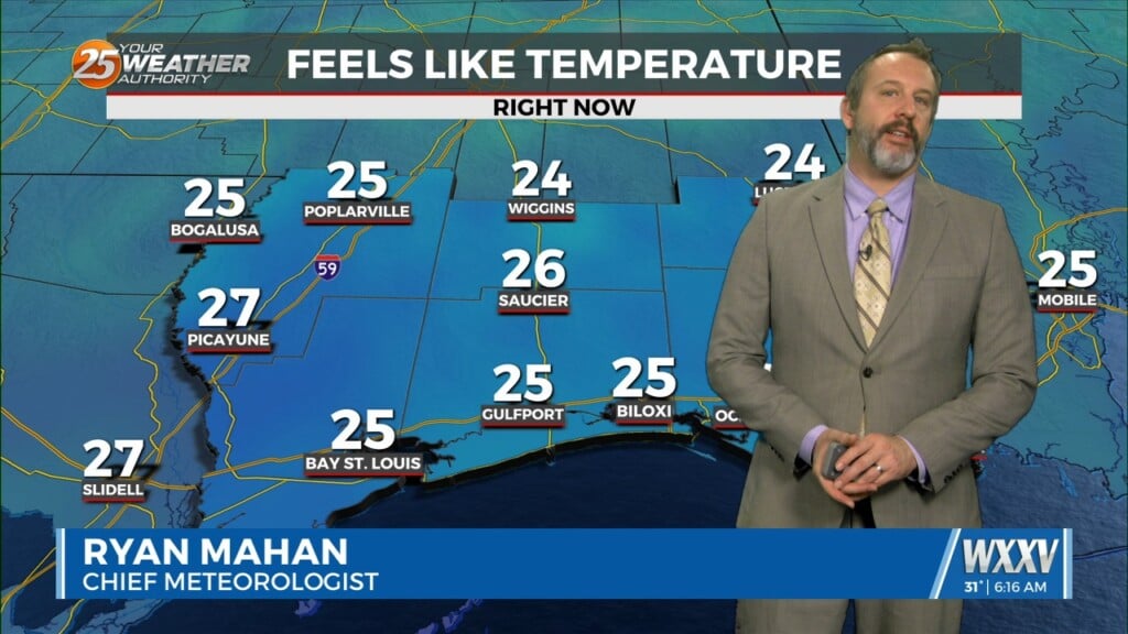
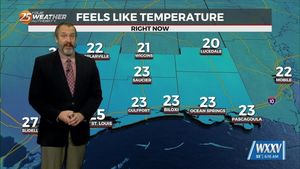
This morning will be the coldest we've seen so far this year/season, bringing a freeze warning to the coastal counties, but honestly it's just a degree or so cooler than…
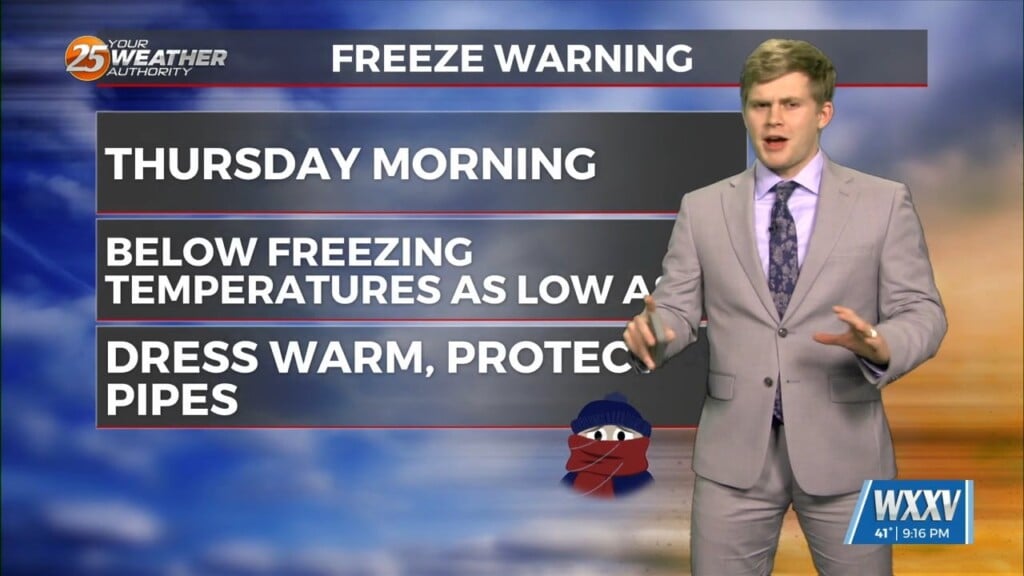
Freeze warnings Thursday morning then to rain showers Thursday into Friday. Thursday morning lows will be the coldest morning of the cold arctic…
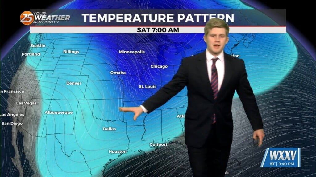
We saw a front pass through to start off the week, and we just keep getting even colder as the week goes on. Thankfully we only have one more…
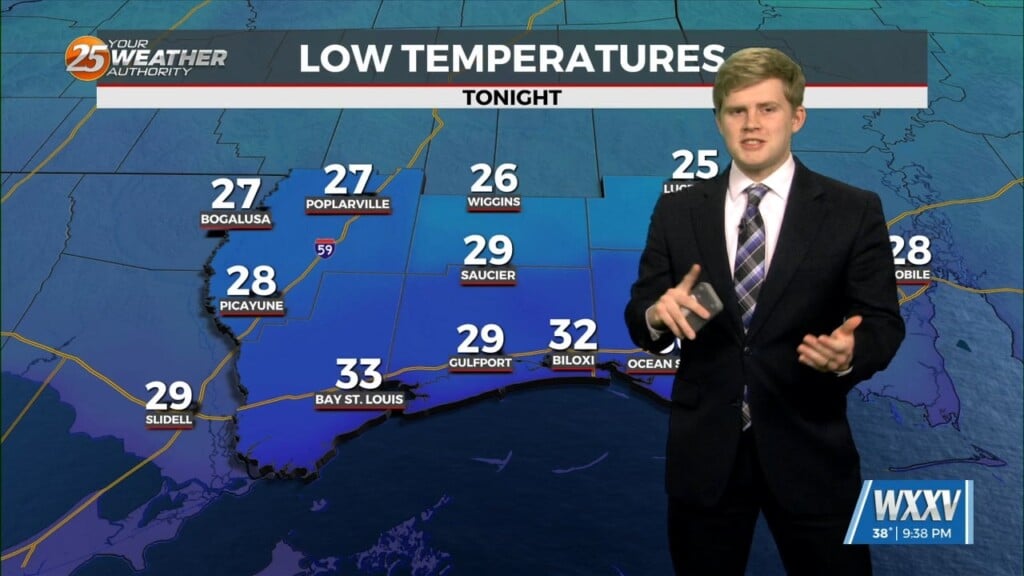
Arctic air settled in for the entirety of today and a few more days until a full day of rainfall. Our hard freeze conditions continue…
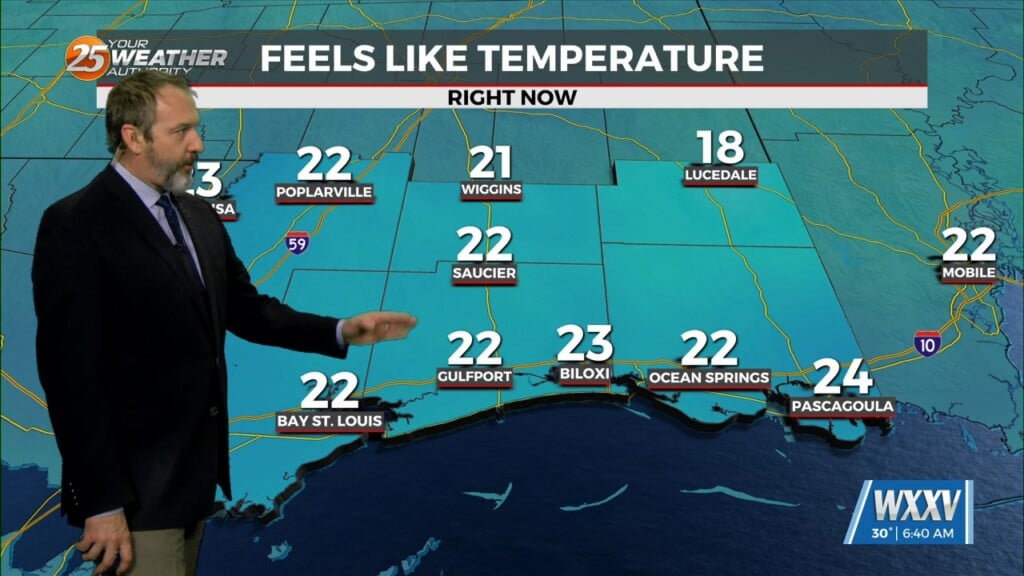
Arctic air is in place and temperatures are below freezing this morning in South Mississippi. In fact, morning lows will remain upwards of several degrees below freezing for most of…
A cold week ahead with increasing rain chances and heavy rain on Friday. Strong artic air will be settling into the local area late tonight…
Drastic changes to the weather pattern we enjoyed over the weekend are moving in on the backside of the coldest front of the season so far. The front didn't…
Severe weather threat increases in the south before the arctic blast. A weaker cold front passed through earlier this afternoon changing wind directions and…
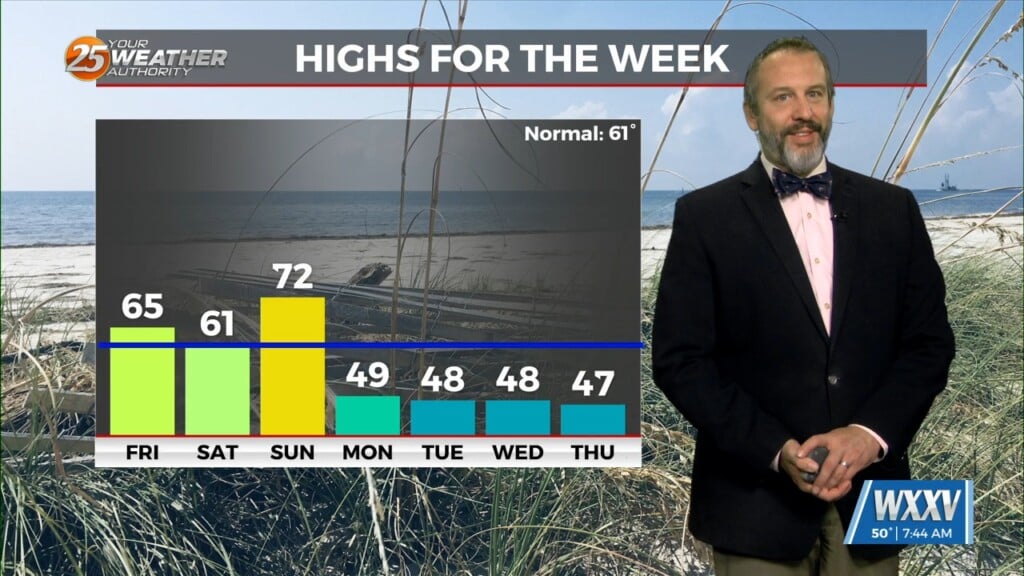
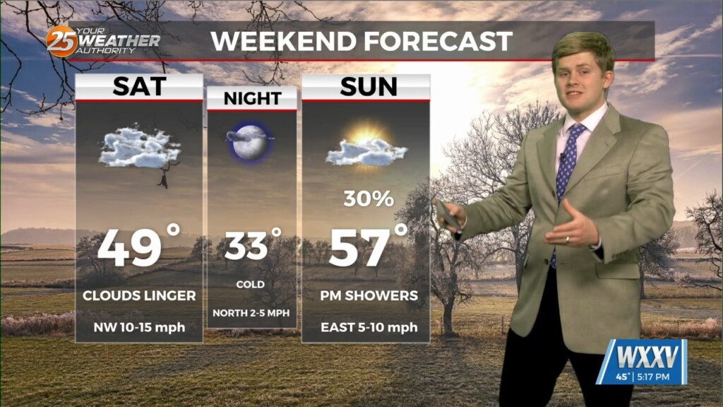
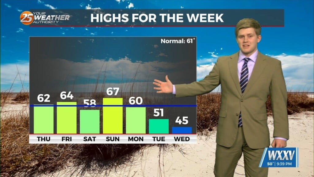
The South Mississippi temperature rollercoaster has been on full display over the last few days, and it'll continue through the weekend as well! This afternoon will be the warmest since…
Near average temperatures until Saturday then comes the arctic blast. We are 2 for 2 on good weather here in south Mississippi for 2025.…
Cooler weather as we begin the new year temperatures finally going back to around our averages. Thursday will have a cooler morning but then…
We're off to a nice start to 2025 with beautiful, seasonal weather in South MS for New Year's Day. This morning's low was right around where it should be…
Fog liners again this morning but cooler weather later this week and cold weather next week. patchy fog for areas this morning…

Foggy start and a few days a warmer weather before our cold front arrives. Monday we have a Dense Fog advisory for all of our…
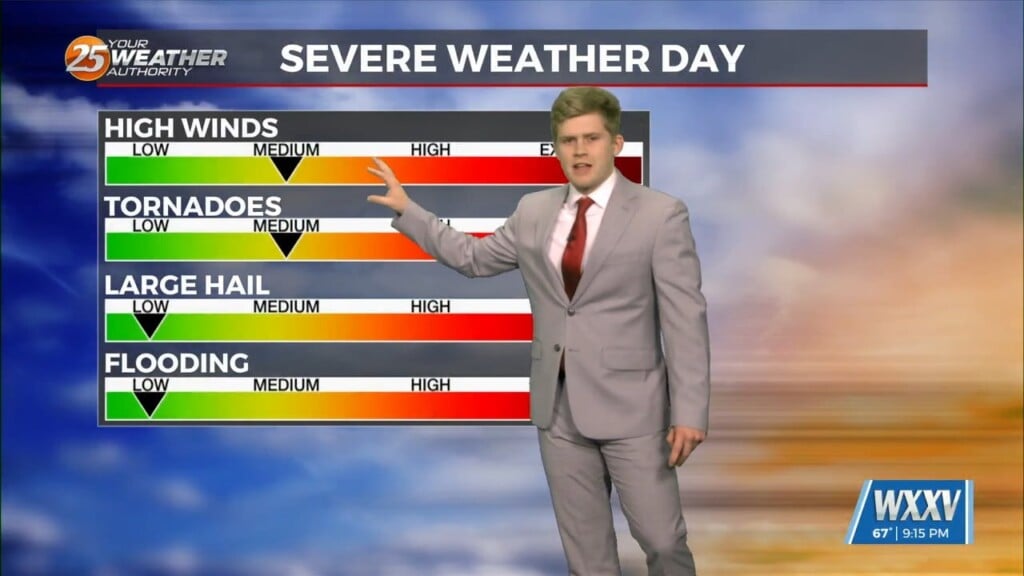
Foggy tonight Gearing up for the Chance of damaging winds, hail, and tornadoes tomorrow. 3 different tornado warnings across south MS earlier today. A dense…
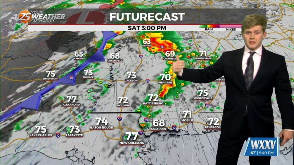
Severe risk of weather Friday and through the weekend. We had a mild Thursday staying in the mid 60s with cloudy weather. Stronger easterly…
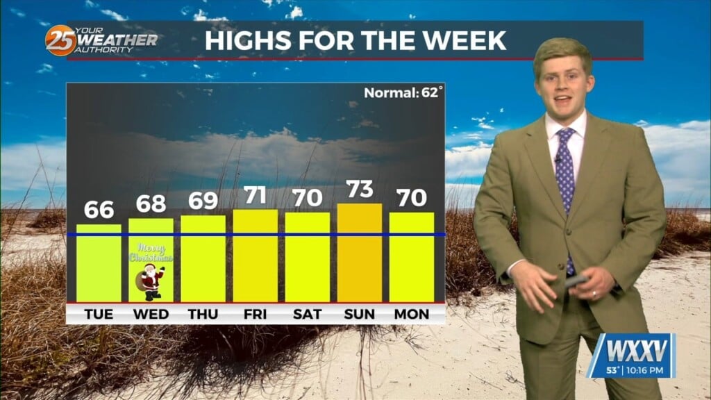
Rain chances of this week with the highest chance on Saturday. A warm Christmas Eve today will give way to an a warm Christmas…
It may have still been cold yesterday, but a warm Christmas Eve today will give way to an a warm Christmas tomorrow thanks to an approaching front. It doesn't…
A week of warm weather with the Chance of showers on Christmas day. Monday had mostly clear skies and temperatures in the 60s on Christmas Eve Eve.…
This is going to be a weird week for Christmas thanks to some seasonally cold weather this morning and later today, but much warmer weather slowly moves in. Not…