2/3 - Sam Parker's "How Warm Is It?" Monday Night Forecast
Spring like afternoons and hard to see mornings most of this week. Dense Fog Advisory for South Mississippi from midnight to 9 AM Tuesday. Dense…
Spring like afternoons and hard to see mornings most of this week. Dense Fog Advisory for South Mississippi from midnight to 9 AM Tuesday. Dense…
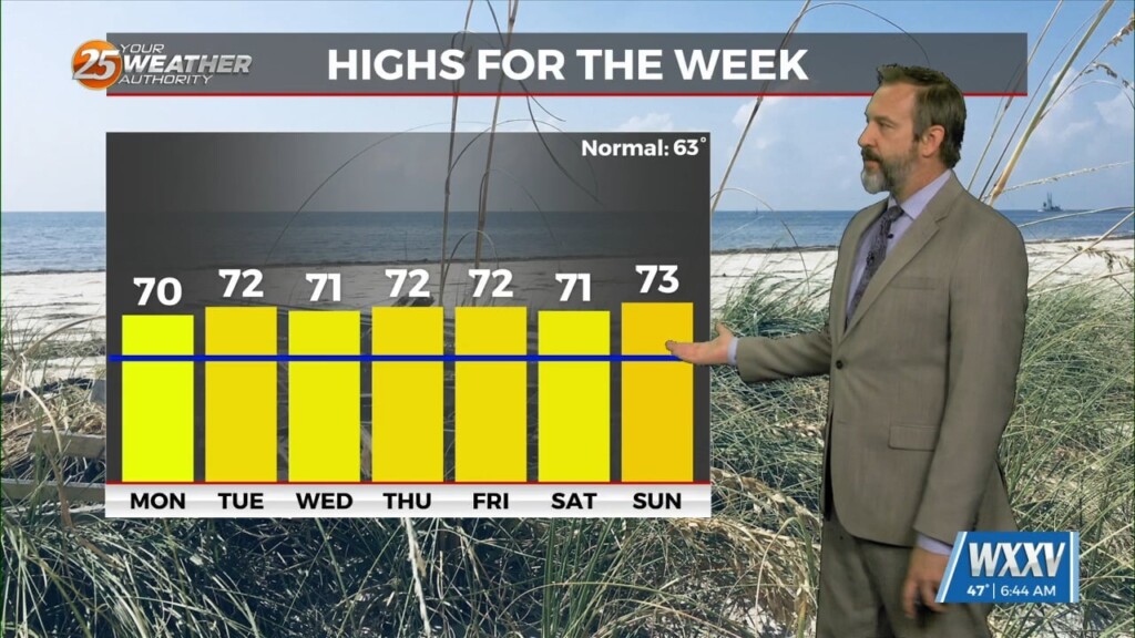
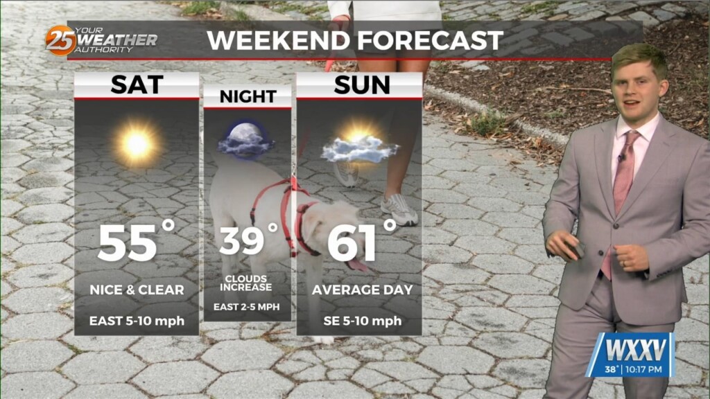
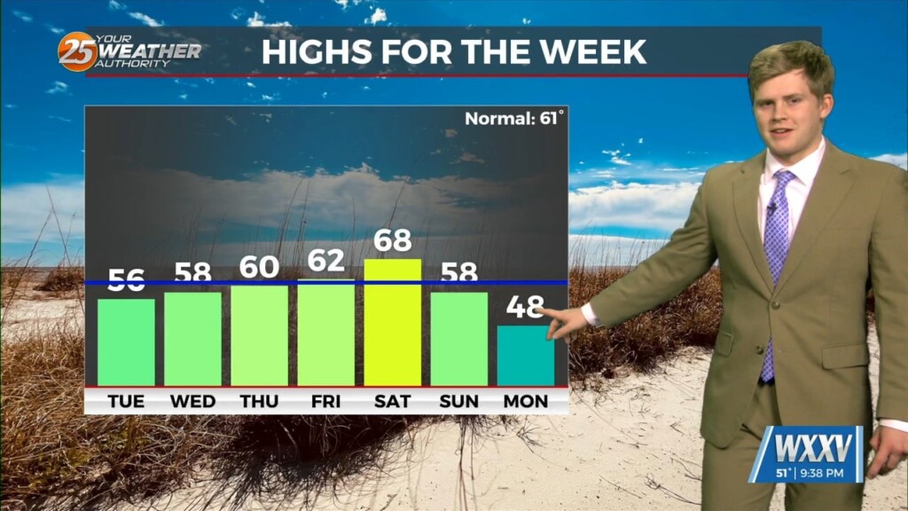
Ol' Punxsutawney Phil saw his shadow yesterday, ushering in "six more weeks of winter," but this week at least will be far more spring-like. It's still on the chilly-to-cool side…
Even though Punxsutawney Phil the Groundhog calls for 6 more weeks of Winter, It looks like Spring in South Mississippi. After a warm mild weekend we go…
Cold front passes giving chilly lows although mildly warm highs this weekend with warmer weather next week. This weekend will be rather quiet with no rain…
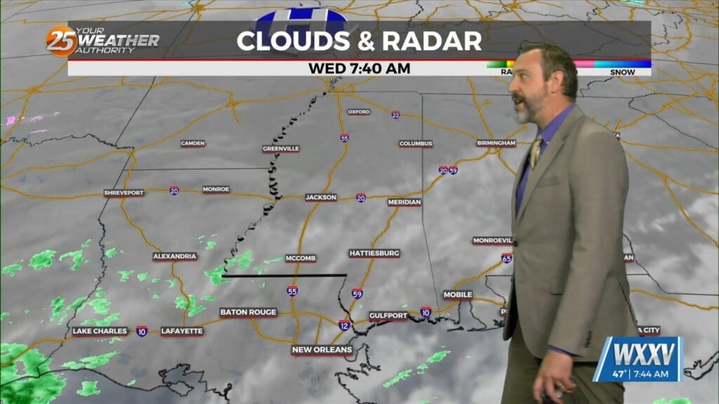
Rain and dense fog on the coast just in one night. Today has been very humid across the area as we continue to see southerly air…
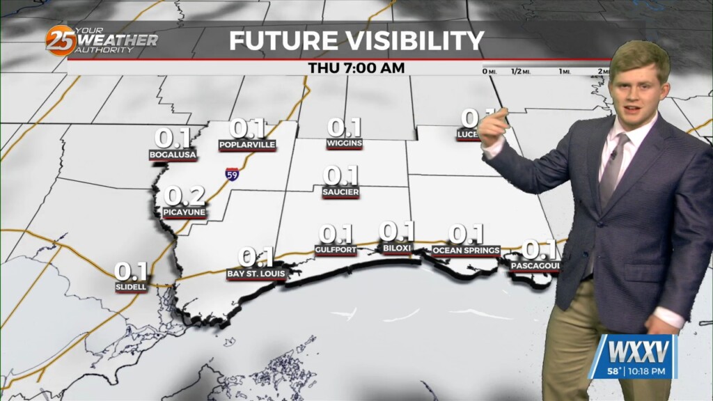
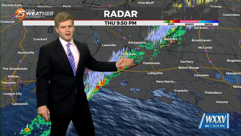
Dense fog for Thursday Morning then watching for rain Friday morning. Warm weather continues across the area and now a Dense Fog Advisory has been…
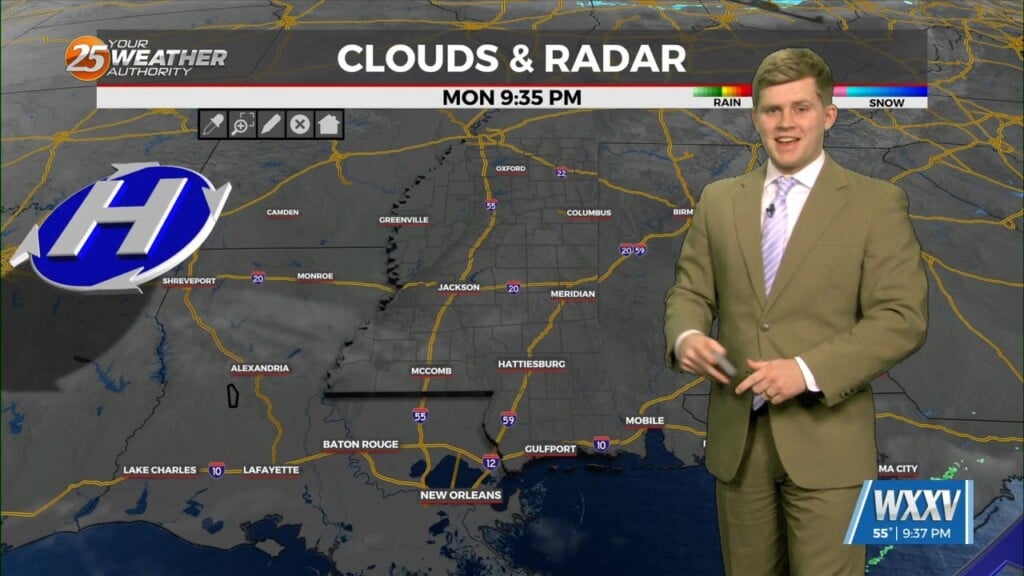
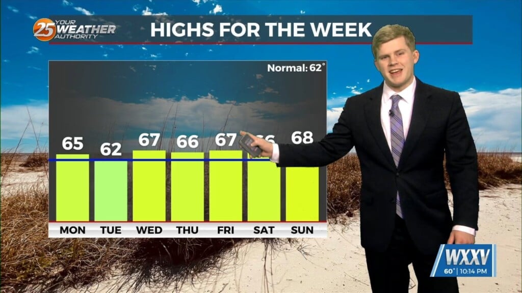
A weak cold front on Monday brought some slightly cooler weather for yesterday and this morning, but we're kicking off a quick warming trend later today! That'll get highs…

Warm next few days before seeing rain on early Friday morning. Tonight has is setting up for a few areas to have patchy fog…
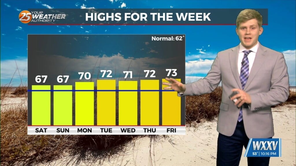
Warm 60s this week with our next chance of rain on Friday. Patchy morning fog each morning Tuesday through Thursday careful on your morning commutes. Mild…
Rain Monday morning then temperatures to be above average most of the week. Rain chances increase overnight and especially early Monday morning. after the moisture…
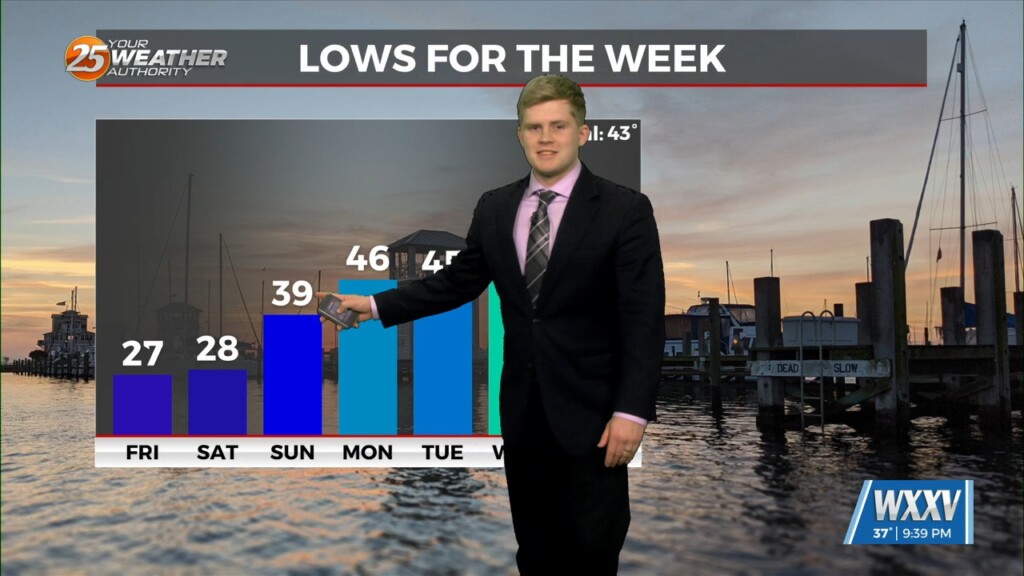
One more evening of freezing mornings then temperatures rise through the weekend and next week. Overnight temperatures will fall below 32 then sunny skies and…
Frigid mornings but snow melting afternoons to continue for the next few days. A warmer day getting into the 50s but overnight dropping back down into…
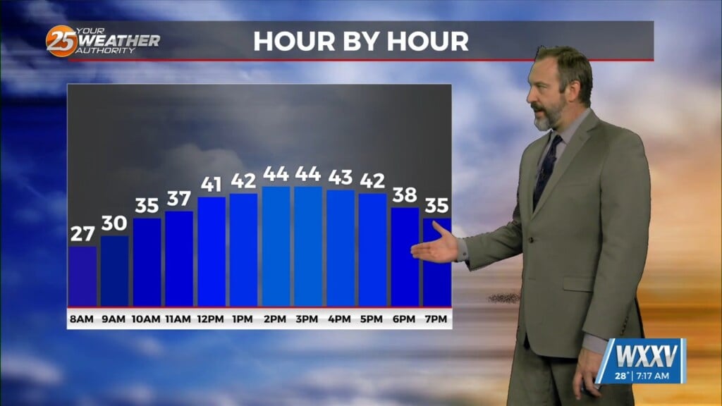
Thanks to ample sun and a few hours above freezing yesterday, things started melting across the area, but at least a few snowy areas remain. We'll see much more melting…
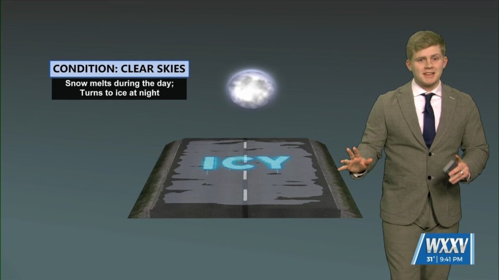
South Mississippi to see pipe freezing temperatures and melted snow likely to refreeze. continuing to see cold starts to the area with a Wednesday morning low…

Major snowfall across South Mississippi today really exceeding everyone's expectations. overnight temperatures will be dropping down into the teens tonight so take into account of the…
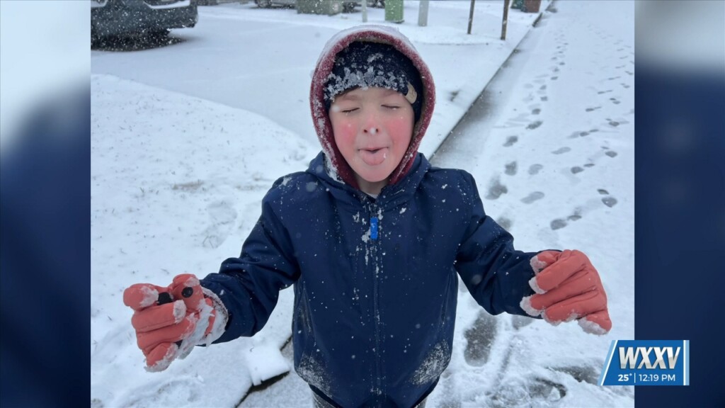
It began snowing at about 5:30 AM, ushering in a rare snow day in South MS, and it continues heavily as I'm writing this. Upwards of 4.5" inches has…
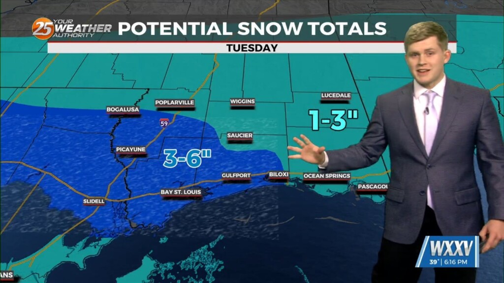
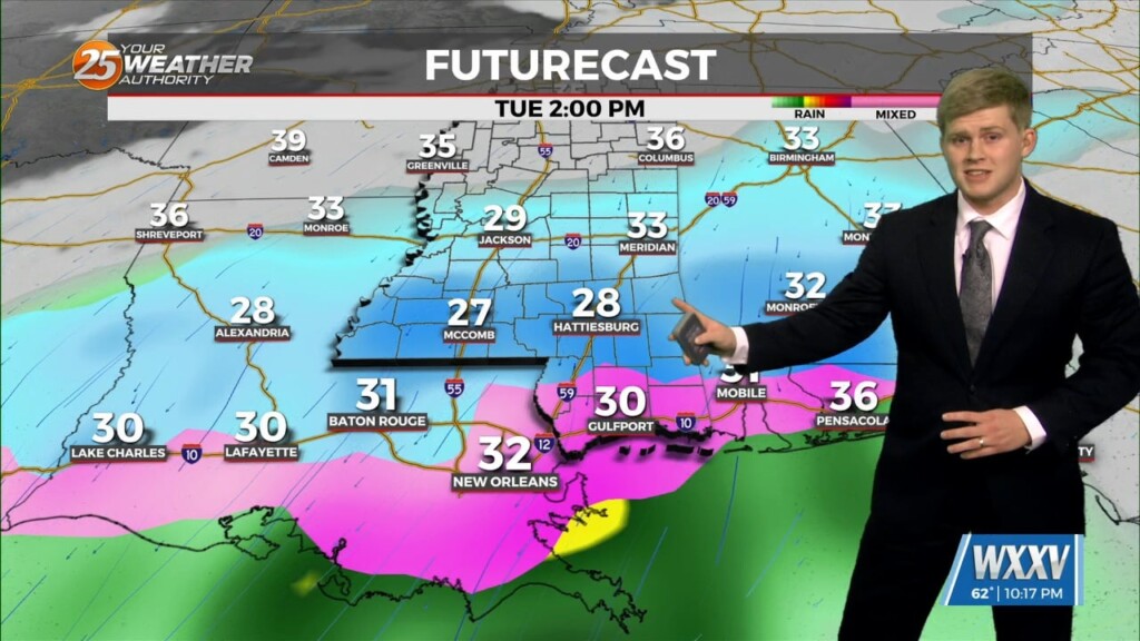
Winter Storm warnings across the Gulf Coast with the good Chance of Snow here in South Mississippi tomorrow. This evening is another hard freeze for the…
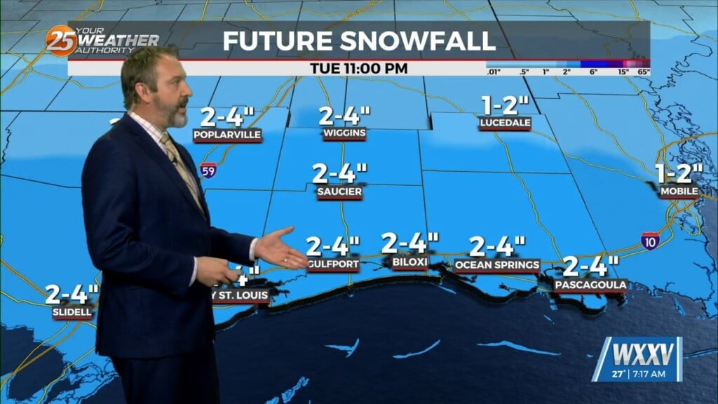
Get ready for one of the most "wintry" weeks we've had in several years as cold weather will linger all week long, and some rare winter weather is moving…
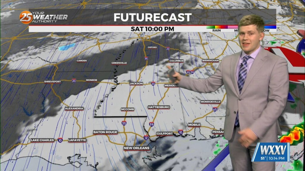
Bitter cold winter weather move in the weekend with a potential winter storm Tuesday. Watching light scattered showers into Saturday morning…
A beautiful Thursday now come the the rain and cold next week. Chilly overnight lows in the low 40s and mostly clear skies. Warmer with…
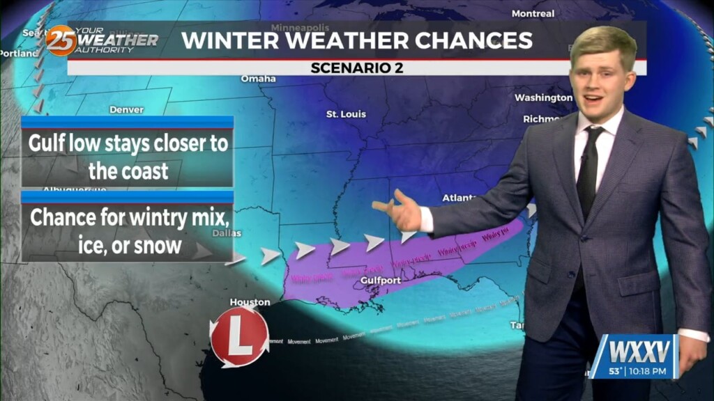
Rain this Saturday and then the big cold front that has the possibility for winter weather next week. Tonight watching lighter rain showers to wet things…
It may be warming up as we hit the mid-month mark for January 2025 today, but don't fret fans of cold (possibly even winter) weather, the coldest air so far…
The next few days will continue to warm up until rainfall this weekend and the big cold front. Chilly overnight lows with cloudy…
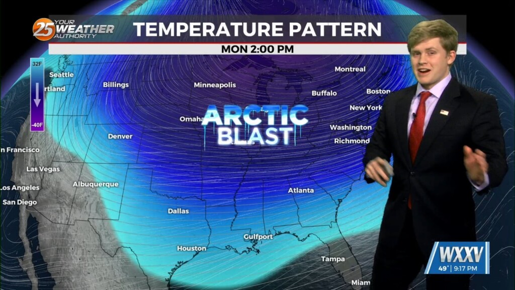
Warming up gradually for the week until showers come at the end and another Arctic blast in 2025. A really beautiful day to start the week…