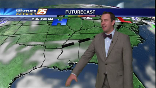
Ryan's "Almost Rainy" Friday Forecast
It's been just a degree or two hotter so far this Friday in South MS, and we've already seen a few showers popping up in the Northern areas. I expect we'll see a more showers as we head into the…

It's been just a degree or two hotter so far this Friday in South MS, and we've already seen a few showers popping up in the Northern areas. I expect we'll see a more showers as we head into the…
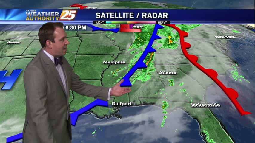
Very light rain has moved into the area, moving onshore and north...
Mark down another humid Wednesday night in the books for South Mississippi, but keep in mind that changes are on the horizon. Tomorrow (Thursday) will be very similar to today, with moderate cloud cover, hot and humid conditions, and a…
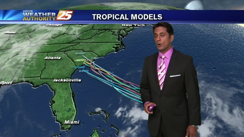
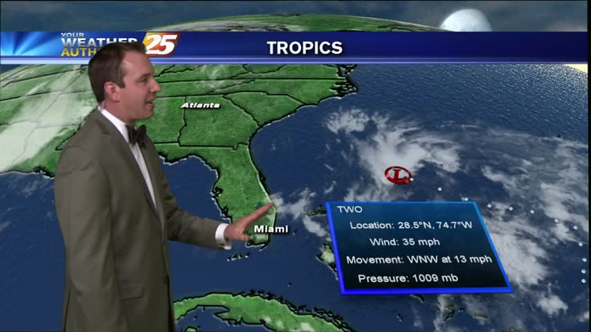
Today is the official start of Hurricane season and it looks like a new area of potential development is forming in the Gulf. Right now there is only a 20% chance of this system becoming tropical within the next 6…

Hot & Humid on this very 1st day of Tropical Storm season...
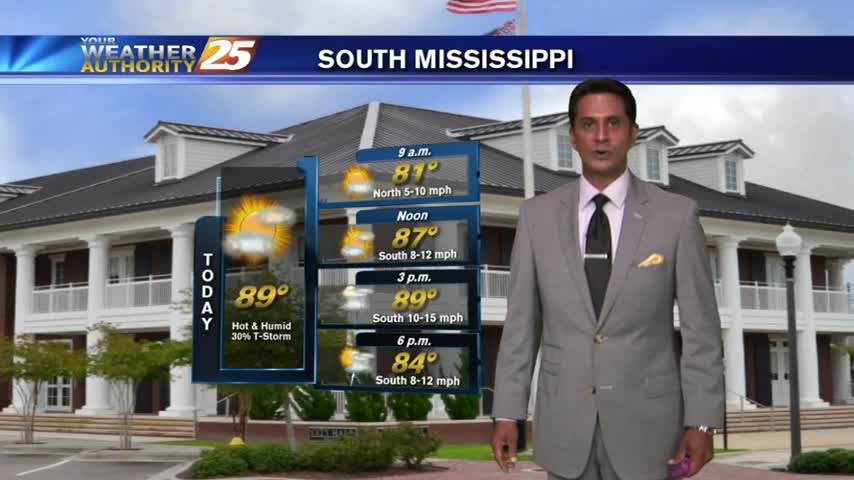
As the mercury climbs into the upper 80s, low-level clouds will provide for isolated t-storms...
A warm & HUMID morning as upper-level clouds move across the area...

Monday afternoon was one of the hottest we have had all year, if not the hottest, but we will slowly cool down through the rest of the week. Today we saw temps reach 90, and although we'll cool down into…
Monday Night's forecast isn't much different from the earlier forecast, but some changes to our weather are on the way. We'll see increasing cloud cover overnight, keeping things a bit warmer tonight, and humidity levels will slowly increase over the…
Last week's forecast has been on point so far and Monday afternoon's continues that trend. We'll see mostly cloudy skies as we head into the overnight hours, with some clearing as Tuesday afternoon comes around. Expect nothing more than a…

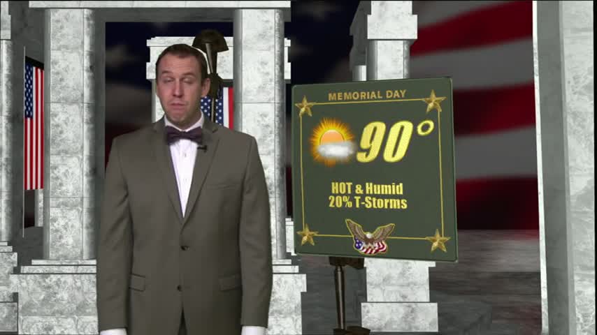
A humid Memorial Day is in store for the Mississippi Gulf Coast and there may be a few showers to dodge, too.
Friday night is going to be another warm, humid evening with a low near 74. Tomorrow will be very similar to today, with partly sunny skies and a slightly warmer high, near 85. From now through Tuesday, rain chances remain…
Your Weather Authority forecast for the week after 01/15/16.

It's been a much better start to today than we had yesterday, but the Friday afternoon forecast calls for even more rain in the future. We will see increasing cloudiness through the evening and into tomorrow, where showers and thunderstorms…
As the mercury climbs, humid conditions continue with mostly cloudy skies...
Temperatures are starting off in the mid/upper 70s this morning under cloudy skies...

The Thursday afternoon forecast has some good news for the memorial day weekend, but the low rain chances are starting to slip into the beginning of next week. Expect a warm and humid evening tonight, low near 74, and steady…
Friday afternoon is here! You made it to the weekend, and it looks like reasonably nice weather awaits you for your Memorial Day festivities. Tonight will be another warm and humid one, with a low near 74 and Southeast winds…

An isolated thunderstorm and a few showers are starting to pop up down here on the Gulf Coast this Thursday afternoon, and I expect to continue to see them move across the area tonight and into tomorrow. Tomorrow will be…

Expect a warm one out there tonight Gulf Coast, the Wednesday night forecast isn't drastically different from the earlier one, but there are some important changes. Most notably, the "area of interest" NE of Cuba is becoming much more likely…
Despite an approaching cold front, our Wednesday ended up being a pleasant day. Skies were mostly overcast in the early morning hours but began to clear in the afternoon and evening. The cold front is still moving through over night,…

We had another beautiful, but humid and hot day today, with temps climbing near 85 in some coastal locations. While the temperature hasn't increased much over the last few days, the humidity has increased drastically, making it feel markedly more…

So ends another beautiful day in South MS, but we're not through yet, we still have the Tuesday evening forecast. Expect a slightly warmer night tonight, with temperatures dropping to near 69 along the waterfront and inland areas a bit…
It's a very pleasant start to the day with cool temps and low humidity...