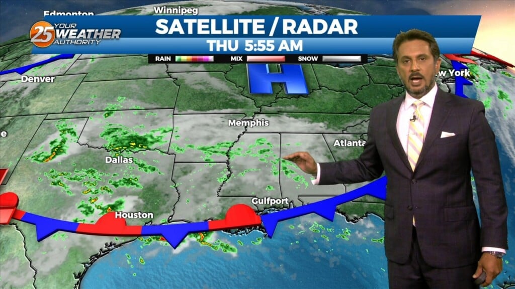
9/14 - The Chief's "Scattered Showers & T-Storms" Thursday Morning Forecast
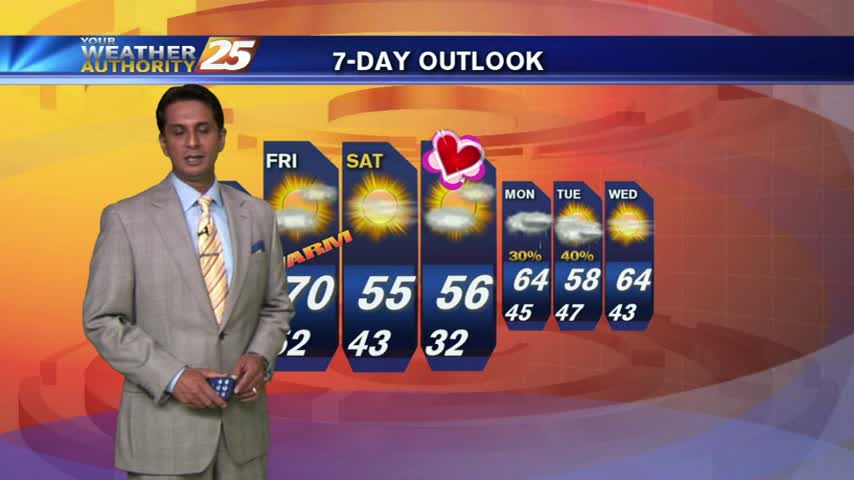
The upper level trough that brought the current stalled front across the area is currently east of the Ohio River Valley and quickly moving eastward.…
The upper level trough that brought the current stalled front across the area is currently east of the Ohio River Valley and quickly moving eastward.…
Temperatures are a bit cooler this afternoon due to cloud coverage and spotty rainfall...

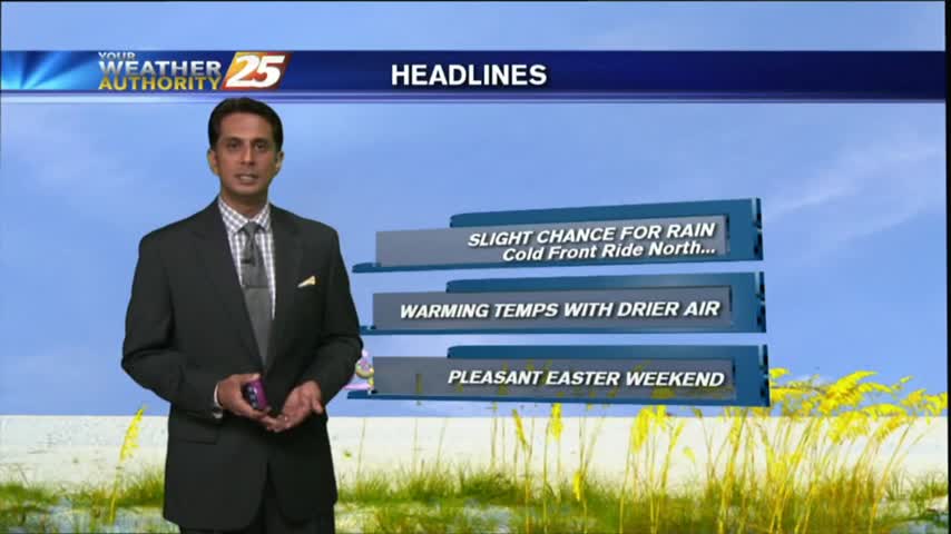
The cooler air mass modified through the weekend with a cold front approaching the region this morning...

As a zonal flow continues, warm/humid conditions along the Mississippi Gulf Coast continues to provide areas of PATCHY DENSE FOG...
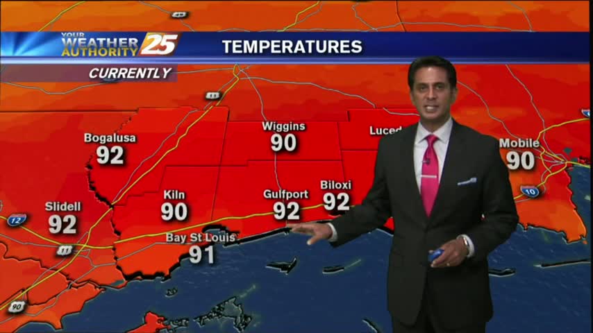
After a warm and humid start to your Friday, its downright HOT in the viewing area and through the region...
After PATCHY FOG earlier this morning, temps continue to warm along with BREEZY conditions from the south...
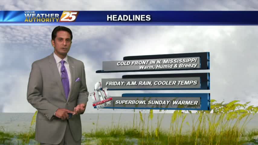
As a weak cold front moves into northern Mississippi, areas of DENSE FOG has developed along the southern 6...

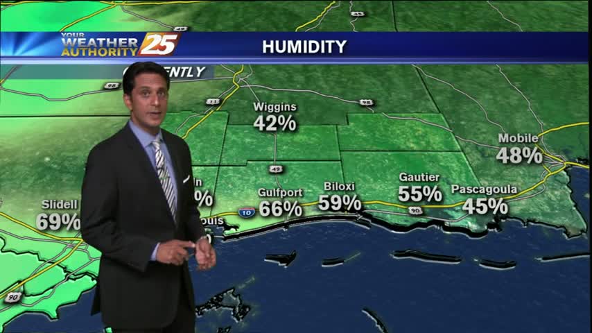
As a cold front to the west moves closer to the area, light patchy fog has developed along the coastal counties...
Upper-level clouds continue to move across the area with warm & hazy conditions...

A cool start with partly cloudy skies as a warm front moves overhead...
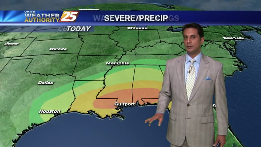
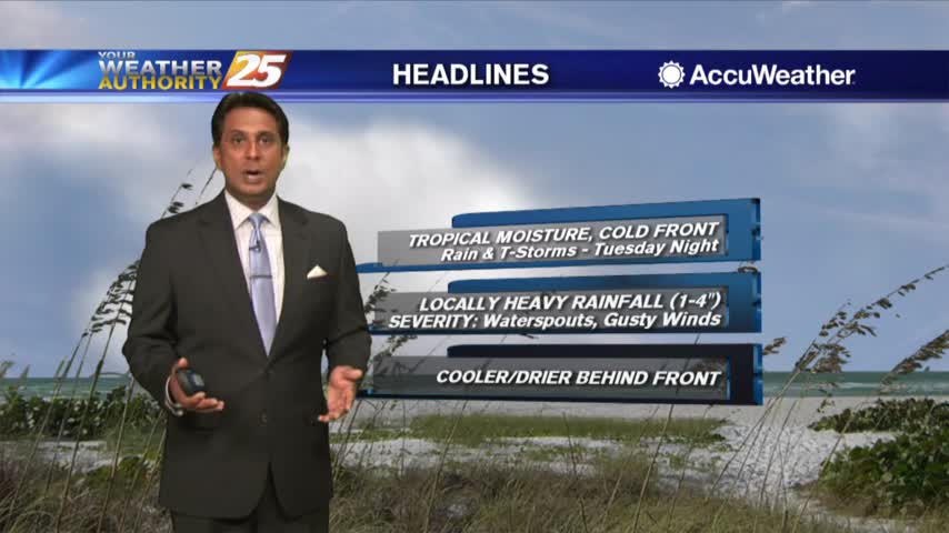
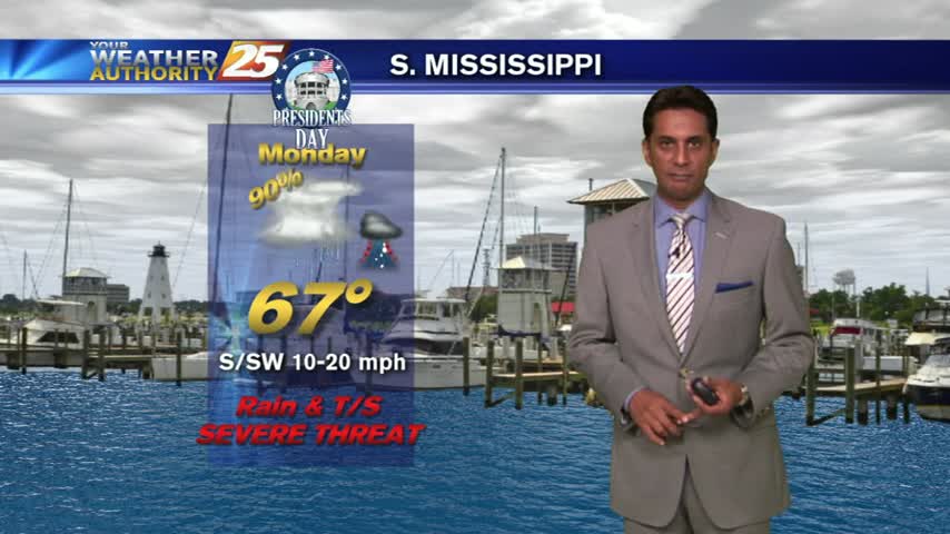
It's a mild start with humid conditions and areas of patch fog. The gulf south is in a "MODERATE" THREAT for severe storms this afternoon/tonight...
Light rain has been moving into the area since prior to sunrise. This activity will increase through the day with the potential for SEVERE STORMS this afternoon...
It's a MUCH WARMER start this morning as a SW wind continues to increase both humidity and the temperature...