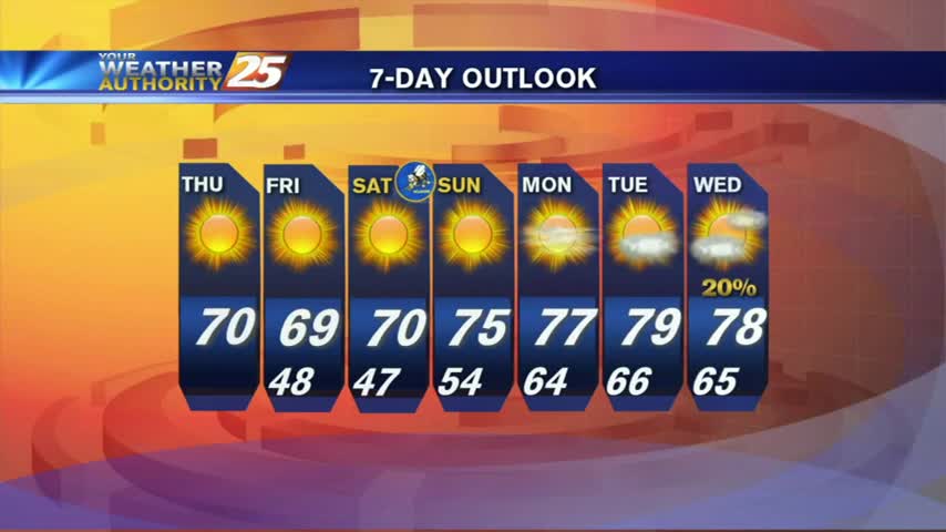
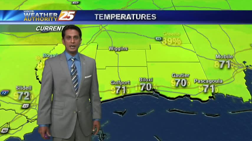
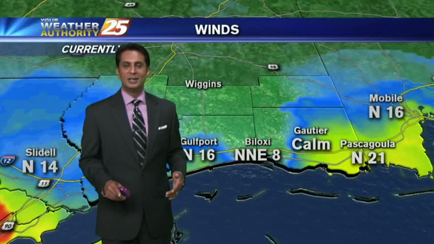
04/27 Ryan's "Warm/Cold Front" Thursday Forecast
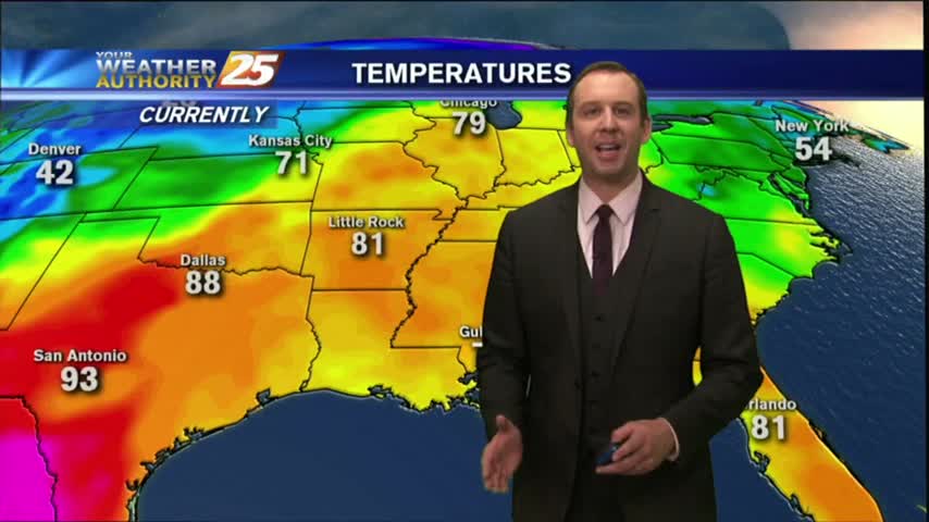
A cold front may have passed through overnight, but temperatures warmed today. Expect a few days of calm weather before another potential severe threat. Watch the full forecast for details.
A cold front may have passed through overnight, but temperatures warmed today. Expect a few days of calm weather before another potential severe threat. Watch the full forecast for details.
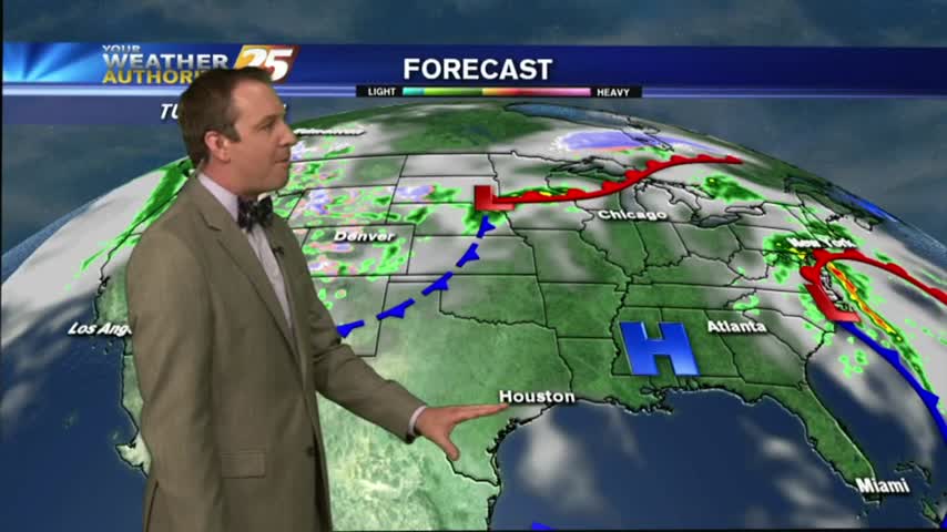
High pressure settled in over the area leading to clear skies, drier, air, and slight cooling. We'll begin seeing changes as a front approaches the area tomorrow night, so watch the forecast for details.
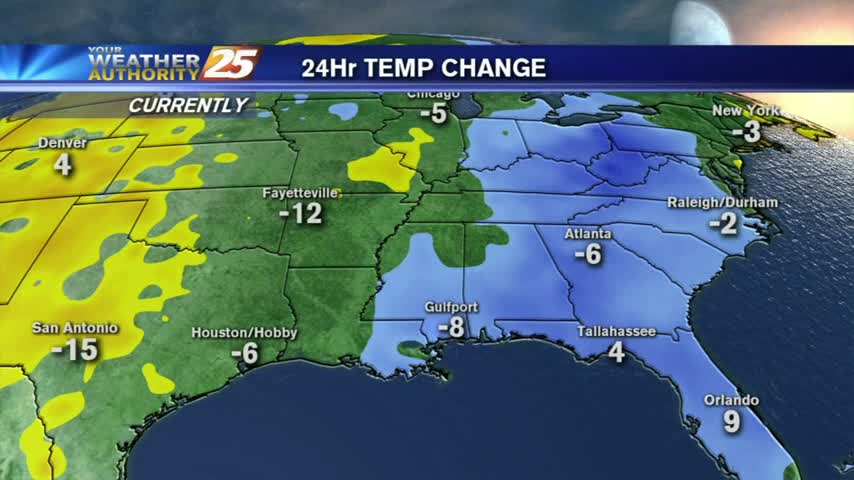
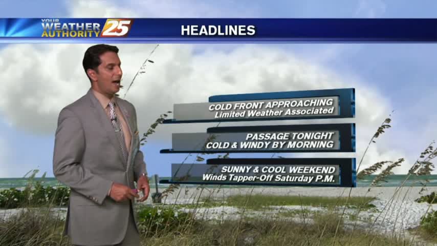
Saturday's cold front brought some stronger storms to the area than anticipated, but severe weather stayed away. The cooler and drier condition didn't stay away, and they'll continue into tomorrow. Watch the forecast for details.
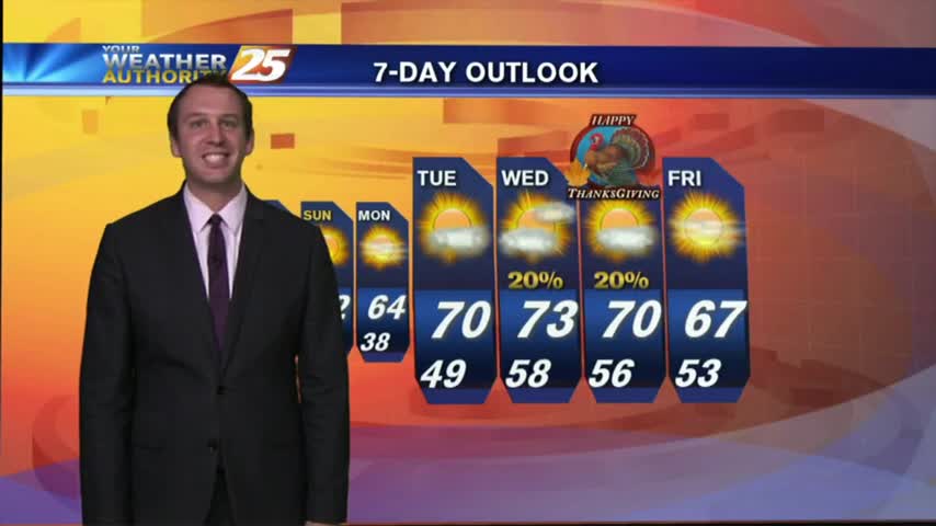
Today was gorgeous and the next few days won't dissapoint either. Click the forecast link for the full forecast details.
Storms pushed through this morning and now we're seeing continuous breezy winds bringing in cool and dry air. Expect a gorgeous next few days, but you'll have to watch the forecast for the details.
The winds have continued to increase and we'll see the first drops of rain within the next few hours. Watch the full forecast for complete details of tomorrow's "active" weather event.
Yesterday's front brought slightly cooler & drier conditions for the evening, but warm & humid conditions continue into tonight with mostly cloudy skies. Watch the forecast for more.
We eyed this evening as the time a cold front will move through the area, and while the storms have already moved out of the area, we'll have to wait a bit for the clearing skies. Full forecast within.

A warm/humid and breezy start to the day along with light showers, as a cold front to the NW approaches the area...

After a cloudy start this morning, breezy conditions along with a north winds have moved in along with thin U/L clouds...
A south wind in advance of an approaching cold front continues to get stronger. Breezy, warm & humid conditions to start off Ash Wednesday...
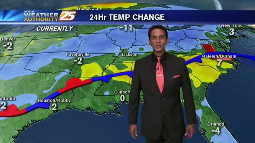
In the wake of a weak cold frontal passage last night, cooler/drier air moving in has clear and cool conditions to start off the day...
In the wake of cold frontal passage last night, rain is out of the area but the clouds will continue to linger...
After a very cold start, temps have warmed into the upper 40 along with an abundance of sunshine for your Friday afternoon...
We've seen warmer, spring-like weather over the past week but that ends overnight as a cold front moves through South MS. Watch the forecast for details.
As a frontal boundary continues moving south from north/central Mississippi...areas of PATCHY FOG has developed this morning...
With an approaching cold front...this morning brings the final day of warm/humid with low clouds and areas of patchy fog...
Another morning of patchy fog as a humid wind continue from the south, in advance of an approaching cold front...

Another BEAUTIFUL start as TD #9 continues to influence our weather by providing a pleasant N/NE wind...
A warm start with another day of showers/t-storms, along with elevating rain potential through the weekend...
Another warm & humid start as a strong southerly wind continues...
After a BEAUTIFUL Mother's Day weekend, the workweek is starting off under cloudy skies and humid conditions...
Low-level moisture has developed partly/mostly cloudy skies...

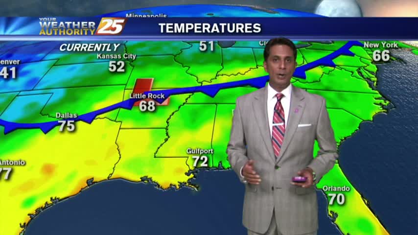
A mixture of sun and clouds with warm & humid conditions for your Tuesday afternoon...