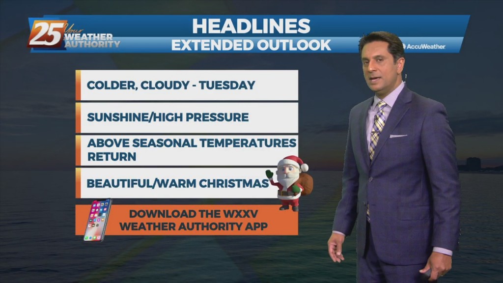
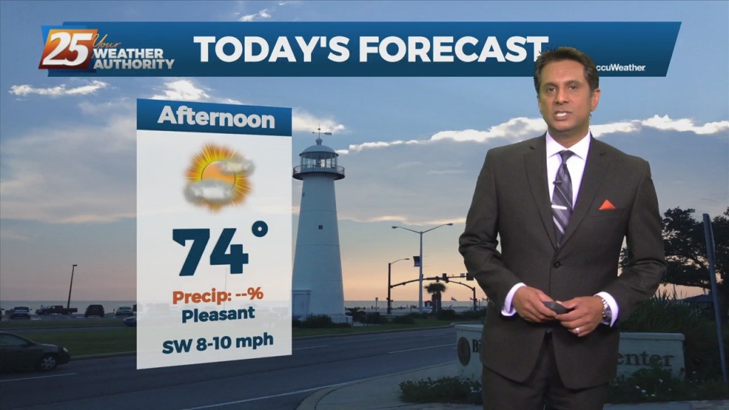
12/31- The Chief's "New Year's Eve" Afternoon Forecast
The main impact for the weekend still comes from the front moving into region. The mid to upper levels are fairly dry and additional instability exists in the…
The main impact for the weekend still comes from the front moving into region. The mid to upper levels are fairly dry and additional instability exists in the…
As the high pressure remains seated over the Bahamas warm and moist air advection continues to be brought in from the Gulf. While there is the possibility of…
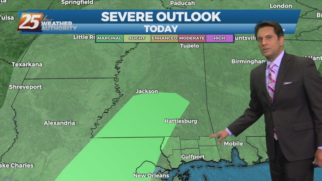
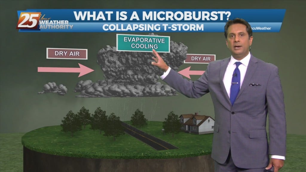
Isolated t-storms will affect the area this afternoon with a low-end threat for severity. If we get a strong thunderstorm, a damaging wind gust may be possible or…
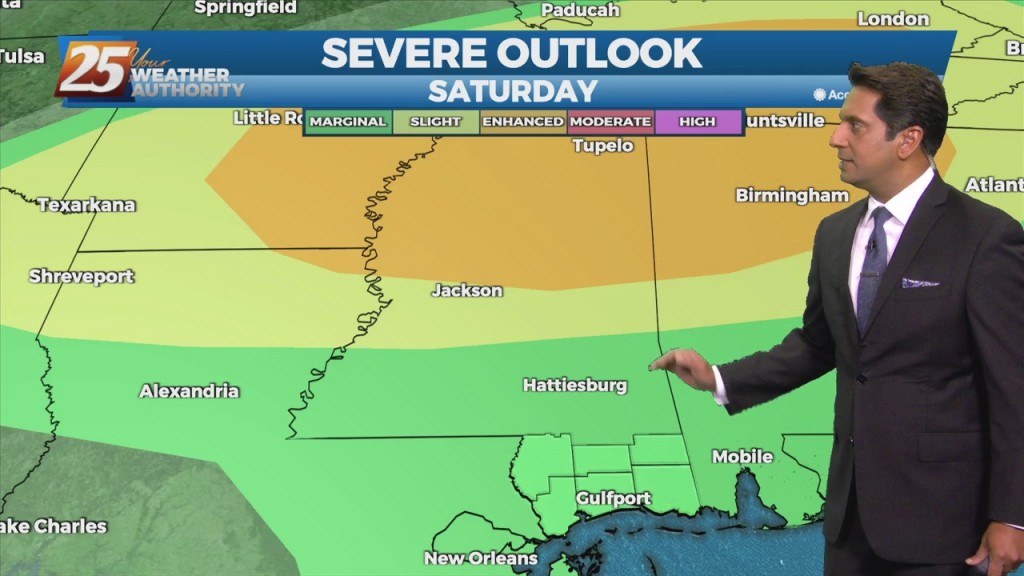
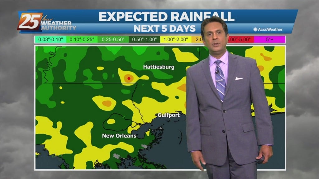
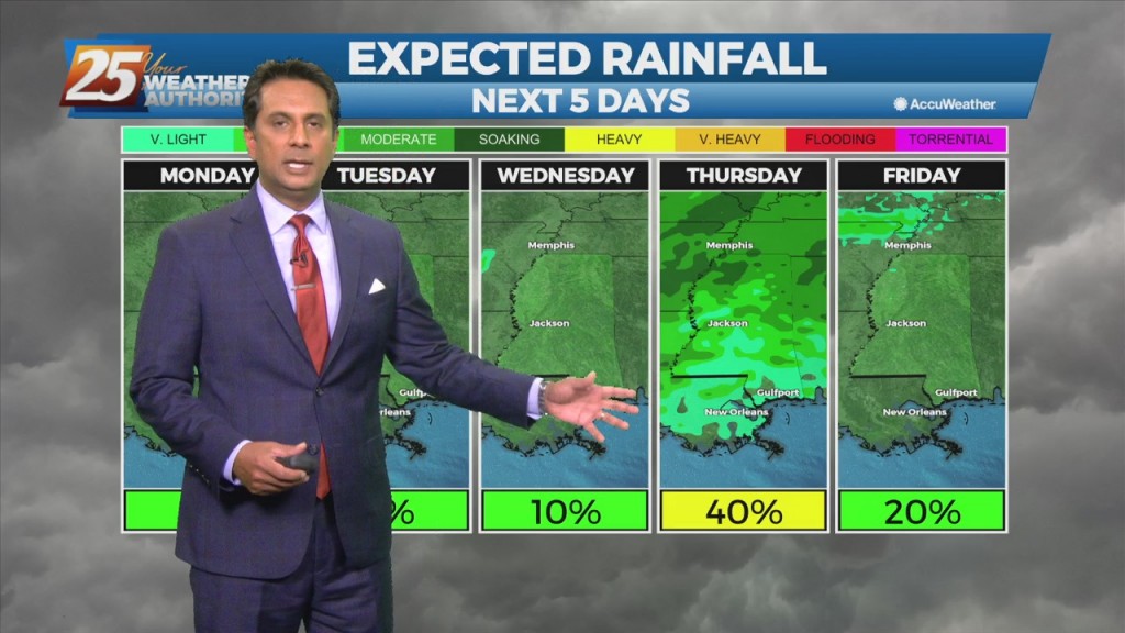
There will be several rounds of potential showers and thunderstorms, with a non-zero threat of severe weather each day. Today's concern will be associated with a disturbance moving…
Clouds will continue to break up and dissipate towards the southeast late this evening and overnight tonight, revealing mostly clear skies for all areas... but it`ll be cold.…
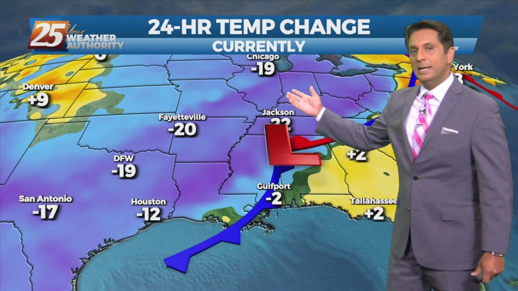
A fast moving low-pressure system along the northern Gulf will continue to move NE. This trajectory will keep the area on the cooler and more stable side of…
Isolated to scattered showers will then persist the rest of the evening and overnight hours as moisture remains in place but loss of daytime heating limits convective potential.…
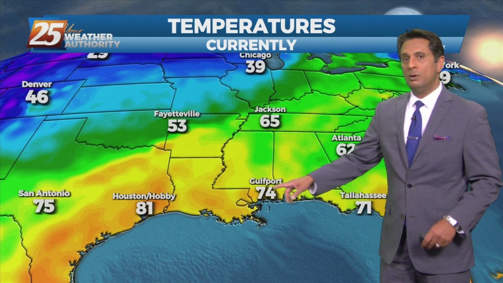
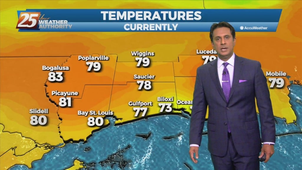
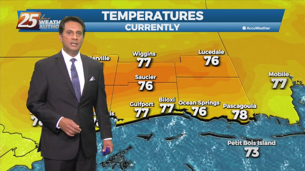
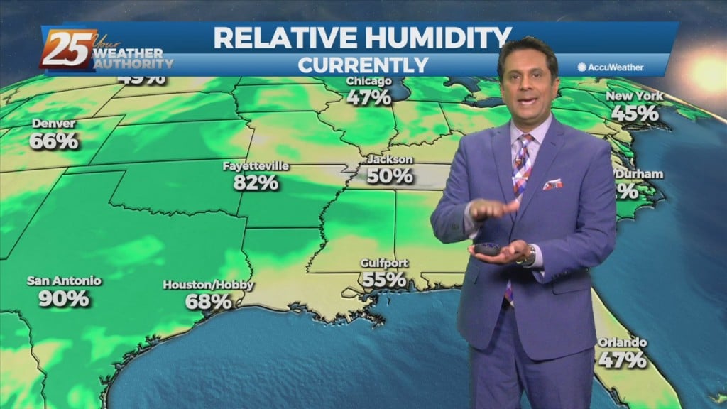
High temperatures today are forecast to reach around 80 for many areas with dew points in the mid-60s, which will make for fairly muggy conditions. I…
Dense morning fog will continue to be a factor through the weekend as overnight low temperatures will bottom out in the upper 50s to low/mid 60s. The winter…
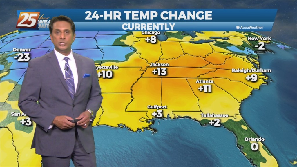
With the return flow beginning this afternoon, warmer temperatures will move in. Now the question is will we test records, it looks like right now we could…
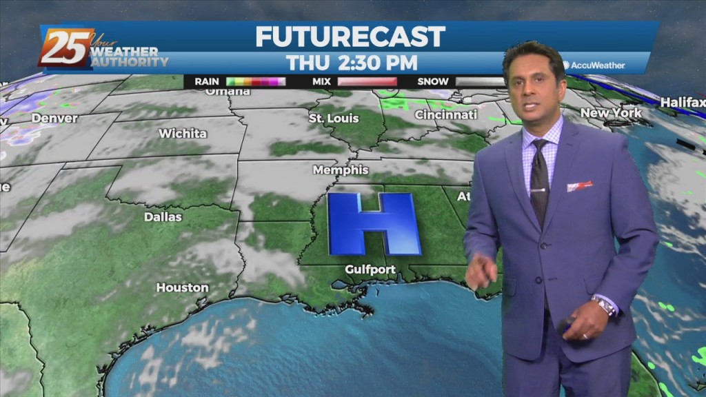
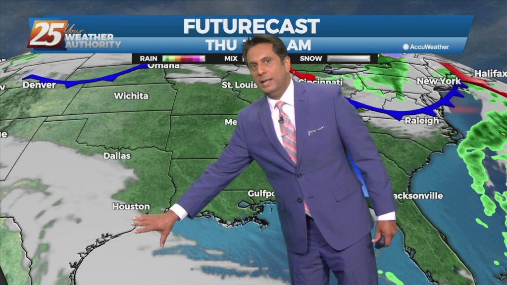
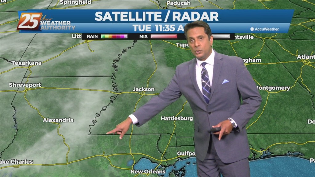
A line of showers from this morning has shifted further south. Another disturbance will move over the area Thursday bringing the opportunity of showers/t-storms back to…
A cold front will bring scattered t-storms this afternoon with rain post frontal passage. The front is expected to slip to the south of the coastline overnight…
High pressure really doesn't give way over the next 24 hours as an upper-level disturbance will move from Texas across the area Saturday morning. There's…
A west-northwestly flow will remain in place through the next 36 hours while an upper level disturbance moves through the upper and middle MS Valley today. Upper level…
As the warmer air begins to move into the area, fog will be a concern over the next few successive nights as conditions begin to strongly support…
The pattern will put the area in a region dominated by high-pressure. So a quiet weather pattern with slowly moderating temps expected through midweek. Guidance is generally in good…
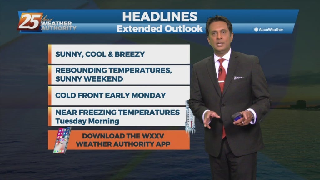
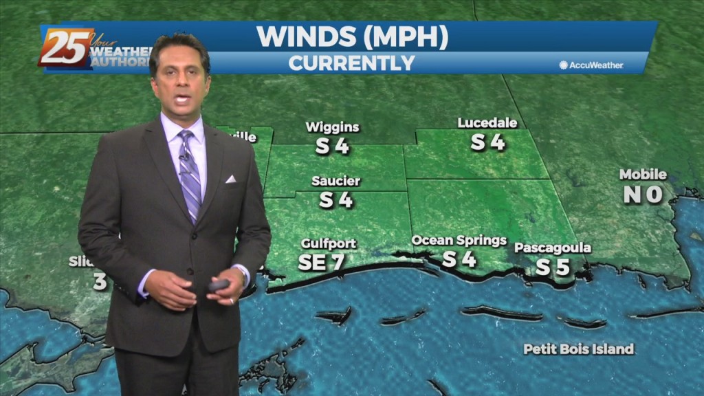
Winds are gusting to around 20 mph and will continue to stay elevated through this evening. The story for tonight will be the near freezing temperatures for areas…
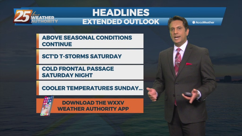
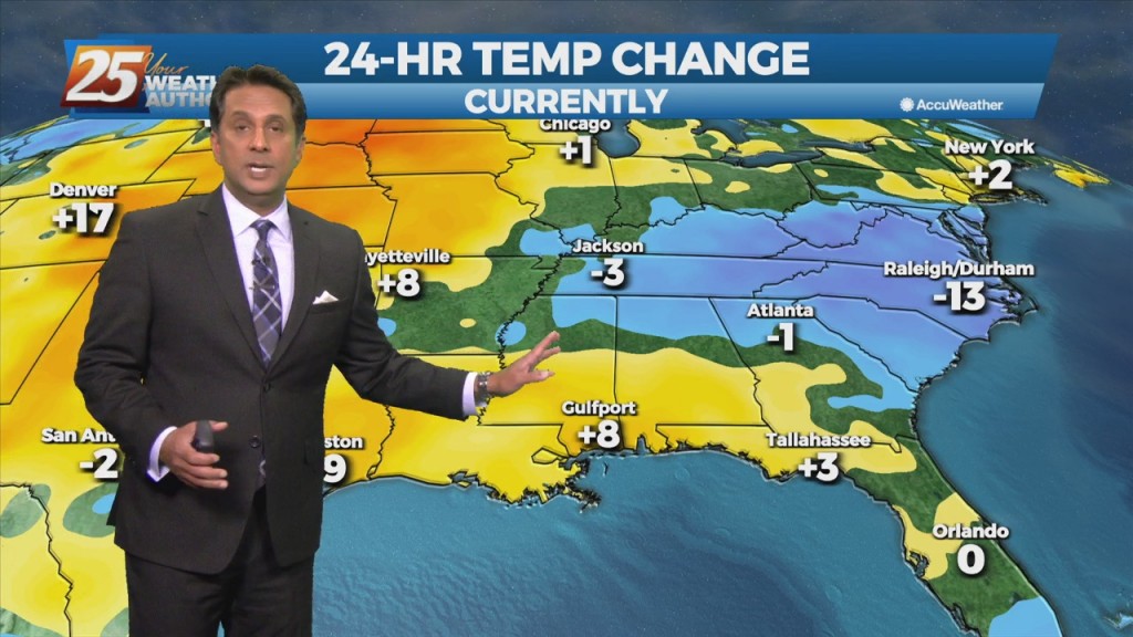
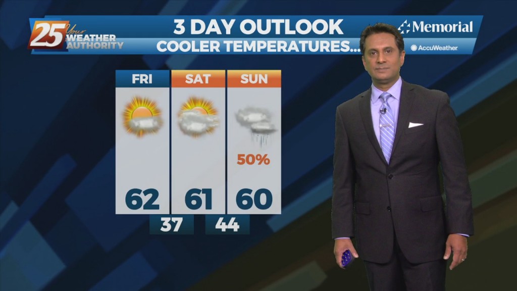
Breezy conditions behind last night's cold front will gradually diminish later in the evening. Low temperatures tonight into Saturday morning will be the coolest of the short term,…
Rain chances will gradually decrease through this afternoon as a cold front moves east. An increase in northeasterly flow will become breezy this evening through Friday evening. Much…
HOT temperatures this afternoon then our attention shifts to the west as our next cold front approaches early Thursday. A few light showers may develop Wednesday night…
Today and Tuesday will bring sunny skies and light winds as highs/lows each day becoming a few degrees warmer than previous days. Thursday, an upper level disturbance…
High-pressure will begin to shift off to the east tomorrow as an upper disturbance extends down into our area ushering in returned moisture. Though this disturbance is expected to…
Much of the workweek will remain a temperature forecast as surface high pressure keeps any rain potential out of the area through midweek. Mild daytime temperatures in the mid…
A cold front from the west will move SE. As a blow-up in activity is expected in the NE GOM, our area will see light rain. A…