Ryan’s “Heat Index” Friday Night Forecast
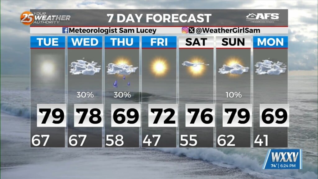
We caught a break from the dangerous heat index values this afternoon as showers popped up and spread upper level clouds to the West, blocking much of the afternoon sun. While I expect similar conditions tomorrow, there will be some areas with heat indices beyond 100-105 degrees so please take extra precaution with prolonged outdoor exposure and protect pets. Isolated showers will provide some relief tomorrow, but it won’t be until Sunday that I expect our usual pattern to return, with afternoon scattered showers popping up along the sea breeze front. This will last until late Tuesday, when I expect high pressure to begin strengthening into the area again. This will dry/clear our skies, but temperatures will climb past the mid 90s as we approach the weekend.


Leave a Reply