Ryan’s “Cooler” Friday Night Forecast
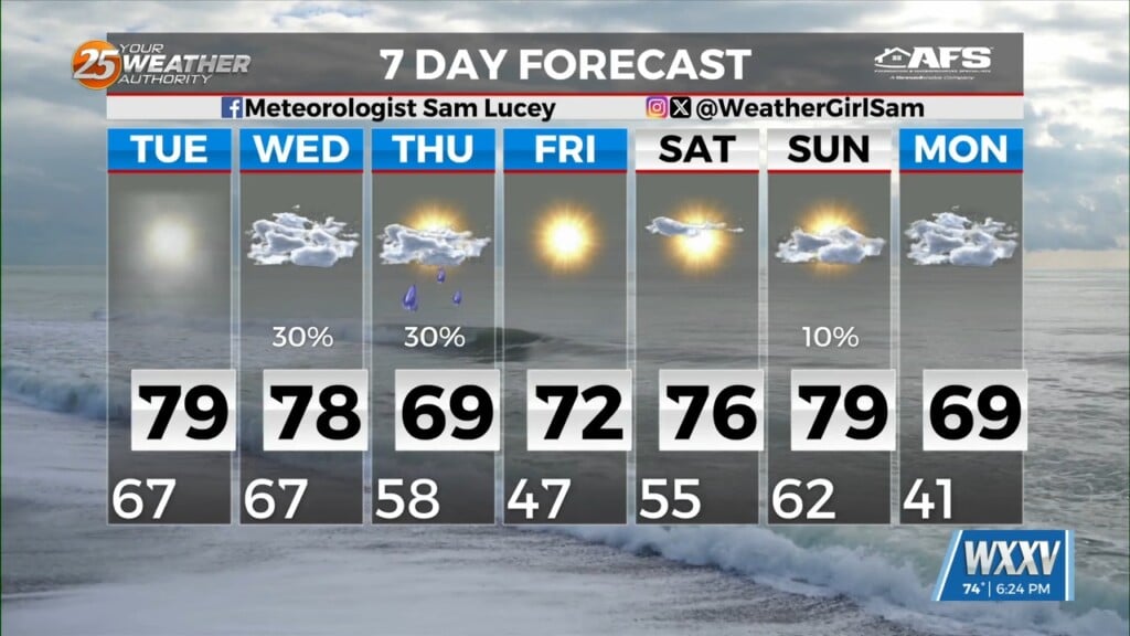
Tonight will be cooler and slightly drier than last night was, but the forecast still calls for a warm and rainy weekend. Expect to see clouds gathering again as we head into tomorrow afternoon, with spot showers popping up ahead of more organized rain moving in later in the evening. These showers will likely have areas of heavier rainfall, but severe weather is not expected at this time. Expect the rain to continue overnight into Sunday, but will begin to weaken in the afternoon. Monday will bring some warmer temperatures at first, but after one final boundary moving through the area in the evening bringing a few showers, we’ll see a significant period of clearer/drier weather. Tuesday brings temperatures in the mid 60s with even cooler temperatures for Wednesday and Thursday. These cooler and drier conditions will last until just before the weekend where we’ll start seeing temperatures inching towards the 70s and cloud cover returning. It seems winter will also make one last ditch effort to come back with some evening lows in the low 40s next week, which will likely be one of our last “cold snaps.”


Leave a Reply