Night Rob’s “T-Storm Chances Up” Hump Day Evening Forecast
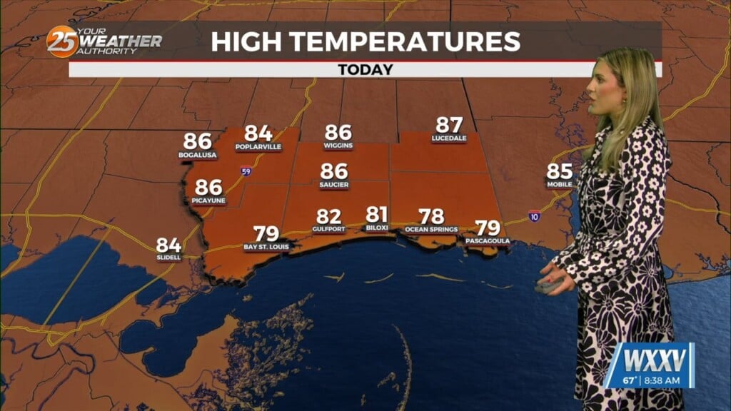
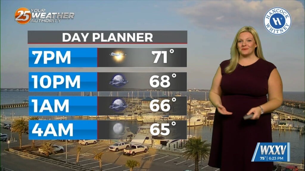
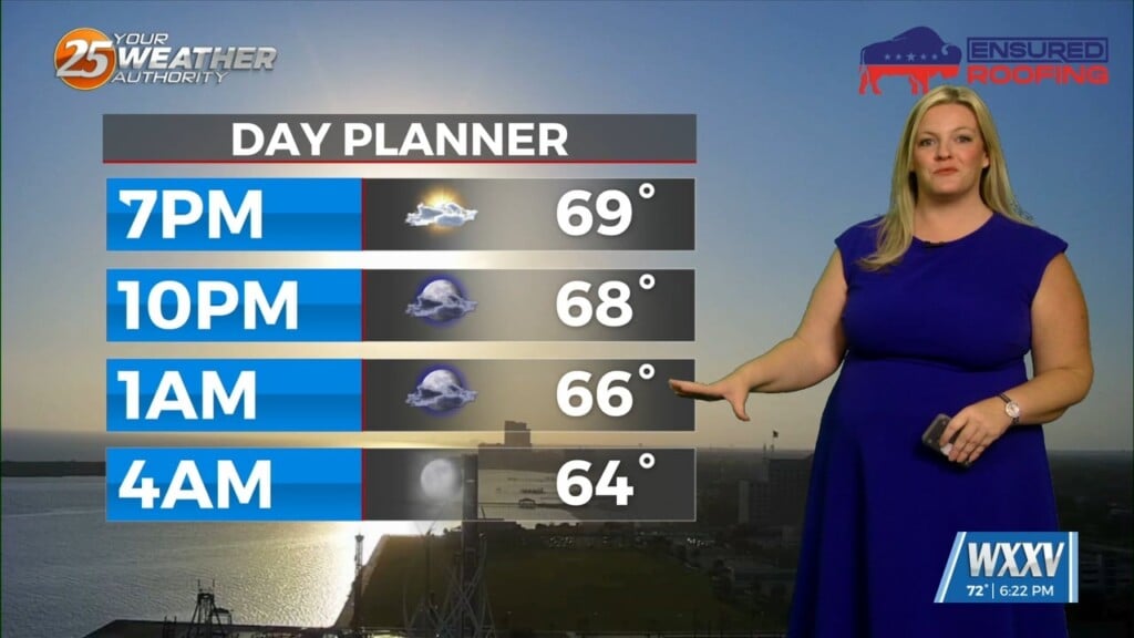
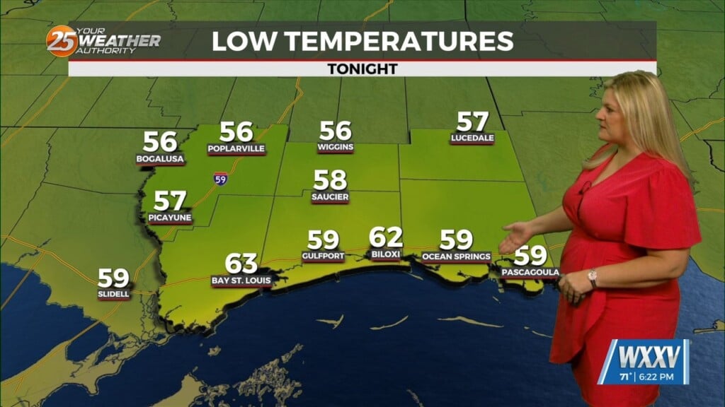
Heat peaks today with numbers not too far behind expected Thursday. We drop into the upper 60s tonight with a not-too-humid feel to the air.
An upper-level low currently in the western Atlantic will move eastward into the east coast of Florida and Georgia by the end of this forecast period. At the same time, an upper level disturbance will swing northeast across the High Plains. As a result of both of those systems moving to those regions, our high pressure system over the area will be getting squeezed north. Losing the sinking air from that high pressure will allow for some afternoon t-storms to start developing Thursday, as rising air will begin developing. Coverage starts out in the 20-40%, topping out closer to 50% by Saturday. A good deal of surface heating may result in gusty winds with the strongest storms of any given day through Saturday. Most, if not all storms, should stay sub-severe.
We’re likely to have lingering t-storms across the area Friday evening as we lose surface heating. This pattern of morning showers and then isolated to scattered afternoon t-storms will continue through the weekend, although the setup will weaken Sunday (about 20% chance precip then).
High pressure builds back in early next week and temperatures will go back up.