Much cooler through the weekend
Meteorologist Sam Lucey has a look at the forecast for south Mississippi
Tonight will be mostly clear, with a few clouds building in overnight as lows fall to the upper 30s and low 40s.
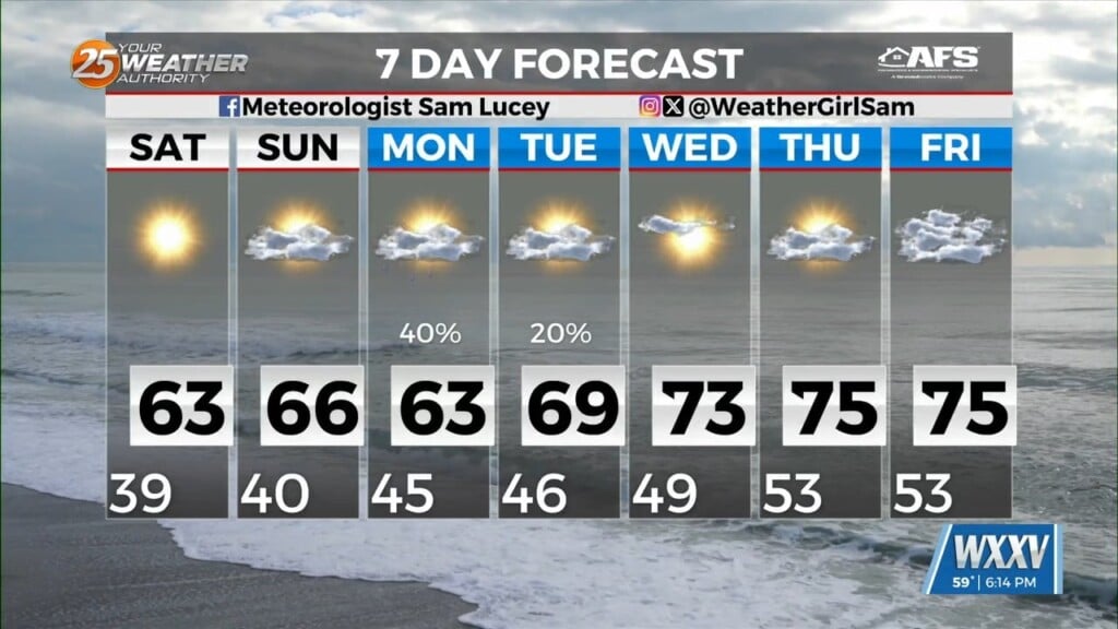
Saturday and Sunday will both be sunny, although temperatures will remain on the cool side. Highs will reach around 63 Saturday and 65 Sunday. Overnight lows will settle near 40 Saturday night and the mid 40s Sunday night.
Clouds will increase Sunday night ahead of our next weather system. Scattered showers could develop Monday afternoon and continue into Monday night. There is a slight chance of rain both Monday and Monday night, with a few thunderstorms possible Monday night as well. Highs will reach the lower 60s Monday, with breezy northeast winds adding to the cooler feel.
A few lingering showers cannot be ruled out Tuesday morning, but conditions should gradually improve. Highs will climb into the upper 60s Tuesday before reaching the lower to middle 70s Wednesday and Thursday.
Looking ahead to Friday, temperatures will continue warming, with highs near 76. A slight chance of showers will remain in the forecast, but much of the day is expected to be mostly sunny.
Marine Forecast
Northeast winds will ease Saturday afternoon before picking back up Saturday night and Sunday. Conditions will deteriorate heading into early next week, with northeast winds increasing to 25 to 30 knots and waves building to 4 to 5 feet by Monday.
Strong winds and choppy seas will continue through Tuesday before gradually easing Wednesday. Scattered showers are also possible Sunday night through Tuesday morning. Small crafts should use caution, especially early next week.