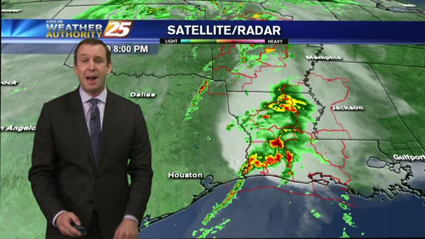
03/29 Ryan's "Pre-Severe" Wednesday Night Forecast
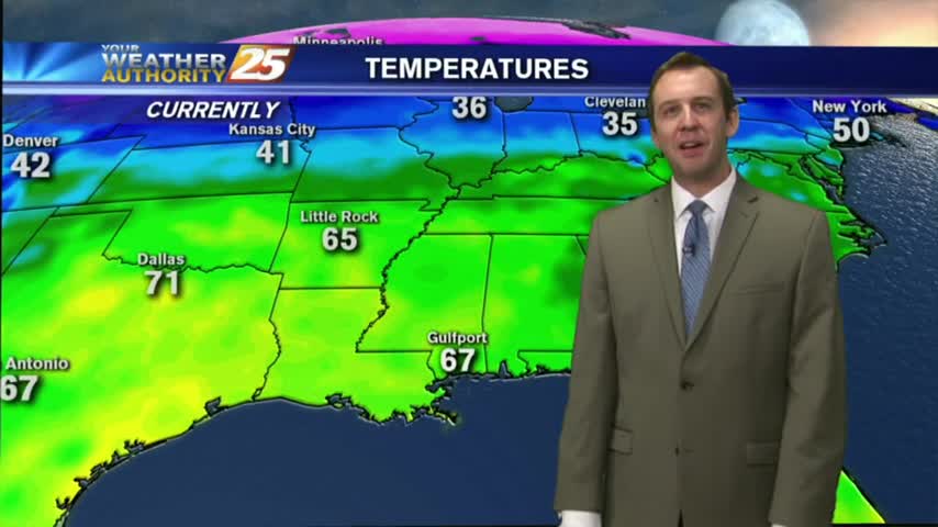
Clouds are increasing ahead of Thursday's storm system, and while it seems to be weakening, South Mississippi remains under a "slight" threat of severe weather. Watch the forecast for more.
Clouds are increasing ahead of Thursday's storm system, and while it seems to be weakening, South Mississippi remains under a "slight" threat of severe weather. Watch the forecast for more.

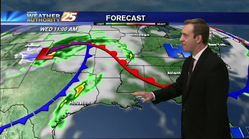
Another dry day in the books with another on tap for tomorrow. Rain is moving in soon though, with storms that could be severe. Watch the full forecast for details.
Mostly cloudy skies and a few showers came and went today, but the next few days will be drier and a little clearer. Watch the full forecast for details.
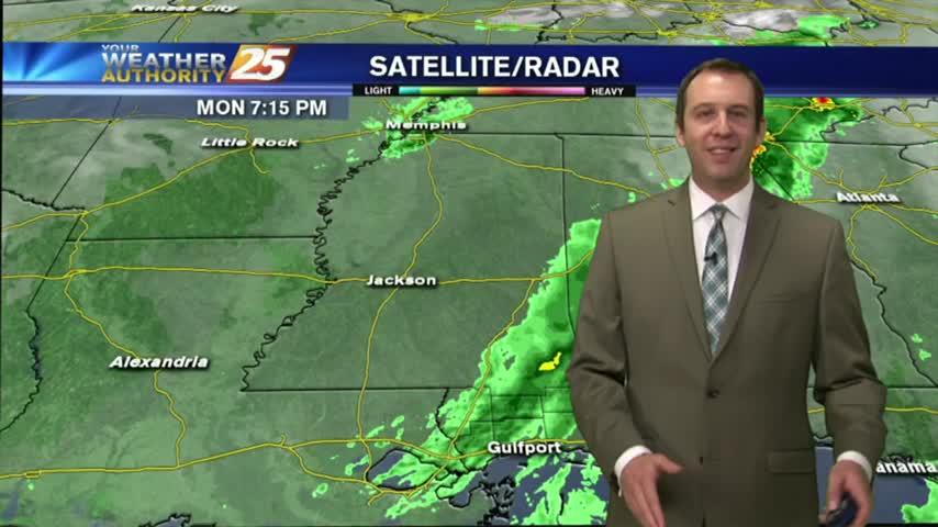
The cloud cover seemed to come and go throughout the day, but now that the night is moving in the skies will darken ahead of our next frontal system tomorrow. Click the forecast link for all the details.
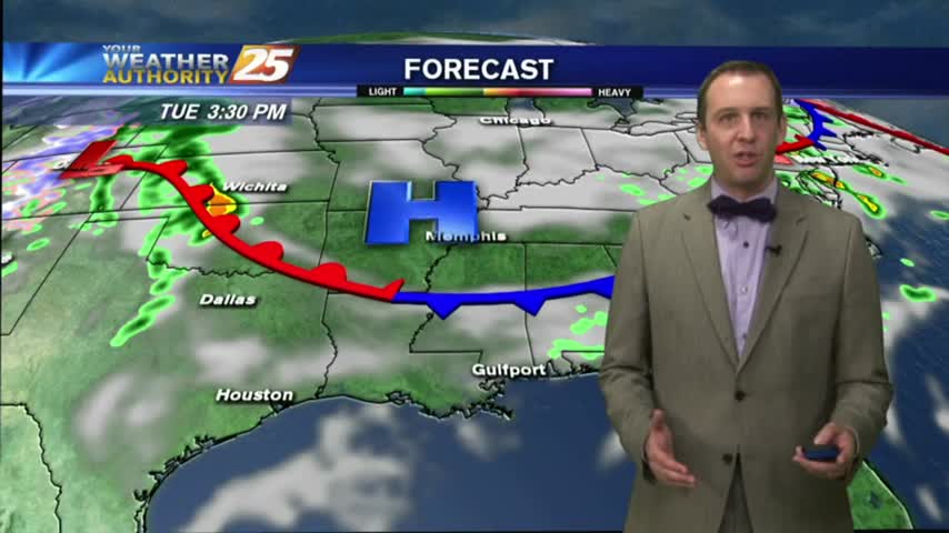
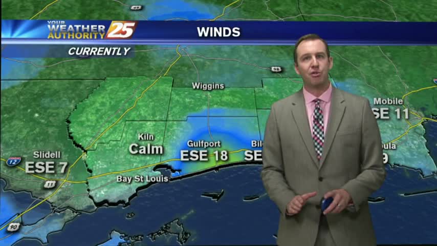
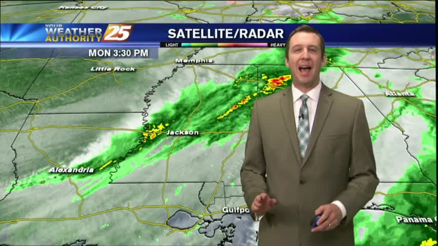
The winds have continued to increase and we'll see the first drops of rain within the next few hours. Watch the full forecast for complete details of tomorrow's "active" weather event.
The clouds moved in during the afternoon and will remain until this weekend's storms. Be sure to watch the full forecast for all the details.
Yesterday's front brought slightly cooler & drier conditions for the evening, but warm & humid conditions continue into tonight with mostly cloudy skies. Watch the forecast for more.
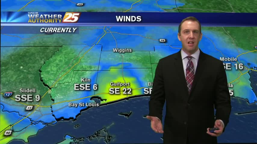
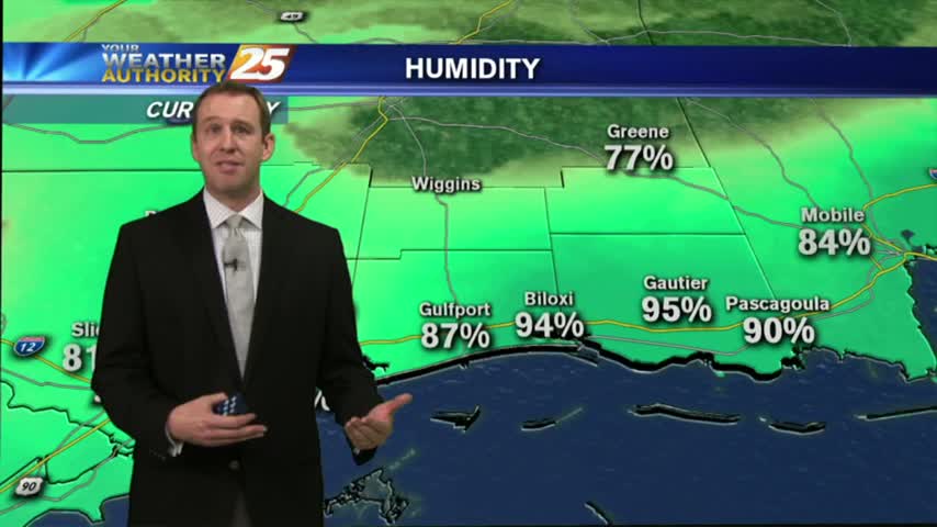
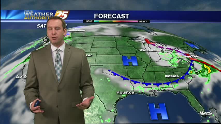
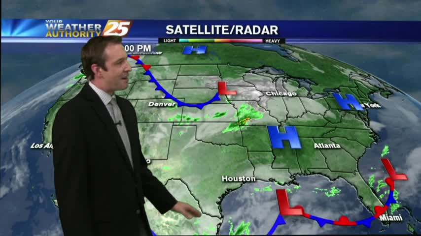
More warm & humid conditions in South MS for tonight, meaning more fog likely, though NE winds should keep it light. Looks like active weather will move in just in time for the weekend, but you'll have to watch the forecast for the details.
It's setting up to be another foggy morning on the Gulf Coast tomorrow, but more sun and warm temperatures are expected tomorrow. Watch the forecast for details.
This afternoon was as gorgeous as predicted, and the next few days are looking very similar, even possibly a bit cooler! Watch the full forecast for details.
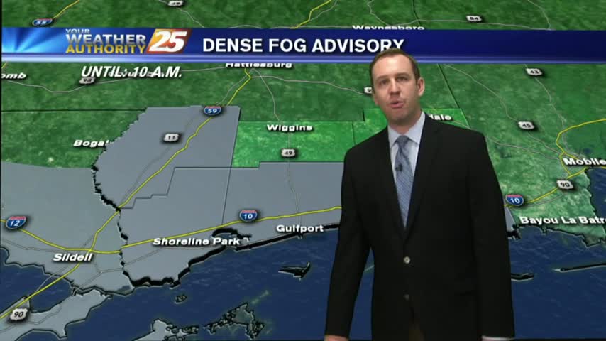
The first day of Spring brought coastal temperatures into the 80s today, and tonight will be even foggier than last night. These conditions continue for much of the week, so watch the forecast for details.
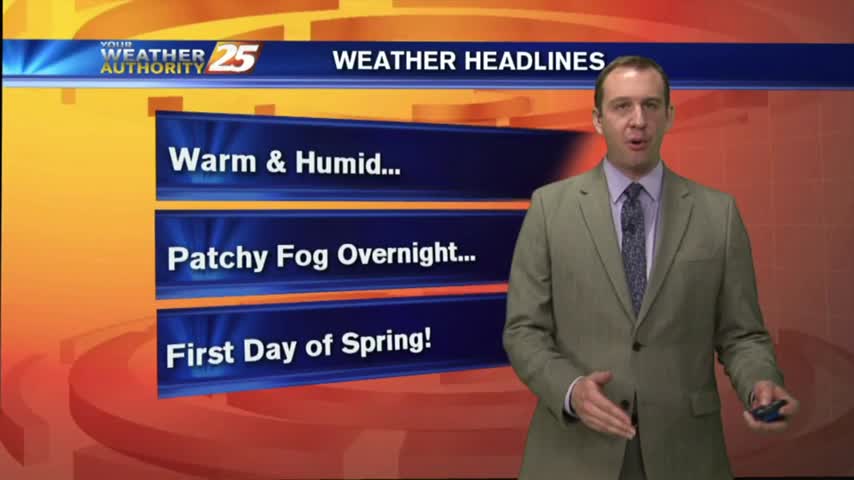
Tonight is the last night of Winter but don't expect any "winter-like" conditions as warm & humid weather moves in for the long haul. Watch the full forecast for details.
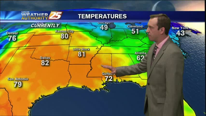
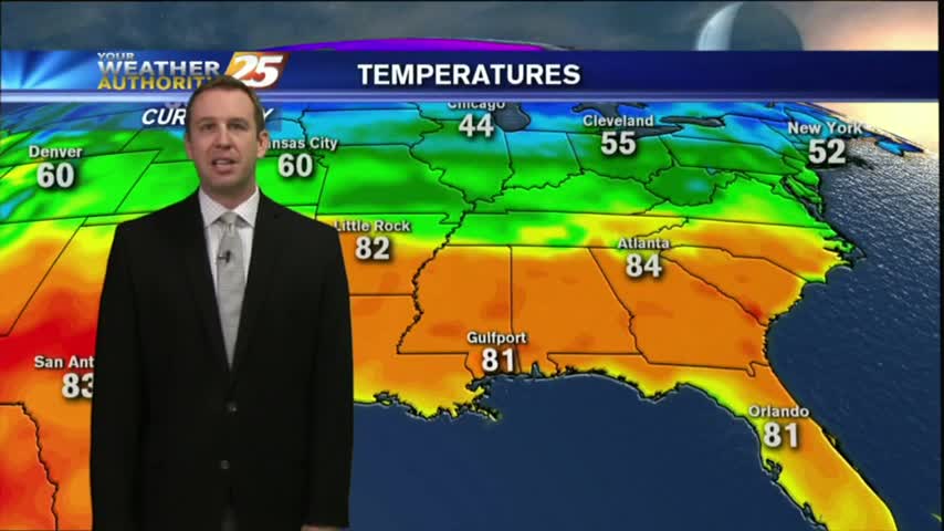
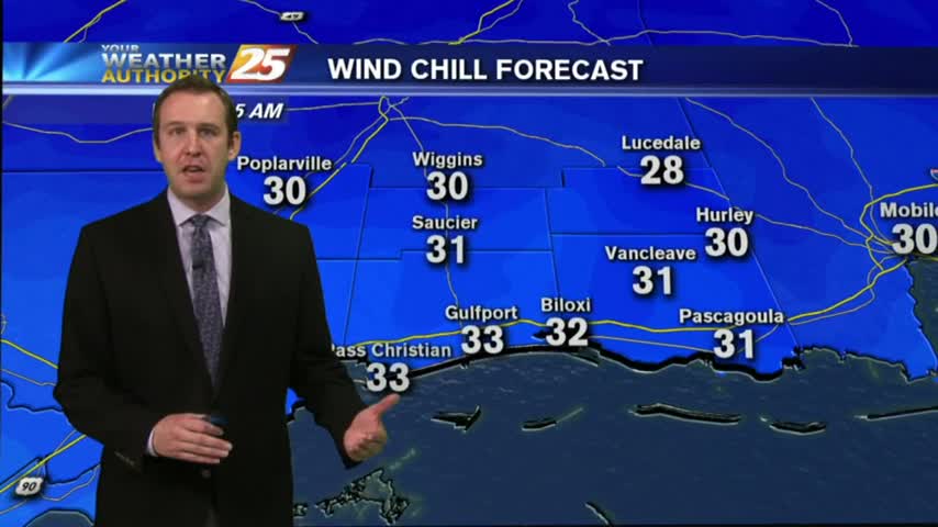
Two nights ago, some counties were under a freeze warning with coastal temps dropping into the 30s. Today, we're closer to the 60s tonight, with even warmer temps ahead. Watch the full forecast for the details.
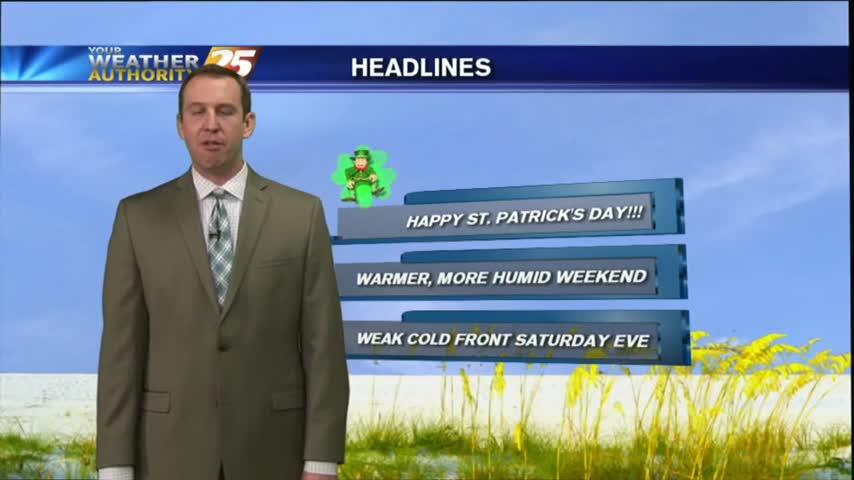
I hope everyone enjoyed their gorgeous St. Paddy's Day weather! Expect the beautiful days to keep coming with almost no chances of rain. Watch the full forecast for more details.
Tonight will be calm and chilly, but still about 10 degrees warmer than last night. Expect this warming trend to continue through the weekend and into the start of Spring. Details inside.
This afternoon was slightly warmer than yesterday's, and tonight's low increases as well. Watch the forecast for the details and be sure to check back later for an update.
We'll begin seeing warmer temperatures after one last frigid night in the 30s tonight, though skies will remain sunny and clear. Click the forecast link for more details.

I promised a beautiful day last night and the weather delivered! Expect one last night in the 30s for a while, and a slightly warmer afternoon tomorrow. For more than that you'll have to watch the forecast.
It was clear and sunny through much of the day, but now we're in for some frigid nights. Click the forecast link for details.
The rain finished in South MS around 9 PM, so the cooling and clearing has begun! Watch the forecast for more information.
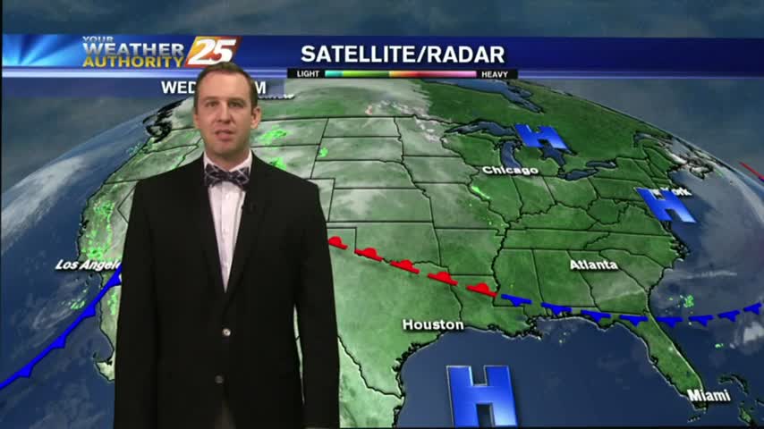
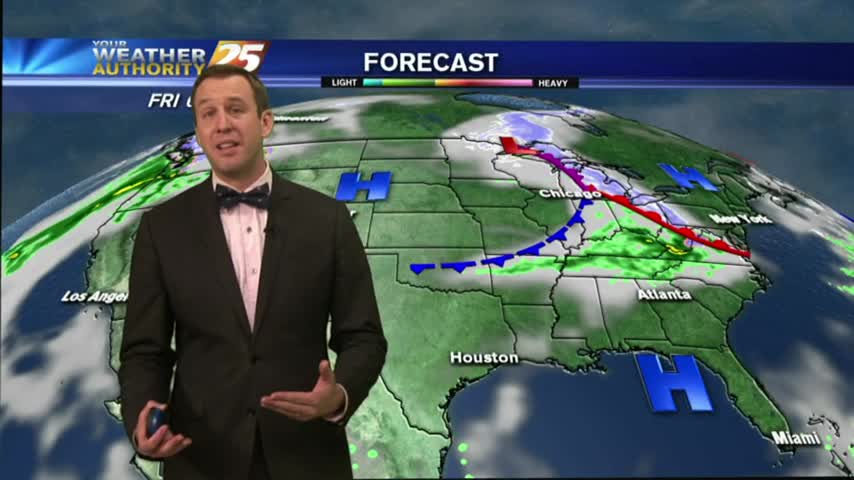
A few late morning showers passed through earlier, and we're just beginning to see the second round of rain beginning as a cold front closes in. Drastically different weather this week than the last few, so be sure to click the forecast link for more information.
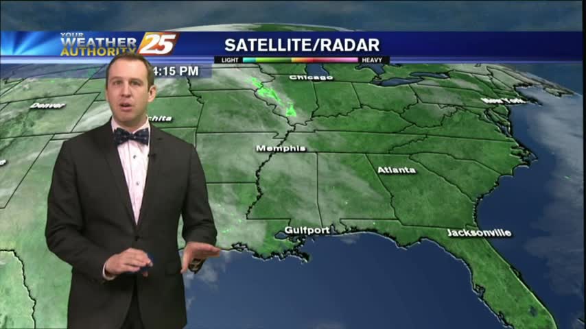
After a weekend that brought some light rain, we saw a bit of clearing earlier today. The clouds are moving back for one last rainy day before a cooler & drier week, so be sure to check out the forecast for details.
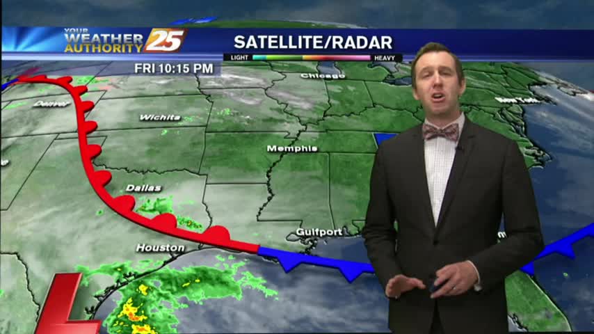
A few sprinkles moved through earlier today ahead of a very weak boundary, but more rain will move through for the weekend. Details inside.
After a nice two day break from the cloudy and warm days we began the week with, the clouds are gathering again. Watch the forecast to find out when that means rain.