3/7 - The Chief's "Sunny & Warm" Friday-Eve Morning Forecast
A beautiful day is ahead with mostly clear skies becoming partly cloudy this afternoon. The next frontal system will be getting together by tonight as the…
A beautiful day is ahead with mostly clear skies becoming partly cloudy this afternoon. The next frontal system will be getting together by tonight as the…
Fog will be primed to form ahead of your Thursday morning. Be sure to take extra care if you have an early morning commute! Fog and early-day cloud…
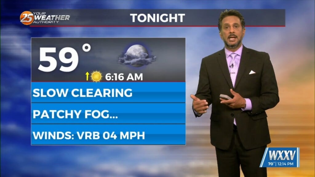
Tonight will feature mild, but slightly cooler temperatures for the Mississippi Coast. If winds can back down quickly, fog will be an issue for your Thursday morning. This…
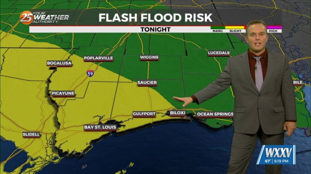
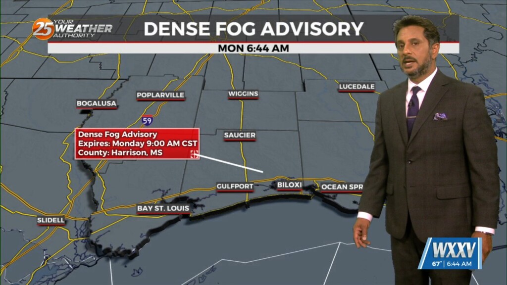
Dense morning fog will be a factor though late morning with a dense fog advisory in effect. Tonight, sounding profiles are showing a…
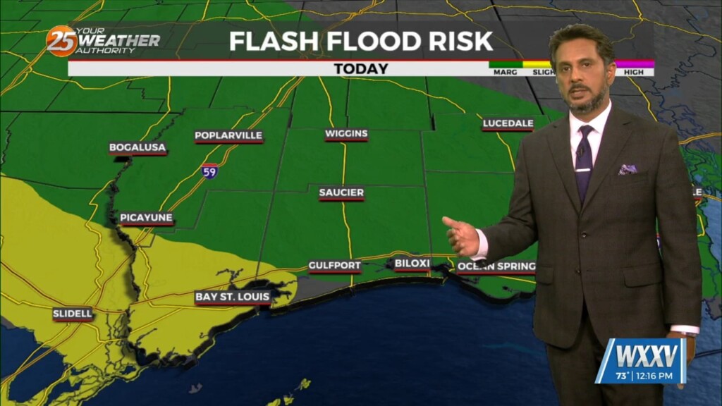
Your Wednesday will likely start with reduced visibility in the form of dense fog. Any fog and cloud coverage will dissipate throughout the day. It will get…
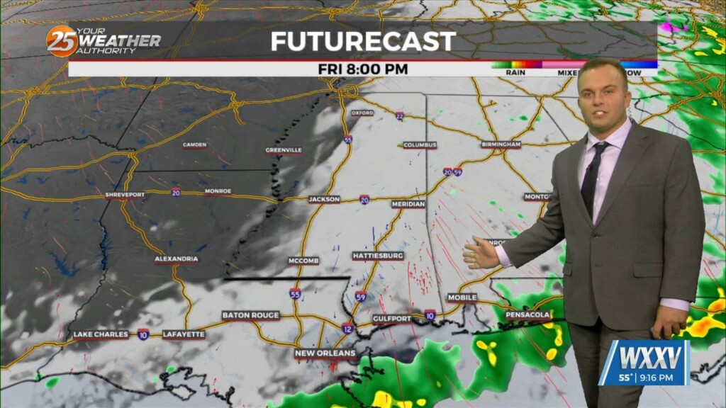
Expect rain and thunderstorms to come to an end this evening and rain-free conditions to commence overnight. You may encounter an isolated shower or two after sunset…
Another disturbance passing north of Interstate 10 into early afternoon will then begin to drop rain chances. Any precipitation this afternoon should be rather limited in coverage,…

Multiple disturbances are moving through west-southwesterly mid-level flow across the northern Gulf Coast. Most of the thunderstorms with these impulses are expected to track south of the area.…
While there will be some dry time overnight, rounds of showers and thunderstorms will continue. Expect coverage of 40-60% on average with thunderstorms remaining below severe limits…

Coverage of rain in the form of showers and thunderstorms picks up this evening and you can expect thunderstorms capable of heavy rain overnight. Some thunderstorms…
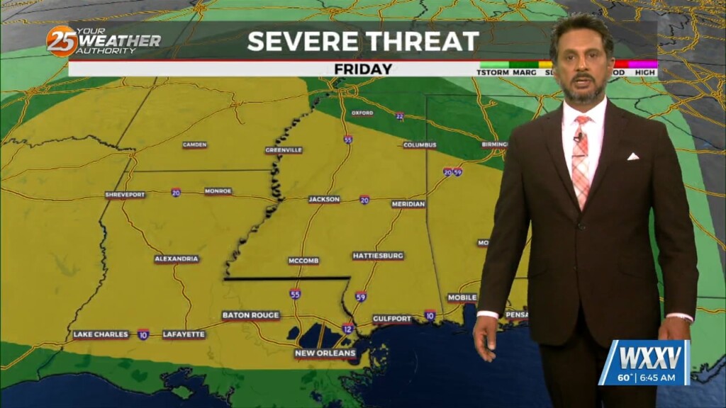
SEVERE & HEAVY RAIN THREAT THIS AFTERNOON/OVERNIGHT... Showers/t-storms will begin around midday with activity increasing this evening and overnight. The next thing would be…
Fog will be in and out at most locations this morning. This fog should get lifted rather quickly by mid-morning as the entire boundary layer should…
Other than a 20% chance of a stray shower, it will be mainly rain-free ahead of your Saturday morning. Fog will be a concern out the…
Expect mainly dry conditions this evening into the overnight hours. A 20% chance of a stray shower cannot be ruled out but the main concern will become…
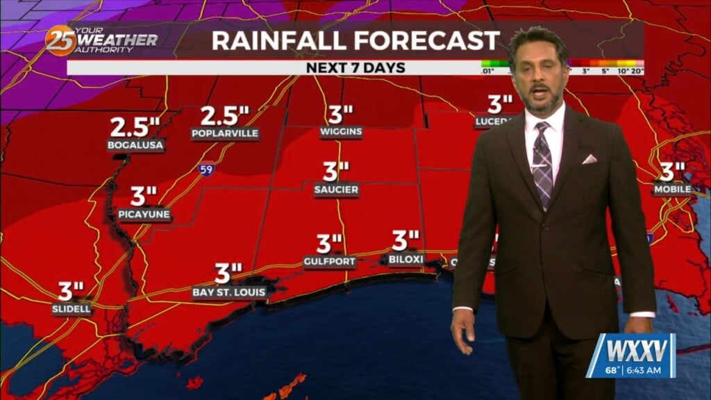
UNSETTLED is the word for the next several days. Heavy rainfall will tapper slowly through the day. Very few severe storms are expected with this…
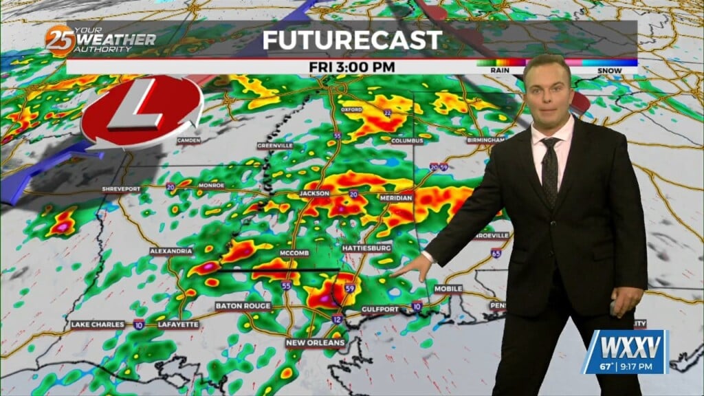
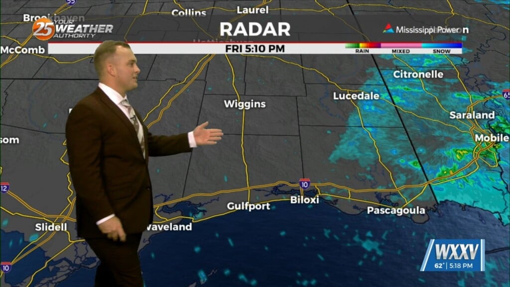
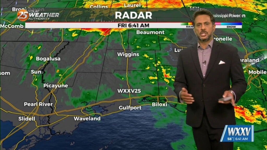
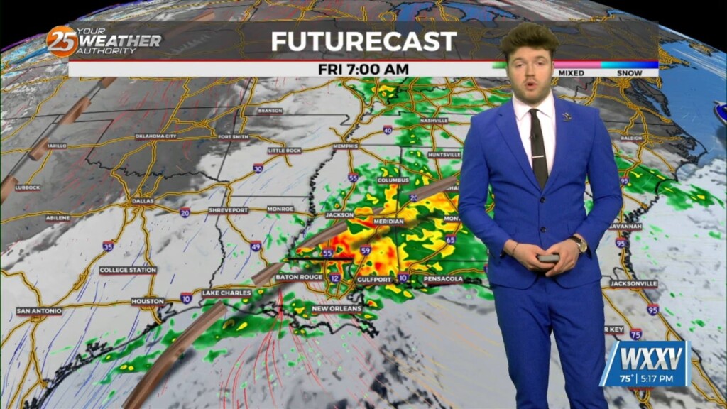
Rain will be moving into the area prior to sunrise Friday. Expect coverage of showers and embedded thunderstorms to peak during the morning hours, and rainfall to…
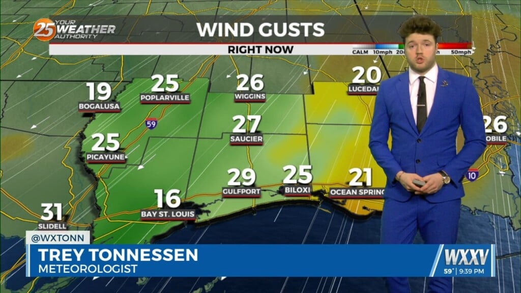
Cloudy skies remain into tonight and winds will begin to pick up. Moisture/humidity will be on the upswing ahead of the first of several disturbances that will…
A dry airmass continues to reside across the region this morning with a fairly active WSW flow aloft with moisture continuing to stream into the…
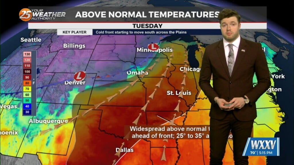
A zonal flow pattern will be in firm control of the area through next Tuesday. A series of fast moving shortwave troughs embedded within this zonal flow…
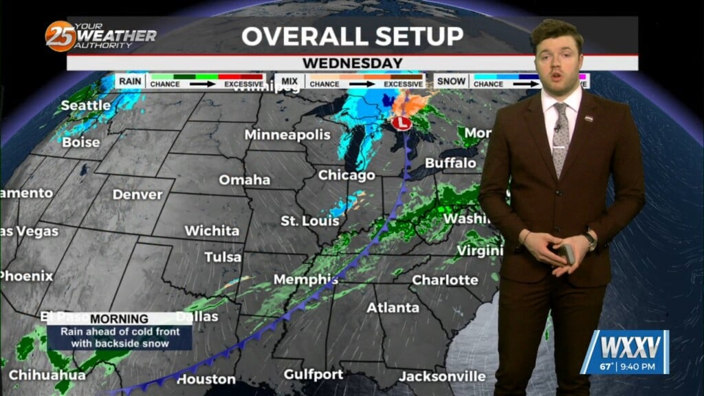
A surface cold front associated with low pressure over the Ohio valley is intruding across our area into the northcentral Gulf Of Mexico. Currently there are some…
With low level moisture continuing to advect into the region from the south a solid low stratus deck of low level clouds has developed across most…
A largely zonal flow pattern will develop over the area on Friday and remain in place through next Monday. Embedded within this zonal flow regime, a series…
Currently the area is under upper level southern branch flow with Troughing over the central plains. As the trough moves east an Associated front drops into…
Tonight, eyes begin to shift upstream as a cold front begins to move southeastward toward our region. Prior to the frontal passage, surface winds should begin…