2/19 - The Chief's "Warming Trend Ahead" Monday Afternoon Forecast
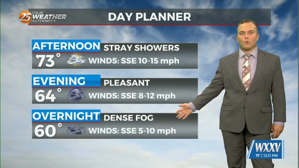
Very nice comfortable/dry conditions ahead today as highs top out in the mid-60s for most. Cool tonight, but no freezing temps expected. The nice continues into…
Very nice comfortable/dry conditions ahead today as highs top out in the mid-60s for most. Cool tonight, but no freezing temps expected. The nice continues into…
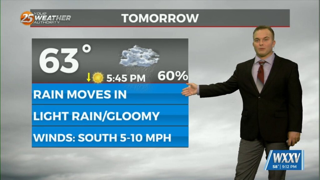
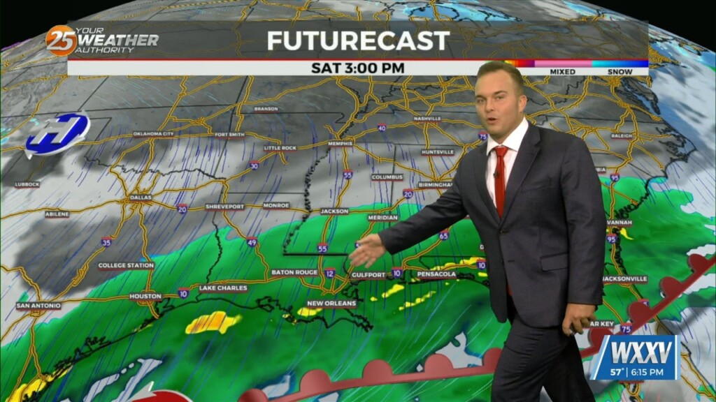
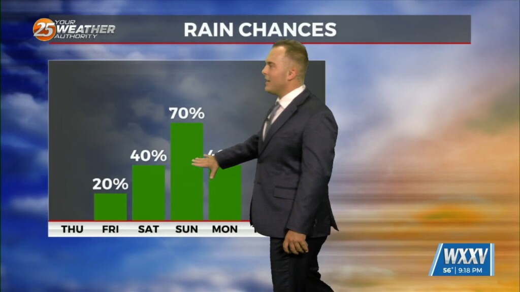
Some dry time arrives overnight but by the time your Saturday could be beginning, light rain will be in the area coinciding with/shortly after a cold front…
A shield of mist and light rain continues to plague our area as a pair of storm systems interact. Light rain will be around into some parts…
A broad region of enhanced upper level forcing will develop over the Gulf South today and continue into Saturday. This forcing will be driven by the…
Cloudy skies continue tonight with mild temperatures. Some spots could see light fog develop & there is a 20% chance of rain past about 2 AM…
Mid-level and upper-level clouds continue to stream in as an active subtropical jet stream is in the region. Temperatures will remain fairly mild overnight as more humidity works back…
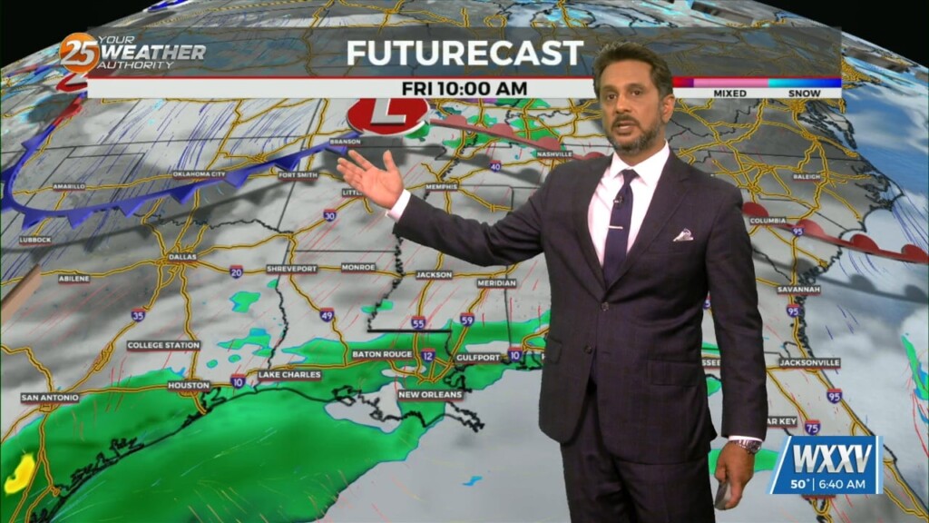
No significant changes in forecast though the weekend. An area of low-pressure along the W’tern Gulf will bring higher rain chances for the start of the weekend.…

Thursday starts off cool/chilly but it will be milder than the last couple of mornings. Cloud cover will be around through the day tomorrow as an active…
Relatively nice conditions we experienced this afternoon will give way to a cool evening. Temperatures overnight will not be as chilly as this morning and winds will be…

A post frontal airmass continues to push into the region with the center of surface ridge currently over the state of Mississippi. The remainder of…
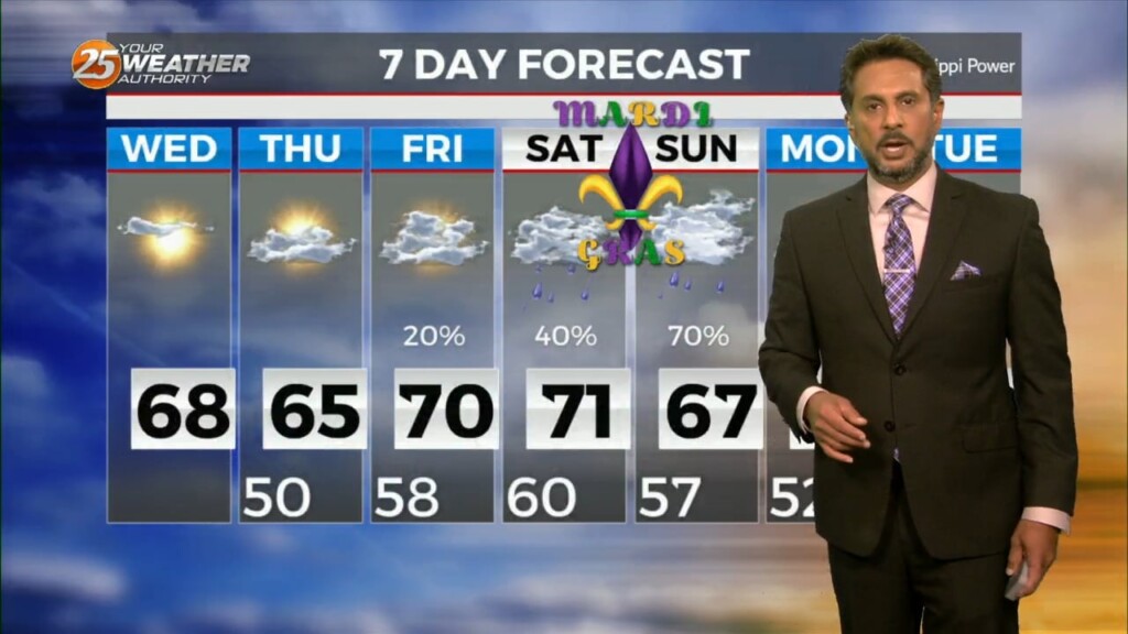
Temperatures overnight will be slightly below average so it will be chilly to start Ash Wednesday/Valentine's Day. Expect a few clouds to partly cloudy skies Wednesday as an active…
Expect temperatures to drop fairly quickly this evening as winds relax and skies remain mainly clear. It will be chilly if you have any remaining Mardi Gras…
The forecast through the remainder of the workweek is pleasant with no major impacts. Rain should at least hold off till late Friday if not…

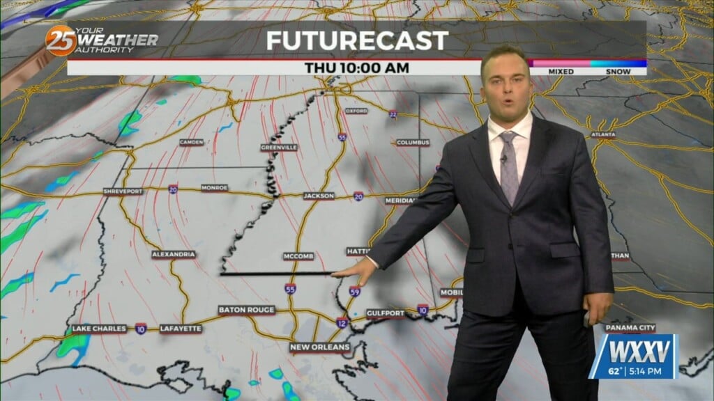
The longer term forecast will see several disturbances rotating around the overall upper low centered over Eastern Canada. An initial fast-moving disturbance will move through the middle part of the country Thursday. The front associated with this will remain well…
Our frontal system has moved off into the eastern Gulf. Strong northerly winds tonight will bring in cooler and drier air into the region, making for a…
A cold front moved through the area this morning which brought an end to the rainfall. This afternoon, some sunshine will emerge but the main concern…
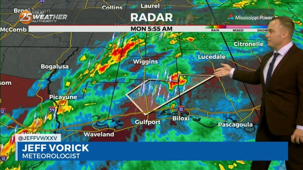
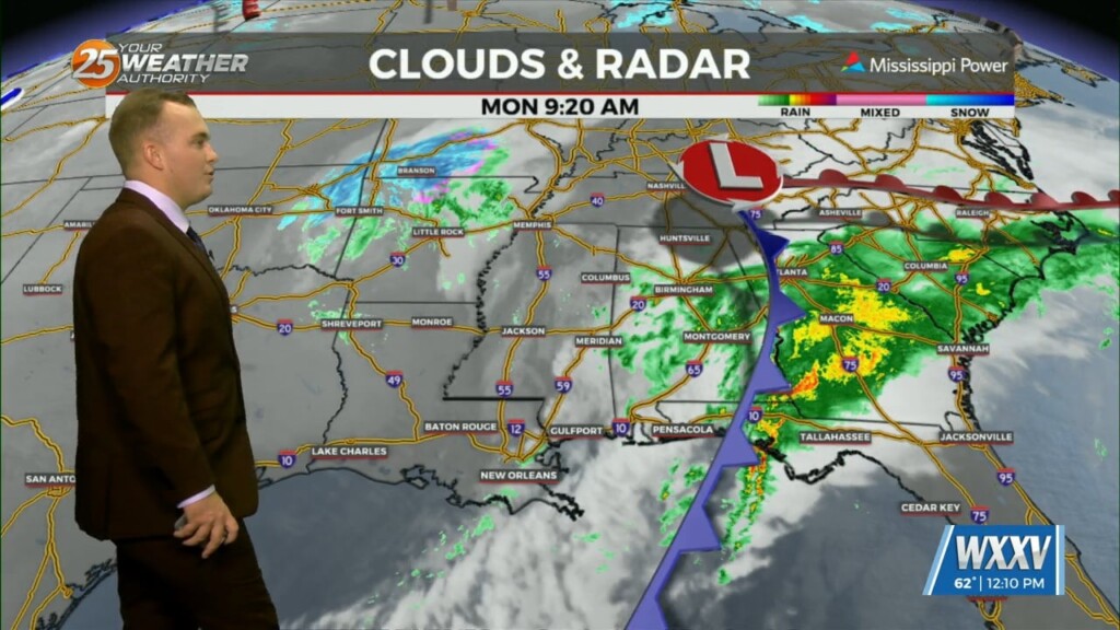
The threat of severe weather will come to an end this morning and the Tornado Watch for Stone, Jackson, Harrison, & George County will be…

As our afternoon arrived we had been watching the storm system to our west as it approached Saturday into Sunday. The setup for Sunday into Monday…
Cloudy skies remain this afternoon as an active subtropical jet stream continues across our region. Beyond that, there is a 20% or so chance of a passing…
Areas of patchy dense fog will dissipate quickly this morning. Cloud cover will remain in place with peeks of sunshine here and there. Temperatures will be quite…
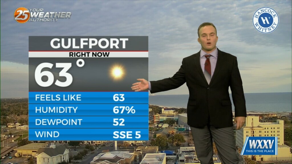
Low level moisture continues to increase with dew-points rising into the upper 40s or tower 50s. This warming/moistening trend will continue today. The…
Temperatures will be a few degrees warmer to start your Thursday. More clouds will be around as a more active subtropical jet stream will contribute…
Another nice day will give way to a fairly pleasant and mild evening tonight. Temperatures will be slower to drop as the overall weather pattern turns more mild.…
High pressure will continue to move downstream over the Mid-Atlantic States through today. As the high moves east, onshore flow will be initiated at the surface.…