Christmas Eve Weather Forecast
Christmas Eve 2014 Weather Cast
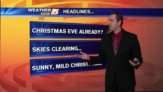
Christmas Eve 2014 Weather Cast
Cool start to Wednesday

Steady weather continues across the coast.
Early morning forecast
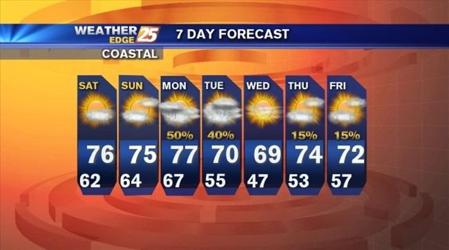
Beautiful weather this weekend
Chilly start to Friday

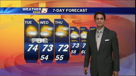
Expect temperatures in the 70s
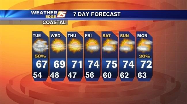
Rain showers give way to a sunny weekend
Beautiful weather for Thursday
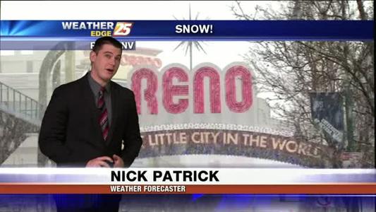
dangerously cold temperatures moving into the region.
Beautiful weather conditions on the coast!
Great looking weekend
Clouds decrease overnight with north winds at 10 to 15 mph and lows in the lower to middle 50s.
Mostly cloudy overnight with scattered showers and storms.
Partly cloudy overnight with lows falling into the upper 40s to lower 50s.
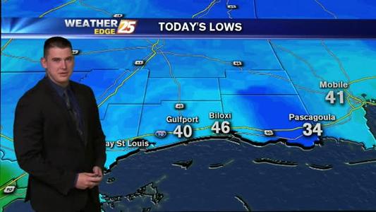
Mostly clear tonight with north winds at 10 to 15 mph. Overnight lows will drop into the middle to upper 30s with a few spots along the coast only in the lower 40s.
Scattered showers and storms tonight with winds shifting form the north at 15 to 25 mph, gusting as high as 30 mph. Overnight lows will drop into the upper 40s to lower 50s.
Mostly cloudy tonight with areas of patchy fog and lows in the upper 50s to lower 60s. Winds will be from the southeast at 5 to 10 mph.
Mostly clear skies tonight with lows in the middle to upper 50s. The great weather continues tomorrow with highs near 80.
Mostly cloudy overnight with scattered showers and storms early, then clouds gradually decreasing. Lows will be in the middle to upper 40s, with a few spots along the coast in the lower 50s.
Mostly cloudy tonight with a slight chance for isolated rain and lows in the lower to middle 50s. Winds will be from the west, shifting from the north at 5 to 10 mph.
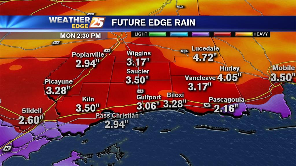
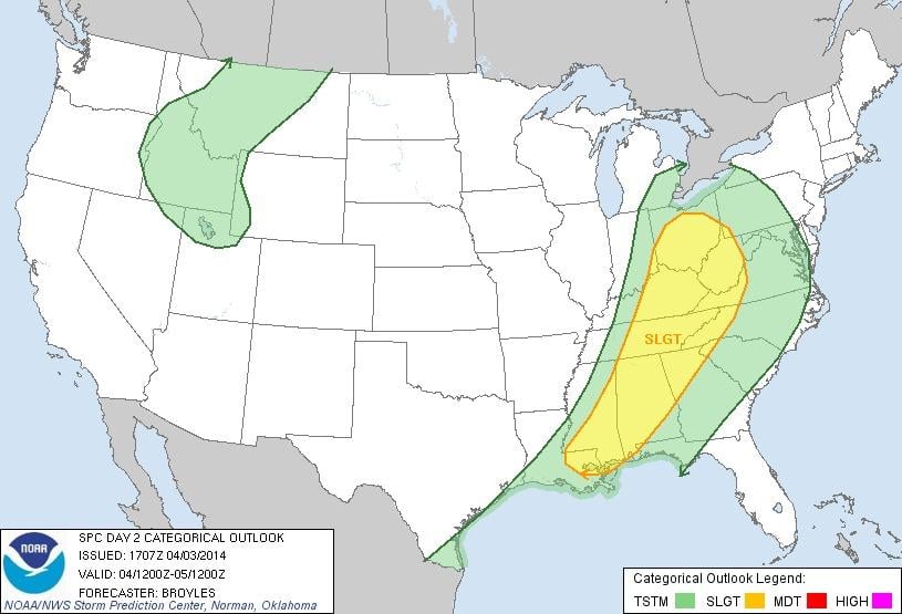
Heavy rainfall will be possible late Saturday through Sunday night with a risk for flash flooding. Additionally, there is a slight risk for severe weather on Sunday.
Tonight: Mostly cloudy with a slight chance for an isolated storm. Lows will be in the mid-60s with winds from the south at 10 to 15 mph.
Cloudy tonight with areas of fog, isolated showers and lows in the mid-50s.