6/6 - The Chief's "Scattered T-Storms" Friday-Eve Morning Forecast
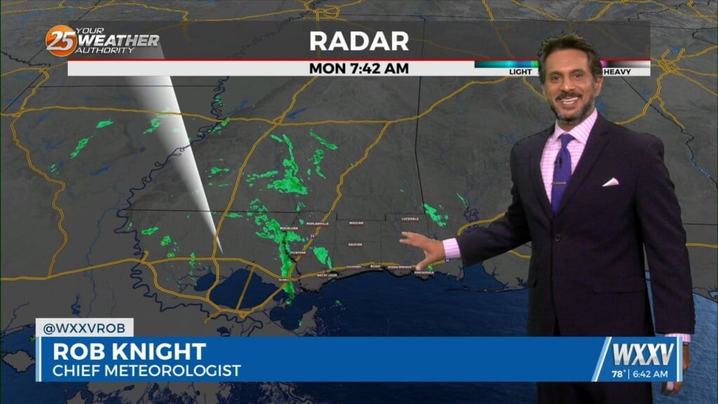
The front that has been talked about is arriving this morning. This is more of a weakness at the surface than a front, but there is some…
The front that has been talked about is arriving this morning. This is more of a weakness at the surface than a front, but there is some…
Warmer and generally drier conditions expected as we end this week and head into the weekend. As the shortwave ejects east, upper level ridge centered over…
A shortwave trough is currently moving through the lower Mississippi River Valley and will continue to track across the southeastern United States. An outflow dominated complex…
A cold front has a surface low-pressure system in Manitoba this morning with a front from there through Wisconsin to Missouri to around the…
Drier mid-level air looks to filter into the area Friday, decreasing rain chances while keeping the boundary somewhere in the area. Scattered showers and storms are…
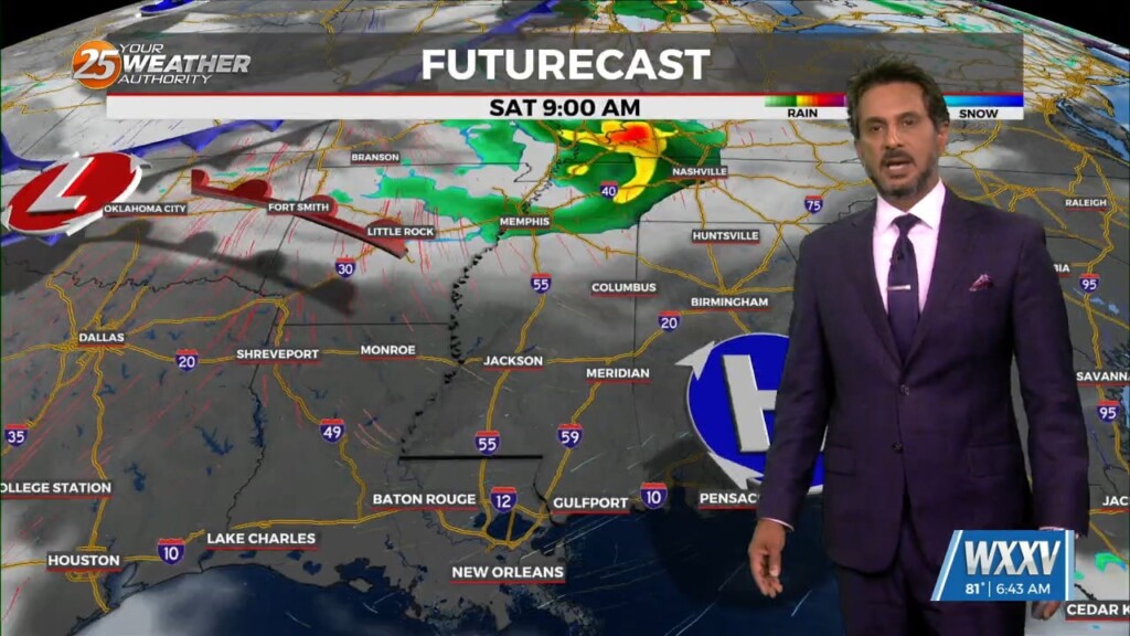
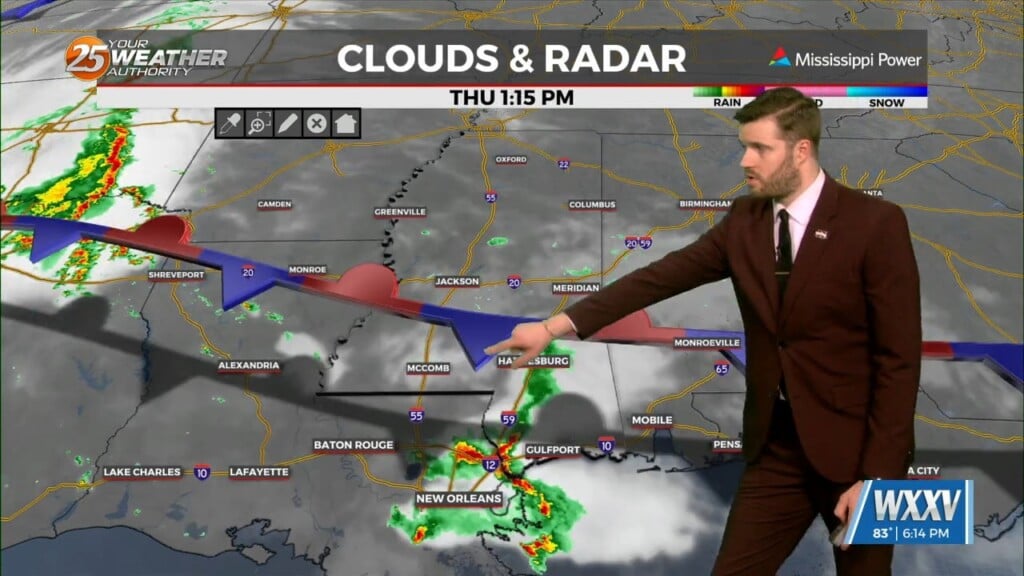
Troughing will be exiting the area to the east by Thursday morning, leaving a remnant boundary behind. The most likely area for the boundary seems…
A complex of t-storms well to the NW will continue SE and dissipate late this evening. The activity will move in to the region and traverse…
The next complex of showers/t-storms is getting started over central Oklahoma. This will move eastward and then down the same travel path as the one that just…

Tuesday, a second complex is forecast to develop over Oklahoma after midnight tonight and follow much of the same track southeastward. While most guidance doesn`t indicate…

The upper pattern is a bit west-northwesterly across the area with a shortwave to the northwest across Kansas, and a stronger trough across the Pacific…
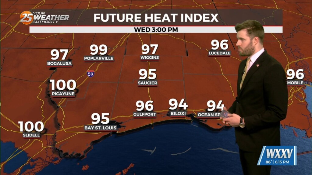
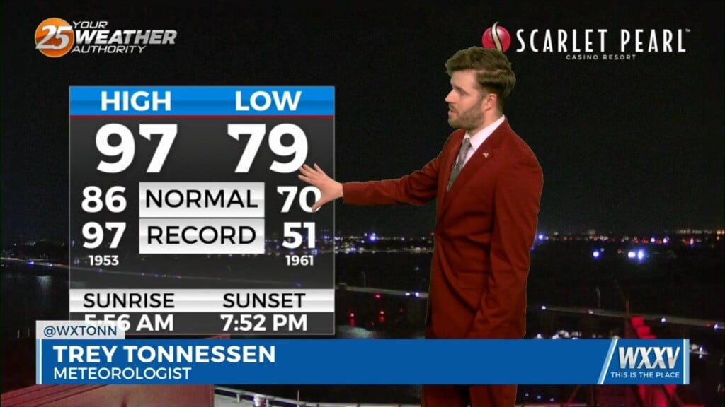
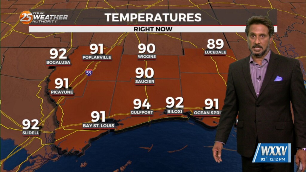
HOT temperatures this afternoon will feel like the low 90s with the heat index! As a stalled boundaries form last week move northward and leave the…
As a stalled boundaries form last week move northward and leave the gulf coast, rain chances will drop off through the weekend. A…

Tuesday will be a very typical early June day across the forecast area. Zonal flow will remain in place aloft and widely scattered convection will develop along…
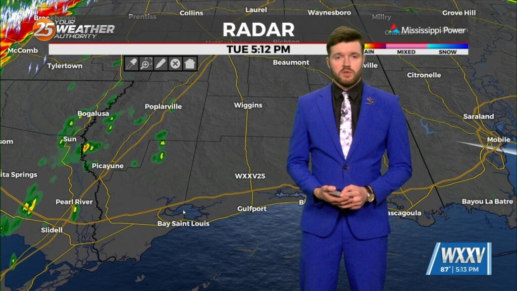
A weak frontal boundary was stalled across southern Mississippi this morning. Although there isn't a huge temperature difference on either side of the boundary, there was…

The old front has backed off into central Mississippi which is where showers/t-storms are developing this morning. A few storms are moving NE as they follow this…
A series of fast moving and weak southern stream shortwave troughs embedded within a largely zonal flow regime aloft will slide through the Lower Mississippi Valley…
Wednesday and Thursday we will continue to see the possibility of convection and just like today and yesterday it will primarily be driven by what develops…

Convection is firing as expected across the area just a tad farther to the southwest than initially expected but there is still quite a bit of convection off to the west trying to slide towards our area. Thee is still…
A stationary front overhead will be the focal point for activity into the weekend. This boundary will help a very large complex of elevated storms develop later…

Tuesday, shortwave trough will help to drive the parent upper trough farther south across the southeastern US on Tuesday. This will bring the associated frontal boundary…
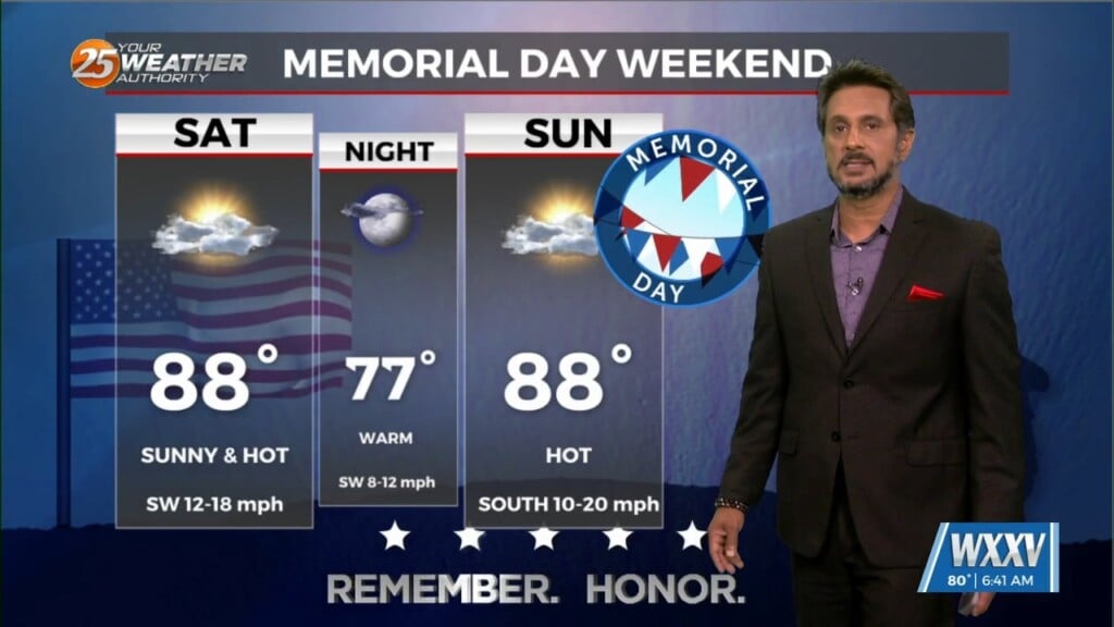
After a hot and generally dry Memorial Day weekend, temperatures will be trending back down some. Although we likely won`t get down to normal temps, at…
An upper high pressure remains over Mexico but has been suppressed southward by a weakness extending from the Great Lakes to Texas. A cold front…
Weak ridging is currently over us with a surface high over the Bahamas and extending into the eastern Gulf Of Mexico. Into Monday, a weak upper…
Upper level high pressure near the Bay of Campeche continues to nose up into the western Gulf of Mexico and Louisiana. Energy will…