5/14 - The Chief's "Simply GORGEOUS" Tuesday Afternoon Forecast
An area of weak low-pressure overhead will slide to the east and dissipate. We will transition into somewhat lower dew-points and maintain those conditions for the next…
An area of weak low-pressure overhead will slide to the east and dissipate. We will transition into somewhat lower dew-points and maintain those conditions for the next…
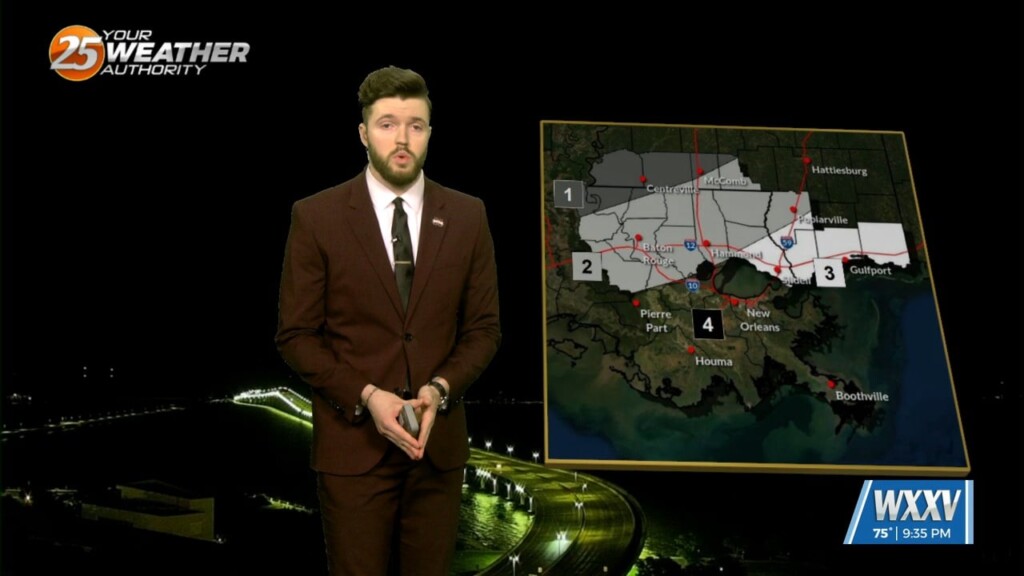
Overview: Severe Thunderstorm watch still in place for coastal MS and coastal southeast LA. Possible Wake Low trying to develop behind the storms Hazards: All…
The developing squall line over southwest Louisiana has already had a history of producing a few tornadoes and widespread wind damage. This line is expected…
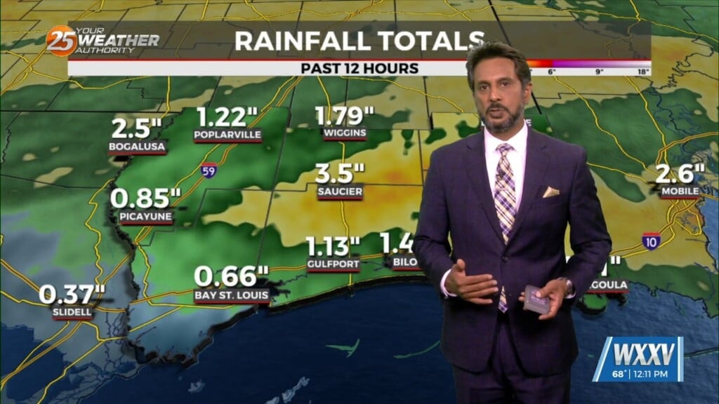
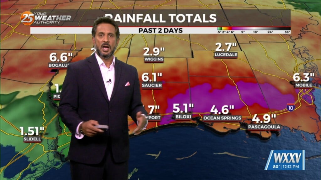
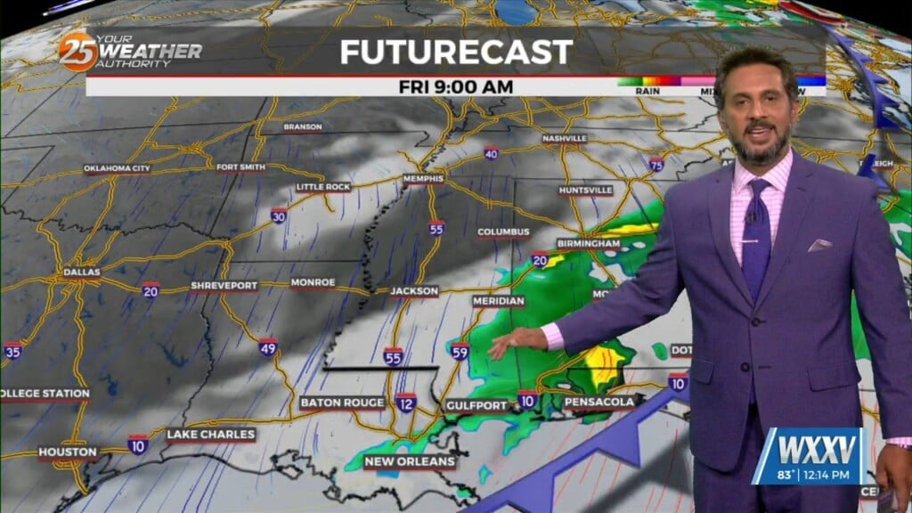
THREAT FOR HEAVY RAINFALL AND SEVERITY. The Flood Watch will remain as rainfall amounts are still coming in from 3 to 6 inches with the…
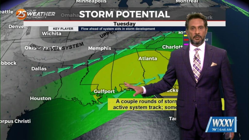
The upper flow is now supportive and subsequent lower level flows are also lining up to support the training of HEAVY RAINFALL. The first of 2 rounds…
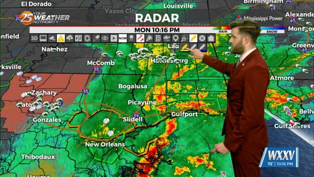
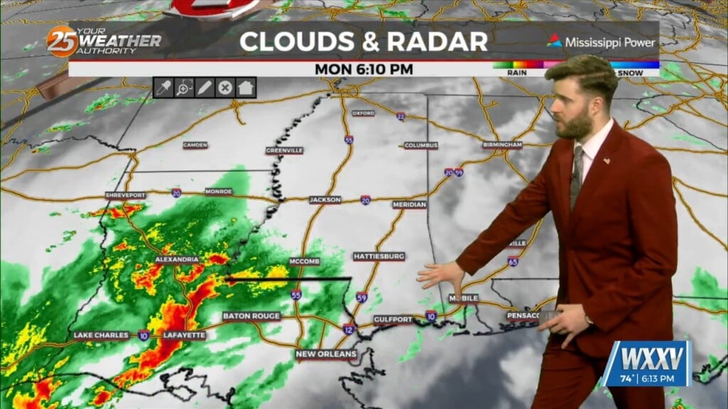
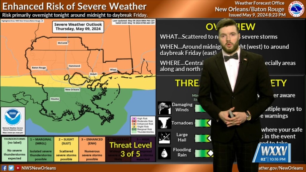
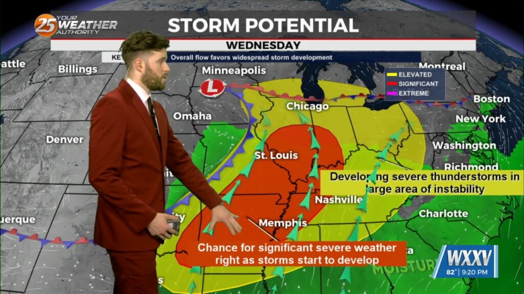
Good Sunday evening! Severe weather is back in the forecast, even though our risk areas are not as high as several places in the region have…
Cold front is moving through the area this morning and will be slow to do so. Dry air will move over the area bringing cloud…
The cold pool in the wake of the convection will allow a front currently draped over north Louisiana to surge southward late tonight into tomorrow…
A vigorous vorticity max and associated 100+ knot upper level jet streak is currently moving through Texas this afternoon and will pass through the Lower Mississippi Valley…
First things first this morning it appears there could be a few isolated low topped showers develop with the initial impulse moving into NW Louisiana.…
The focus of the weather community here on the Mississippi Gulf Coast has been locked on the humid feeling throughout Wednesday. Luckily, after we get past…
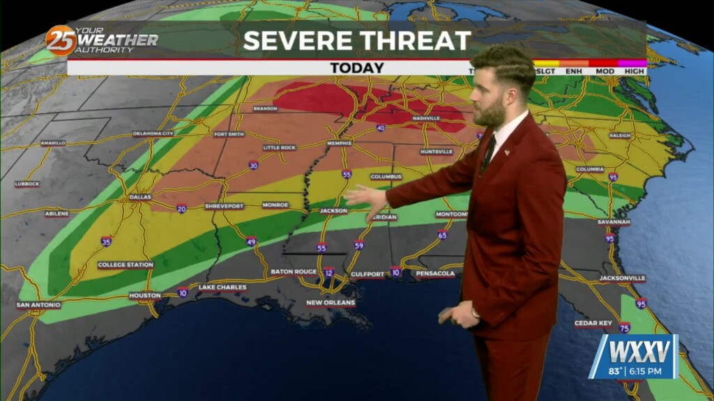
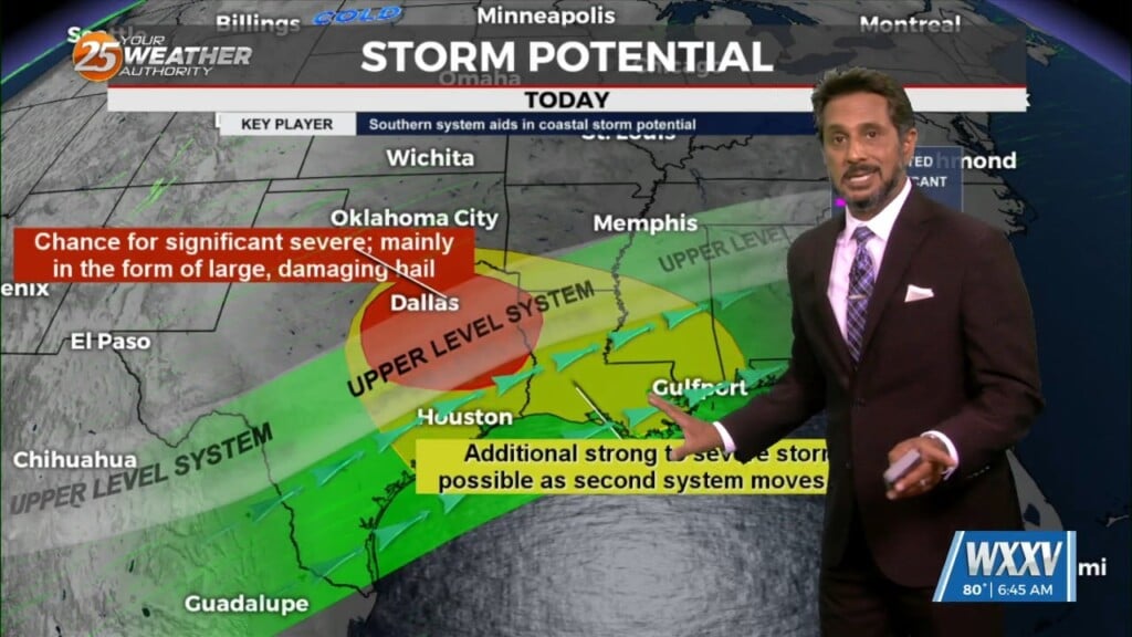
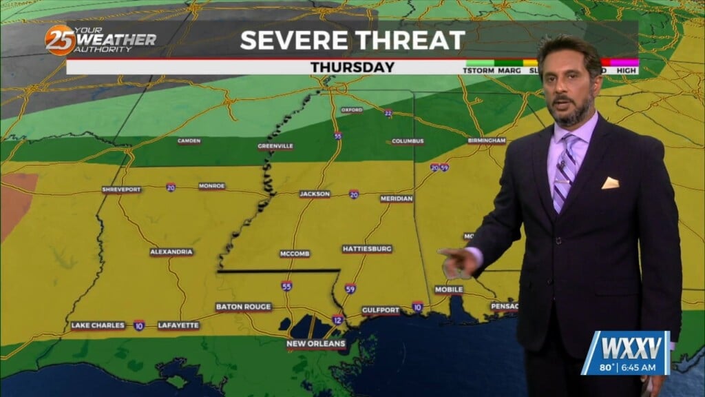
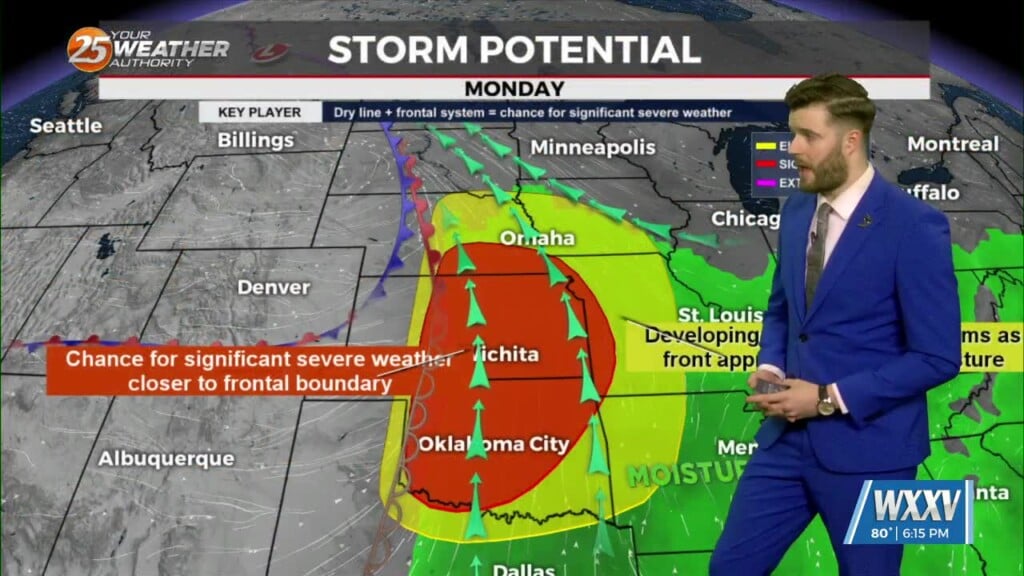
The main story of the short term period is tomorrow's chance of severe weather. All of the WXXV viewing area is highlighted in a SLIGHT Risk…
HOT...HUMID & BREEZY afternoon ahead... On Thursday a strong upper level disturbance will help send a cold front southward toward the region. During the…
Today will be a rather dry day across the region with most of the upper support in the active SW flow aloft staying to our…
Conditions will begin to improve on Friday as the jet streak moves to the east and increasing upper level subsidence takes hold of the area. Lingering…
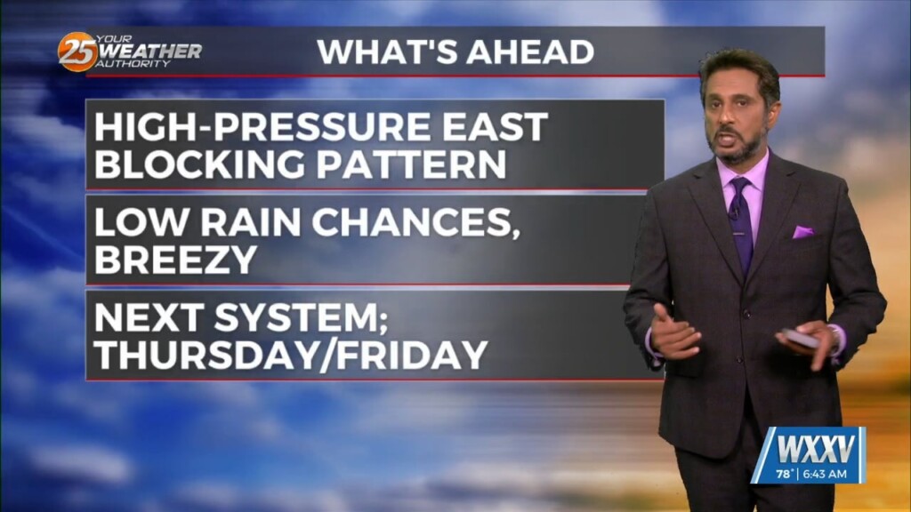
Even though we were much more favorable in terms of weather to start the workweek, there have been transitional changes in our weather pattern that will…
A somewhat weak high pressure across the Bay of Campeche and southern Gulf will help warm most of our region well into the 80s again…

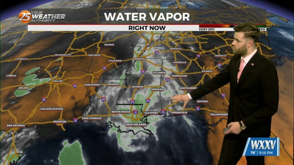
Low stratus continues this morning as very rich low level moisture continues to stream northward from the Gulf. The low stratus deck will begin…
Monday was another in a string of days here on the Mississippi Gulf Coast in which Mother Nature has looked fondly on us. Things don't look…
The region will continue to feel the influence of a shortwave ridge axis extending in a southwest to northeast orientation across the Gulf South through the…
A rather zonal/progressive upper level flow will continue through the morning and into the afternoon hours across our region. Later today and…
A shortwave ridge axis will remain over the area through Tuesday night, and this will help suppress most convective activity even as a series of…
T-storm complexes will stay on the lee side of the Rockies this morning and have been for a while. Another weakening one is moving up from…
Across the Mississippi Gulf coast we have several weather changes in the extended forecast. Multiple weather models are indicating a decent shot of rain for the…